Cottie Hill

Hill, Mountain in Midlothian

Scotland

Cottie Hill

The remains of Ewes Castle There is not much to see of this ruined tower house by the Lugate Water. My previous visit was in 2007 <a href="https://www.geograph.org.uk/photo/410068">NT4344 : Ewes Castle</a>.
The remains of Ewes Castle Credit: Walter Baxter

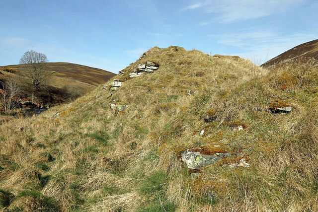
Cottie Hill is a prominent hill located in Midlothian, Scotland. It is part of the Southern Uplands, a range of hills and mountains that stretch across southern Scotland. Standing at an elevation of approximately 476 meters (1,561 feet), Cottie Hill offers breathtaking panoramic views of the surrounding countryside.

The hill is covered in a mix of grassland and heather, providing a diverse habitat for a variety of wildlife. It is home to numerous bird species, including red grouse, kestrels, and peregrine falcons. Visitors may also spot rabbits, hares, and deer roaming the area.

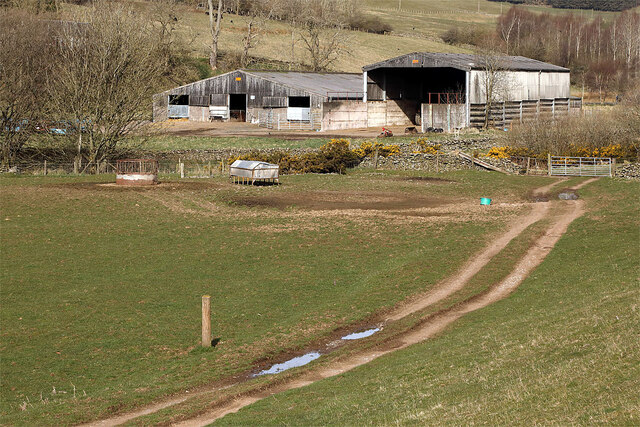
Cottie Hill is a popular destination for outdoor enthusiasts and nature lovers. It offers several walking and hiking trails, ranging from easy strolls to more challenging treks. The paths wind through the hillside, leading visitors through picturesque landscapes and offering opportunities for exploration and adventure.

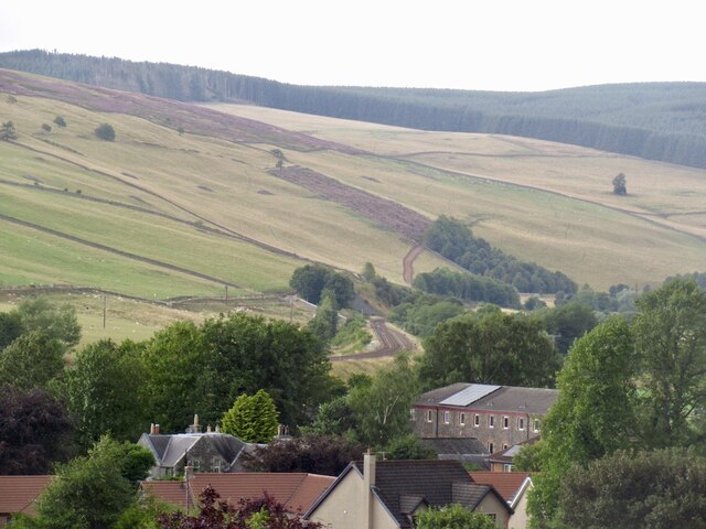
The hill is easily accessible, with a car park located at the base, making it a convenient destination for day trips. On a clear day, the summit offers stunning views of the surrounding countryside, with the Edinburgh skyline visible in the distance.

Cottie Hill is steeped in history, with evidence of human habitation dating back thousands of years. There are several ancient burial grounds and stone circles in the vicinity, reflecting the area's rich heritage.

Overall, Cottie Hill in Midlothian is a captivating natural landmark that showcases the beauty of the Scottish landscape and offers a range of outdoor activities for visitors to enjoy.

If you have any feedback on the listing, please let us know in the comments section below.
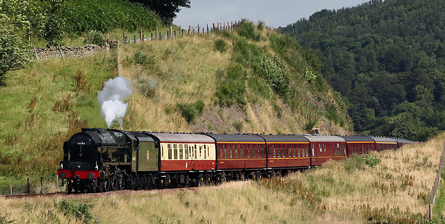
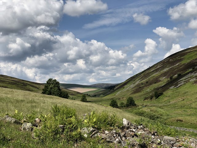
Cottie Hill Images

Images are sourced within 2km of 55.698665/-2.8983696 or Grid Reference NT4345. Thanks to Geograph Open Source API. All images are credited.

The remains of Ewes Castle There is not much to see of this ruined tower house by the Lugate Water. My previous visit was in 2007 <a href="https://www.geograph.org.uk/photo/410068">NT4344 : Ewes Castle</a>.
The remains of Ewes Castle
There is not much to see of this ruined tower house by the Lugate Water. My previous visit was in 2007 NT4344 : Ewes Castle.
Farm buildings at Lugate
Borders Railway leaving Stow View northwards to the end of the passing loop.
Borders Railway leaving Stow
View northwards to the end of the passing loop.
Royal Scot on the Borders Railway This steam special is heading for Tweedbank and will be hauled back to Edinburgh by a vintage diesel as there is no passing loop or turntable at the Tweedbank terminus. The line at this location near Stow is very close to the A7 road. The vertical fence posts clearly show the camber of the line at this section of the line.
Royal Scot on the Borders Railway
This steam special is heading for Tweedbank and will be hauled back to Edinburgh by a vintage diesel as there is no passing loop or turntable at the Tweedbank terminus. The line at this location near Stow is very close to the A7 road. The vertical fence posts clearly show the camber of the line at this section of the line.
Royal Scot on the Borders Railway The steam special is approaching Watherston near Stow as it makes its way to Tweedbank Station.
Royal Scot on the Borders Railway
The steam special is approaching Watherston near Stow as it makes its way to Tweedbank Station.
Forest on Wetherston Hill The A7 road at Galabank can be seen in the background. Viewed from an Edinburgh bound flight from Prague.
Forest on Wetherston Hill
The A7 road at Galabank can be seen in the background. Viewed from an Edinburgh bound flight from Prague.
Western road, Gala Water A quiet alternative to the A7, on the opposite bank of the Gala Water. The railway keeps crossing the river.
Western road, Gala Water
A quiet alternative to the A7, on the opposite bank of the Gala Water. The railway keeps crossing the river.
The quieter road up the Gala Water The single track road on the opposite side of the Gala Water from the A7.  Now accompanied by the reopened railway.
The quieter road up the Gala Water
The single track road on the opposite side of the Gala Water from the A7. Now accompanied by the reopened railway.
Borders Railway The reopened Waverley Line north of Stow.
Borders Railway
The reopened Waverley Line north of Stow.
Galabank Row of houses on the A7 north of Stow.
Galabank
Row of houses on the A7 north of Stow.
Farm road, Watherston A wide enclosed track climbing to the ridge on the west side of the Gala Water.
Farm road, Watherston
A wide enclosed track climbing to the ridge on the west side of the Gala Water.
Quarry, Craigs Wood A landmark on the A7, but seen here from the yellow road on the opposite side of the Gala Water.
Quarry, Craigs Wood
A landmark on the A7, but seen here from the yellow road on the opposite side of the Gala Water.
Borders Railway, Watherston The A7 runs close to the railway here and has a sharp bend by Galabank.
Borders Railway, Watherston
The A7 runs close to the railway here and has a sharp bend by Galabank.
Forestry on Watherston Hill With the valley of the Gala Water beyond and the Luggate Water in the foreground.
Forestry on Watherston Hill
With the valley of the Gala Water beyond and the Luggate Water in the foreground.
View towards Stow Still lots of snow left from the previous weekend.
View towards Stow
Still lots of snow left from the previous weekend.
Road, Stagehall The quiet side of the Gala Water.
Road, Stagehall
The quiet side of the Gala Water.
Ewes Castle (remains of) Ruins of Ewes Castle next to the Lugate Water looking North West along the valley
Ewes Castle (remains of)
Ruins of Ewes Castle next to the Lugate Water looking North West along the valley
Wet and muddy track by the Lugate Water A test for the boots on the track up the valley.
Wet and muddy track by the Lugate Water
A test for the boots on the track up the valley.
Show me another place!

Cottie Hill is located at Grid Ref: NT4345 (Lat: 55.698665, Lng: -2.8983696)

Unitary Authority: The Scottish Borders

Police Authority: The Lothians and Scottish Borders

What 3 Words

///trespass.work.armrests. Near Lauder, Scottish Borders

Nearby Locations

Cottie Hill Cribbilaw Hill

Related Wikis

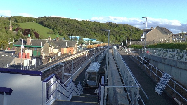
Stow railway station

Stow is a railway station on the Borders Railway, which runs between Edinburgh Waverley and Tweedbank. The station, situated 26 miles 45 chains (43 km...

Stow of Wedale

Stow of Wedale, or more often Stow, is a village in the Scottish Borders area of Scotland (historically Midlothian), 7 miles (11 kilometres) north of...

Stow of Wedale Town Hall

Stow of Wedale Town Hall is a municipal building in Earlston Road, Stow of Wedale, Scottish Borders, Scotland. The structure, which serves as a community...

Allanshaugh

Allanshaugh is a fermtoun in the Scottish Borders area of Scotland. == See also == List of places in the Scottish Borders List of places in Scotland...

Nearby Amenities

Located within 500m of 55.698665,-2.8983696
Cottie Hill
Ele: 352
Natural: peak
Lat/Long: 55.6994517/-2.8999644
The data included in this document is from www.openstreetmap.org. The data is made available under ODbL.

Have you been to Cottie Hill?

Leave your review of Cottie Hill below (or comments, questions and feedback).