Clayhooter Hill

Hill, Mountain in Aberdeenshire

Scotland

Clayhooter Hill

Ruined croft on the Moss of Tolophin
Ruined croft on the Moss of Tolophin Credit: Peter Moore

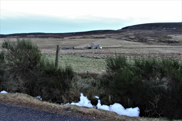
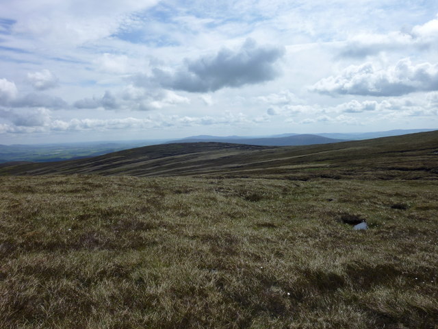
Clayhooter Hill is a prominent hill located in Aberdeenshire, Scotland. It is situated approximately 7 miles south of the town of Aberdeen and stands at an elevation of 417 meters (1,368 feet). This makes it a popular destination for hikers and outdoor enthusiasts, offering breathtaking panoramic views of the surrounding countryside.

The hill is part of the larger Grampian Mountains range, which stretches across the northeastern region of Scotland. Clayhooter Hill is characterized by its gentle slopes, covered in heather and grasses, giving it a picturesque appearance. Its summit is marked by a cairn, a pile of stones traditionally used as a navigational marker.

The area surrounding Clayhooter Hill is rich in natural beauty, with diverse flora and fauna. It is home to various species of birds, including red grouse and pheasants, making it a haven for birdwatchers. The hill also offers a habitat for small mammals like rabbits and deer.

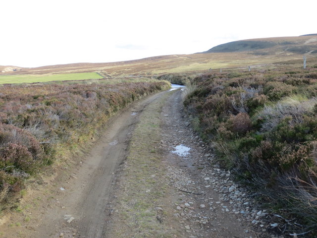
Hiking and walking trails provide access to Clayhooter Hill, with different routes catering to various skill levels. The ascent to the summit can be challenging, but the reward is the stunning view from the top. On a clear day, one can see the North Sea to the east and the Cairngorms National Park to the west.

Overall, Clayhooter Hill is a captivating destination for nature lovers and outdoor enthusiasts, offering a chance to immerse oneself in the beauty of Aberdeenshire's landscape.

If you have any feedback on the listing, please let us know in the comments section below.

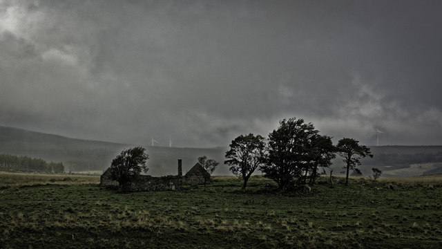
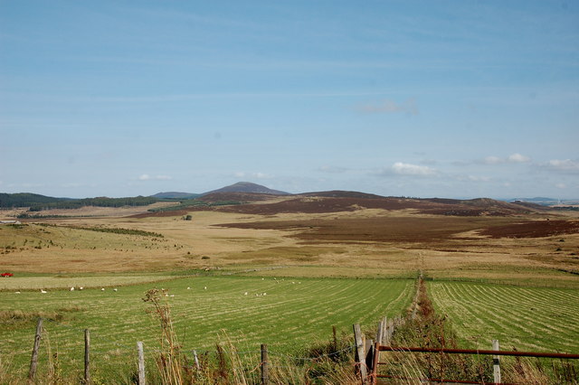
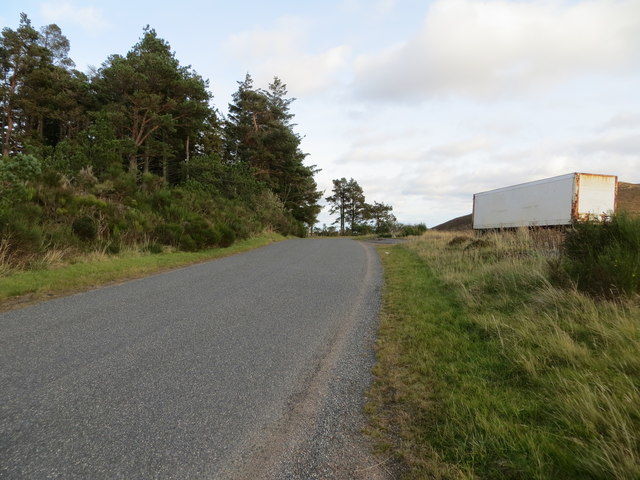
Clayhooter Hill Images

Images are sourced within 2km of 57.301602/-2.9416453 or Grid Reference NJ4323. Thanks to Geograph Open Source API. All images are credited.

Ruined croft on the Moss of Tolophin
View down the valley of the Burn of Craig Tap o'Noth (elev. 563 m) looms in the background.
View down the valley of the Burn of Craig
Tap o'Noth (elev. 563 m) looms in the background.
Road (B9002) near Whitehillock Looking westward.
Road (B9002) near Whitehillock
Looking westward.
Road (B9002) at Innesbrae Looking eastward.
Road (B9002) at Innesbrae
Looking eastward.
Moorland track near Broomhill heading towards Silverford Bridge Looking south-eastward.
Moorland track near Broomhill heading towards Silverford Bridge
Looking south-eastward.
Rough pasture at Silverford A disused farmstead.
Rough pasture at Silverford
A disused farmstead.
Track to Moss of Tolophin Burn of Buck runs down the depression on the right.
Track to Moss of Tolophin
Burn of Buck runs down the depression on the right.
Ruin near Elrick The old maps don't name this ruined building. On the skyline is Tap o' Noth.
Ruin near Elrick
The old maps don't name this ruined building. On the skyline is Tap o' Noth.
The Moss of Tolophin Looking east from the B9009 near Dryford How. The ruin is the same as can be seen in this view <a title="https://www.geograph.org.uk/photo/7181242" href="https://www.geograph.org.uk/photo/7181242">Link</a>
The Moss of Tolophin
Looking east from the B9009 near Dryford How. The ruin is the same as can be seen in this view Link
Rainbow on the way down the hill
Deer on heather moor on south side of Clayhooter Hill Deer, mainly hinds but with at least one buck stand on the heather slope below the estate road crossing the south side of Clayhooter Hill. The fields and tree plantings below lie to the west of the village of Lumsden.
Deer on heather moor on south side of Clayhooter Hill
Deer, mainly hinds but with at least one buck stand on the heather slope below the estate road crossing the south side of Clayhooter Hill. The fields and tree plantings below lie to the west of the village of Lumsden.
Todstone The ruin of Todstone lies south of the minor stream, Burn of Glenny.
Todstone
The ruin of Todstone lies south of the minor stream, Burn of Glenny.
Blooming heather near and far Hills of the north-eastern Grampians with heather flowering at its peak. The near slopes are those of Craigenscore Hill whilst in the distance there's Tap o'Noth and its associated tops.
Blooming heather near and far
Hills of the north-eastern Grampians with heather flowering at its peak. The near slopes are those of Craigenscore Hill whilst in the distance there's Tap o'Noth and its associated tops.
Lochan on Clayhooter Hill A jewel of a lochan to the north-east of Clayhooter Hill's summit.
Lochan on Clayhooter Hill
A jewel of a lochan to the north-east of Clayhooter Hill's summit.
Moorland dome south of Peddie's Hill An expanse of fairly nondescript moorland lies between the minor hill tops of  Clayhooter Hill and Hill of Towanreef; this minor dome is itself nameless on OS maps. The distant shadowed conical hill is Tap o' Noth.
Moorland dome south of Peddie's Hill
An expanse of fairly nondescript moorland lies between the minor hill tops of Clayhooter Hill and Hill of Towanreef; this minor dome is itself nameless on OS maps. The distant shadowed conical hill is Tap o' Noth.
Buck O' Cabrach Ascent Looking along the boundary fence that marks the (very boggy) ascent path.
Buck O' Cabrach Ascent
Looking along the boundary fence that marks the (very boggy) ascent path.
Kebbuck Knowe Col Looking east from the soggy col between "The Buck" and Kebbuck Knowe.
Kebbuck Knowe Col
Looking east from the soggy col between "The Buck" and Kebbuck Knowe.
When the world is your oyster...... A lone motorcyclist on a vintage machine is caught traversing the Moss of Tolophin.
When the world is your oyster......
A lone motorcyclist on a vintage machine is caught traversing the Moss of Tolophin.
Show me another place!

Clayhooter Hill is located at Grid Ref: NJ4323 (Lat: 57.301602, Lng: -2.9416453)

Unitary Authority: Aberdeenshire

Police Authority: North East

What 3 Words

///attaching.strongman.spellings. Near Alford, Aberdeenshire

Nearby Locations

Clayhooter Hill

Related Wikis

Clashindarroch Forest

Clashindarroch Forest is possibly the largest forest in Aberdeenshire, situated to the south-west of the market town of Huntly. Managed by Forest Enterprise...

Clova Monastery

Clova Monastery (also called Cloveth) was a medieval Culdee monastery in Kildrummy, Aberdeenshire, Scotland. == Founding == Clova was founded in the late...

Lumsden, Aberdeenshire

Lumsden is an inland village in Aberdeenshire, Scotland on the A97 road. == Location == It crowns a rising-ground 227 m (745 ft) above sea level amid a...

St Mary's Kirk, Auchindoir

St Mary's Kirk at Auchindoir, between Rhynie and Lumsden, in Aberdeenshire, Scotland, is one of the country's finest surviving medieval parish kirks. The...

Cabrach

The Cabrach (Scottish Gaelic: A' Chabrach, A' Chabraich) is an estate and largely depopulated rural community in Moray, Scotland. The meaning of the name...

Lesmoir Castle

Lesmoir Castle was a 16th-century castle, about 2.0 miles (3.2 km) west of Rhynie, Aberdeenshire, Scotland, south-west of Tap o' Noth, at Mains of Lesmoir...

Mossat

Mossat is a settlement in Aberdeenshire, Scotland on the A97 road near Glenkindie and Lumsden, between Bridge of Alford and Strathdon, and is situated...

Wormy Hillock Henge

Wormy Hillock Henge, also known as The Dragon's Grave, is a small henge in Aberdeenshire, Scotland. It is a Scheduled Ancient Monument located in the Clashindarroch...

Nearby Amenities

Located within 500m of 57.301602,-2.9416453
Clayhooter Hill
Ele: 537
Natural: peak
Lat/Long: 57.3013954/-2.9411587
The data included in this document is from www.openstreetmap.org. The data is made available under ODbL.

Have you been to Clayhooter Hill?

Leave your review of Clayhooter Hill below (or comments, questions and feedback).