Black Craig

Hill, Mountain in Aberdeenshire

Scotland

Black Craig

Gathering Cairn across the heather moor Lochnagar can just be seen in the extreme right hand of the picture above the green at the head of Glen Tanar
Gathering Cairn across the heather moor Credit: Bob Peace

Black Craig is a prominent hill located in Aberdeenshire, Scotland. It is situated in the eastern part of the county, near the village of Tarland. With an elevation of approximately 495 meters (1,624 feet), Black Craig offers stunning panoramic views of the surrounding landscape.

The hill is characterized by its distinctive shape, with a steep and rocky summit that is often shrouded in mist. It is composed mainly of granite, which is a common geological feature in the area. The hill is also home to various species of flora and fauna, including heather, moss, and a variety of bird species. It is a popular destination for hikers and nature enthusiasts, who can enjoy the picturesque scenery and the tranquility of the hill.

Black Craig is easily accessible, with several well-marked trails leading to the summit. The most popular route starts from the village of Tarland, where hikers can follow a well-maintained path that gradually ascends the hill. Along the way, there are several viewpoints where visitors can pause and admire the breathtaking vistas.

The hill is a great place for outdoor activities such as walking, hiking, and photography. It offers a peaceful retreat from the hustle and bustle of daily life, allowing visitors to connect with nature and enjoy the beauty of the Scottish countryside. Whether you are an experienced hiker or just looking for a scenic spot to relax, Black Craig is a must-visit destination in Aberdeenshire.

If you have any feedback on the listing, please let us know in the comments section below.
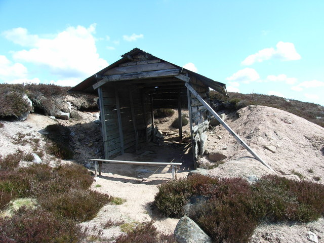
Black Craig Images

Images are sourced within 2km of 57.002042/-2.9386891 or Grid Reference NO4390. Thanks to Geograph Open Source API. All images are credited.

Gathering Cairn across the heather moor Lochnagar can just be seen in the extreme right hand of the picture above the green at the head of Glen Tanar
Gathering Cairn across the heather moor
Lochnagar can just be seen in the extreme right hand of the picture above the green at the head of Glen Tanar
Track leading towards Gathering Cairn The tracks on these grouse moors are built to facilitate grouse management
Track leading towards Gathering Cairn
The tracks on these grouse moors are built to facilitate grouse management
The lower slopes of Hill of Cairney and the Water of Cairney
Derelict shed The shed has almost transformed itself into a pile of rusted tin & weathered timber.  What I like about the geograph site is you can compare photos and see the changes over a period of time
Derelict shed
The shed has almost transformed itself into a pile of rusted tin & weathered timber. What I like about the geograph site is you can compare photos and see the changes over a period of time
Track through the heather A distinct track leading up the hillside towards Gathering Cairn
Track through the heather
A distinct track leading up the hillside towards Gathering Cairn
Land management for biodiversity Showing the burnt heather patches to encourage new growth.  Glen Tanar Estate are doing everything they can to encourage new growth on the moorland.  Clachen Yell is to the right of the col behind the burnt heather.
Land management for biodiversity
Showing the burnt heather patches to encourage new growth. Glen Tanar Estate are doing everything they can to encourage new growth on the moorland. Clachen Yell is to the right of the col behind the burnt heather.
Solar Panels & Clachan Yell A satellite dish & solar panels on a remote hillside????? Clachan Yell in the background
Solar Panels & Clachan Yell
A satellite dish & solar panels on a remote hillside????? Clachan Yell in the background
Wolf Grain A view towards Wolf Grain, a burn draining north-east from high ground situated between Braid Cairn and the Gathering Cairn. Walking here is close to purgatorial, due to peat hags and deep, ankle-grasping heather.
Wolf Grain
A view towards Wolf Grain, a burn draining north-east from high ground situated between Braid Cairn and the Gathering Cairn. Walking here is close to purgatorial, due to peat hags and deep, ankle-grasping heather.
Wolf Grain A view down the course of Wolf Grain. Difficult walking here on steep pathless terrain, with bog, peat hags and deep heather to negotiate.
Wolf Grain
A view down the course of Wolf Grain. Difficult walking here on steep pathless terrain, with bog, peat hags and deep heather to negotiate.
Gathering Cairn Heather-clad ground on the Gathering Cairn, with hills beyond the Water of Gairney visible in the distance.
Gathering Cairn
Heather-clad ground on the Gathering Cairn, with hills beyond the Water of Gairney visible in the distance.
East of Wolf Grain Steep heather clad slopes to the east of Wolf Grain - difficult walking here.
East of Wolf Grain
Steep heather clad slopes to the east of Wolf Grain - difficult walking here.
Fir Bog & Shiel of Glentanar Looking South West across Fir Bog towards the green patch of Shiel of Glentanar with the mountain of Lochnagar just visible 19 km away.
Fir Bog & Shiel of Glentanar
Looking South West across Fir Bog towards the green patch of Shiel of Glentanar with the mountain of Lochnagar just visible 19 km away.
Gathering Cairn Looking South across the North Eastern flank of Gathering Cairn with Braid Cairn behind and the roof of a small shelter in the centre of the photograph. This view shows the poor state of the track junction. The track generally remains much the same until 2 km East of here where it is being improved considerably.
Gathering Cairn
Looking South across the North Eastern flank of Gathering Cairn with Braid Cairn behind and the roof of a small shelter in the centre of the photograph. This view shows the poor state of the track junction. The track generally remains much the same until 2 km East of here where it is being improved considerably.
Derelict Shelter This derelict shelter is not exactly windproof, which is probably why it is not shown on the Geograph map although it is shown on earlier Ordnance Survey maps.
Derelict Shelter
This derelict shelter is not exactly windproof, which is probably why it is not shown on the Geograph map although it is shown on earlier Ordnance Survey maps.
Water of Gairney Looking South East across the Water of Gairney and Burn of Redshank towards Cock Cairn.
Water of Gairney
Looking South East across the Water of Gairney and Burn of Redshank towards Cock Cairn.
Fir Bog & Gathering Cairn Looking southeast up the slope of Fir Bog towards the peak of Gathering Cairn.
Fir Bog & Gathering Cairn
Looking southeast up the slope of Fir Bog towards the peak of Gathering Cairn.
Fir Bog & Red Craig Northeast across the slope of Fir Bog towards the summits of Red Craig on the left and Black Craig on the right.
Fir Bog & Red Craig
Northeast across the slope of Fir Bog towards the summits of Red Craig on the left and Black Craig on the right.
Track leading towards Red Craig
Show me another place!

Black Craig is located at Grid Ref: NO4390 (Lat: 57.002042, Lng: -2.9386891)

Unitary Authority: Aberdeenshire

Police Authority: North East

What 3 Words

///mourner.flux.surfer. Near Ballater, Aberdeenshire

Nearby Locations

Black Craig

Related Wikis

Mount Keen

Mount Keen (Scottish Gaelic: Monadh Caoin) is a 939-metre-high (3,081 ft) mountain in Scotland and the most easterly Munro. It can be accessed from several...

Kincardine and Deeside

Kincardine and Deeside was formerly (1975–96) a local government district in the Grampian Region of Scotland. In 1996 it was included in the Aberdeenshire...

Dee Castle

Dee Castle was a 15th-century castle, about 5 miles (8.0 km) east of Ballater, Aberdeenshire, Scotland, and south of the River Dee.It may be known alternatively...

Glen Tanar

Glen Tanar (Scottish Gaelic: Gleann Tanar) is a glen in Aberdeenshire, eastern Scotland, through which the Water of Tanar flows. Near the mouth of the...

Nearby Amenities

Located within 500m of 57.002042,-2.9386891
Black Craig
Ele: 640
Natural: peak
Lat/Long: 57.001441/-2.9376479
The data included in this document is from www.openstreetmap.org. The data is made available under ODbL.

Have you been to Black Craig?

Leave your review of Black Craig below (or comments, questions and feedback).