Crumside Hill

Hill, Mountain in Midlothian

Scotland

Crumside Hill

Summit, Bowshank Hill
Summit, Bowshank Hill Credit: Richard Webb

Crumside Hill is a prominent hill located in Midlothian, Scotland. It stands at an elevation of approximately 430 meters (1,410 feet) and is part of the Moorfoot Hills range. The hill is situated about 17 kilometers (10.5 miles) southeast of the city of Edinburgh.

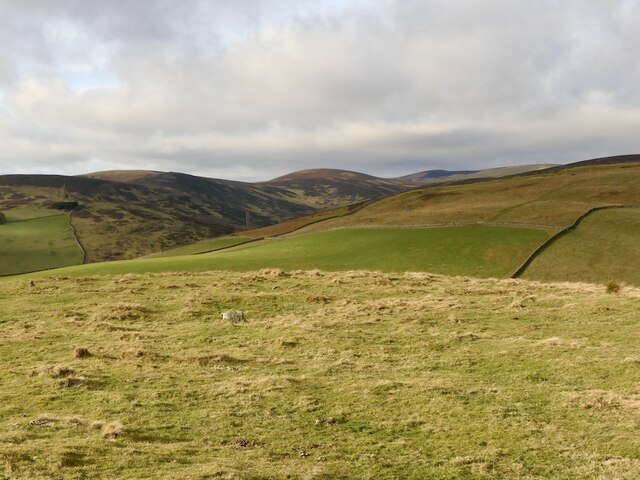
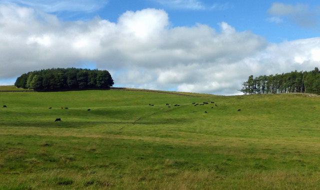
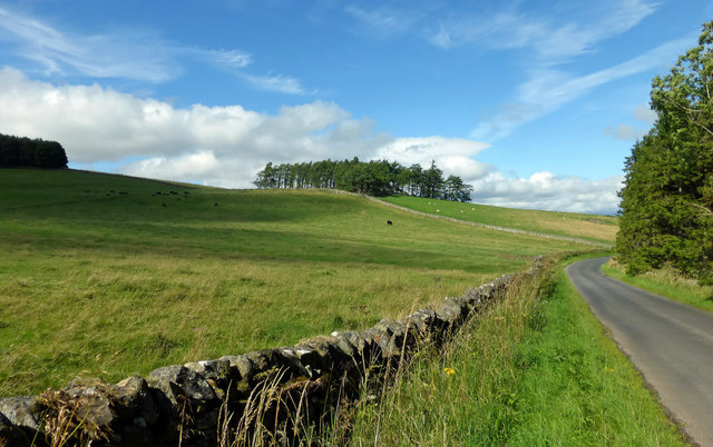
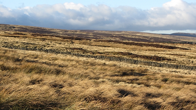
Crumside Hill is characterized by its gently sloping terrain and is covered with a mix of heather, grass, and scattered patches of woodland. The hill offers stunning panoramic views of the surrounding countryside, including the nearby Pentland Hills to the northwest and the Firth of Forth to the northeast.

The area around Crumside Hill is rich in history, with several ancient sites of interest nearby. These include the remains of medieval settlements, prehistoric hill forts, and burial mounds. The hill itself is said to have been a site of human activity dating back thousands of years.

Crumside Hill is a popular destination for hikers, nature enthusiasts, and birdwatchers, offering a variety of walking routes and trails. The hill is home to a diverse range of wildlife, including various bird species, such as buzzards and kestrels, as well as deer and other mammals.

Access to Crumside Hill is relatively straightforward, with a number of well-maintained paths leading to the summit. The hill provides a peaceful and tranquil setting for visitors to enjoy the beauty of the Scottish countryside and take in the breathtaking views.

If you have any feedback on the listing, please let us know in the comments section below.

Crumside Hill Images

Images are sourced within 2km of 55.660858/-2.9087889 or Grid Reference NT4241. Thanks to Geograph Open Source API. All images are credited.

Summit, Bowshank Hill
Union of South Africa on the Borders Railway This steam special is approaching a road bridge at Ferniehirst.
Union of South Africa on the Borders Railway
This steam special is approaching a road bridge at Ferniehirst.
Bowland Farmland Grazing land on the Bowland Estate with Peat Wood on the far left.
Bowland Farmland
Grazing land on the Bowland Estate with Peat Wood on the far left.
Bowland Estate Farmland A late-summer view of grazing land on the Bowland Estate.
Bowland Estate Farmland
A late-summer view of grazing land on the Bowland Estate.
Ferniehirst Farm A late-summer view with the cereal fields already harvested.
Ferniehirst Farm
A late-summer view with the cereal fields already harvested.
Windydoors Midden There is a new fence which crosses the old march dyke here. The boundaries are shown on the Ordnance Survey 1:25,000 map, including my 20 year old edition, suggesting that the new fence has replaced an older one.
Windydoors Midden
There is a new fence which crosses the old march dyke here. The boundaries are shown on the Ordnance Survey 1:25,000 map, including my 20 year old edition, suggesting that the new fence has replaced an older one.
Dyke junction on Ferniehirst Hill A big, blighted view down the Gala Water towards the Eildon Hills and The Cheviot.
Dyke junction on Ferniehirst Hill
A big, blighted view down the Gala Water towards the Eildon Hills and The Cheviot.
Cairn on Ferniehirst Hill The moorland is grassy here.
Cairn on Ferniehirst Hill
The moorland is grassy here.
Pond on Ferniehirst Hill The hillside is grazed by sheep.
Pond on Ferniehirst Hill
The hillside is grazed by sheep.
Dyke on Ferniehirst Hill A substantial wall with no obvious intended crossing point which suggests it's a farm boundary. The dyke had collapsed at one point opening up an escape route.
Dyke on Ferniehirst Hill
A substantial wall with no obvious intended crossing point which suggests it's a farm boundary. The dyke had collapsed at one point opening up an escape route.
Hope Rig The corner of a big enclosed area of rough grazing on Ferniehirst Hill. The woodland is part of a strip which shelters improved land below.
Hope Rig
The corner of a big enclosed area of rough grazing on Ferniehirst Hill. The woodland is part of a strip which shelters improved land below.
Between Yardstone Knowe and Ferniehirst Hill A new fence runs beside a ruined dyke along the broad moorland ridge.
Between Yardstone Knowe and Ferniehirst Hill
A new fence runs beside a ruined dyke along the broad moorland ridge.
Dyke on Ferniehirst Hill A ruined dyke has been supported as stock proofing by a new wire fence. This is at least the second fence to be built here, going on map evidence.
Dyke on Ferniehirst Hill
A ruined dyke has been supported as stock proofing by a new wire fence. This is at least the second fence to be built here, going on map evidence.
Ferniehirst Hill The summit area.
Ferniehirst Hill
The summit area.
A woodland's corner Rough grazing on Ferniehurst Hill with woodland sheltering lower ground.
A woodland's corner
Rough grazing on Ferniehurst Hill with woodland sheltering lower ground.
Rough grazing, Ferniehirst Rough ground above the Gala Water. It is grazed by sheep.
Rough grazing, Ferniehirst
Rough ground above the Gala Water. It is grazed by sheep.
New Wood A clear felled and replanted section of woodland.
New Wood
A clear felled and replanted section of woodland.
Sheep, Fowie Farmland sheltered from the moors above by woodland. The fields are on stony ground and there are numerous clearance cairns and dykes using up cleared rock.
Sheep, Fowie
Farmland sheltered from the moors above by woodland. The fields are on stony ground and there are numerous clearance cairns and dykes using up cleared rock.
Show me another place!

Crumside Hill is located at Grid Ref: NT4241 (Lat: 55.660858, Lng: -2.9087889)

Unitary Authority: The Scottish Borders

Police Authority: The Lothians and Scottish Borders

What 3 Words

///cross.pilots.reference. Near Galashiels, Scottish Borders

Related Wikis

Bowshank

Bowshank is a village in the Scottish Borders area of Scotland, close to the A7, beside the Gala Water. Nearby are Bow Castle Broch, as well as Buckholm...

Bowland railway station

Bowland railway station (Bowland Bridge between May 1849 and July 1862) was a railway station in the village of Bowland, near Galashiels, Scotland. Located...

Bow Castle Broch

Bow Castle is the remains of an iron-age broch near the Gala Water, in the Scottish Borders area of Scotland, in the parish of Stow. It is a scheduled...

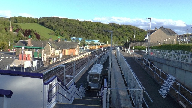
Stow railway station

Stow is a railway station on the Borders Railway, which runs between Edinburgh Waverley and Tweedbank. The station, situated 26 miles 45 chains (43 km...
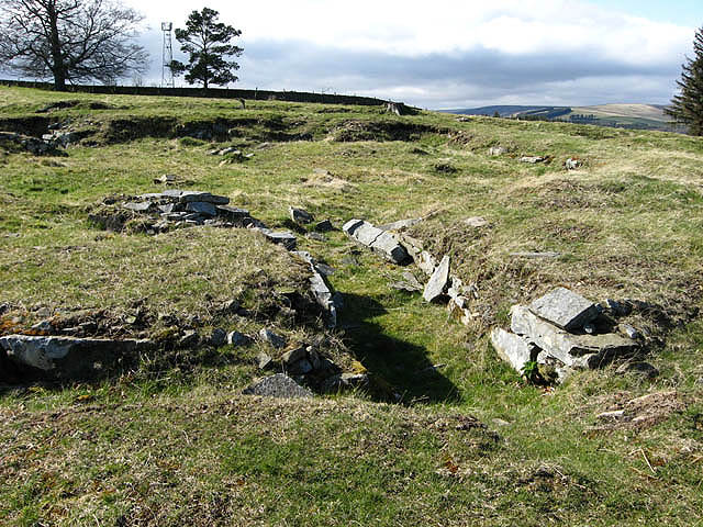
Torwoodlee Broch

Torwoodlee Broch is the remains of an iron-age broch located near the town of Galashiels in the Scottish Borders. == Description == Torwoodlee Broch...

Stow of Wedale

Stow of Wedale, or more often Stow, is a village in the Scottish Borders area of Scotland (historically Midlothian), 7 miles (11 kilometres) north of...

Stow of Wedale Town Hall

Stow of Wedale Town Hall is a municipal building in Earlston Road, Stow of Wedale, Scottish Borders, Scotland. The structure, which serves as a community...

Clovenfords railway station

Clovenfords railway station served the village of Clovenfords, Scottish Borders, Scotland from 1866 to 1962 on the Peebles Railway. == History == The station...

Nearby Amenities

Located within 500m of 55.660858,-2.9087889
Crumside Hill
Place: locality
Lat/Long: 55.65684/-2.9081183
The data included in this document is from www.openstreetmap.org. The data is made available under ODbL.

Have you been to Crumside Hill?

Leave your review of Crumside Hill below (or comments, questions and feedback).