Henwood Hill

Hill, Mountain in Dorset

England

Henwood Hill

Colmers Hill
Colmers Hill Credit: Mark Percy

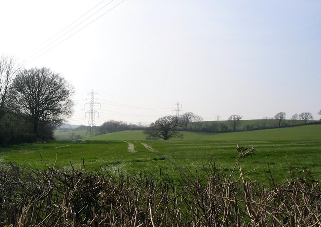
Henwood Hill is a prominent hill located in the county of Dorset, England. Situated in the southwestern part of the county, it forms part of the picturesque countryside landscape of the region. The hill is known for its distinctive shape and commanding views over the surrounding areas.

With an elevation of approximately 180 meters (590 feet), Henwood Hill is not particularly tall compared to some of the nearby peaks, but its position provides it with a prominent presence in the local landscape. Covered in lush green grass and sporadic patches of woodland, the hill is a haven for local wildlife and offers ample opportunities for nature enthusiasts to explore.

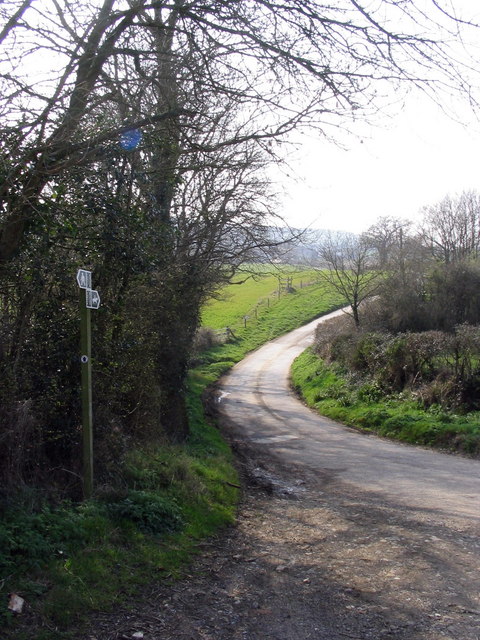
The summit of Henwood Hill offers breathtaking panoramic views of the surrounding countryside. On clear days, visitors can see for miles, with sights ranging from the rolling hills of Dorset to the distant coastline. The hill is a popular spot for hikers and walkers, with several footpaths and trails crisscrossing its slopes.

Henwood Hill is also steeped in history, with evidence of human habitation dating back thousands of years. Archaeological discoveries in the area have revealed ancient burial mounds and remnants of Iron Age settlements, highlighting its significance as a historical site.

Overall, Henwood Hill is a picturesque and historically significant landmark in Dorset. Its natural beauty, panoramic views, and rich history make it an appealing destination for locals and tourists alike.

If you have any feedback on the listing, please let us know in the comments section below.
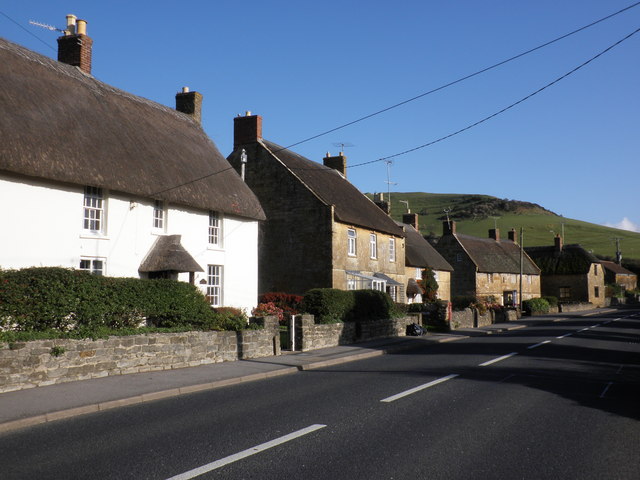
Henwood Hill Images

Images are sourced within 2km of 50.750905/-2.8120536 or Grid Reference SY4294. Thanks to Geograph Open Source API. All images are credited.

Colmers Hill
Colmers Hill
Colmers Hill View from the Symondsbury Estate car park.  A permissive path takes visitors on a pleasant walk to the hill.
Colmers Hill
View from the Symondsbury Estate car park. A permissive path takes visitors on a pleasant walk to the hill.
Coppet Hill
Coppet Hill
Colmer's Hill
Colmer's Hill
Quarry Hill
Quarry Hill
Farmland east of Hardown Hill
Green lane and farmland, north of Quarry Cross
Near Denhay Farms, Broadoak A view across fields near the Denhay Corner House and Upper and Lower Denhay Farms, near Broadoak.
Near Denhay Farms, Broadoak
A view across fields near the Denhay Corner House and Upper and Lower Denhay Farms, near Broadoak.
Track to Denhay Farms This is the point where the "road, generally less than 4m wide" towards Denhay Farms veers right and becomes an "other road, drive or track". The signs indicate that it is also a public bridleway.
Track to Denhay Farms
This is the point where the "road, generally less than 4m wide" towards Denhay Farms veers right and becomes an "other road, drive or track". The signs indicate that it is also a public bridleway.
Unusual view of an electricity pylon You'll have to take my word that this is the actual pylon at the precise grid reference I've entered - also, there is no option in "direction photographer facing" for UP! 
Interestingly, when comparing the 1:50000 map on Geograph with the 1:25000 map I was carrying, there is quite a big discrepancy between the exact siting of the pylons. This one is only shown on the larger scale map.
Unusual view of an electricity pylon
You'll have to take my word that this is the actual pylon at the precise grid reference I've entered - also, there is no option in "direction photographer facing" for UP! Interestingly, when comparing the 1:50000 map on Geograph with the 1:25000 map I was carrying, there is quite a big discrepancy between the exact siting of the pylons. This one is only shown on the larger scale map.
View towards Atrim The minor lane from Broadoak to Atrim crosses a public footpath here.
View towards Atrim
The minor lane from Broadoak to Atrim crosses a public footpath here.
Broadoak Farm, Broadoak Broadoak Farm seen from the lane leading up from Symondsbury. The hill in the distance is near South Bowood.
Broadoak Farm, Broadoak
Broadoak Farm seen from the lane leading up from Symondsbury. The hill in the distance is near South Bowood.
Recycling or junk? This old Humber car is surrounded by farmyard junk and improvised chicken runs, and appears to be part of the birds' accommodation. Still a bit of an eyesore though.
Recycling or junk?
This old Humber car is surrounded by farmyard junk and improvised chicken runs, and appears to be part of the birds' accommodation. Still a bit of an eyesore though.
Silverbridge Farm from Carter's Lane A view down the hill from Carter's Lane towards Silverbridge Farm. Carter's Lane is a small country road climbing from North Chideock (32m) to Morcombelake (128m) at an average gradient of about 1 in 10.
Silverbridge Farm from Carter's Lane
A view down the hill from Carter's Lane towards Silverbridge Farm. Carter's Lane is a small country road climbing from North Chideock (32m) to Morcombelake (128m) at an average gradient of about 1 in 10.
Right Bottom This valley is shown on the 1:25000 map as 'Right Bottom', and the track is a private road which crosses the valley to Carter's Lane. 

A small warning to walkers - the bridleway is not as shown on the 1:25000 map between here and Hounsell's Cross. To avoid a long detour you need to go around the field centred on SY415941. If you try to cross it as the map shows, there is no way out at the eastern end. The farmer's a nice chap though, seemingly quite used to people wandering around his fields looking lost!.
Right Bottom
This valley is shown on the 1:25000 map as 'Right Bottom', and the track is a private road which crosses the valley to Carter's Lane. A small warning to walkers - the bridleway is not as shown on the 1:25000 map between here and Hounsell's Cross. To avoid a long detour you need to go around the field centred on SY415941. If you try to cross it as the map shows, there is no way out at the eastern end. The farmer's a nice chap though, seemingly quite used to people wandering around his fields looking lost!.
Cottages and overhead wires at North Chideock A view of attractive thatched buildings in North Chideock, looking east along the road leading to Brighthay and Wells Farms, which for some reason becomes 'Hell lane' a bit further along.
Cottages and overhead wires at North Chideock
A view of attractive thatched buildings in North Chideock, looking east along the road leading to Brighthay and Wells Farms, which for some reason becomes 'Hell lane' a bit further along.
Colmer's Hill Colmers Hill can be seen from all around the area and was named after the Rev. John Colmer, who was the local rector of Symondsbury from 1805-06. The trees on the top of the hill were planted during WW1. 

To see some 360°Panoramas of Dorset please visit this <span class="nowrap"><a title="http://www.360panoramas.co.uk" rel="nofollow ugc noopener" href="http://www.360panoramas.co.uk">Link</a><img style="margin-left:2px;" alt="External link" title="External link - shift click to open in new window" src="https://s1.geograph.org.uk/img/external.png" width="10" height="10"/></span>
Colmer's Hill
Colmers Hill can be seen from all around the area and was named after the Rev. John Colmer, who was the local rector of Symondsbury from 1805-06. The trees on the top of the hill were planted during WW1. To see some 360°Panoramas of Dorset please visit this LinkExternal link
View from near Chideock Manor Looking east towards Quarry Hill
To see some 360° Panoramas of Dorset please visit this <span class="nowrap"><a title="http://www.360panoramas.co.uk" rel="nofollow ugc noopener" href="http://www.360panoramas.co.uk">Link</a><img style="margin-left:2px;" alt="External link" title="External link - shift click to open in new window" src="https://s1.geograph.org.uk/img/external.png" width="10" height="10"/></span>
View from near Chideock Manor
Looking east towards Quarry Hill To see some 360° Panoramas of Dorset please visit this LinkExternal link
Show me another place!

Henwood Hill is located at Grid Ref: SY4294 (Lat: 50.750905, Lng: -2.8120536)

Unitary Authority: Dorset

Police Authority: Dorset

What 3 Words

///diverting.saints.explores. Near Bridport, Dorset

Related Wikis

Atrim

Atrim is a small village in Dorset, England, just north of the large town, Bridport. It is situated on the River Simene. The nearest village is Dottery...

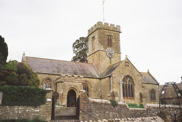
St Paul's Church, Broadoak

St Paul's Church is a Church of England church in Broadoak, Dorset, England. It was designed by Thomas Talbot Bury and built in 1865–66. The church has...

Symondsbury

Symondsbury () is a village and civil parish in southwest Dorset, England, 1.5 miles (2.4 km) west of Bridport and 16 miles (26 km) west of Dorchester...

Chideock

Chideock ( CHID-ək) is a village and civil parish in south west Dorset, England, situated close to the English Channel between Bridport and Lyme Regis...

Nearby Amenities

Located within 500m of 50.750905,-2.8120536
Material: wood
Power: pole
Source: bing
Lat/Long: 50.7513113/-2.8174768
Material: wood
Power: pole
Source: bing
Lat/Long: 50.7518975/-2.808231
Material: wood
Power: pole
Source: bing
Lat/Long: 50.7519525/-2.8094432
Material: wood
Power: pole
Source: bing
Lat/Long: 50.7519716/-2.8106372
Material: wood
Power: pole
Source: bing
Lat/Long: 50.7519973/-2.8132488
Material: wood
Power: pole
Source: bing
Lat/Long: 50.7520036/-2.8144264
Material: wood
Power: pole
Source: bing
Lat/Long: 50.7520476/-2.815747
Material: wood
Power: pole
Source: bing
Lat/Long: 50.7520502/-2.8170273
Material: wood
Power: pole
Source: bing
Lat/Long: 50.7520665/-2.8062941
Material: wood
Power: pole
Source: bing
Lat/Long: 50.7520933/-2.8184245
The data included in this document is from www.openstreetmap.org. The data is made available under ODbL.

Have you been to Henwood Hill?

Leave your review of Henwood Hill below (or comments, questions and feedback).