Skea Hill

Hill, Mountain in Orkney

Scotland

Skea Hill

Coastline below Skea Hill, Westray, Orkney Looking towards Rousay (left) and Orkney Mainland.
Coastline below Skea Hill, Westray, Orkney Credit: Claire Pegrum

Skea Hill is a prominent landmark located in the Orkney Islands, an archipelago situated off the northeastern coast of Scotland. Rising to a height of approximately 360 meters (1,181 feet), it is considered one of the highest points in the region, offering breathtaking panoramic views of the surrounding landscape.

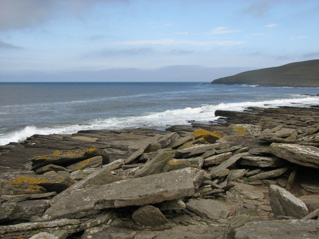
Situated on the island of Eday, Skea Hill is characterized by its rugged and imposing appearance. It is composed mainly of Old Red Sandstone, a type of sedimentary rock that gives the hill its distinctive reddish hue. The hill's steep slopes and craggy cliffs make it an appealing destination for hikers and outdoor enthusiasts, who can enjoy the challenging ascent and the stunning vistas from the summit.

Skea Hill is also known for its rich historical and archaeological significance. The hill features several ancient burial mounds, known as tumuli, which date back to the Bronze Age. These burial sites provide valuable insights into the island's early inhabitants and their burial practices. In addition, the hill is home to a variety of wildlife, including nesting seabirds and rare plant species.

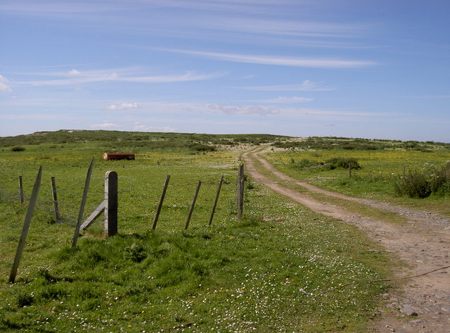
Accessing Skea Hill is relatively straightforward, with a well-marked path leading to the summit. However, caution is advised, as the terrain can be uneven and steep in some areas. Visitors are advised to wear appropriate footwear and bring provisions for their hike. The effort is rewarded with stunning views of the Orkney Islands and the North Sea, making Skea Hill a must-visit destination for nature lovers and history enthusiasts alike.

If you have any feedback on the listing, please let us know in the comments section below.

Skea Hill Images

Images are sourced within 2km of 59.279327/-3.0162199 or Grid Reference HY4244. Thanks to Geograph Open Source API. All images are credited.

Coastline below Skea Hill, Westray, Orkney Looking towards Rousay (left) and Orkney Mainland.
Coastline below Skea Hill, Westray, Orkney
Looking towards Rousay (left) and Orkney Mainland.
Peerie Breast, Westray, Orkney Peerie Breast is the closest headland.  Red Nev is beyond and in the far distance is North Hill.
Peerie Breast, Westray, Orkney
Peerie Breast is the closest headland. Red Nev is beyond and in the far distance is North Hill.
Rocky foreshore This is near to Muckle Water, with a view of Skea Hill in the background.
Rocky foreshore
This is near to Muckle Water, with a view of Skea Hill in the background.
Coastline NW of Fitty Hill This forms part of the West Westray Walk.
Coastline NW of Fitty Hill
This forms part of the West Westray Walk.
Fitty Hill Used the footpath via Lengemire which is now a ruin with Jim Bloomer and Tricky Speirs.
Name: Fitty Hill
Hill number: 1557
Height: 169m / 554ft
Area: 23: Orkney Islands
Class: Ma,1
Grid ref: HY 42976 44856
Summit feature: trig point
Drop: 169m
Col: Sea
Fitty Hill
Used the footpath via Lengemire which is now a ruin with Jim Bloomer and Tricky Speirs. Name: Fitty Hill Hill number: 1557 Height: 169m / 554ft Area: 23: Orkney Islands Class: Ma,1 Grid ref: HY 42976 44856 Summit feature: trig point Drop: 169m Col: Sea
Heading For Fitty Hill
Summit, Fitty Hill A triangulation pillar at the highest point of Westray.
Summit, Fitty Hill
A triangulation pillar at the highest point of Westray.
Slopes of Fitty Hill View towards the Ness of Tuquoy at the southern tip of Westray.
Slopes of Fitty Hill
View towards the Ness of Tuquoy at the southern tip of Westray.
Fitty Hill The highest hill on Westray.
Fitty Hill
The highest hill on Westray.
Fields and beach near Kirbest, Westside View toward beach near Kirbest, Westside district of Westray
Fields and beach near Kirbest, Westside
View toward beach near Kirbest, Westside district of Westray
Old shed on shore near Kirbest, Westside, Westray Old store by the shore with island of Egilday on horizon above it - you can just make out the tower of St Magnus Church on Egilsay.
Old shed on shore near Kirbest, Westside, Westray
Old store by the shore with island of Egilday on horizon above it - you can just make out the tower of St Magnus Church on Egilsay.
Cottage below Fitty Hill, Westside, Westray
Farm of Hammers, Westside Westray
'Patience' - farm cottage
Sandy Links of Gairy, Westside, Westray Like all sandy areas in Westray, this is over-run with rabbits.  Is used occasionally for Motocross races.
Sandy Links of Gairy, Westside, Westray
Like all sandy areas in Westray, this is over-run with rabbits. Is used occasionally for Motocross races.
House of Powdykes, Westside, Westray Shed used to be part of croft of Cottahowan.
House of Powdykes, Westside, Westray
Shed used to be part of croft of Cottahowan.
Arable farmland, Powdykes, Westside, Westray Farmland of Powdykes in foreground - being cut for winter silage.  Cottages of Netherhouse on horizon.
Arable farmland, Powdykes, Westside, Westray
Farmland of Powdykes in foreground - being cut for winter silage. Cottages of Netherhouse on horizon.
Overgrown burn (stream) near Netherhouse, Westray This burn, or stream, carries on to the sea.  To the right of centre, you can just make out a little bump against the sea which is the remains of the Broch o Burristae.
Overgrown burn (stream) near Netherhouse, Westray
This burn, or stream, carries on to the sea. To the right of centre, you can just make out a little bump against the sea which is the remains of the Broch o Burristae.
Show me another place!

Skea Hill is located at Grid Ref: HY4244 (Lat: 59.279327, Lng: -3.0162199)

Unitary Authority: Orkney Islands

Police Authority: Highlands and Islands

What 3 Words

///scar.aboard.discouraged. Near Pierowall, Orkney Islands

Related Wikis

Westray

Westray (, Scots: Westree) is one of the Orkney Islands in Scotland, with a usual resident population of just under 600 people. Its main village is Pierowall...

Westside Church

Westside Church, (also known as Cross Kirk), is a ruined 12th century church located on the island of Westray in Orkney, Scotland. Archaeological excavations...

Pierowall

Pierowall is a village of Westray in the Orkney Islands, off the coast of the northern Scottish mainland. The village is the island's largest settlement...

Noltland Castle

Noltland Castle is located near Pierowall on the island of Westray in the Orkney Islands of Scotland. It dates mainly to the later 16th century, although...

Links of Noltland

Links of Noltland is a large prehistoric settlement located on the north coast of the island of Westray in Orkney, Scotland. The extensive ruins includes...

Lady Kirk

The Lady Kirk (or St Mary's Kirk) at Pierowall is a ruined 17th-century church on the island of Westray, in Orkney, Scotland. The church was built in 1674...

Noup Head Lighthouse

Noup Head Lighthouse lies on the north west headland of the isle of Westray, in Orkney, Scotland. It was constructed by David A Stevenson in 1898 for...

Quoygrew settlement, Westray

Quoygrew, Westray is the site of a medieval Norse settlement on the island of Westray in Orkney, Scotland. Established as a small farmstead most likely...

Nearby Amenities

Located within 500m of 59.279327,-3.0162199
Skea Hill
Corbett: no
Ele: 80
Graham: no
Marilyn: no
Munro: no
Natural: peak
Lat/Long: 59.2794834/-3.0174683
Power: pole
Lat/Long: 59.2769251/-3.0091931
The data included in this document is from www.openstreetmap.org. The data is made available under ODbL.

Have you been to Skea Hill?

Leave your review of Skea Hill below (or comments, questions and feedback).