Grumack Hill
Hill, Mountain in Banffshire
Scotland
Grumack Hill

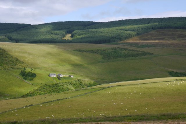
Grumack Hill is a prominent landmark located in Banffshire, Scotland. Rising to an elevation of 331 meters (1,086 feet), it is classified as a hill rather than a mountain. Despite its relatively modest height, Grumack Hill offers stunning panoramic views of the surrounding countryside and coastline.
The hill is characterized by its gentle slopes and grassy terrain, making it a popular destination for hikers and nature enthusiasts. A network of well-marked trails crisscrosses the hill, providing visitors with opportunities to explore its diverse flora and fauna.
Grumack Hill is also home to a variety of wildlife, including birds of prey, deer, and other small mammals. The hill is part of a designated nature reserve, ensuring the protection of its natural habitats and species.
In addition to its natural beauty, Grumack Hill has historical significance as well. The remains of ancient settlements and fortifications can be found on its slopes, serving as a reminder of the area's rich cultural heritage.
Overall, Grumack Hill is a peaceful and picturesque destination, offering visitors a chance to connect with nature and immerse themselves in the history of Banffshire.
If you have any feedback on the listing, please let us know in the comments section below.
Grumack Hill Images
Images are sourced within 2km of 57.381597/-2.9701246 or Grid Reference NJ4132. Thanks to Geograph Open Source API. All images are credited.


Grumack Hill is located at Grid Ref: NJ4132 (Lat: 57.381597, Lng: -2.9701246)
Unitary Authority: Moray
Police Authority: North East
What 3 Words
///remembers.shredding.changed. Near Dufftown, Moray
Nearby Locations
Related Wikis

Wormy Hillock Henge
Wormy Hillock Henge, also known as The Dragon's Grave, is a small henge in Aberdeenshire, Scotland. It is a Scheduled Ancient Monument located in the Clashindarroch...

Beldorney Castle
Beldorney Castle is a Z-plan castle dating from the mid-16th century, about two miles south of Glass, in hilly country in the valley of the Deveron, in...

Glass, Aberdeenshire
Glass is a parish about 8 miles west of Huntly, Aberdeenshire, Scotland. It is now wholly located in Aberdeenshire but before the reorganisation of Scottish...

Clashindarroch Forest
Clashindarroch Forest is possibly the largest forest in Aberdeenshire, situated to the south-west of the market town of Huntly. Managed by Forest Enterprise...
Nearby Amenities
Located within 500m of 57.381597,-2.9701246Have you been to Grumack Hill?
Leave your review of Grumack Hill below (or comments, questions and feedback).