Crumblie Hill

Hill, Mountain in Fife

Scotland

Crumblie Hill

The fertile lands of Fife Agricultural land close by the A92. In the middle distance is a bridge over a former railway line between Newport on Tay and Newburgh.
The fertile lands of Fife Credit: Gordon Hatton

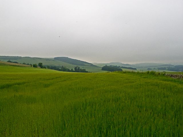
Crumblie Hill is a prominent hill located in the region of Fife, Scotland. It is situated approximately 2 miles northwest of the town of Cupar, and its summit stands at an elevation of 232 meters (761 feet) above sea level. The hill is part of the Lomond Hills range, which is a collection of peaks that form a distinctive landscape feature in the region.

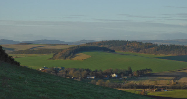
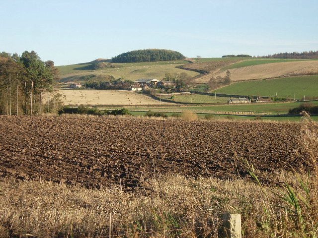
Crumblie Hill offers breathtaking panoramic views of the surrounding countryside, including the nearby towns, villages, and farmland. On clear days, it is possible to see as far as the River Tay and the city of Dundee to the north, and the Firth of Forth and the city of Edinburgh to the south. The hill is a popular destination for outdoor enthusiasts, hikers, and nature lovers who are attracted by its natural beauty and the opportunity for outdoor activities.

The terrain of Crumblie Hill is characteristically hilly and covered with heather, grasses, and patches of woodland. It is home to a variety of wildlife, including birds, rabbits, and deer. The hill is accessible via several well-marked footpaths, and there is a car park nearby for visitors who prefer to drive.

Crumblie Hill holds historical significance as well. It is rumored to have been a site of ancient settlements, with remnants of Iron Age forts and burial mounds discovered in the area. This adds to the hill's allure, as it provides a glimpse into the region's rich cultural heritage.

If you have any feedback on the listing, please let us know in the comments section below.

Crumblie Hill Images

Images are sourced within 2km of 56.387523/-2.9556648 or Grid Reference NO4122. Thanks to Geograph Open Source API. All images are credited.

The fertile lands of Fife Agricultural land close by the A92. In the middle distance is a bridge over a former railway line between Newport on Tay and Newburgh.
The fertile lands of Fife
Agricultural land close by the A92. In the middle distance is a bridge over a former railway line between Newport on Tay and Newburgh.
West to Kilmany from Cruivie
Expansive undulating landscape along the A92 Photographer is above the actual pavement of the A92 road.
Expansive undulating landscape along the A92
Photographer is above the actual pavement of the A92 road.
Ploughed field, Kilmany The ground is drying out on another mild day.
Ploughed field, Kilmany
The ground is drying out on another mild day.
Willow crop Damp ground is being used to grow a fuel crop.
Willow crop
Damp ground is being used to grow a fuel crop.
Disused Newburgh and North Fife Railway The very overgrown trackbed of the Newburgh and North Fife Railway, which ran from Newburgh to St Fort. This route was opened in 1909, and was eventually closed in 1964. A short section of the disused railway west of Kilmany now serves as a heritage path - see: <span class="nowrap"><a title="http://www.heritagepaths.co.uk/pathdetails.php?path=14" rel="nofollow ugc noopener" href="http://www.heritagepaths.co.uk/pathdetails.php?path=14">Link</a><img style="margin-left:2px;" alt="External link" title="External link - shift click to open in new window" src="https://s1.geograph.org.uk/img/external.png" width="10" height="10"/></span>
Disused Newburgh and North Fife Railway
The very overgrown trackbed of the Newburgh and North Fife Railway, which ran from Newburgh to St Fort. This route was opened in 1909, and was eventually closed in 1964. A short section of the disused railway west of Kilmany now serves as a heritage path - see: LinkExternal link
Farmland near Forret Mill Arable farmland west of Forret Mill, viewed in early July 2012 in a prolonged period of wet weather, with visibility limited by low-lying cloud. The place name "Forret", (which also occurs in nearby Easter/Wester Forret, and Torr Forret) is believed to be derived from the personal name Ferat.
Farmland near Forret Mill
Arable farmland west of Forret Mill, viewed in early July 2012 in a prolonged period of wet weather, with visibility limited by low-lying cloud. The place name "Forret", (which also occurs in nearby Easter/Wester Forret, and Torr Forret) is believed to be derived from the personal name Ferat.
Stone bridge Carrying the A92 road across the Pitedie Burn.
Stone bridge
Carrying the A92 road across the Pitedie Burn.
Heading for a hump This minor road climbs steeply to surmount a hump-backed bridge across a long-vanished railway.
Heading for a hump
This minor road climbs steeply to surmount a hump-backed bridge across a long-vanished railway.
Stubble, Kilmany View to the village.
Stubble, Kilmany
View to the village.
Newburgh and North Fife Railway Trackbed near Kilmany.
Newburgh and North Fife Railway
Trackbed near Kilmany.
Forret hill and NE Fife From the slopes between Logie and Easter Forret, across Kilmany and Round Hill, towards Perthshire
Forret hill and NE Fife
From the slopes between Logie and Easter Forret, across Kilmany and Round Hill, towards Perthshire
Grassland, Long Hill Much of the land here is arable, but this steep slope is under grass.
Grassland, Long Hill
Much of the land here is arable, but this steep slope is under grass.
Minor road off the A92 heading to Logie
Farm road to Cruivie
Towers of bales Stacks of bales by the roadside east of Kilmany.
Towers of bales
Stacks of bales by the roadside east of Kilmany.
A92 east of Kilmany The A92 heading northbound at the junction with the minor road to Logie.
A92 east of Kilmany
The A92 heading northbound at the junction with the minor road to Logie.
Farmland near Kilmany The view is taken from the minor road which leads south from the A914 in the middle of the grid box. It looks south east across the box towards Cruivie  which is in NO4022
Farmland near Kilmany
The view is taken from the minor road which leads south from the A914 in the middle of the grid box. It looks south east across the box towards Cruivie which is in NO4022
Show me another place!

Crumblie Hill is located at Grid Ref: NO4122 (Lat: 56.387523, Lng: -2.9556648)

Unitary Authority: Fife

Police Authority: Fife

What 3 Words

///earplugs.putter.copper. Near Balmullo, Fife

Related Wikis

Lucklawhill

Lucklawhill is a hamlet one mile (1.6 km) northwest of the village of Balmullo in Fife, Scotland. Historically, Lucklawhill belonged to the Logie parish...

Logie, Fife

Logie (Scottish Gaelic: An Lagan) is a parish and village in east Fife, Scotland, 5 miles north-east of Cupar.The parish is bounded on the east by the...

Balmullo

Balmullo (Gaelic: Baile Mhullaich) is a village in Fife, Scotland. It is 7 miles (11 km) from the town of St Andrews and near to the villages of Lucklawhill...

St Fort railway station

St. Fort railway station served the civil parish of Forgan, Fife, Scotland from 1878 to 1965 on the Tay Bridge Line and Newburgh and North Fife Railway...

Kilmany Parish Church

Kilmany Parish Church is an ancient church building in Kilmany, Fife, Scotland. Dating to 1768, it is Category A listed.The church's pulpit was re-seated...

Kilmany

Kilmany (Scottish Gaelic: Cille Mheinidh) is a village and parish in Fife, Scotland. It is located on the A92 between Auchtermuchty and the Tay Road Bridge...

Kilmany railway station

Kilmany railway station served the village of Kilmany, Fife, Scotland from 1909 to 1951 on the Newburgh and North Fife Railway. == History == The station...

St Fort

St Fort (, , or ) is a rural area, largely in Forgan parish, Fife. The current form of the name is late eighteenth century, the origin being a sandy ford...

Nearby Amenities

Located within 500m of 56.387523,-2.9556648
Generator Method: wind_turbine
Generator Source: wind
Power: generator
Lat/Long: 56.386308/-2.9575405
Power: pole
Lat/Long: 56.3915989/-2.9564862
Power: pole
Lat/Long: 56.3908776/-2.9559506
Power: pole
Lat/Long: 56.390163/-2.9553533
Power: pole
Lat/Long: 56.3892695/-2.9554619
Power: pole
Lat/Long: 56.3884033/-2.95561
Power: pole
Lat/Long: 56.387615/-2.955684
Power: pole
Lat/Long: 56.3867693/-2.9557926
Power: pole
Lat/Long: 56.3858907/-2.9558988
Power: pole
Lat/Long: 56.3852007/-2.9560024
Power: pole
Lat/Long: 56.3839607/-2.9580954
Power: pole
Lat/Long: 56.384664/-2.9574331
Power: pole
Lat/Long: 56.3849262/-2.9567341
The data included in this document is from www.openstreetmap.org. The data is made available under ODbL.

Have you been to Crumblie Hill?

Leave your review of Crumblie Hill below (or comments, questions and feedback).