Bonlee Hill

Hill, Mountain in Aberdeenshire

Scotland

Bonlee Hill

Minor road towards Migvie
Minor road towards Migvie Credit: Steven Brown

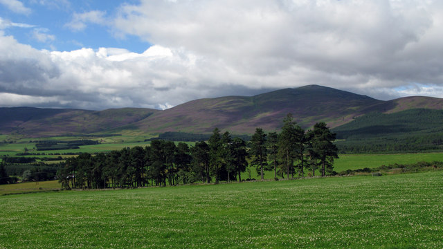
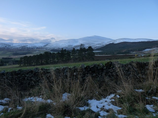
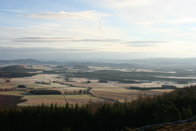
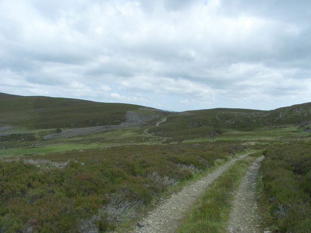
Bonlee Hill is a prominent hill located in Aberdeenshire, Scotland. Situated in the eastern part of the county, it forms part of the scenic landscape of the region. Standing at an elevation of approximately 315 meters (1,033 feet), it offers stunning panoramic views of the surrounding countryside.

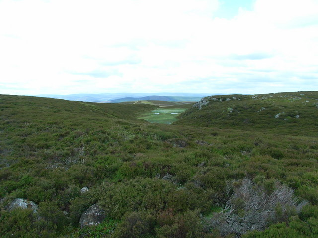
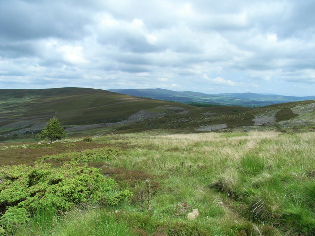
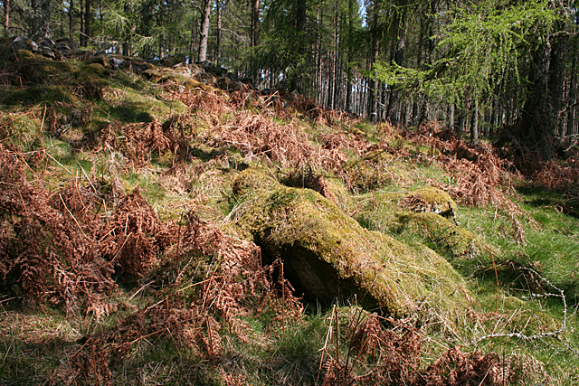
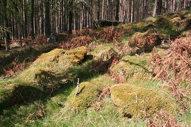
The hill is characterized by its gently sloping terrain, covered with heather, grasses, and scattered shrubs. It is primarily composed of granite, which is a common geological feature in this part of Scotland. Bonlee Hill is part of a larger range of hills known as the Grampian Mountains, which stretch across northeastern Scotland.

Access to Bonlee Hill is relatively easy, with several footpaths and trails leading to its summit. Hikers and outdoor enthusiasts frequent this area to enjoy the picturesque scenery and the tranquility of the surrounding nature. The hill is also a popular spot for birdwatching, as it attracts a variety of bird species, including red grouse, skylarks, and meadow pipits.

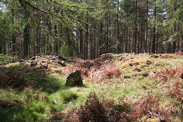
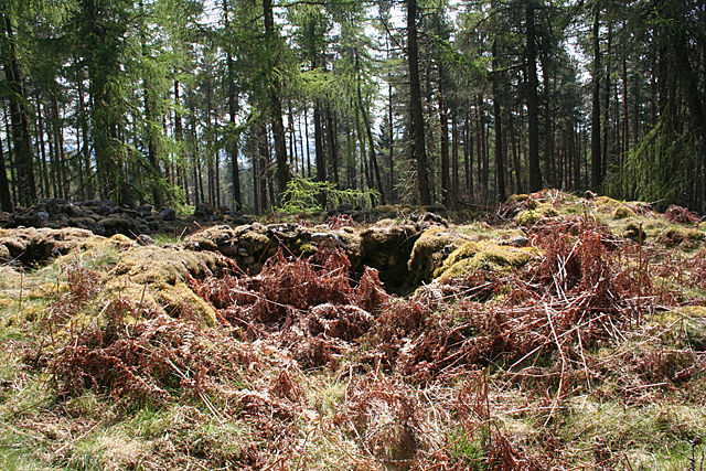
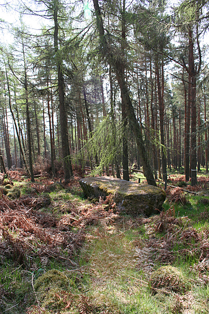
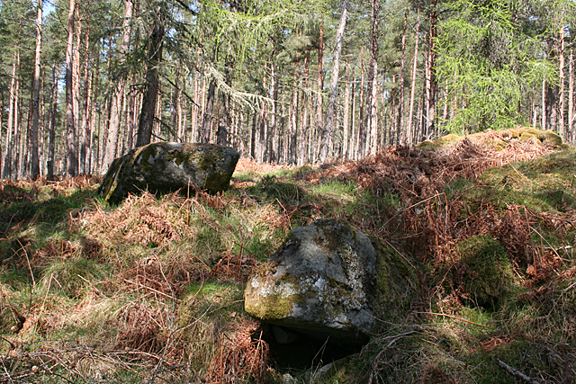
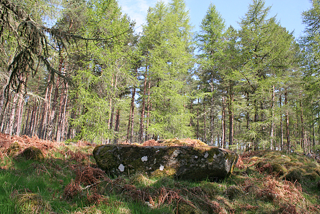
Historically, Bonlee Hill has played a significant role in the region's agriculture, with grazing livestock being a common sight on its slopes. The hill is also home to several ancient archaeological sites, such as cairns and stone circles, which offer insights into the area's rich cultural and historical heritage.

Overall, Bonlee Hill is a captivating natural landmark in Aberdeenshire, offering visitors a chance to immerse themselves in the breathtaking beauty of the Scottish countryside while exploring its diverse flora, fauna, and fascinating history.

If you have any feedback on the listing, please let us know in the comments section below.
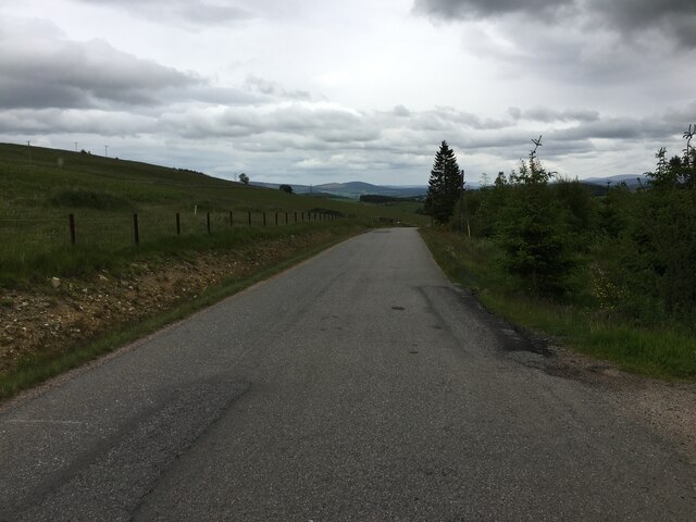
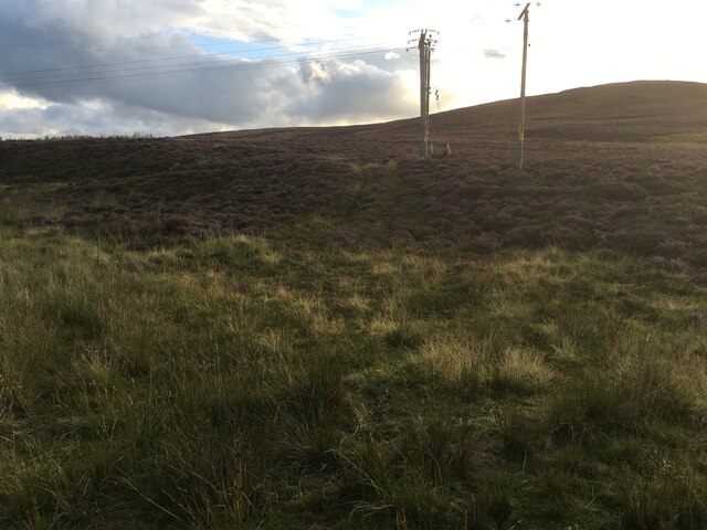
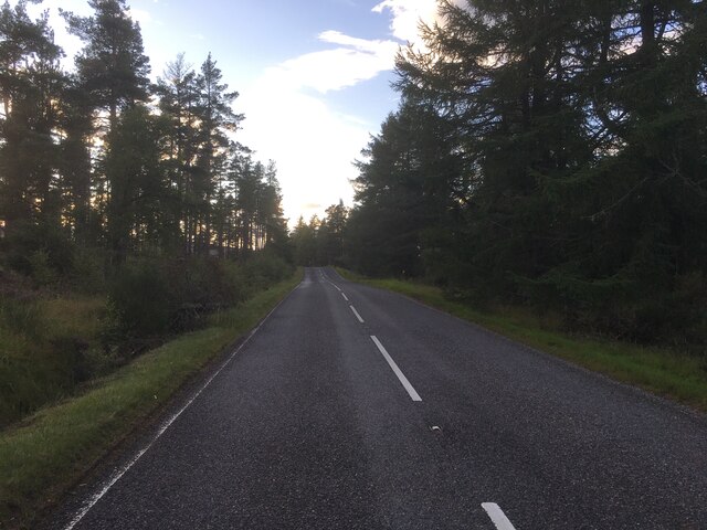
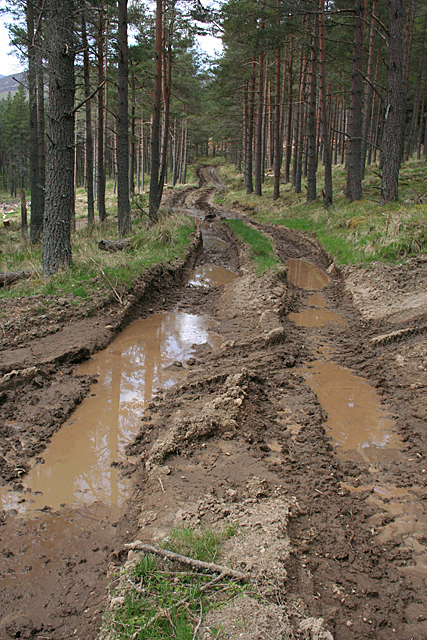
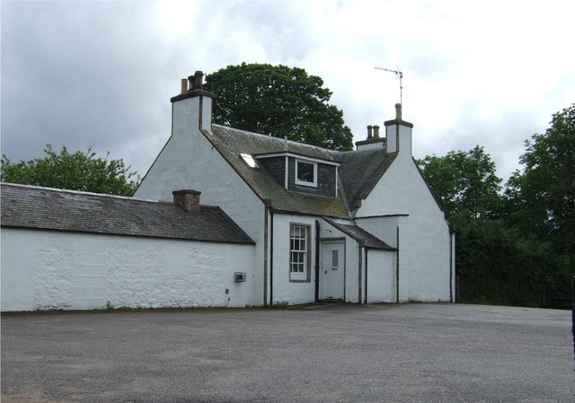
Bonlee Hill Images

Images are sourced within 2km of 57.15243/-2.9818693 or Grid Reference NJ4007. Thanks to Geograph Open Source API. All images are credited.

Minor road towards Migvie
Rough track on Craig Glas
A97 near Witchock Loch
Fields with trees south-west of A97 Agricultural land sweeps away from the A97 towards a distant mountain which is Morven.
Fields with trees south-west of A97
Agricultural land sweeps away from the A97 towards a distant mountain which is Morven.
Pittentaggart fields Morven in the first white coat of winter lies behind the farmland.
Pittentaggart fields
Morven in the first white coat of winter lies behind the farmland.
View of Cromar from side of Morven Winter morning view of Cromar valley, taken from Morven.
View of Cromar from side of Morven
Winter morning view of Cromar valley, taken from Morven.
Hill of Allamuc Looking North over the North eastern slopes of Hill of Allamuc.
Hill of Allamuc
Looking North over the North eastern slopes of Hill of Allamuc.
Craig Walgan Looking North West from below the Northern summit of Craig Walgan. Looking through the gap, Bad an Teachdaire can be seen behind Ardan Breac.
Craig Walgan
Looking North West from below the Northern summit of Craig Walgan. Looking through the gap, Bad an Teachdaire can be seen behind Ardan Breac.
Bonlee Hill Looking North East from the track descending Hill of Allamuc with Bonlee Hill on the left. The track descends across the saddle to the right into Balronald Wood.
Bonlee Hill
Looking North East from the track descending Hill of Allamuc with Bonlee Hill on the left. The track descends across the saddle to the right into Balronald Wood.
Burn of Badanseaneach Looking East across the Burn of Badanseaneach towards the saddle between Bonlee Hill and Hill of Allamuc. The track continues down into Balronald Wood. The track also runs alongside the wood South of Bonlee Hill but this track can easily be missed.
Burn of Badanseaneach
Looking East across the Burn of Badanseaneach towards the saddle between Bonlee Hill and Hill of Allamuc. The track continues down into Balronald Wood. The track also runs alongside the wood South of Bonlee Hill but this track can easily be missed.
Blue Cairn of Ladieswell (1) This Recumbent Stone Circle is distinguished by having a large cairn inside it, and by having a full complement of orthostats interdigitated with the kerbstones of the cairn. Unfortunately the whole things is so overgrown that it is all but impossible to identify the stones. This is the approach to the cairn from the north-east, with one small identifiable orthostat in the foreground. See <span class="nowrap"><a title="https://canmore.org.uk/site/17000/blue-cairn-of-ladieswell" rel="nofollow ugc noopener" href="https://canmore.org.uk/site/17000/blue-cairn-of-ladieswell">Link</a><img style="margin-left:2px;" alt="External link" title="External link - shift click to open in new window" src="https://s1.geograph.org.uk/img/external.png" width="10" height="10"/></span> for more details. <a href="https://www.geograph.org.uk/photo/4951262">NJ4106 : Blue Cairn of Ladieswell (2)</a>
Blue Cairn of Ladieswell (1)
This Recumbent Stone Circle is distinguished by having a large cairn inside it, and by having a full complement of orthostats interdigitated with the kerbstones of the cairn. Unfortunately the whole things is so overgrown that it is all but impossible to identify the stones. This is the approach to the cairn from the north-east, with one small identifiable orthostat in the foreground. See LinkExternal link for more details. NJ4106 : Blue Cairn of Ladieswell (2)
Blue Cairn of Ladieswell (2) The centre of the cairn was excavated in the 19th century, leaving some holes among the stones that do not reflect its original shape. See <span class="nowrap"><a title="https://canmore.org.uk/site/17000/blue-cairn-of-ladieswell" rel="nofollow ugc noopener" href="https://canmore.org.uk/site/17000/blue-cairn-of-ladieswell">Link</a><img style="margin-left:2px;" alt="External link" title="External link - shift click to open in new window" src="https://s1.geograph.org.uk/img/external.png" width="10" height="10"/></span> for more details. <a href="https://www.geograph.org.uk/photo/4951349">NJ4106 : Blue Cairn of Ladieswell (3)</a>
Blue Cairn of Ladieswell (2)
The centre of the cairn was excavated in the 19th century, leaving some holes among the stones that do not reflect its original shape. See LinkExternal link for more details. NJ4106 : Blue Cairn of Ladieswell (3)
Blue Cairn of Ladieswell (3) This large stone is what enables archaeologists to classify the Blue Cairn as a Recumbent Stone Circle, as it is plainly a recumbent. See <span class="nowrap"><a title="https://canmore.org.uk/site/17000/blue-cairn-of-ladieswell" rel="nofollow ugc noopener" href="https://canmore.org.uk/site/17000/blue-cairn-of-ladieswell">Link</a><img style="margin-left:2px;" alt="External link" title="External link - shift click to open in new window" src="https://s1.geograph.org.uk/img/external.png" width="10" height="10"/></span> for more details. <a href="https://www.geograph.org.uk/photo/4951355">NJ4106 : Blue Cairn of Ladieswell (4)</a>
Blue Cairn of Ladieswell (3)
This large stone is what enables archaeologists to classify the Blue Cairn as a Recumbent Stone Circle, as it is plainly a recumbent. See LinkExternal link for more details. NJ4106 : Blue Cairn of Ladieswell (4)
Blue Cairn of Ladieswell (4) The stone at upper left is the recumbent, and the stone nearest the camera is the largest surviving orthostat, lying at a shallow angle. See <span class="nowrap"><a title="https://canmore.org.uk/site/17000/blue-cairn-of-ladieswell" rel="nofollow ugc noopener" href="https://canmore.org.uk/site/17000/blue-cairn-of-ladieswell">Link</a><img style="margin-left:2px;" alt="External link" title="External link - shift click to open in new window" src="https://s1.geograph.org.uk/img/external.png" width="10" height="10"/></span> for more details. <a href="https://www.geograph.org.uk/photo/4951453">NJ4106 : Blue Cairn of Ladieswell (5)</a>
Blue Cairn of Ladieswell (4)
The stone at upper left is the recumbent, and the stone nearest the camera is the largest surviving orthostat, lying at a shallow angle. See LinkExternal link for more details. NJ4106 : Blue Cairn of Ladieswell (5)
Blue Cairn of Ladieswell (5) The large moss-covered stone is probably a fallen orthostat, and there are probably kerbstones and further orthostats beyond it, but they are so covered by vegetation that it is difficult to know. See <span class="nowrap"><a title="https://canmore.org.uk/site/17000/blue-cairn-of-ladieswell" rel="nofollow ugc noopener" href="https://canmore.org.uk/site/17000/blue-cairn-of-ladieswell">Link</a><img style="margin-left:2px;" alt="External link" title="External link - shift click to open in new window" src="https://s1.geograph.org.uk/img/external.png" width="10" height="10"/></span> for more details. <a href="https://www.geograph.org.uk/photo/4951457">NJ4106 : Blue Cairn of Ladieswell (6)</a>
Blue Cairn of Ladieswell (5)
The large moss-covered stone is probably a fallen orthostat, and there are probably kerbstones and further orthostats beyond it, but they are so covered by vegetation that it is difficult to know. See LinkExternal link for more details. NJ4106 : Blue Cairn of Ladieswell (6)
Blue Cairn of Ladieswell (6) The shapes under the moss are almost certainly fallen orthostats, but it's hard to be sure when they are so well covered. See <span class="nowrap"><a title="https://canmore.org.uk/site/17000/blue-cairn-of-ladieswell" rel="nofollow ugc noopener" href="https://canmore.org.uk/site/17000/blue-cairn-of-ladieswell">Link</a><img style="margin-left:2px;" alt="External link" title="External link - shift click to open in new window" src="https://s1.geograph.org.uk/img/external.png" width="10" height="10"/></span> for more details. <a href="https://www.geograph.org.uk/photo/4951460">NJ4106 : Blue Cairn of Ladieswell (7)</a>
Blue Cairn of Ladieswell (6)
The shapes under the moss are almost certainly fallen orthostats, but it's hard to be sure when they are so well covered. See LinkExternal link for more details. NJ4106 : Blue Cairn of Ladieswell (7)
Blue Cairn of Ladieswell (7) This is the recumbent, the only stone that can be clearly seen. See <span class="nowrap"><a title="https://canmore.org.uk/site/17000/blue-cairn-of-ladieswell" rel="nofollow ugc noopener" href="https://canmore.org.uk/site/17000/blue-cairn-of-ladieswell">Link</a><img style="margin-left:2px;" alt="External link" title="External link - shift click to open in new window" src="https://s1.geograph.org.uk/img/external.png" width="10" height="10"/></span> for more details. <a href="https://www.geograph.org.uk/photo/4951116">NJ4106 : Blue Cairn of Ladieswell (1)</a>
Blue Cairn of Ladieswell (7)
This is the recumbent, the only stone that can be clearly seen. See LinkExternal link for more details. NJ4106 : Blue Cairn of Ladieswell (1)
Deep Muddy Ruts Only a forest harvester could create anything like this. It was quite a challenge to cross it dryshod. See also <a href="https://www.geograph.org.uk/photo/4952233">NJ4106 : Mud Slide</a>.
Deep Muddy Ruts
Only a forest harvester could create anything like this. It was quite a challenge to cross it dryshod. See also NJ4106 : Mud Slide.
Show me another place!

Bonlee Hill is located at Grid Ref: NJ4007 (Lat: 57.15243, Lng: -2.9818693)

Unitary Authority: Aberdeenshire

Police Authority: North East

What 3 Words

///rejoin.croutons.notion. Near Ballater, Aberdeenshire

Nearby Locations

Bonlee Hill

Related Wikis

Nearby Amenities

Located within 500m of 57.15243,-2.9818693
Bonlee Hill
Ele: 495
Natural: peak
Lat/Long: 57.1521196/-2.9820999
Hunting Stand
Lat/Long: 57.1508017/-2.9803045
Hunting Stand
Lat/Long: 57.1506082/-2.9799747
Hunting Stand
Lat/Long: 57.1510101/-2.9805852
Hunting Stand
Lat/Long: 57.1512062/-2.9808994
Hunting Stand
Lat/Long: 57.1514409/-2.981261
Hunting Stand
Lat/Long: 57.1517013/-2.9816285
Hunting Stand
Lat/Long: 57.1519425/-2.9819841
Hunting Stand
Lat/Long: 57.1521898/-2.982345
Hunting Stand
Lat/Long: 57.1524491/-2.982735
Hunting Stand
Lat/Long: 57.1527634/-2.9832108
Hunting Stand
Lat/Long: 57.1532668/-2.9802863
The data included in this document is from www.openstreetmap.org. The data is made available under ODbL.

Have you been to Bonlee Hill?

Leave your review of Bonlee Hill below (or comments, questions and feedback).