Bonfire Hill

Hill, Mountain in Cumberland Eden

England

Bonfire Hill

Clump of trees
Clump of trees Credit: N Chadwick

Bonfire Hill is a prominent natural landmark located in Cumberland, a historic county in the northwest of England. Rising approximately 389 meters above sea level, it is classified as a hill rather than a mountain due to its elevation. The hill is part of the Pennines, a mountain range stretching across northern England.

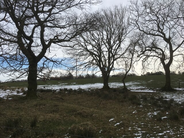
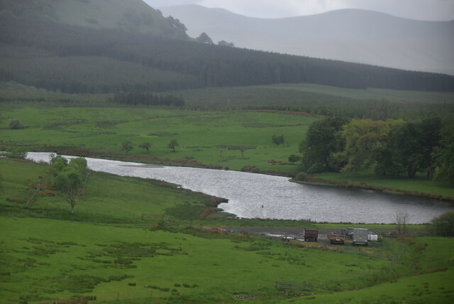
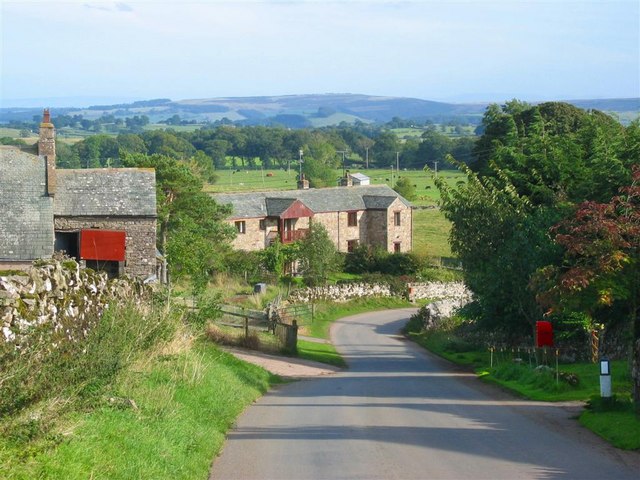
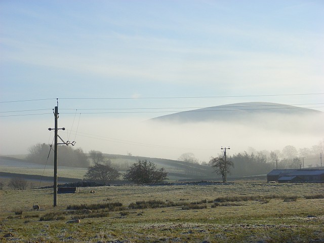
Bonfire Hill is characterized by its distinctive conical shape and commanding presence in the surrounding landscape. It offers breathtaking panoramic views of the surrounding countryside, including the picturesque villages of Cumberland, lush green fields, and rolling hills. On clear days, the hill provides excellent visibility, allowing visitors to spot landmarks in the distance, such as the nearby Lake District National Park.

The name "Bonfire Hill" is believed to have originated from its historical association with bonfire celebrations. In the past, local communities would gather on the hill to mark significant events or festivals, lighting bonfires atop the hill to create a mesmerizing spectacle visible for miles around.

Today, Bonfire Hill remains a popular destination for outdoor enthusiasts and nature lovers. The hill is a haven for hikers, offering a variety of trails of varying difficulty levels. It is also a favorite spot for paragliders and hang gliders, who take advantage of the hill's favorable wind conditions.

Bonfire Hill is not only a natural landmark but also holds cultural and historical significance for the local community, attracting visitors from near and far who are drawn to its beauty and charm.

If you have any feedback on the listing, please let us know in the comments section below.

Bonfire Hill Images

Images are sourced within 2km of 54.645432/-2.9205442 or Grid Reference NY4028. Thanks to Geograph Open Source API. All images are credited.

Clump of trees
Clump of trees
Route of old railway line near Troutbeck
Old course of A66
Old course of A66
Old course of A66
Old course of A66
Track at Cocklakes Track at Cocklakes.
Track at Cocklakes
Track at Cocklakes.
Stream through a field near Troutbeck
Trees at field edge near Berrier
Fields with farm roads beside Whitbarrow Village Whitbarrow Village is a holiday development near to Penruddock. The image shows farmland to the east of the main building on the site, the view being to the east.
The hills of the north Pennines are on the horizon.
Fields with farm roads beside Whitbarrow Village
Whitbarrow Village is a holiday development near to Penruddock. The image shows farmland to the east of the main building on the site, the view being to the east. The hills of the north Pennines are on the horizon.
Old Boundary Marker on the B5288 in Motherby Township Boundary Marker on the verge on the southeast side of the B5288 in Motherby, outside Stag Cottage West. Until 1866 this was the boundary of Motherby and Gill and Hutton Soil townships, then Greystoke and Hutton Soil parishes until 1934, then Greystoke and Hutton parishes. Now entirely in Hutton parish. The plate on the south side is now missing. The stone is inscribed MDII (1502 if these are Roman numerals) on the north side.

Milestone Society National ID: CU_HUTT02pb
Old Boundary Marker on the B5288 in Motherby
Township Boundary Marker on the verge on the southeast side of the B5288 in Motherby, outside Stag Cottage West. Until 1866 this was the boundary of Motherby and Gill and Hutton Soil townships, then Greystoke and Hutton Soil parishes until 1934, then Greystoke and Hutton parishes. Now entirely in Hutton parish. The plate on the south side is now missing. The stone is inscribed MDII (1502 if these are Roman numerals) on the north side. Milestone Society National ID: CU_HUTT02pb
Minor road near Penruddock
Ruined barn
Ruined barn
Large barn
Large barn
Lake near Cocklakes
Lake near Cocklakes
A66 The A66 is a major road in northern England running from near Middlesbrough to Workington. The section between Scotch Corner and Penrith is a Trans-Pennine route between the A1 and M6, following an old Roman Road.
Wikipedia: <span class="nowrap"><a title="http://en.wikipedia.org/wiki/A66_road" rel="nofollow ugc noopener" href="http://en.wikipedia.org/wiki/A66_road">Link</a><img style="margin-left:2px;" alt="External link" title="External link - shift click to open in new window" src="https://s1.geograph.org.uk/img/external.png" width="10" height="10"/></span>
A66
The A66 is a major road in northern England running from near Middlesbrough to Workington. The section between Scotch Corner and Penrith is a Trans-Pennine route between the A1 and M6, following an old Roman Road. Wikipedia: LinkExternal link
Cocklakes House
Cocklakes House
Rural traffic, A66 The A66 is a major road in northern England running from near Middlesbrough to Workington. The section between Scotch Corner and Penrith is a Trans-Pennine route between the A1 and M6, following an old Roman Road.
Wikipedia: <span class="nowrap"><a title="http://en.wikipedia.org/wiki/A66_road" rel="nofollow ugc noopener" href="http://en.wikipedia.org/wiki/A66_road">Link</a><img style="margin-left:2px;" alt="External link" title="External link - shift click to open in new window" src="https://s1.geograph.org.uk/img/external.png" width="10" height="10"/></span>
Rural traffic, A66
The A66 is a major road in northern England running from near Middlesbrough to Workington. The section between Scotch Corner and Penrith is a Trans-Pennine route between the A1 and M6, following an old Roman Road. Wikipedia: LinkExternal link
A66 looking east The A66 is a major road in northern England running from near Middlesbrough to Workington. The section between Scotch Corner and Penrith is a Trans-Pennine route between the A1 and M6, following an old Roman Road.
Wikipedia: <span class="nowrap"><a title="http://en.wikipedia.org/wiki/A66_road" rel="nofollow ugc noopener" href="http://en.wikipedia.org/wiki/A66_road">Link</a><img style="margin-left:2px;" alt="External link" title="External link - shift click to open in new window" src="https://s1.geograph.org.uk/img/external.png" width="10" height="10"/></span>
A66 looking east
The A66 is a major road in northern England running from near Middlesbrough to Workington. The section between Scotch Corner and Penrith is a Trans-Pennine route between the A1 and M6, following an old Roman Road. Wikipedia: LinkExternal link
Tarn Moss Nature Reserve
Show me another place!

Bonfire Hill is located at Grid Ref: NY4028 (Lat: 54.645432, Lng: -2.9205442)

Administrative County: Cumbria

District: Eden

Police Authority: Cumbria

What 3 Words

///compelled.direction.giants. Near Penrith, Cumbria

Nearby Locations

Bonfire Hill

Related Wikis

Berrier

Berrier is a hamlet in Cumbria, England. It is in the civil parish of Mungrisdale, which is made up of eight hamlets and had a population of 297 in the...

Beckces

Beckces is a hamlet approximately 800 yards (750 metres) west of Penruddock railway station on the former Cockermouth, Keswick & Penrith Railway within...

Penruddock railway station

Penruddock railway station was situated on the Cockermouth, Keswick and Penrith Railway between Penrith and Cockermouth in Cumberland (now in Cumbria)...

Troutbeck railway station

Troutbeck railway station was situated on the Cockermouth, Keswick and Penrith Railway between Penrith and Cockermouth in Cumberland (now in Cumbria),...
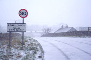
Penruddock

Penruddock is a small village in Cumbria, England, 5.5 miles to the west of Penrith. It forms part of the civil parish of Hutton. == History == The name...

Great Mell Fell

Great Mell Fell (Bare hill, with the later additions of both "Fell" and "Great") is an isolated hill or fell in the English Lake District, north of Ullswater...

Hutton, Cumbria

Hutton is a small civil parish about 6 miles (9.7 km) west of Penrith in the English county of Cumbria. The parish contains the small mansion and former...

Troutbeck, Hutton

Troutbeck is a hamlet within Cumbria, England, a few miles to the west of Penrith. It was previously in the county of Cumberland. It lies within the Lake...

Nearby Amenities

Located within 500m of 54.645432,-2.9205442
Parking
Parking: street_side
Lat/Long: 54.6420263/-2.9156344
Post Box
Ref: CA11 209
Source: survey
Lat/Long: 54.6431609/-2.922557
Give Way
Direction: forward
Lat/Long: 54.6423303/-2.9255279
Give Way
Direction: forward
Lat/Long: 54.6419173/-2.9253039
Give Way
Direction: forward
Lat/Long: 54.6430398/-2.9231089
Give Way
Direction: backward
Lat/Long: 54.6421614/-2.9230431
Restaurant
Seasons
Addr City: Berrier
Addr Housename: Whitbarrow Village
Addr Postcode: CA11 0XB
Fhrs Id: 307043
Lat/Long: 54.6474831/-2.9159506
Power: pole
Lat/Long: 54.6484363/-2.9151324
Power: pole
Lat/Long: 54.6475542/-2.914466
Power: pole
Lat/Long: 54.6464882/-2.9174199
Power: pole
Lat/Long: 54.6465381/-2.9191323
Power: pole
Lat/Long: 54.6465786/-2.9202151
Power: pole
Lat/Long: 54.646613/-2.9213143
Power: pole
Lat/Long: 54.6466596/-2.9226637
Power: pole
Lat/Long: 54.6466923/-2.9237034
Power: pole
Lat/Long: 54.6467561/-2.9252434
Power: pole
Lat/Long: 54.6468061/-2.926709
Power: pole
Lat/Long: 54.6457684/-2.9226578
Power: pole
Lat/Long: 54.6449497/-2.9226235
Power: pole
Lat/Long: 54.6440792/-2.9226161
Power: pole
Lat/Long: 54.6432828/-2.9225907
Communication Mobile Phone: yes
Man Made: mast
Tower Type: communication
Lat/Long: 54.6452693/-2.9189459
Communication Mobile Phone: yes
Man Made: mast
Tower Type: communication
Lat/Long: 54.645141/-2.9185069
Bonfire Hill
Natural: peak
Lat/Long: 54.6455619/-2.9209344
Man Made: utility_pole
Lat/Long: 54.6441663/-2.9229146
Man Made: utility_pole
Lat/Long: 54.6441445/-2.9230904
Give Way
Direction: backward
Lat/Long: 54.6430224/-2.9157383
The data included in this document is from www.openstreetmap.org. The data is made available under ODbL.

Have you been to Bonfire Hill?

Leave your review of Bonfire Hill below (or comments, questions and feedback).