Berrier Hill

Hill, Mountain in Cumberland Eden

England

Berrier Hill

Field and boundary of Greystoke Forest
Field and boundary of Greystoke Forest Credit: Steven Brown

Berrier Hill is a prominent hill located in the county of Cumberland in northwest England. It forms part of the Lake District National Park and is situated near the village of Mungrisdale. Rising to a height of 1,523 feet (464 meters), Berrier Hill offers stunning panoramic views of the surrounding landscape.

The hill is primarily composed of slate and is known for its rugged and rocky terrain, making it a popular destination for hikers and nature enthusiasts. Its slopes are covered with grasses, heather, and patches of woodland, providing a diverse habitat for various plant and animal species.

Reaching the summit of Berrier Hill requires a moderate level of fitness and navigation skills, as there are no marked trails. However, for those willing to make the effort, the reward is a breathtaking vista that stretches across the rolling hills and valleys of the Lake District. On a clear day, it is even possible to spot the distant peaks of Skiddaw and Blencathra.

The hill is also home to several archaeological sites, including ancient settlements and burial mounds, which provide insights into the area's rich history. These remnants of the past add an additional layer of intrigue to the already captivating landscape.

Overall, Berrier Hill is a captivating natural feature that showcases the beauty of the Lake District. Its rugged terrain, stunning views, and historical significance make it a must-visit destination for those seeking an authentic outdoor experience in Cumberland.

If you have any feedback on the listing, please let us know in the comments section below.
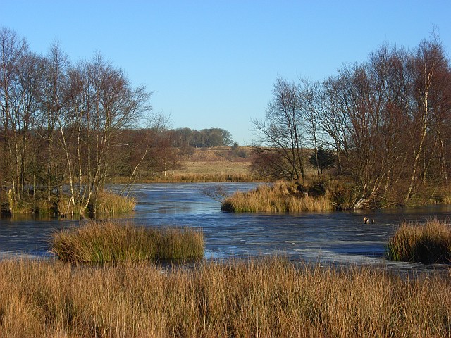
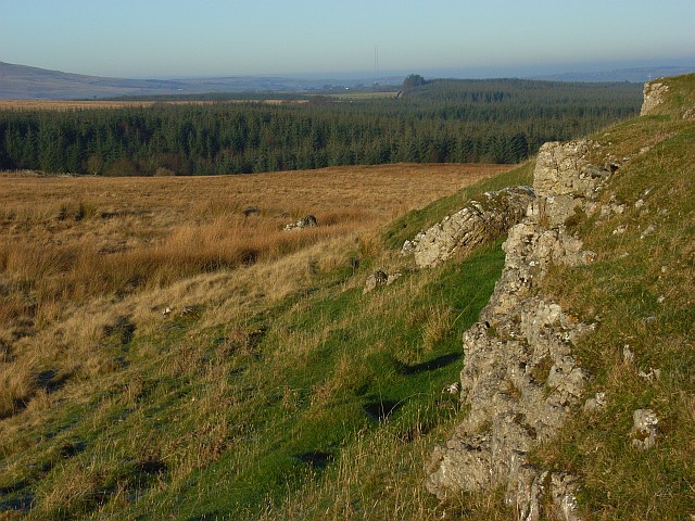
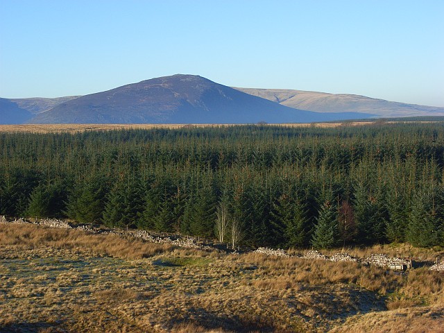
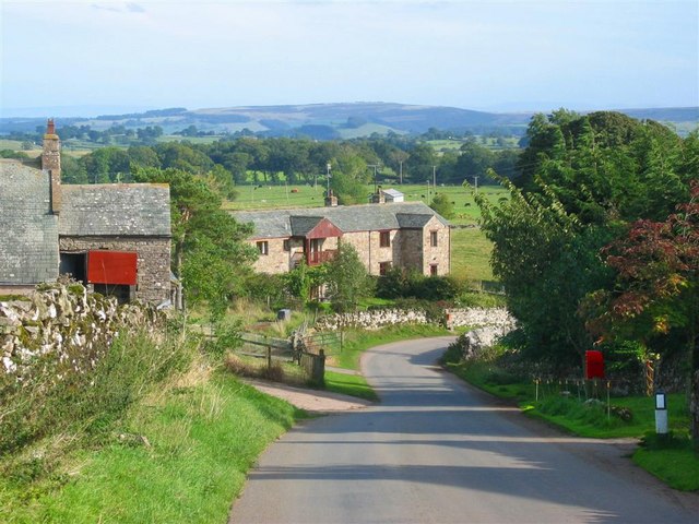
Berrier Hill Images

Images are sourced within 2km of 54.669657/-2.924581 or Grid Reference NY4030. Thanks to Geograph Open Source API. All images are credited.
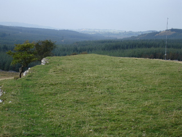
Field and boundary of Greystoke Forest
Farm track near Greystoke Forest
Outcrops of limestone on Highbanks [Murrah Hill] Highbanks and Murrah Hill are names which do not appear on OS maps and have been created perhaps as the hill feature qualifies as a TuMP - a hill with at least 30 metres or more prominence. There are several surface outcrops of limestone on the hill, almost in the form of pavement; this is one of the examples. There's surely a rogue boulder perched beside the outcrop, presumably an erratic.
The distant trees seen through thin mist are in the Greystoke Forest.
Outcrops of limestone on Highbanks [Murrah Hill]
Highbanks and Murrah Hill are names which do not appear on OS maps and have been created perhaps as the hill feature qualifies as a TuMP - a hill with at least 30 metres or more prominence. There are several surface outcrops of limestone on the hill, almost in the form of pavement; this is one of the examples. There's surely a rogue boulder perched beside the outcrop, presumably an erratic. The distant trees seen through thin mist are in the Greystoke Forest.
Forest road through Speaker Gully plantation A relatively light duty road heading north-north-east through the plantation which is part of Greystoke Forest.
Forest road through Speaker Gully plantation
A relatively light duty road heading north-north-east through the plantation which is part of Greystoke Forest.
Berrier Hill View of Greystoke Forest to the north
Berrier Hill
View of Greystoke Forest to the north
Parkland with escarpment. Fine parkland with sheep grazing near to lambing time.
Parkland with escarpment.
Fine parkland with sheep grazing near to lambing time.
Across the old wood site and up to the new wood. The maps show a wood in the ditch area in the foreground but I do not think there have been trees here for a long time.
Across the old wood site and up to the new wood.
The maps show a wood in the ditch area in the foreground but I do not think there have been trees here for a long time.
Limekiln and quad bike tracks. Such is diversity although to be fair the limekilns have not been used for some time.
Limekiln and quad bike tracks.
Such is diversity although to be fair the limekilns have not been used for some time.
Pasture and forest, Berrier Hill This is just outside of the Lake District National Park. In the background are Great Dodd and Clough Head.
Pasture and forest, Berrier Hill
This is just outside of the Lake District National Park. In the background are Great Dodd and Clough Head.
Pastures above Greystoke A view across the Petteril and Eden valleys to the highest of the Pennines. The scant remains of snow can just be made out on the tops of Cross Fell and the Dun Fells.
Pastures above Greystoke
A view across the Petteril and Eden valleys to the highest of the Pennines. The scant remains of snow can just be made out on the tops of Cross Fell and the Dun Fells.
Gillcambon Tarn The frozen waters of the tarn sit amid sparse deciduous woodland and low altitude moorland.
Gillcambon Tarn
The frozen waters of the tarn sit amid sparse deciduous woodland and low altitude moorland.
Berrier Hill These rough pastures are the site of a proposed windfarm. The view takes in the hazy Eden valley. The Pennines beyond could be mistaken for a cloud.
Berrier Hill
These rough pastures are the site of a proposed windfarm. The view takes in the hazy Eden valley. The Pennines beyond could be mistaken for a cloud.
Limestone outcrops, Berrier Hill Two parallel outcrops cross Berrier Hill which is rough pasture beside Greystoke Forest. In the distance you can just make out the two Caldbeck transmitters.
Limestone outcrops, Berrier Hill
Two parallel outcrops cross Berrier Hill which is rough pasture beside Greystoke Forest. In the distance you can just make out the two Caldbeck transmitters.
Pastures above Greystoke Viewed from a limestone outcrop. The Pennines are in the distance. The woodland is on the eastern edge of the grid-square.
Pastures above Greystoke
Viewed from a limestone outcrop. The Pennines are in the distance. The woodland is on the eastern edge of the grid-square.
Pastures above Greystoke Blencathra appears beyond this southern part of Greystoke Forest.
Pastures above Greystoke
Blencathra appears beyond this southern part of Greystoke Forest.
Hawthorn on Berrier Hill Standing on the more northerly of two lines of limestone outcrops. None of the rocks on either of the scarps are visible as they face southwest.
Hawthorn on Berrier Hill
Standing on the more northerly of two lines of limestone outcrops. None of the rocks on either of the scarps are visible as they face southwest.
Greystoke Forest A view across the extensive forestry to Carrock Fell from Berrier Hill.
Greystoke Forest
A view across the extensive forestry to Carrock Fell from Berrier Hill.
Rough pasture beside Greystoke Forest The wall heading southeast towards Square Plantation.
Rough pasture beside Greystoke Forest
The wall heading southeast towards Square Plantation.
Show me another place!

Berrier Hill is located at Grid Ref: NY4030 (Lat: 54.669657, Lng: -2.924581)

Administrative County: Cumbria

District: Eden

Police Authority: Cumbria

What 3 Words

///sway.declines.teacher. Near Penrith, Cumbria

Nearby Locations

Berrier Hill

Related Wikis

Berrier

Berrier is a hamlet in Cumbria, England. It is in the civil parish of Mungrisdale, which is made up of eight hamlets and had a population of 297 in the...
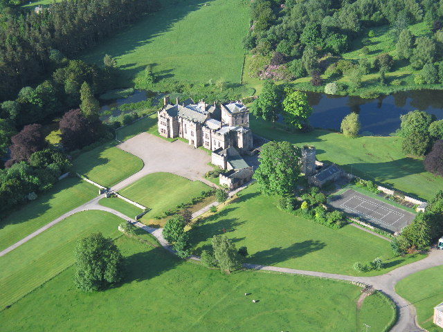
Greystoke Castle

Greystoke Castle is in the village of Greystoke 8 kilometres (5.0 mi) west of Penrith in the county of Cumbria in northern England. (grid reference NY435309...

Beckces

Beckces is a hamlet approximately 800 yards (750 metres) west of Penruddock railway station on the former Cockermouth, Keswick & Penrith Railway within...
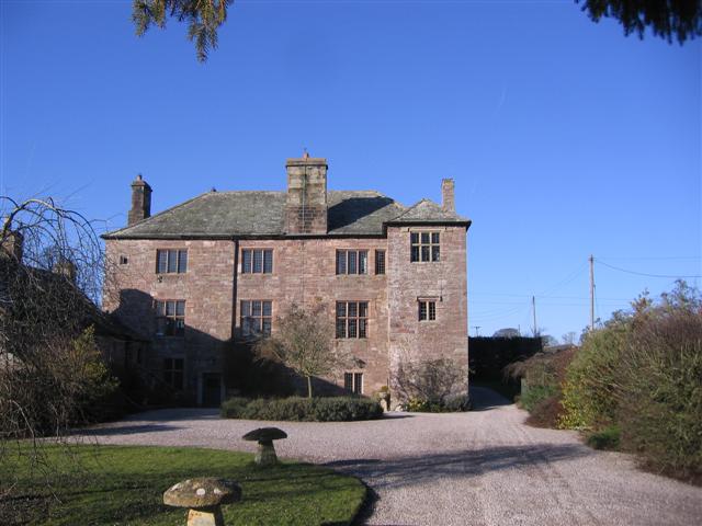
Johnby Hall

Johnby Hall is a fortified manor house near Greystoke, Cumbria. It was built in 1583, incorporating the fabric of a medieval tower house, and has been...

Have you been to Berrier Hill?

Leave your review of Berrier Hill below (or comments, questions and feedback).