Cakemuir Hill
Hill, Mountain in Midlothian
Scotland
Cakemuir Hill
Cakemuir Hill is a notable hill located in Midlothian, Scotland. It is situated near the village of Temple, approximately 11 miles south of the capital city, Edinburgh. Rising to an elevation of around 339 meters (1,112 feet), Cakemuir Hill stands as a prominent landmark in the area.
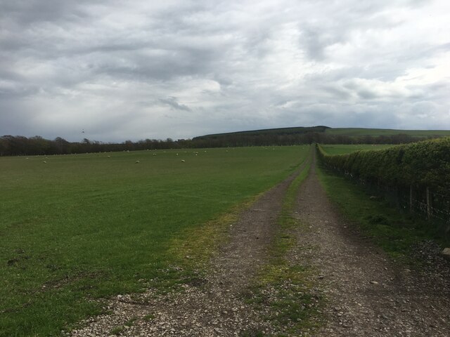
The hill is adorned with lush green vegetation and offers stunning panoramic views of the surrounding countryside. Its slopes are covered in a mixture of grasses, heather, and scattered trees, creating a picturesque landscape that attracts visitors and outdoor enthusiasts.
Cakemuir Hill is a popular destination for hikers and nature lovers. Several well-maintained trails lead up to its summit, providing opportunities for both leisurely walks and more challenging hikes. The paths are relatively easy to navigate, although they can become muddy during wet weather, so appropriate footwear is recommended.
From the top of Cakemuir Hill, on clear days, visitors can enjoy breathtaking vistas of the Pentland Hills to the northwest, the Firth of Forth to the north, and the rolling hills and farmland of Midlothian stretching out in all directions.
The hill's location, close to Edinburgh, makes it easily accessible for both locals and tourists. Whether it's for a peaceful walk, a family picnic, or simply to admire the beauty of the Scottish countryside, Cakemuir Hill offers a tranquil and scenic escape from the bustling city life.
If you have any feedback on the listing, please let us know in the comments section below.
Cakemuir Hill Images
Images are sourced within 2km of 55.808106/-2.9522811 or Grid Reference NT4057. Thanks to Geograph Open Source API. All images are credited.


Cakemuir Hill is located at Grid Ref: NT4057 (Lat: 55.808106, Lng: -2.9522811)
Unitary Authority: The Scottish Borders
Police Authority: The Lothians and Scottish Borders
What 3 Words
///sharpen.sprinting.crispier. Near Gorebridge, Midlothian
Nearby Locations
Related Wikis

Cakemuir Castle
Cakemuir Castle is an historic house situated 4 miles (6.4 km) southeast of Pathhead, in the Lammermuir Hills, Midlothian, Scotland. The name may be connected...

Tynehead railway station
Tynehead railway station served the village of Pathhead, Midlothian, Scotland from 1848 to 1969 on the Waverley Line. == History == The station opened...

Falahill
Falahill is a village in the Scottish Borders, in the Moorfoot Hills, at NT387563, in the Parish of Heriot, and close to the border with Midlothian. Nearby...
Fala Flow
Fala Flow is an area of upland blanket bog on the edge of the Lammermuir Hills, in Midlothian, Scotland. Located north of the village of Fala, around 15...
Nearby Amenities
Located within 500m of 55.808106,-2.9522811Have you been to Cakemuir Hill?
Leave your review of Cakemuir Hill below (or comments, questions and feedback).