Aller Hill

Hill, Mountain in Somerset South Somerset

England

Aller Hill

Port Moor Part of the Somerset Levels, where all the lines you see are one sort of ditch or another.  Looking north towards Aller Hill <a href="https://www.geograph.org.uk/gridref/ST4029">ST4029</a>
This photo was taken from the 1158 Penzance to London Paddington train, having left Taunton at 1529.
Port Moor Credit: Graham Horn

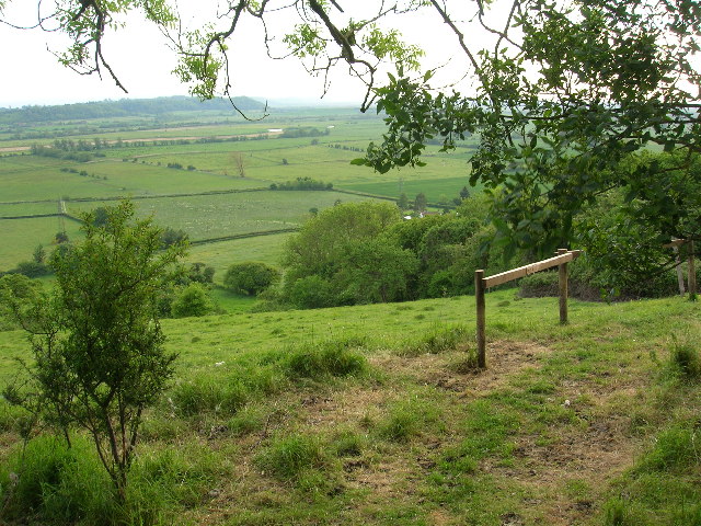
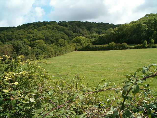
Aller Hill is a prominent hill located in the county of Somerset, England. It is part of the Quantock Hills, a designated Area of Outstanding Natural Beauty. Rising to an elevation of 307 meters (1,007 feet), Aller Hill offers stunning panoramic views of the surrounding countryside and is a popular spot for hikers and nature enthusiasts.

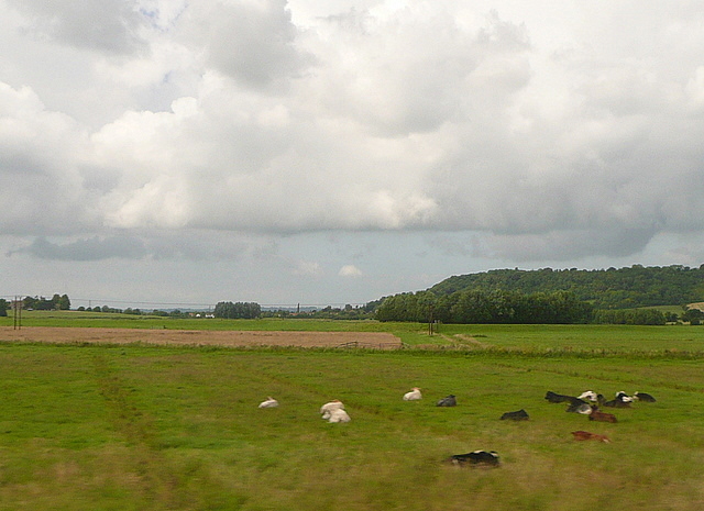
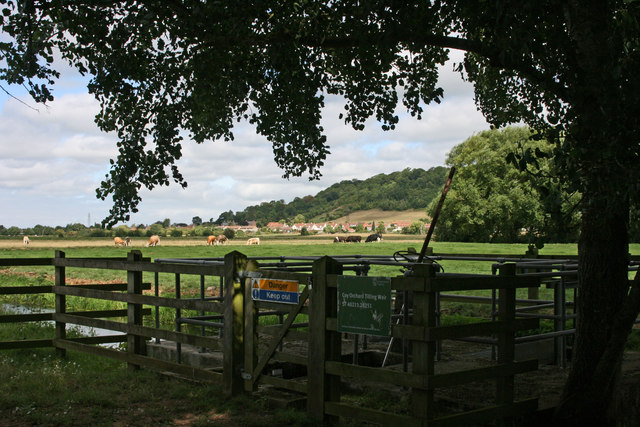
The hill is covered in lush green vegetation, including grasslands, heather, and bracken. It is also home to a variety of wildlife, such as deer, rabbits, and a wide range of bird species. The hill's diverse ecosystem provides habitats for many rare and protected species, making it an important area for conservation.

At the summit of Aller Hill, there is a trig point, which serves as a marker for geodetic surveys. This feature adds to the hill's allure for visitors interested in geography and navigation.

There are several walking trails that lead to the top of Aller Hill, offering different levels of difficulty and lengths. The most popular route starts from the nearby village of Crowcombe, taking walkers through picturesque countryside and woodlands before reaching the summit. On a clear day, visitors can enjoy breathtaking views stretching as far as the Bristol Channel and the Welsh mountains.

Aller Hill is not only a natural beauty but also holds historical significance. The area is scattered with ancient burial mounds and remnants of prehistoric settlements, providing tangible links to the region's past.

Overall, Aller Hill is a magnificent natural landmark that showcases the beauty and diversity of Somerset's countryside, making it a must-visit destination for outdoor enthusiasts and those seeking a connection with nature and history.

If you have any feedback on the listing, please let us know in the comments section below.
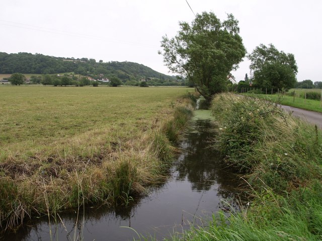
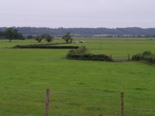
Aller Hill Images

Images are sourced within 2km of 51.061114/-2.8523459 or Grid Reference ST4029. Thanks to Geograph Open Source API. All images are credited.

Port Moor Part of the Somerset Levels, where all the lines you see are one sort of ditch or another.  Looking north towards Aller Hill <a href="https://www.geograph.org.uk/gridref/ST4029">ST4029</a>
This photo was taken from the 1158 Penzance to London Paddington train, having left Taunton at 1529.
Port Moor
Part of the Somerset Levels, where all the lines you see are one sort of ditch or another. Looking north towards Aller Hill ST4029 This photo was taken from the 1158 Penzance to London Paddington train, having left Taunton at 1529.
Coy Orchard Tilting Weir
River Parrett near Aller
Monk's Leaze Clyse on River Parrett
Middlemoor from Combe
River Parrett from Aller Hill
The Old Pound Inn at Aller
Aller  St Andrew's church and farm at Aller
Aller
St Andrew's church and farm at Aller
Aller The Old Pound Inn
Aller
The Old Pound Inn
Aller Ridge Looking south westwards onto the Somerset Levels with the River Parrett in the distance
Aller Ridge
Looking south westwards onto the Somerset Levels with the River Parrett in the distance
Monk's Leaze Clyce  on the River Parrett This sluice regulates the flow of water in the River Parrett. It is used to retain water in the summer and to help control flooding in the winter.
Monk's Leaze Clyce on the River Parrett
This sluice regulates the flow of water in the River Parrett. It is used to retain water in the summer and to help control flooding in the winter.
Nightingale Farm at Beer The old Nightingale Farm has been subdivided into a number of smaller units, but retains its historical identity to the locals.
Nightingale Farm at Beer
The old Nightingale Farm has been subdivided into a number of smaller units, but retains its historical identity to the locals.
Aller Wood View from the A372 near Beer Corner.
Aller Wood
View from the A372 near Beer Corner.
Allerdrove Rhyne This runs beside Aller Drove on the right, which divides North Moor from Aller Moor and connects Pathe to Aller across this narrow stretch of the Somerset Levels. Seen from the junction with Leazeway Drove.
Allerdrove Rhyne
This runs beside Aller Drove on the right, which divides North Moor from Aller Moor and connects Pathe to Aller across this narrow stretch of the Somerset Levels. Seen from the junction with Leazeway Drove.
Rhyne at Longstone This continuation of Black Withies Rhyne bends at Longstone to run beside Aller Drove, the lane on the right. In the distance are buildings at Aller, and Aller Hill.
Rhyne at Longstone
This continuation of Black Withies Rhyne bends at Longstone to run beside Aller Drove, the lane on the right. In the distance are buildings at Aller, and Aller Hill.
Middle Moor A view from the A372 just outside Aller across part of the Somerset levels towards the River Parrett. The field to the right of the zigzagging hedge is shown on the 1:10000 map as an orchard, but on no others (including the 1940 1" map).
Middle Moor
A view from the A372 just outside Aller across part of the Somerset levels towards the River Parrett. The field to the right of the zigzagging hedge is shown on the 1:10000 map as an orchard, but on no others (including the 1940 1" map).
Wood Drove This no through road runs along the plateau above Aller Hill. Here the lane is passing Hill Farm.
Wood Drove
This no through road runs along the plateau above Aller Hill. Here the lane is passing Hill Farm.
North Moor Cattle graze near a conventional-looking haystack on the eastern part of North Moor, seen from Northmoor Drove.  According to <span class="nowrap"><a title="http://webapp1.somerset.gov.uk/her/details.asp?prn=18892" rel="nofollow ugc noopener" href="http://webapp1.somerset.gov.uk/her/details.asp?prn=18892">Link</a><img style="margin-left:2px;" alt="External link" title="External link - shift click to open in new window" src="https://s1.geograph.org.uk/img/external.png" width="10" height="10"/></span> , this area was actually the site of a number of medieval stack stands.

The building in the background is Black Withies. Aller Wood, on the slopes of Aller Hill, is in ST4030.
North Moor
Cattle graze near a conventional-looking haystack on the eastern part of North Moor, seen from Northmoor Drove. According to LinkExternal link , this area was actually the site of a number of medieval stack stands. The building in the background is Black Withies. Aller Wood, on the slopes of Aller Hill, is in ST4030.
Show me another place!

Aller Hill is located at Grid Ref: ST4029 (Lat: 51.061114, Lng: -2.8523459)

Administrative County: Somerset

District: South Somerset

Police Authority: Avon and Somerset

What 3 Words

///incur.viewer.feed. Near Langport, Somerset

Nearby Locations

Aller Hill

Related Wikis

Aller Hill

Aller Hill (grid reference ST408291) is an 18.4 hectare (45.4 acre) biological Site of Special Scientific Interest near Aller in Somerset, notified in...

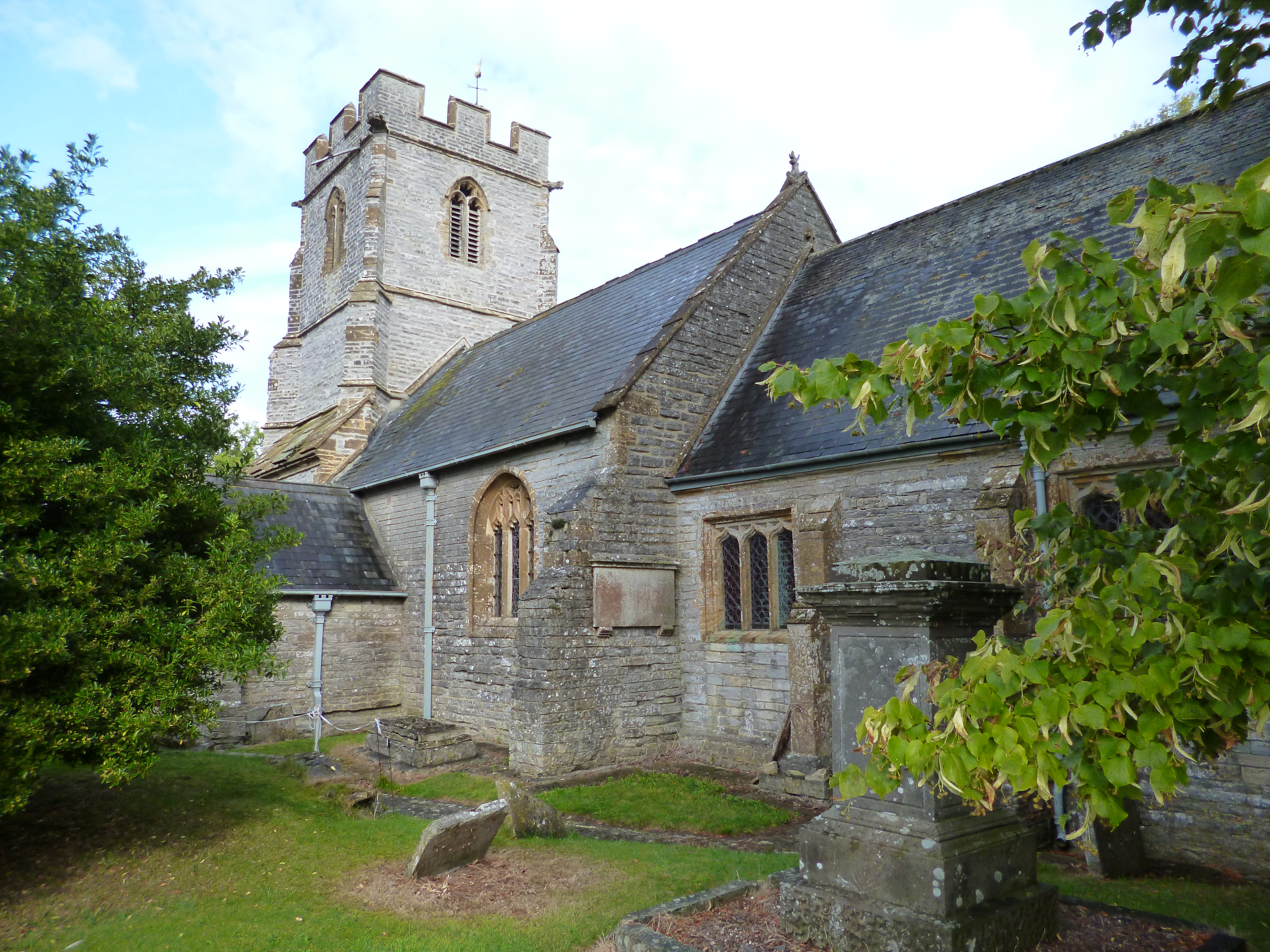
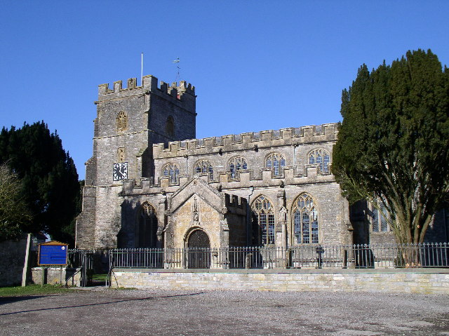
Church of St Andrew, Aller

The Anglican Church of St Andrew in Aller, Somerset, England, was built in the 11th century. It is a Grade II* listed building. == History == The Church...

Aller and Beer Woods

Aller and Beer Woods (grid reference ST404305) is a 56.9 hectares (141 acres) biological Site of Special Scientific Interest. off the A372 Othery to Langport...

Aller, Somerset

Aller is a village and parish in Somerset, England, situated 5 miles (8.0 km) west of Somerton on the A372 road towards Bridgwater. The village has a population...

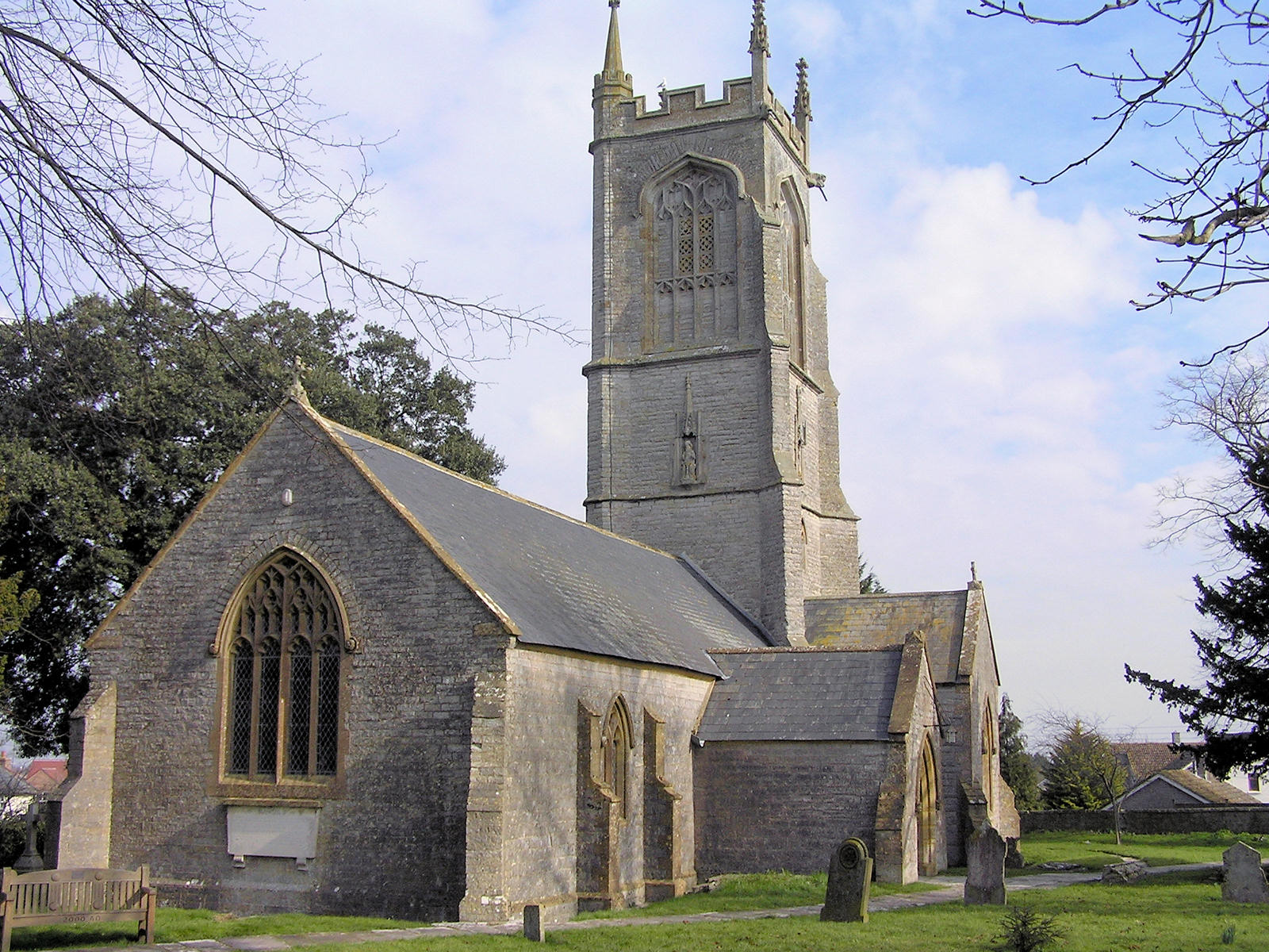
St Andrew's Church, High Ham

The Church of Saint Andrew is an Anglican parish church located on Turnhill Road, in High Ham, Somerset, England. It shows evidence of 12th- and 14th...

High Ham

High Ham is a village and civil parish in Somerset, England. Within the parish of High Ham, there are the villages of High Ham and Low Ham and the hamlets...

Othery

The parish and village of Othery, established in 1515, sits on a detached extension of Sowy island on the Somerset Levels. It is 7 miles (11 km) east of...

Low Ham

Low Ham is a village in the civil parish of High Ham in the English county of Somerset. At the time of the Domesday Book Low Ham was part of the estate...

Nearby Amenities

Located within 500m of 51.061114,-2.8523459
Aller
Is In: Somerset, England, UK
Place: village
Source: npe
Lat/Long: 51.0593356/-2.857156
Barrier: kissing_gate
Foot: yes
Lat/Long: 51.0574361/-2.8546015
Direction: both
Maxspeed: 30 mph
Traffic Sign: maxspeed
Lat/Long: 51.0573788/-2.8536596
Direction: both
Maxspeed: 30 mph
Traffic Sign: maxspeed
Lat/Long: 51.056667/-2.8524192
Direction: both
Maxspeed: 30 mph
Traffic Sign: maxspeed
Lat/Long: 51.0581567/-2.8550454
Direction: both
Maxspeed: 30 mph
Traffic Sign: maxspeed
Lat/Long: 51.0591385/-2.8568223
Post Box
Brand: Royal Mail
Brand Wikidata: Q638098
Brand Wikipedia: en:Royal Mail
Drive Through: no
Operator: Royal Mail
Operator Wikidata: Q638098
Post Box Type: lamp
Ref: TA10 106
Royal Cypher: EIIR
Royal Cypher Wikidata: Q33102113
Lat/Long: 51.0590915/-2.8569508
Power: pole
Lat/Long: 51.0607676/-2.8593098
Material: wood
Power: pole
Lat/Long: 51.0614332/-2.8585136
Material: wood
Power: pole
Lat/Long: 51.0622992/-2.8578705
Material: wood
Power: pole
Lat/Long: 51.0626786/-2.8577759
Power: pole
Lat/Long: 51.0634005/-2.8576148
Power: pole
Lat/Long: 51.0571287/-2.8549818
Power: pole
Lat/Long: 51.0567004/-2.8536384
The data included in this document is from www.openstreetmap.org. The data is made available under ODbL.

Have you been to Aller Hill?

Leave your review of Aller Hill below (or comments, questions and feedback).