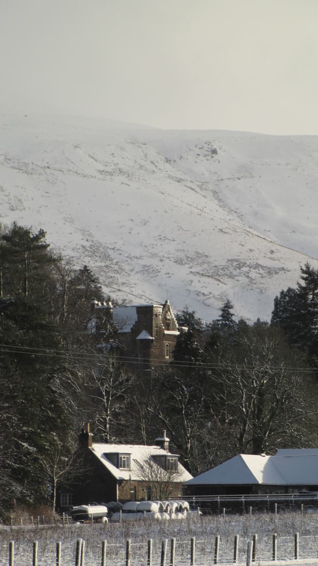
Auldshiels Hill

Hill, Mountain in Dumfriesshire

Scotland

Auldshiels Hill
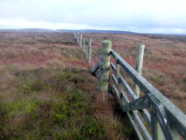
Arkleton Hill Bagged trig first with Phil Cooper then White Hill TUMP, Salter Grain Hill, Pike Fell and Arkleton Hill after parking near Mosspeeble.
Name: Arkleton Hill
Hill number: 1926
Height: 521m / 1709ft
Parent (Ma/M): 1918  Roan Fell
Section: 28B: The River Tweed to the English Border
County/UA: Dumfries and Galloway (UA)
Class: HuMP, Donald Dewey, subMarilyn
Grid ref: NY 40507 92181
Summit feature: no feature: near fence junction
Drop: 146m
Col: 375m  NY421937
Arkleton Hill Credit: Rude Health

The requested URL returned error: 429 Too Many Requests

If you have any feedback on the listing, please let us know in the comments section below.

Auldshiels Hill Images

Images are sourced within 2km of 55.203214/-2.9454235 or Grid Reference NY3990. Thanks to Geograph Open Source API. All images are credited.

Arkleton Hill Bagged trig first with Phil Cooper then White Hill TUMP, Salter Grain Hill, Pike Fell and Arkleton Hill after parking near Mosspeeble.
Name: Arkleton Hill
Hill number: 1926
Height: 521m / 1709ft
Parent (Ma/M): 1918  Roan Fell
Section: 28B: The River Tweed to the English Border
County/UA: Dumfries and Galloway (UA)
Class: HuMP, Donald Dewey, subMarilyn
Grid ref: NY 40507 92181
Summit feature: no feature: near fence junction
Drop: 146m
Col: 375m  NY421937
Arkleton Hill
Bagged trig first with Phil Cooper then White Hill TUMP, Salter Grain Hill, Pike Fell and Arkleton Hill after parking near Mosspeeble. Name: Arkleton Hill Hill number: 1926 Height: 521m / 1709ft Parent (Ma/M): 1918 Roan Fell Section: 28B: The River Tweed to the English Border County/UA: Dumfries and Galloway (UA) Class: HuMP, Donald Dewey, subMarilyn Grid ref: NY 40507 92181 Summit feature: no feature: near fence junction Drop: 146m Col: 375m NY421937
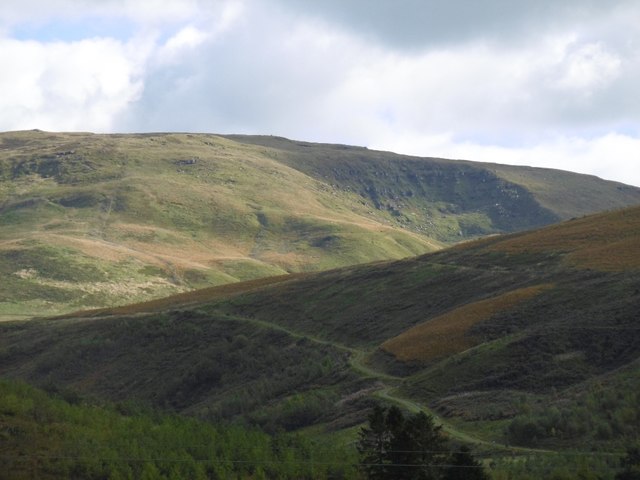
Black Cove Small corrie on Arkleton Hill. View from the A7 over Mosspeeble.
Black Cove
Small corrie on Arkleton Hill. View from the A7 over Mosspeeble.
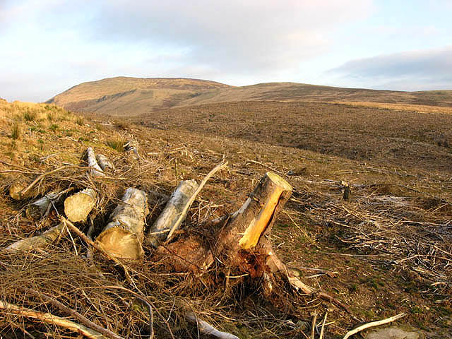
Clear fell area on Auldshiels Hill The forestry shown on the O.S. Map no longer exists. Viewed from a forestry road towards Arkleton Hill.
Clear fell area on Auldshiels Hill
The forestry shown on the O.S. Map no longer exists. Viewed from a forestry road towards Arkleton Hill.
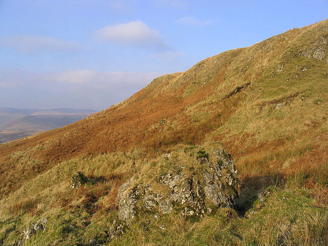
Under Nick on Arkleton Hill On the southwest slopes of the hill on a fine December day.
Under Nick on Arkleton Hill
On the southwest slopes of the hill on a fine December day.
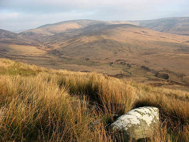
White Brae Rough grazing hill countryside with the Byrecleuch Burn below and Mid Height in the centre background. Viewed in December.
White Brae
Rough grazing hill countryside with the Byrecleuch Burn below and Mid Height in the centre background. Viewed in December.
Forestry road on Auldshiels Hill In a clear fell area with a view towards Arkleton Hill.
Forestry road on Auldshiels Hill
In a clear fell area with a view towards Arkleton Hill.
White Cove Small crags at White Cove on Arkleton Hill.
White Cove
Small crags at White Cove on Arkleton Hill.
A crag at Under Nick on Arkleton Hill
Under Nick The source of a small burn running down the southwest face of Arkleton Hill.
Under Nick
The source of a small burn running down the southwest face of Arkleton Hill.
Arkleton Hill Gently sloping ground between Upper Nick and Under Nick on Arkleton Hill.
Arkleton Hill
Gently sloping ground between Upper Nick and Under Nick on Arkleton Hill.
Byre Cleuchs Rough grazing terrain by the Byrecleuch Burn with Mid Height centre right in the background.
Byre Cleuchs
Rough grazing terrain by the Byrecleuch Burn with Mid Height centre right in the background.
Clear fell, Ewe Rig Another stand of sitka spruce has been harvested. The feral goats are looking for pickings amongst the wreckage.
Clear fell, Ewe Rig
Another stand of sitka spruce has been harvested. The feral goats are looking for pickings amongst the wreckage.
Rough grazing hillside Viewed from the road to Cooms Farm.
Rough grazing hillside
Viewed from the road to Cooms Farm.
The road to Cooms Farm A section of Sitka forest on the left beyond the Tarras Water, has been clear felled.
The road to Cooms Farm
A section of Sitka forest on the left beyond the Tarras Water, has been clear felled.
The road to Cooms by the Tarras Water This single lane road by the Tarras Water runs for just over 3km from Tarras Lodge to Cooms Farm.
The road to Cooms by the Tarras Water
This single lane road by the Tarras Water runs for just over 3km from Tarras Lodge to Cooms Farm.
Bridge over the Tarras Water Provides access to forestry on Auldshiels Hill but the hillside behind has been clear felled.
Bridge over the Tarras Water
Provides access to forestry on Auldshiels Hill but the hillside behind has been clear felled.
A farm track on Auldshiels Hill Viewed on a cold December day.
A farm track on Auldshiels Hill
Viewed on a cold December day.
A drystone dyke and electric fence A dyke on the way to Bittlestone Height with a single strand electric wire either side, in an area of rough grazing for hill cattle and sheep.
A drystone dyke and electric fence
A dyke on the way to Bittlestone Height with a single strand electric wire either side, in an area of rough grazing for hill cattle and sheep.
Show me another place!

Auldshiels Hill is located at Grid Ref: NY3990 (Lat: 55.203214, Lng: -2.9454235)

Unitary Authority: Dumfries and Galloway

Police Authority: Dumfries and Galloway

What 3 Words

///unearthly.task.viewer. Near Langholm, Dumfries & Galloway

Nearby Locations

Auldshiels Hill

Related Wikis

Arkleton

Arkleton is a mansion and estate in the civil parish of Ewes, in Dumfries and Galloway, Scotland. Arkleton House was built in 1860/1884 and incorporates...

Ewesdale

Ewesdale is a glen and former lordship in Dumfries and Galloway, Scotland. The Ewes Water runs through the valley from its source at Mosspaul, until it...

Unthank, Dumfries and Galloway

Unthank is a village in Dumfries and Galloway, Scotland. == References == The geographic coordinates are from the Ordnance Survey.

Barntalloch Castle

Barntalloch Castle was a castle located at Staplegorton, in Dumfries and Galloway, Scotland. The castle was built in the 12th century by Galfrid de Coninsburgh...

Nearby Amenities

Located within 500m of 55.203214,-2.9454235
Barrier: stile
Lat/Long: 55.2005122/-2.9510682
Auldshiels Hill
Ele: 366
Natural: peak
Source: NLS-OS-1st_Series
Lat/Long: 55.203096/-2.9454968
Barrier: stile
Lat/Long: 55.2055195/-2.9459634
Barrier: stile
Lat/Long: 55.2004904/-2.9510468
Information: route_marker
Tourism: information
Lat/Long: 55.199878/-2.947815
Information: route_marker
Tourism: information
Lat/Long: 55.20548/-2.9459069
The data included in this document is from www.openstreetmap.org. The data is made available under ODbL.

Have you been to Auldshiels Hill?

Leave your review of Auldshiels Hill below (or comments, questions and feedback).