Bapton

Settlement in Wiltshire

England

Bapton

Signs by the A303
Signs by the A303 Credit: N Chadwick

Bapton is a charming village located in the county of Wiltshire, England. Situated approximately 7 miles southeast of the town of Warminster, Bapton is nestled amidst the picturesque countryside and offers a tranquil and idyllic setting.

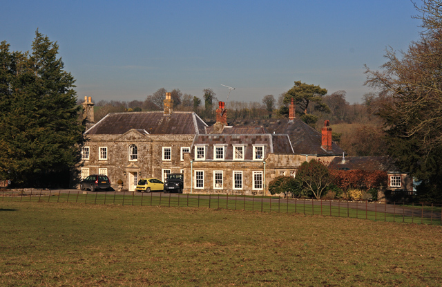
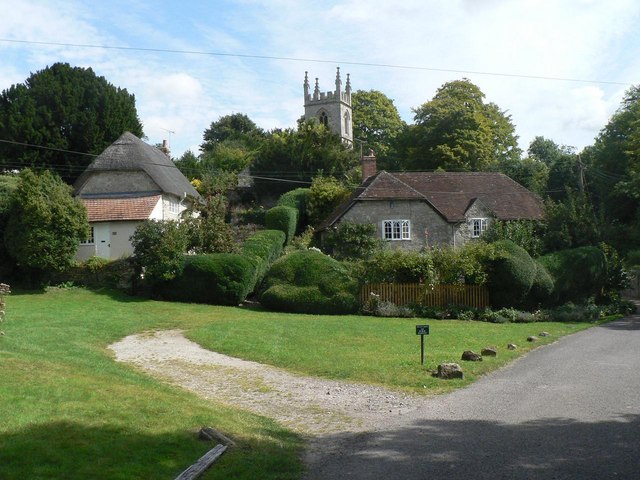
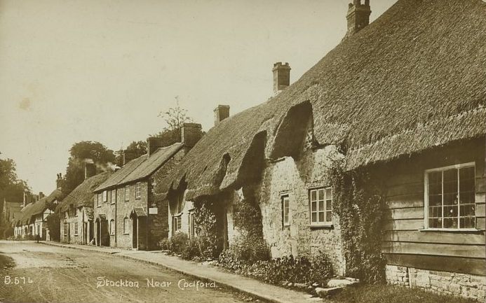
The village is characterized by its traditional English architecture, with many of its buildings dating back to the 17th and 18th centuries. The local stone cottages, thatched roofs, and well-maintained gardens add to the village's rustic charm.

Bapton is home to a close-knit community, with a population of around 200 residents. The village boasts a small but welcoming pub, which serves as a social hub for locals and visitors alike. The pub often hosts community events, providing an opportunity for villagers to come together and enjoy each other's company.

Surrounded by rolling hills and lush meadows, Bapton offers ample opportunities for outdoor activities. The village is crisscrossed by numerous footpaths and bridleways, making it a popular destination for walkers and cyclists. The nearby countryside also provides a haven for nature enthusiasts, with an abundance of wildlife and scenic vistas to enjoy.

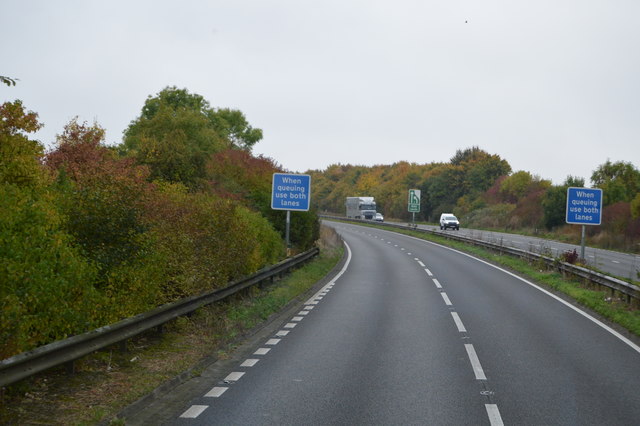
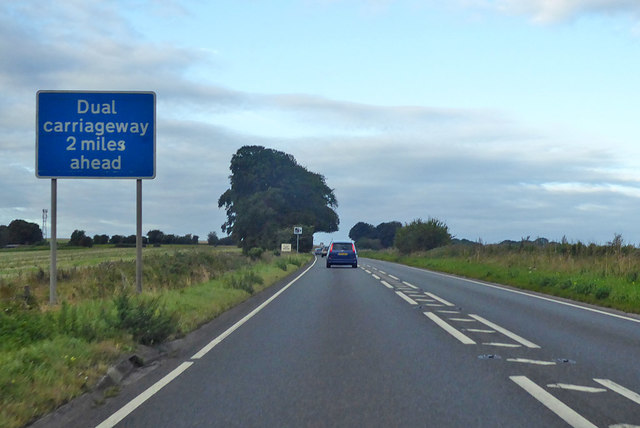
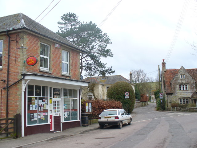
While Bapton may be small in size, it is well-connected to larger towns and cities in the region. The village is conveniently located near major road networks, allowing easy access to nearby attractions and amenities. Additionally, the historic city of Salisbury is within a short drive, offering a range of cultural, shopping, and entertainment options.

Bapton is a quintessential English village, offering a peaceful and picturesque haven in the heart of Wiltshire. Its charm, natural beauty, and friendly community make it a delightful place to visit or call home.

If you have any feedback on the listing, please let us know in the comments section below.

Bapton Images

Images are sourced within 2km of 51.143547/-2.013978 or Grid Reference ST9938. Thanks to Geograph Open Source API. All images are credited.

Signs by the A303
Signs by the A303
A303, westbound The A303 is a main trunk road running 92 miles between Basingstoke and Honiton. Along with the A30 and M3 it forms a major route between London and the South West. Much of the road is dual carriageway, but some stretches remain single and prone to congestion.

Wikipedia: <span class="nowrap"><a title="http://en.wikipedia.org/wiki/A303_road" rel="nofollow ugc noopener" href="http://en.wikipedia.org/wiki/A303_road">Link</a><img style="margin-left:2px;" alt="External link" title="External link - shift click to open in new window" src="https://s1.geograph.org.uk/img/external.png" width="10" height="10"/></span>
A303, westbound
The A303 is a main trunk road running 92 miles between Basingstoke and Honiton. Along with the A30 and M3 it forms a major route between London and the South West. Much of the road is dual carriageway, but some stretches remain single and prone to congestion. Wikipedia: LinkExternal link
A303 The A303 is a main trunk road running 92 miles between Basingstoke and Honiton. Along with the A30 and M3 it forms a major route between London and the South West. Much of the road is dual carriageway, but some stretches remain single and prone to congestion.

Wikipedia: <span class="nowrap"><a title="http://en.wikipedia.org/wiki/A303_road" rel="nofollow ugc noopener" href="http://en.wikipedia.org/wiki/A303_road">Link</a><img style="margin-left:2px;" alt="External link" title="External link - shift click to open in new window" src="https://s1.geograph.org.uk/img/external.png" width="10" height="10"/></span>
A303
The A303 is a main trunk road running 92 miles between Basingstoke and Honiton. Along with the A30 and M3 it forms a major route between London and the South West. Much of the road is dual carriageway, but some stretches remain single and prone to congestion. Wikipedia: LinkExternal link
A303, dual carriageway ending The A303 is a main trunk road running 92 miles between Basingstoke and Honiton. Along with the A30 and M3 it forms a major route between London and the South West. Much of the road is dual carriageway, but some stretches remain single and prone to congestion.

Wikipedia: <span class="nowrap"><a title="http://en.wikipedia.org/wiki/A303_road" rel="nofollow ugc noopener" href="http://en.wikipedia.org/wiki/A303_road">Link</a><img style="margin-left:2px;" alt="External link" title="External link - shift click to open in new window" src="https://s1.geograph.org.uk/img/external.png" width="10" height="10"/></span>
A303, dual carriageway ending
The A303 is a main trunk road running 92 miles between Basingstoke and Honiton. Along with the A30 and M3 it forms a major route between London and the South West. Much of the road is dual carriageway, but some stretches remain single and prone to congestion. Wikipedia: LinkExternal link
Copse by the A303
Copse by the A303
Road from Wylye towards Bapton and Stockton
Road from Wylye towards Stockton The 30 limit signs for Stockton are in the distance.
Road from Wylye towards Stockton
The 30 limit signs for Stockton are in the distance.
Cottages, Stockton A great deal of thatch, some grade II listed buildings.
Cottages, Stockton
A great deal of thatch, some grade II listed buildings.
Wiltshire : The A303 Heading through Wiltshire on the A303.
Wiltshire : The A303
Heading through Wiltshire on the A303.
The A303 west of Wylye
River Wylye above the former mill at Fisherton de la Mere
Footbridge over the River Wylye at Fisherton de la Mere
Old Boundary Marker by the A36, Salisbury Road, Codford Parish Boundary Marker by the A36, in parish of Codford (West Wiltshire District), Salisbury Road, Codford. Junction with track to Starveall, on embankment.

Inscription reads:-
: CODFORD ST MARY : : FISHERTON / DE LA MER : 

Grade II listed.
List Entry Number: 1181168 <span class="nowrap"><a title="https://historicengland.org.uk/listing/the-list/list-entry/1181168" rel="nofollow ugc noopener" href="https://historicengland.org.uk/listing/the-list/list-entry/1181168">Link</a><img style="margin-left:2px;" alt="External link" title="External link - shift click to open in new window" src="https://s1.geograph.org.uk/img/external.png" width="10" height="10"/></span>

Surveyed

Milestone Society National ID: WI_SAWM12pb
Old Boundary Marker by the A36, Salisbury Road, Codford
Parish Boundary Marker by the A36, in parish of Codford (West Wiltshire District), Salisbury Road, Codford. Junction with track to Starveall, on embankment. Inscription reads:- : CODFORD ST MARY : : FISHERTON / DE LA MER : Grade II listed. List Entry Number: 1181168 LinkExternal link Surveyed Milestone Society National ID: WI_SAWM12pb
Old Milestone by the A303, southwest of Wylye, Stockton parish Carved stone post by the A303, in parish of STOCKTON (WEST WILTSHIRE District), roadside, by the road, on North side of road. Amesbury stone, erected by the Amesbury turnpike trust in the 19th century. 

Inscription reads:-
LXXXIX
Miles from
LONDON
XI
from
Amesbury

Grade II listed.  
List Entry Number: 1284952 <span class="nowrap"><a title="https://historicengland.org.uk/listing/the-list/list-entry/1284952" rel="nofollow ugc noopener" href="https://historicengland.org.uk/listing/the-list/list-entry/1284952">Link</a><img style="margin-left:2px;" alt="External link" title="External link - shift click to open in new window" src="https://s1.geograph.org.uk/img/external.png" width="10" height="10"/></span>

Milestone Society National ID: WI_AMWH11.
Old Milestone by the A303, southwest of Wylye, Stockton parish
Carved stone post by the A303, in parish of STOCKTON (WEST WILTSHIRE District), roadside, by the road, on North side of road. Amesbury stone, erected by the Amesbury turnpike trust in the 19th century. Inscription reads:- LXXXIX Miles from LONDON XI from Amesbury Grade II listed. List Entry Number: 1284952 LinkExternal link Milestone Society National ID: WI_AMWH11.
A303 heading west The end of a dual carriageway section.
A303 heading west
The end of a dual carriageway section.
A303 heading west
A303 heading west
2011 : East along the Wylye Valley A view from the A36.
The little blue line marking the edge of the grid square runs through the trees bordering the pasture, houses on the edge of Fisherton de la Mare are beyond.
Hills under cloud are on the other side of the valley.
2011 : East along the Wylye Valley
A view from the A36. The little blue line marking the edge of the grid square runs through the trees bordering the pasture, houses on the edge of Fisherton de la Mare are beyond. Hills under cloud are on the other side of the valley.
2011 : A36 heading east beyond Codford St.Peter Along the edge of Foxhole Bottom to the left of the road.
The bypass round Codfords St.Peter and St.Mary is behind then follows the Wylye Valley to the right.
2011 : A36 heading east beyond Codford St.Peter
Along the edge of Foxhole Bottom to the left of the road. The bypass round Codfords St.Peter and St.Mary is behind then follows the Wylye Valley to the right.
Show me another place!

Bapton is located at Grid Ref: ST9938 (Lat: 51.143547, Lng: -2.013978)

Unitary Authority: Wiltshire

Police Authority: Wiltshire

What 3 Words

///widgets.sketching.backfired. Near Stockton, Wiltshire

Nearby Locations

Wylye Valley Bapton

Related Wikis

Bapton

Bapton is a hamlet in Wiltshire, England, in the civil parish of Stockton. It lies south of the A36 and the River Wylye, on the minor road which follows...

Fisherton de la Mere

Fisherton de la Mere, also spelt Fisherton Delamere, is a small village and former civil parish, now in the parish of Wylye, on the River Wylye, Wiltshire...

St Nicholas's Church, Fisherton Delamere

St Nicholas's Church in Fisherton Delamere, Wiltshire, England, was built in the 14th century. It is recorded in the National Heritage List for England...

Stockton, Wiltshire

Stockton is a small village and civil parish in the Wylye Valley in Wiltshire, England, about 8 miles (13 km) southeast of Warminster. The parish includes...

Wylye

Wylye () is a village and civil parish on the River Wylye in Wiltshire, England. The village is about 9+1⁄2 miles (15 km) northwest of Salisbury and a...

Starveall and Stony Down

Starveall and Stony Down is a 22.5 hectare biological Site of Special Scientific Interest in the parishes of Codford and Wylye, Wiltshire, England, notified...

Wylye railway station

Wylye railway station is a former railway station in Wylye, Wiltshire, UK, in the Wylye Valley. The station name was spelled "Wiley" by the GWR until 1874...

Wylye and Church Dean Downs

Wylye and Church Dean Downs (grid reference SU002361) is an 80.9 hectare biological Site of Special Scientific Interest in Wiltshire, England, notified...

Nearby Amenities

Located within 500m of 51.143547,-2.013978
Post Box
Operator: Royal Mail
Operator Wikidata: Q638098
Post Box Type: wall
Ref: BA12 49
Royal Cypher: VR
Royal Cypher Wikidata: Q33102356
Lat/Long: 51.1421421/-2.0159781
Bapton
Place: hamlet
Wikidata: Q664005
Lat/Long: 51.1433608/-2.0136758
Bicycle: yes
Crossing: uncontrolled
Horse: yes
Railway: crossing
Supervised: no
Lat/Long: 51.1398857/-2.0115393
Bicycle: yes
Crossing: uncontrolled
Horse: yes
Railway: crossing
Supervised: no
Lat/Long: 51.1398522/-2.0115517
The data included in this document is from www.openstreetmap.org. The data is made available under ODbL.

Have you been to Bapton?

Leave your review of Bapton below (or comments, questions and feedback).