Hobbister Hill

Hill, Mountain in Orkney

Scotland

Hobbister Hill

Peat cutting This is an historic peat-bed on Veness (Orkney)
Some peat has recently been cut and removed; the small remaining pile dries in the wind and sun. Notice the tough, fissured, old bed and the recently worked, unweathered, face.
Peat should always be removed in an environmentally-friendly way if possible.
The ground should be reinstated as one progresses and the area left as clean as possible for the next year. See also <a href="https://www.geograph.org.uk/photo/2301223">HY3705 : Neat Workspace</a> and <a href="https://www.geograph.org.uk/photo/2301210">HY3705 : Peat stooks</a> and <a href="https://www.geograph.org.uk/photo/2301177">HY3705 : Cutting peat on Veness</a>
Anyone contemplating opening up old beds or considering cutting should be aware of the general impact - here <span class="nowrap"><a title="http://en.wikipedia.org/wiki/Peat#Environmental_and_ecological_issues" rel="nofollow ugc noopener" href="http://en.wikipedia.org/wiki/Peat#Environmental_and_ecological_issues">Link</a><img style="margin-left:2px;" alt="External link" title="External link - shift click to open in new window" src="https://s1.geograph.org.uk/img/external.png" width="10" height="10"/></span>
Peat cutting Credit: Derek Mayes

Hobbister Hill, located on the Orkney Islands in Scotland, is a prominent landmark known for its distinctive shape and rich historical significance. Rising to a height of 279 meters (915 feet), it is one of the highest hills in Orkney. Situated near the village of Harray, Hobbister Hill offers breathtaking panoramic views of the surrounding countryside, including the sparkling waters of the Loch of Harray and the nearby Orphir Hills.

The hill itself is a volcanic plug, formed millions of years ago during intense volcanic activity in the region. Composed mainly of basalt, it is characterized by steep slopes covered with heather, grasses, and scattered outcrops of rocks. The hill's unique shape, resembling a cone, makes it easily distinguishable from its surroundings.

Hobbister Hill has great cultural and historical significance. It is believed to have been used as a defensive fortification during the Iron Age, with remnants of ancient settlements and defensive ditches found on its slopes. The hill was also a site of Viking activity, serving as a lookout point and signaling station during their occupation of the Orkney Islands.

Today, Hobbister Hill attracts hikers and nature enthusiasts who enjoy its scenic beauty and tranquil environment. Several walking trails lead to the summit, offering a moderate challenge for visitors. The hill's commanding views make it a popular spot for photography, and its rich history adds to its appeal for those interested in archaeology and heritage tourism.

If you have any feedback on the listing, please let us know in the comments section below.

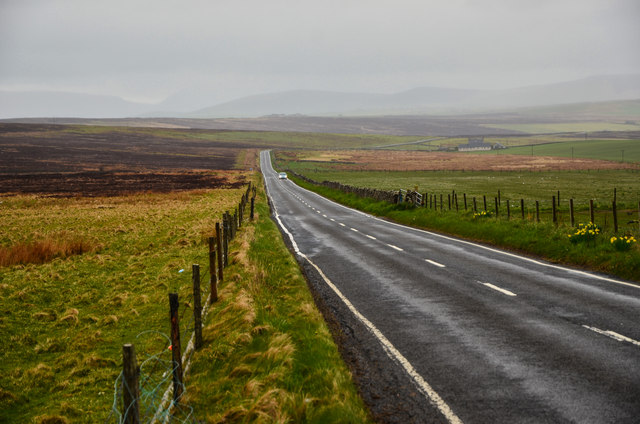
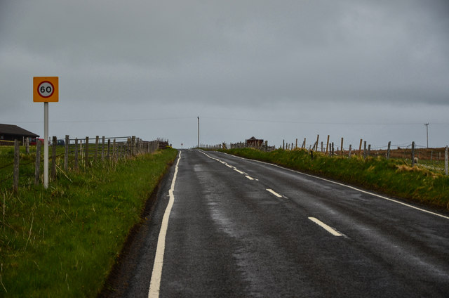
Hobbister Hill Images

Images are sourced within 2km of 58.941307/-3.0651 or Grid Reference HY3806. Thanks to Geograph Open Source API. All images are credited.

Peat cutting This is an historic peat-bed on Veness (Orkney)
Some peat has recently been cut and removed; the small remaining pile dries in the wind and sun. Notice the tough, fissured, old bed and the recently worked, unweathered, face.
Peat should always be removed in an environmentally-friendly way if possible.
The ground should be reinstated as one progresses and the area left as clean as possible for the next year. See also <a href="https://www.geograph.org.uk/photo/2301223">HY3705 : Neat Workspace</a> and <a href="https://www.geograph.org.uk/photo/2301210">HY3705 : Peat stooks</a> and <a href="https://www.geograph.org.uk/photo/2301177">HY3705 : Cutting peat on Veness</a>
Anyone contemplating opening up old beds or considering cutting should be aware of the general impact - here <span class="nowrap"><a title="http://en.wikipedia.org/wiki/Peat#Environmental_and_ecological_issues" rel="nofollow ugc noopener" href="http://en.wikipedia.org/wiki/Peat#Environmental_and_ecological_issues">Link</a><img style="margin-left:2px;" alt="External link" title="External link - shift click to open in new window" src="https://s1.geograph.org.uk/img/external.png" width="10" height="10"/></span>
Peat cutting
This is an historic peat-bed on Veness (Orkney) Some peat has recently been cut and removed; the small remaining pile dries in the wind and sun. Notice the tough, fissured, old bed and the recently worked, unweathered, face. Peat should always be removed in an environmentally-friendly way if possible. The ground should be reinstated as one progresses and the area left as clean as possible for the next year. See also HY3705 : Neat Workspace and HY3705 : Peat stooks and HY3705 : Cutting peat on Veness Anyone contemplating opening up old beds or considering cutting should be aware of the general impact - here LinkExternal link
Peat Face The Peat Extraction beds worked by the Highland Park Distillery <span class="nowrap"><a title="https://www.highlandparkwhisky.com/en/distillery" rel="nofollow ugc noopener" href="https://www.highlandparkwhisky.com/en/distillery">Link</a><img style="margin-left:2px;" alt="External link" title="External link - shift click to open in new window" src="https://s1.geograph.org.uk/img/external.png" width="10" height="10"/></span>
This very high peat bank has been cut, in one go, down to the underfloor of soil, sand and rock.
Such cutting can only be done using a JCB type digger.  It is quite destructive because it leaves little surface for reinstatement or repair.
Recent work to repair the whole headland after years of such extraction seems to be successful owing to a joint management programme with the RSPB.
See also here - <a href="https://www.geograph.org.uk/photo/2402241">HY3705 : Peat cutting</a>
Peat Face
The Peat Extraction beds worked by the Highland Park Distillery LinkExternal link This very high peat bank has been cut, in one go, down to the underfloor of soil, sand and rock. Such cutting can only be done using a JCB type digger. It is quite destructive because it leaves little surface for reinstatement or repair. Recent work to repair the whole headland after years of such extraction seems to be successful owing to a joint management programme with the RSPB. See also here - HY3705 : Peat cutting
Peat Worker Small stooks are built to catch the wind and sunshine.
This is peat cutting on a near industrial scale and the finished peats are taken to the Highland Park Distillery and used in the drying furnace to add a 'smoky' flavour to the finished product, see here - <span class="nowrap"><a title="https://www.highlandparkwhisky.com/en/distillery" rel="nofollow ugc noopener" href="https://www.highlandparkwhisky.com/en/distillery">Link</a><img style="margin-left:2px;" alt="External link" title="External link - shift click to open in new window" src="https://s1.geograph.org.uk/img/external.png" width="10" height="10"/></span>
Once cleared, this drying area will remain open to the winds and rain, so erosion will take place. It will be a long time before the vegetation returns - see also <a href="https://www.geograph.org.uk/photo/2323772">NS9547 : Ryeflat Moss</a>.
In contrast see this <a href="https://www.geograph.org.uk/photo/2301223">HY3705 : Neat Workspace</a>
Peat Worker
Small stooks are built to catch the wind and sunshine. This is peat cutting on a near industrial scale and the finished peats are taken to the Highland Park Distillery and used in the drying furnace to add a 'smoky' flavour to the finished product, see here - LinkExternal link Once cleared, this drying area will remain open to the winds and rain, so erosion will take place. It will be a long time before the vegetation returns - see also NS9547 : Ryeflat Moss. In contrast see this HY3705 : Neat Workspace
Hobbister: alongside Waulkmill Bay Looking along the northern edge of Waulkmill Bay into Scapa Flow.
Hobbister: alongside Waulkmill Bay
Looking along the northern edge of Waulkmill Bay into Scapa Flow.
Kirbister: postbox № KW17 5 An Elizabeth II-reign postbox set into the perimeter wall of Kirbister Mill, on the A964. It is emptied at noon, daily except Sunday.
Kirbister: postbox № KW17 5
An Elizabeth II-reign postbox set into the perimeter wall of Kirbister Mill, on the A964. It is emptied at noon, daily except Sunday.
Hobbister: the A964 heads for Orphir Looking along this excellent part of the A-road network on Orkney, with the magnificent backdrop of the island of Hoy. A bus has just turned the corner at the bottom and can be seen (right) heading for Orphir and, eventually, Stromness.
Hobbister: the A964 heads for Orphir
Looking along this excellent part of the A-road network on Orkney, with the magnificent backdrop of the island of Hoy. A bus has just turned the corner at the bottom and can be seen (right) heading for Orphir and, eventually, Stromness.
Hobbister: looking up Waulkmill Bay A pleasant view over a load of thistles towards the head of the bay.
Hobbister: looking up Waulkmill Bay
A pleasant view over a load of thistles towards the head of the bay.
Lash and tack Lash is a small self-catering cottage overlooking Scapa Flow.
See <span class="nowrap"><a title="http://www.lash-orkney.co.uk/" rel="nofollow ugc noopener" href="http://www.lash-orkney.co.uk/">Link</a><img style="margin-left:2px;" alt="External link" title="External link - shift click to open in new window" src="https://s1.geograph.org.uk/img/external.png" width="10" height="10"/></span>
Beyond her is Gulden Leeuw, a three masted Topsail schooner.
See <span class="nowrap"><a title="http://www.gulden-leeuw.nl/en/" rel="nofollow ugc noopener" href="http://www.gulden-leeuw.nl/en/">Link</a><img style="margin-left:2px;" alt="External link" title="External link - shift click to open in new window" src="https://s1.geograph.org.uk/img/external.png" width="10" height="10"/></span> and <a href="https://www.geograph.org.uk/photo/2884257">HY3704 : Scapa Flow vessels</a>
Lash and tack
Lash is a small self-catering cottage overlooking Scapa Flow. See LinkExternal link Beyond her is Gulden Leeuw, a three masted Topsail schooner. See LinkExternal link and HY3704 : Scapa Flow vessels
Sunset over Waulkmill Bay, from Hobbister Hill
Sunset over the Loch of Kirbister, from Hobbister Hill
Hobbister Farm Track through to the farm from the A964.
Hobbister Farm
Track through to the farm from the A964.
Hobbister House Looks as though some repair work to the gable end was underway when I visited.
Hobbister House
Looks as though some repair work to the gable end was underway when I visited.
Track by Hobbister Farm Leads from the farm to the A964.
Track by Hobbister Farm
Leads from the farm to the A964.
Natural Quarry near Hobbister Farm Surrounded by rock and stane wall with a feeder in place, it provides natural cover for livestock.
Natural Quarry near Hobbister Farm
Surrounded by rock and stane wall with a feeder in place, it provides natural cover for livestock.
Twartquoy View down the A964 with the Orphir hills to the right and the Hills of Hoy left, all shrouded in mist.
Twartquoy
View down the A964 with the Orphir hills to the right and the Hills of Hoy left, all shrouded in mist.
Passing Twartquoy Left of picture at the side of the A964.
Passing Twartquoy
Left of picture at the side of the A964.
Alone at Waulkmill Sands
Waulkmill Bay  near Hobbister Afternoon walk on the beach in between the rain showers.
Waulkmill Bay near Hobbister
Afternoon walk on the beach in between the rain showers.
Show me another place!

Hobbister Hill is located at Grid Ref: HY3806 (Lat: 58.941307, Lng: -3.0651)

Unitary Authority: Orkney Islands

Police Authority: Highlands and Islands

What 3 Words

///joked.darkest.barn. Near Orphir, Orkney Islands

Related Wikis

Waulkmill Bay

Waulkmill Bay is a tidal bay on the southwest of Mainland Orkney, Scotland. This bay and its immediately surrounding area have been identified as a Site...

Loch of Kirbister

The Loch of Kirbister is a small, shallow, somewhat triangular-shaped loch located on Mainland Orkney, Scotland, in the parish of Orphir. It lies 5 mi...

BBC Radio Orkney

BBC Radio Orkney is a community radio station and local opt-out service of BBC Radio Scotland, covering the Orkney Islands. The station is based in Castle...

BBC Radio nan Gàidheal

BBC Radio nan Gàidheal is a Scottish Gaelic language radio station owned and operated by BBC Scotland, a division of the BBC. The station was launched...

Nearby Amenities

Located within 500m of 58.941307,-3.0651
Toilets
Source: survey
Lat/Long: 58.9406038/-3.073667
Hobbister Hill
Natural: hill
Lat/Long: 58.9413197/-3.0682242
Power: pole
Lat/Long: 58.9412776/-3.0665508
Power: pole
Lat/Long: 58.9421798/-3.0664784
Power: pole
Lat/Long: 58.9431055/-3.06687
Power: pole
Lat/Long: 58.9436258/-3.0670416
Power: pole
Lat/Long: 58.9441668/-3.0672053
Power: pole
Lat/Long: 58.9447563/-3.0697346
Power: pole
Lat/Long: 58.9446926/-3.0685088
Power: pole
Lat/Long: 58.9446138/-3.0672911
Power: pole
Lat/Long: 58.9446068/-3.0667841
Power: pole
Lat/Long: 58.9448684/-3.0657434
Power: pole
Lat/Long: 58.9451243/-3.0647859
Power: pole
Lat/Long: 58.9454204/-3.0637425
The data included in this document is from www.openstreetmap.org. The data is made available under ODbL.

Have you been to Hobbister Hill?

Leave your review of Hobbister Hill below (or comments, questions and feedback).