Crook

Coastal Feature, Headland, Point in Orkney

Scotland

Crook

Moorland near Greenigoe
Moorland near Greenigoe Credit: Eirian Evans

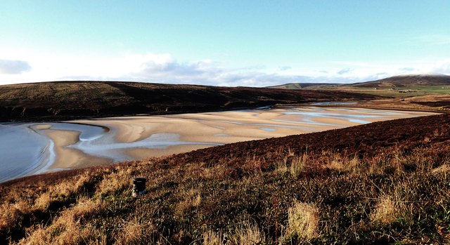
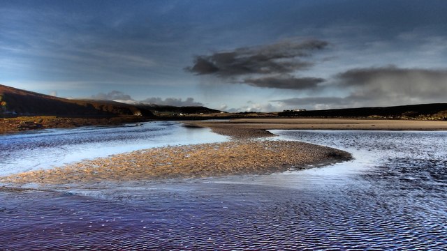
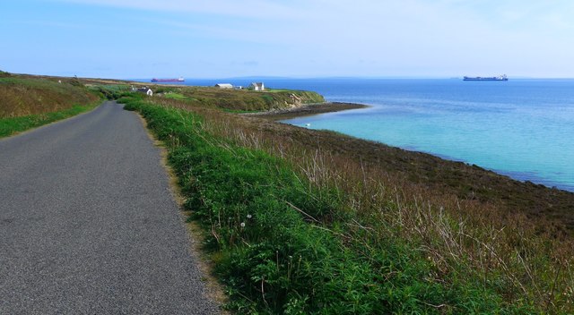
Crook is a headland situated on the southern coast of the Orkney Islands in Scotland. It is located in the parish of Deerness, approximately 12 miles east of Kirkwall, the capital of Orkney. The headland extends into the North Sea, forming a prominent point that juts out into the water.

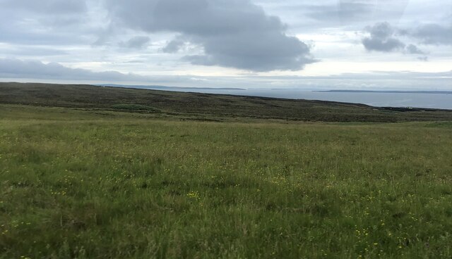
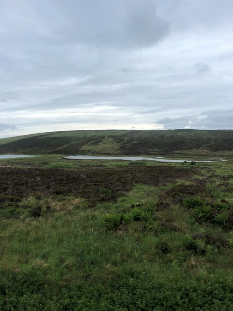
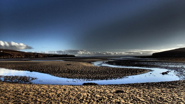
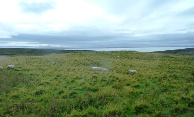
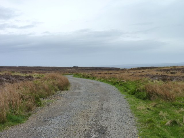
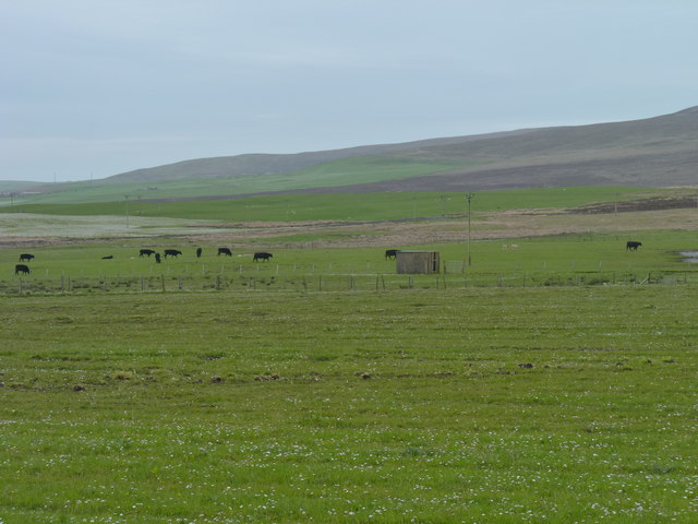
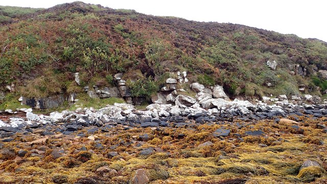
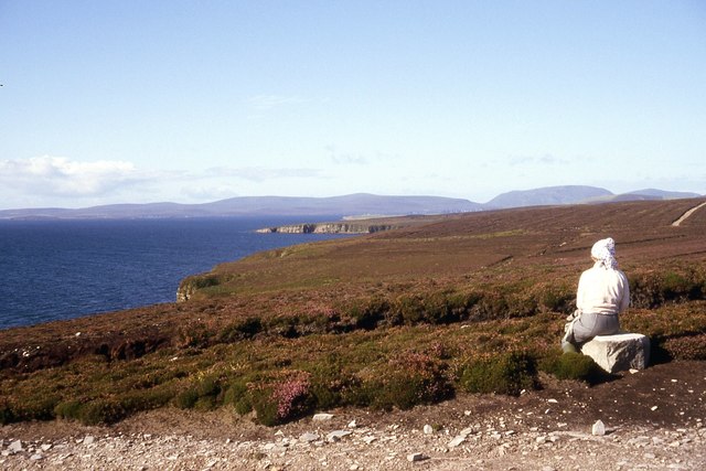
Crook is known for its rugged and dramatic coastal landscape, characterized by towering cliffs that reach up to 30 meters in height. The cliffs are composed of sandstone and are often covered in lush vegetation, including grasses, heather, and wildflowers. The headland offers breathtaking panoramic views of the surrounding sea, providing a picturesque backdrop for visitors.

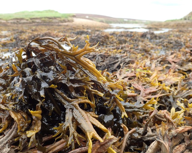
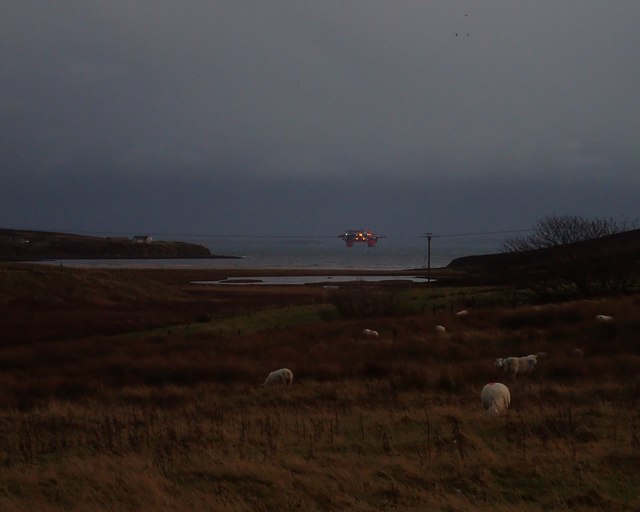
The area around Crook is home to a diverse range of wildlife. The cliffs provide nesting sites for a variety of seabirds, including puffins, guillemots, and razorbills. Visitors may also spot other bird species such as fulmars and kittiwakes. Additionally, seals can often be seen basking on the rocks or swimming in the waters surrounding the headland.

Crook is a popular destination for outdoor enthusiasts and nature lovers. It offers opportunities for hiking and walking along the coastal paths, allowing visitors to explore the stunning scenery and observe the abundant wildlife. The headland is also a favored spot for birdwatching, photography, and simply enjoying the tranquility of the natural surroundings.

In summary, Crook in Orkney is a picturesque headland characterized by towering cliffs, diverse wildlife, and stunning coastal views. It is a must-visit destination for those seeking to immerse themselves in the beauty of Scotland's coastal landscapes.

If you have any feedback on the listing, please let us know in the comments section below.

Crook Images

Images are sourced within 2km of 58.937165/-3.0674397 or Grid Reference HY3806. Thanks to Geograph Open Source API. All images are credited.

Moorland near Greenigoe
Skaith from the A964 The Skaith sits between the north-western end of Waulkmill Bay and the Loch of Kirbister.
Skaith from the A964
The Skaith sits between the north-western end of Waulkmill Bay and the Loch of Kirbister.
Water tank platform Mostly degraded but was a tank storing pumped water to supply nearby housing in the middle of last Century.
a revisit to <a title="https://www.geograph.org.uk/photo/2303631" href="https://www.geograph.org.uk/photo/2303631">Link</a>
Water tank platform
Mostly degraded but was a tank storing pumped water to supply nearby housing in the middle of last Century. a revisit to Link
Waulkmill Pools Waulkmill Bay is 15 minutes from my home.  It has a lot of moods, with sands exposed, tidal pools, birds and flotsam - it is a favourite place. In November, few people take to descending from the nearby road.
Waulkmill Pools
Waulkmill Bay is 15 minutes from my home. It has a lot of moods, with sands exposed, tidal pools, birds and flotsam - it is a favourite place. In November, few people take to descending from the nearby road.
Waulkmill Bay - tide's out A well visited part of Orkney. But in early winter few people wander these sands. Quite recently I watched a light aircraft do two bumps and circuits onto the sands at the edge of daylight. I'd like to have been in the cockpit.
Waulkmill Bay - tide's out
A well visited part of Orkney. But in early winter few people wander these sands. Quite recently I watched a light aircraft do two bumps and circuits onto the sands at the edge of daylight. I'd like to have been in the cockpit.
Waulkmill's River Mill Burn stays near the west edge of the bay as it drains from the Skaith - it has a strong predictable route. It is easy to cross, even in Wellies, in places. Where the burn exists the Skaith there is one of Orkney's best sites for Horned Wrack - Fucus ceranoides.
See <a title="https://www.geograph.org.uk/photo/4751187" href="https://www.geograph.org.uk/photo/4751187">Link</a>
Waulkmill's River
Mill Burn stays near the west edge of the bay as it drains from the Skaith - it has a strong predictable route. It is easy to cross, even in Wellies, in places. Where the burn exists the Skaith there is one of Orkney's best sites for Horned Wrack - Fucus ceranoides. See Link
Horned Wrack - Fucus ceranoides In the outlet from the Skaith to Waulkmill Bay a huge swathe of this rather uncommon seaweed. It only really thrives in a mixture of sea and freshwater. It is also known as the Estuary Wrack. See <span class="nowrap"><a title="http://www.marlin.ac.uk/speciesfullreview.php?speciesID=3344" rel="nofollow ugc noopener" href="http://www.marlin.ac.uk/speciesfullreview.php?speciesID=3344">Link</a><img style="margin-left:2px;" alt="External link" title="External link - shift click to open in new window" src="https://s1.geograph.org.uk/img/external.png" width="10" height="10"/></span>
and <span class="nowrap"><a title="http://www.ispotnature.org/node/688049" rel="nofollow ugc noopener" href="http://www.ispotnature.org/node/688049">Link</a><img style="margin-left:2px;" alt="External link" title="External link - shift click to open in new window" src="https://s1.geograph.org.uk/img/external.png" width="10" height="10"/></span>
and <span class="nowrap"><a title="http://www.ispotnature.org/node/690270" rel="nofollow ugc noopener" href="http://www.ispotnature.org/node/690270">Link</a><img style="margin-left:2px;" alt="External link" title="External link - shift click to open in new window" src="https://s1.geograph.org.uk/img/external.png" width="10" height="10"/></span>
Horned Wrack - Fucus ceranoides
In the outlet from the Skaith to Waulkmill Bay a huge swathe of this rather uncommon seaweed. It only really thrives in a mixture of sea and freshwater. It is also known as the Estuary Wrack. See LinkExternal link and LinkExternal link and LinkExternal link
Alien arrival, edge of daylight Looking from the A964 over the Skaith (the Geo-subject) and out into Scapa Flow and beyond, though the gloom, to South Ronaldsay, is the semi-submersible Regalia.
The picture, taken on the very edge of daylight plays tricks on the imagination. But sure enough she is out there, in position 58°55'9.37" 3°1'16.27" (precisely)
See  <span class="nowrap"><a title="http://www.prosafe.com/regalia/category137.html" rel="nofollow ugc noopener" href="http://www.prosafe.com/regalia/category137.html">Link</a><img style="margin-left:2px;" alt="External link" title="External link - shift click to open in new window" src="https://s1.geograph.org.uk/img/external.png" width="10" height="10"/></span>
Alien arrival, edge of daylight
Looking from the A964 over the Skaith (the Geo-subject) and out into Scapa Flow and beyond, though the gloom, to South Ronaldsay, is the semi-submersible Regalia. The picture, taken on the very edge of daylight plays tricks on the imagination. But sure enough she is out there, in position 58°55'9.37" 3°1'16.27" (precisely) See LinkExternal link
Grassland from A964 Rough pastures here where sheep graze. Scapa Flow visible in background.
Grassland from A964
Rough pastures here where sheep graze. Scapa Flow visible in background.
Track towards Scapa Flow Provides access to the Hobbister nature reserve.
Track towards Scapa Flow
Provides access to the Hobbister nature reserve.
Cattle near Hobbister
Tractor under cover At Kirbister Mill.
Tractor under cover
At Kirbister Mill.
Study Zone Part of a 100m x 100m Study area.
The aim is to identify 100 organisms with the same 6 figure Grid Reference.
The study is to be spread over four seasons but may not strictly represent Seasonal organisms.
The specific area was chosen for its diversity, which includes Aspen trees, seaweeds, marine fauna, maritime heath and typical coastal-cliff plants
Another image that shows part of the area is <a title="https://www.geograph.org.uk/photo/4551850" href="https://www.geograph.org.uk/photo/4551850">Link</a>
The biological recording is seen here <span class="nowrap"><a title="https://www.ispotnature.org/communities/uk-and-ireland/view/project/746155/100-x-100-x-100-orkney" rel="nofollow ugc noopener" href="https://www.ispotnature.org/communities/uk-and-ireland/view/project/746155/100-x-100-x-100-orkney">Link</a><img style="margin-left:2px;" alt="External link" title="External link - shift click to open in new window" src="https://s1.geograph.org.uk/img/external.png" width="10" height="10"/></span>
Study Zone
Part of a 100m x 100m Study area. The aim is to identify 100 organisms with the same 6 figure Grid Reference. The study is to be spread over four seasons but may not strictly represent Seasonal organisms. The specific area was chosen for its diversity, which includes Aspen trees, seaweeds, marine fauna, maritime heath and typical coastal-cliff plants Another image that shows part of the area is Link The biological recording is seen here LinkExternal link
Starabir on the edge of the Hobbister Hill moorland On the north side of Scapa Flow.  The horizon is the Island of Hoy.
Starabir on the edge of the Hobbister Hill moorland
On the north side of Scapa Flow. The horizon is the Island of Hoy.
The track by Waulkmill Bay Tankers in the sea beyond (Scapa Flow), probably awaiting loading at the oil terminal on Flotta.
The track by Waulkmill Bay
Tankers in the sea beyond (Scapa Flow), probably awaiting loading at the oil terminal on Flotta.
Milestone, Orkney - Mainland Milestone inscribed K6 (facing) O3 (reverse) A964 to the east of Kirkbister Mill.
Milestone, Orkney - Mainland
Milestone inscribed K6 (facing) O3 (reverse) A964 to the east of Kirkbister Mill.
Houses near Kirbister
Old Milestone by the A964, Kirbister, Orphir parish Milestone by the A964, in parish of Orphir (Mainland District), Kirbister, above farm, behind wire fence.

Inscription reads:-
: K / 6 : : O / 3 :
(To Kirkwall and Orphir)
Rivet benchmark on top.

Surveyed

Milestone Society National ID: OR_KWOP06
Old Milestone by the A964, Kirbister, Orphir parish
Milestone by the A964, in parish of Orphir (Mainland District), Kirbister, above farm, behind wire fence. Inscription reads:- : K / 6 : : O / 3 : (To Kirkwall and Orphir) Rivet benchmark on top. Surveyed Milestone Society National ID: OR_KWOP06
Show me another place!

Crook is located at Grid Ref: HY3806 (Lat: 58.937165, Lng: -3.0674397)

Unitary Authority: Orkney Islands

Police Authority: Highlands and Islands

What 3 Words

///interests.investors.taps. Near Orphir, Orkney Islands

Related Wikis

Waulkmill Bay

Waulkmill Bay is a tidal bay on the southwest of Mainland Orkney, Scotland. This bay and its immediately surrounding area have been identified as a Site...

Loch of Kirbister

The Loch of Kirbister is a small, shallow, somewhat triangular-shaped loch located on Mainland Orkney, Scotland, in the parish of Orphir. It lies 5 mi...

Scapa Flow

Scapa Flow (; from Old Norse Skalpaflói 'bay of the long isthmus') is a body of water in the Orkney Islands, Scotland, sheltered by the islands of Mainland...

BBC Radio Orkney

BBC Radio Orkney is a local opt-out service of BBC Radio Scotland, covering the Orkney Islands. The station is based in Castle Street, Kirkwall, Orkney...

Nearby Amenities

Located within 500m of 58.937165,-3.0674397
Hobbister Hill
Natural: hill
Lat/Long: 58.9413197/-3.0682242
Waulkmill Bay
Lat/Long: 58.9367738/-3.075521
Power: pole
Lat/Long: 58.9412776/-3.0665508
The data included in this document is from www.openstreetmap.org. The data is made available under ODbL.

Have you been to Crook?

Leave your review of Crook below (or comments, questions and feedback).