White Hillocks

Hill, Mountain in Aberdeenshire

Scotland

White Hillocks

Looking east from the Braes of Fintock near Strathdon
Looking east from the Braes of Fintock near Strathdon Credit: ian shiell

White Hillocks is a notable hill located in Aberdeenshire, Scotland. Situated in the eastern part of the county, it lies approximately 10 miles southeast of the town of Turriff. The hill is part of the larger range known as the Grampian Mountains, which span across the Scottish Highlands.

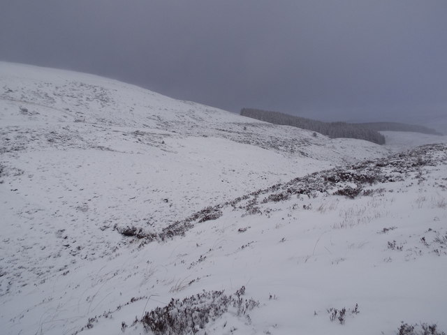
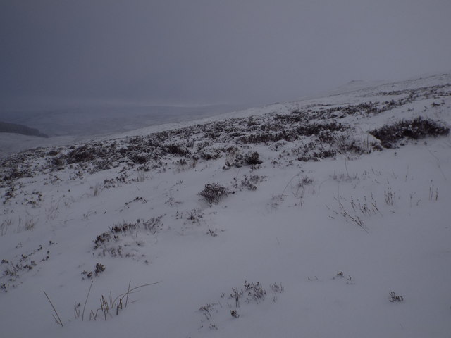
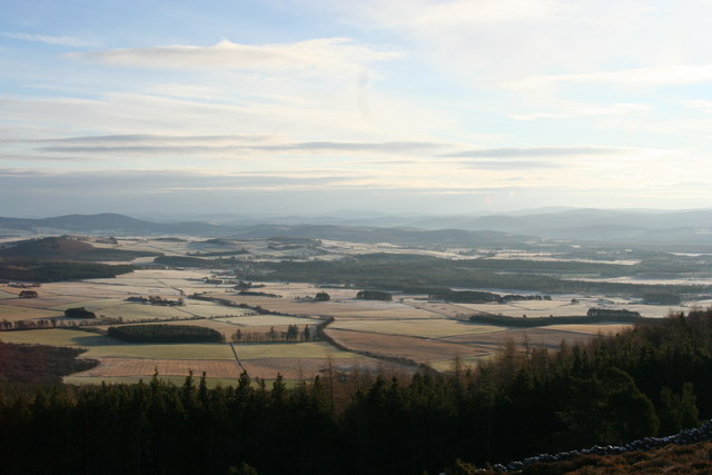
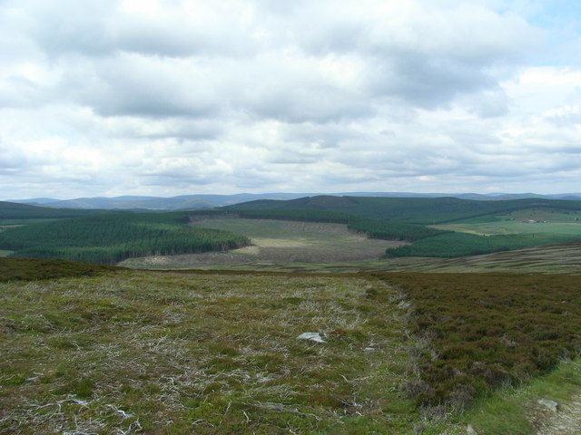
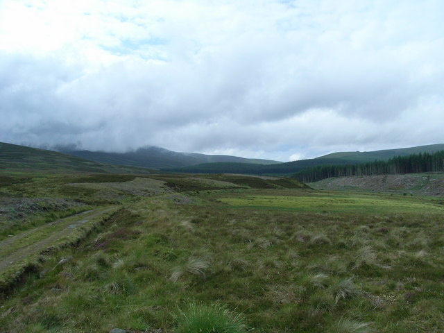
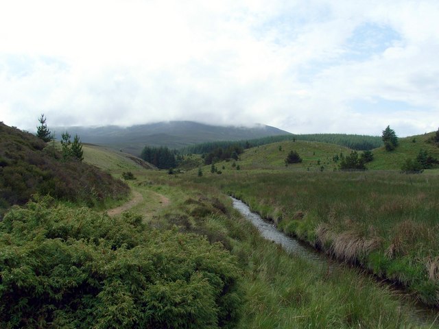
With an elevation of about 1,216 feet (370 meters), White Hillocks offers stunning panoramic views of the surrounding countryside. Its distinctive name originates from the white quartzite rock formations that can be found on its slopes. These striking rocks create a stark contrast against the green vegetation, particularly in the summer months when the hillside is covered in vibrant wildflowers.

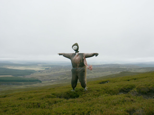
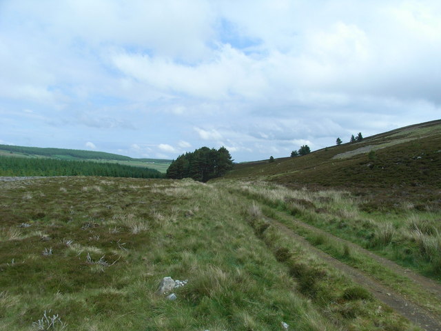
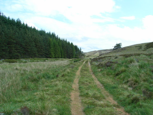
White Hillocks is a popular destination for outdoor enthusiasts and hikers who are drawn to its scenic beauty and tranquil surroundings. The hill features a well-defined path that leads to the summit, making it accessible for both experienced and novice walkers. From the top, visitors can enjoy breathtaking vistas of the rolling Aberdeenshire landscape, with distant views of the North Sea on clear days.

The area around White Hillocks is also rich in wildlife, and it is not uncommon to spot various bird species soaring above or small mammals scurrying through the undergrowth. The hill is surrounded by picturesque farmland and is often used for grazing sheep and cattle.

Overall, White Hillocks offers a rewarding and picturesque experience for those seeking a peaceful escape into the natural beauty of Aberdeenshire.

If you have any feedback on the listing, please let us know in the comments section below.

White Hillocks Images

Images are sourced within 2km of 57.141243/-3.0137299 or Grid Reference NJ3806. Thanks to Geograph Open Source API. All images are credited.

Looking east from the Braes of Fintock near Strathdon
Heathery slopes of White Hillock near Braes of Fintock
Boggy pool on Morven On a flat area at just over 600 metres above sea level.
Boggy pool on Morven
On a flat area at just over 600 metres above sea level.
Hillside below Mid Cairn, Morven A patch of mossy, stony hillside, and a view towards Crannach Hill and Culblean Hill, in shadow.
Hillside below Mid Cairn, Morven
A patch of mossy, stony hillside, and a view towards Crannach Hill and Culblean Hill, in shadow.
Mid Cairn, Morven A navigational aid on the way to Morven's summit.
Mid Cairn, Morven
A navigational aid on the way to Morven's summit.
Eastern slope of Morven looking towards Little Cairn
Path towards Mid Cairn of Morven
Eagle Sculpture An interesting eagle sculpture made from agricultural machinery, gearbox cogs, etc.
Eagle Sculpture
An interesting eagle sculpture made from agricultural machinery, gearbox cogs, etc.
Eagle sculpture Another view of this interesting metal sculpture seemingly launching itself from a rocky outcrop on Preas Whin.
Eagle sculpture
Another view of this interesting metal sculpture seemingly launching itself from a rocky outcrop on Preas Whin.
Mystery man From a distance in silhouette this figure looked like a gigantic Chinese character. On closer inspection it appears to be a "scarecrow", although why it should be here at 600 m on the North slope of Morven, who knows?
Mystery man
From a distance in silhouette this figure looked like a gigantic Chinese character. On closer inspection it appears to be a "scarecrow", although why it should be here at 600 m on the North slope of Morven, who knows?
Natural pool in the peat & heather
Rainbow over Mid Cairn on Morven In addition to the cairn on the summit of Morven, there are two substantial cairns on the east ridge of the hill.  This is Mid Cairn.  Little Cairn can be seen slightly to the right in the distance.  A shower had just passed and the sun had returned.
Rainbow over Mid Cairn on Morven
In addition to the cairn on the summit of Morven, there are two substantial cairns on the east ridge of the hill. This is Mid Cairn. Little Cairn can be seen slightly to the right in the distance. A shower had just passed and the sun had returned.
View of Cromar from side of Morven Winter morning view of Cromar valley, taken from Morven.
View of Cromar from side of Morven
Winter morning view of Cromar valley, taken from Morven.
Bad an Teachdaire Looking North West from Ardan Breac towards Bad an Teachdaire in the centre with Craig of Bunzeach further away to the right.
Bad an Teachdaire
Looking North West from Ardan Breac towards Bad an Teachdaire in the centre with Craig of Bunzeach further away to the right.
Deskry Water track North Looking North along the track beside Deskry Water.
Deskry Water track North
Looking North along the track beside Deskry Water.
Deskry Water track South Looking South down the track beside Deskry Water. Morven on the left horizon is hidden in cloud.
Deskry Water track South
Looking South down the track beside Deskry Water. Morven on the left horizon is hidden in cloud.
Deskry Water further South Looking South down Deskry Water towards Morven hidden in cloud.
Deskry Water further South
Looking South down Deskry Water towards Morven hidden in cloud.
Deskry Water track further South Looking South down the track beside Deskry water.
Deskry Water track further South
Looking South down the track beside Deskry water.
Show me another place!

White Hillocks is located at Grid Ref: NJ3806 (Lat: 57.141243, Lng: -3.0137299)

Unitary Authority: Aberdeenshire

Police Authority: North East

What 3 Words

///readjust.spoons.basher. Near Ballater, Aberdeenshire

Related Wikis

Morven, Aberdeenshire

Morven (Scottish Gaelic: A' Mhòr Bheinn) is a Corbett in Aberdeenshire, Scotland. It is 871 m (2858 ft) high. The poet, Lord Byron, who spent some of his...

Blue cairn circle

Blue cairn circle is a 21 metres (69 ft) diameter stone circle in Aberdeenshire, Scotland. In the center is a large stone cairn with several pits in it...

Migvie Castle

Migvie Castle was a 13th-century castle to the west of Migvie, Aberdeenshire, Scotland. Its remains were listed as a scheduled monument in 2007. ��2�...

Logie Coldstone

Logie Coldstone (Scottish Gaelic: Lògaidh) is a village in Aberdeenshire, Scotland. The village lies north of the River Dee, near Tarland in the Cromar...

Blelack

Blelack (, Scottish Gaelic: Blàth Bholg) is a place in Aberdeenshire, Scotland, the location of Blelack House, a Scottish mansion house with origins in...

Castle Newe

Castle Newe was a castellated mansion house, situated in Aberdeenshire, and designed in 1831 by Archibald Simpson. It was based on an existing Z-plan castle...

Colquhonnie Castle

Colquhonnie Castle is a ruined 16th-century tower house, about 10.5 miles (16.9 km) north of Ballater, Aberdeenshire, Scotland, around 1.0 mile (1.6 km...

Bellabeg

Bellabeg (an anglicisation of Scottish Gaelic: Am Baile Beag, 'the small farmtown') is a small roadside settlement in Strathdon, Aberdeenshire, Scotland...

Nearby Amenities

Located within 500m of 57.141243,-3.0137299
Hunting Stand
Hunting Stand: grouse_butt
Lat/Long: 57.1433953/-3.007054
The data included in this document is from www.openstreetmap.org. The data is made available under ODbL.

Have you been to White Hillocks?

Leave your review of White Hillocks below (or comments, questions and feedback).