Brae Head

Hill, Mountain in Roxburghshire

Scotland

Brae Head

Old Boundary Marker near Calfshaw Head Estate Boundary Marker beside a wooden fence on the edge of Craik Forest, 545 metres northeast of Calfshaw Head. Inscribed I on the north face. On the former boundary of Teviothead and Roberton parishes in Roxburghshire, but the inscription perhaps indicates this is an estate marker.

Milestone Society National ID: RX_TEVROB01em
Old Boundary Marker near Calfshaw Head Credit: J Glew

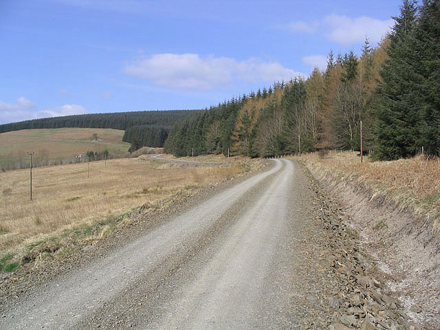
Brae Head is a prominent hill located in Roxburghshire, a historic county in the Scottish Borders region of Scotland. Standing at an elevation of approximately 330 meters (1,082 feet), Brae Head forms part of the picturesque Cheviot Hills, which straddle the border between Scotland and England.

The hill is characterized by its gentle slopes and rolling grasslands, offering stunning panoramic views of the surrounding countryside. Its location within the Northumberland National Park ensures that Brae Head is teeming with diverse flora and fauna, making it a popular destination for nature enthusiasts and hikers alike.

Due to its accessible location, Brae Head attracts visitors from near and far. The hill is conveniently situated near the village of Town Yetholm, which provides amenities such as parking, accommodation, and dining options for those wishing to explore the area. Additionally, the nearby Pennine Way, a long-distance footpath, passes close to Brae Head, providing an opportunity for more extensive hikes and exploration of the wider Cheviot Hills.

Brae Head's rich history also adds to its allure. The hill is believed to have been inhabited for thousands of years, with evidence of prehistoric settlements and ancient burial grounds found in the vicinity. Today, visitors can discover remnants of these past civilizations while enjoying the tranquility and natural beauty that Brae Head has to offer.

If you have any feedback on the listing, please let us know in the comments section below.
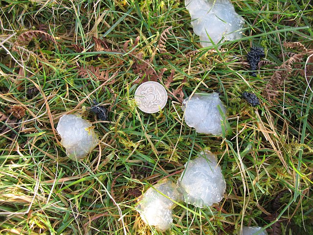
Brae Head Images

Images are sourced within 2km of 55.35455/-2.9796257 or Grid Reference NT3707. Thanks to Geograph Open Source API. All images are credited.

Old Boundary Marker near Calfshaw Head Estate Boundary Marker beside a wooden fence on the edge of Craik Forest, 545 metres northeast of Calfshaw Head. Inscribed I on the north face. On the former boundary of Teviothead and Roberton parishes in Roxburghshire, but the inscription perhaps indicates this is an estate marker.

Milestone Society National ID: RX_TEVROB01em
Old Boundary Marker near Calfshaw Head
Estate Boundary Marker beside a wooden fence on the edge of Craik Forest, 545 metres northeast of Calfshaw Head. Inscribed I on the north face. On the former boundary of Teviothead and Roberton parishes in Roxburghshire, but the inscription perhaps indicates this is an estate marker. Milestone Society National ID: RX_TEVROB01em
Farm Road The road from Hislop Farm to Falnash Farm and the A7. Also used to gain access to Craik Forest. A new forestry road has been formed on the left.
Farm Road
The road from Hislop Farm to Falnash Farm and the A7. Also used to gain access to Craik Forest. A new forestry road has been formed on the left.
Hazelhope Hill A rough grazing hillside.
Hazelhope Hill
A rough grazing hillside.
Forestry The edge of Craik Forest south-southeast of Merry Naze.
Forestry
The edge of Craik Forest south-southeast of Merry Naze.
Forestry Road Provides access to Craik Forest and the building at Lairhope.
Forestry Road
Provides access to Craik Forest and the building at Lairhope.
Crib Sike To the north of Lairhope.
Crib Sike
To the north of Lairhope.
Hill farmland Viewed from the road at Falnash Farm towards Birkybrae Head.
Hill farmland
Viewed from the road at Falnash Farm towards Birkybrae Head.
Forestry Road To the east of Lairhope with forestry to the right on Lairhope Braes.
Forestry Road
To the east of Lairhope with forestry to the right on Lairhope Braes.
Forestry on Merry Naze Viewed from Tanlaw Naze.
Forestry on Merry Naze
Viewed from Tanlaw Naze.
Rough grazing countryside Looking along to Lodge Hill from Philhope Fell over a large area of rough grazing for hill cattle and sheep.
Rough grazing countryside
Looking along to Lodge Hill from Philhope Fell over a large area of rough grazing for hill cattle and sheep.
Calfshaw Head A hill with approximately 50% rough grazing and 50% forestry within the square.
Calfshaw Head
A hill with approximately 50% rough grazing and 50% forestry within the square.
A grass track to the northeast of Calfshaw Head
The trig point on Calfshaw Head Between a fence and a forest edge at 403m with a flush bracket number S7687.
The trig point on Calfshaw Head
Between a fence and a forest edge at 403m with a flush bracket number S7687.
Rough grazing on Calfshaw Head Lodge Hill is in the centre of the photo.
Rough grazing on Calfshaw Head
Lodge Hill is in the centre of the photo.
Teviotdale hill countryside To the east-northeast of Calfshaw Head near the source of the Dryden Burn. Viewed in early October with the bracken turning brown.
Teviotdale hill countryside
To the east-northeast of Calfshaw Head near the source of the Dryden Burn. Viewed in early October with the bracken turning brown.
Dyke junction, Eilrig The eastern edge of Craik Forest. The cornrows are a second generation of Sitka spruce. The other two sectors are still rough grazing, with the right hand sector running through the forest up to the house at Eilrig.
Dyke junction, Eilrig
The eastern edge of Craik Forest. The cornrows are a second generation of Sitka spruce. The other two sectors are still rough grazing, with the right hand sector running through the forest up to the house at Eilrig.
Pwdre ser - a slime mould? There had been a lot of correspondence with the Radio Scotland "Out of Doors" programme about jelly found on the hill.  Here is a typical sample. Folklore has it that it is of meteoric origin, hence the Welsh name Pwdre Ser or star rot. It could be one of many species of slime mould, an unusual group of organisms, which at certain times in their life cycle form giant cells.  Normally microscopic, amoeba like cells join up to form giant multi-nucleated cells. Each glob of jelly here is a single cell.
Traditionally classified as fungi, but now shifted out of the way into their own kingdom, these blobs and their microscopic originators move.

However much correspondence suggests that this is the unpalatable jelly from frog ovaries - the stuff that prevents frog spawn from being eaten. Predators eat the rest of the frog, but not the jelly. Fungal DNA has been found in the jelly, but this is probably decomposition fungi growing on the jelly.
Pwdre ser - a slime mould?
There had been a lot of correspondence with the Radio Scotland "Out of Doors" programme about jelly found on the hill. Here is a typical sample. Folklore has it that it is of meteoric origin, hence the Welsh name Pwdre Ser or star rot. It could be one of many species of slime mould, an unusual group of organisms, which at certain times in their life cycle form giant cells. Normally microscopic, amoeba like cells join up to form giant multi-nucleated cells. Each glob of jelly here is a single cell. Traditionally classified as fungi, but now shifted out of the way into their own kingdom, these blobs and their microscopic originators move. However much correspondence suggests that this is the unpalatable jelly from frog ovaries - the stuff that prevents frog spawn from being eaten. Predators eat the rest of the frog, but not the jelly. Fungal DNA has been found in the jelly, but this is probably decomposition fungi growing on the jelly.
Drainage ditch, Meadshaw Rig One of several drains crossing the slope in a newly replanted forestry block. This part of Craik Forest is managed by Kronospan, who also have a large holding on the Eskdalemuir side of the forest.

Looking out from the forest with many kilometres of trees behind me towards Philhope Fell. The small rectangular plantation on the saddle has been left off the 1:50,000 map.
Drainage ditch, Meadshaw Rig
One of several drains crossing the slope in a newly replanted forestry block. This part of Craik Forest is managed by Kronospan, who also have a large holding on the Eskdalemuir side of the forest. Looking out from the forest with many kilometres of trees behind me towards Philhope Fell. The small rectangular plantation on the saddle has been left off the 1:50,000 map.
Show me another place!

Brae Head is located at Grid Ref: NT3707 (Lat: 55.35455, Lng: -2.9796257)

Unitary Authority: The Scottish Borders

Police Authority: The Lothians and Scottish Borders

What 3 Words

///track.waddled.spectacle. Near Teviothead, Scottish Borders

Nearby Locations

Brae Head Mid Hill

Related Wikis

Falnash

Falnash (Scots: Fawenesh) is a village in the Scottish Borders of Scotland. It is near Teviothead, in the former Roxburghshire, and in the parish of Teviothead...

Teviothead

Teviothead (Scottish Gaelic: Ceann Tìbhiot) is a small village and civil parish in Teviotdale in the Scottish Borders, known locally as Teviotheid. It...

Caerlanrig

Caerlanrig - also spelled 'Carlenrig' - (Gaelic: Cathair Lannraig) is a hamlet in the parish of Cavers, Borders, Scotland, lying on the River Teviot, 6...

River Teviot

The River Teviot (; Scottish Gaelic: Abhainn Tìbhiot), or Teviot Water, is a river of the Scottish Borders area of Scotland, and is the largest tributary...

Craik, Scottish Borders

Craik is a hamlet in Craik Forest, by the Airhouse Burn in the Scottish Borders area of Scotland, close to Roberton, Scottish Borders (grid reference NT348084...

Craik Forest

Craik Forest is a forest near Hawick in the Scottish Borders area of Scotland, and managed by the Forestry Commission. It is adjoined to the south-west...

Burnfoot, Roberton

Burnfoot (Scottish Gaelic: Bun na h-Aibhne) is a hamlet in the Scottish Borders area of Scotland, close to Roberton, by the Borthwick Water. The nearest...

Broadhaugh

Broadhaugh is a hamlet in the Scottish Borders area of Scotland, in the parish of Teviothead, in former Roxburghshire. == See also == List of places in...

Nearby Amenities

Located within 500m of 55.35455,-2.9796257
Brae Head
Ele: 369
Natural: peak
Source: NLS-OS-1st_Series
Lat/Long: 55.351354/-2.9843738
The data included in this document is from www.openstreetmap.org. The data is made available under ODbL.

Have you been to Brae Head?

Leave your review of Brae Head below (or comments, questions and feedback).