Puckington Hill

Hill, Mountain in Somerset South Somerset

England

Puckington Hill

Stocklinch Ottersey church Remote from its village
Stocklinch Ottersey church Credit: Martin Bodman

Puckington Hill is a prominent natural feature located in the county of Somerset, England. Rising to an elevation of 129 meters (423 feet), it is classified as a hill rather than a mountain. Situated near the village of Puckington, the hill offers commanding views of the surrounding countryside, making it a popular destination for hikers and nature enthusiasts.

The hill is characterized by its gentle slopes and rolling terrain, covered in lush green vegetation. It is primarily composed of sedimentary rocks, including limestone and sandstone, which contribute to its distinctive geological formation. Puckington Hill is also home to a diverse array of plant and animal species, including various wildflowers and birdlife, adding to its ecological significance.

At the summit of Puckington Hill, visitors can enjoy panoramic vistas that stretch across the Somerset Levels, a renowned area of wetland and wildlife habitat. On clear days, the hill offers breathtaking views of the distant Mendip Hills to the west and the Blackdown Hills to the south.

For centuries, Puckington Hill has held cultural and historical importance. It is believed to have been an ancient settlement, evidenced by the presence of burial mounds and earthworks. The hill has also been associated with folklore and legends, with stories of mythical creatures and hidden treasures passed down through generations.

Today, Puckington Hill remains a cherished natural landmark, providing both locals and tourists with an opportunity to immerse themselves in the beauty of the Somerset countryside while exploring its rich history and diverse ecosystem.

If you have any feedback on the listing, please let us know in the comments section below.

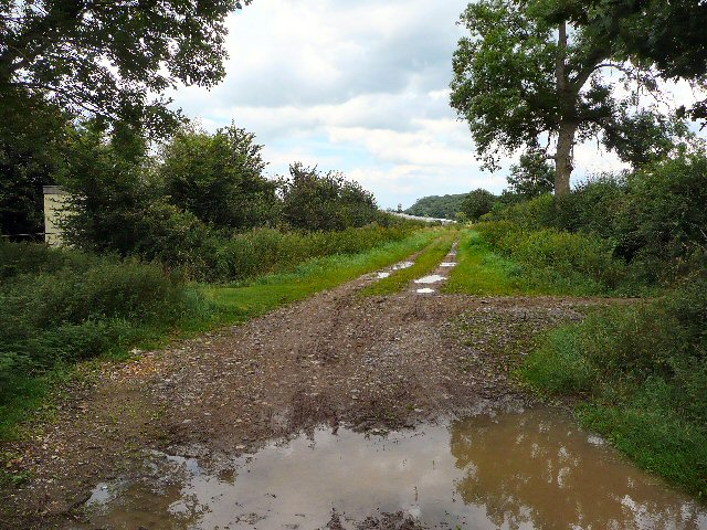
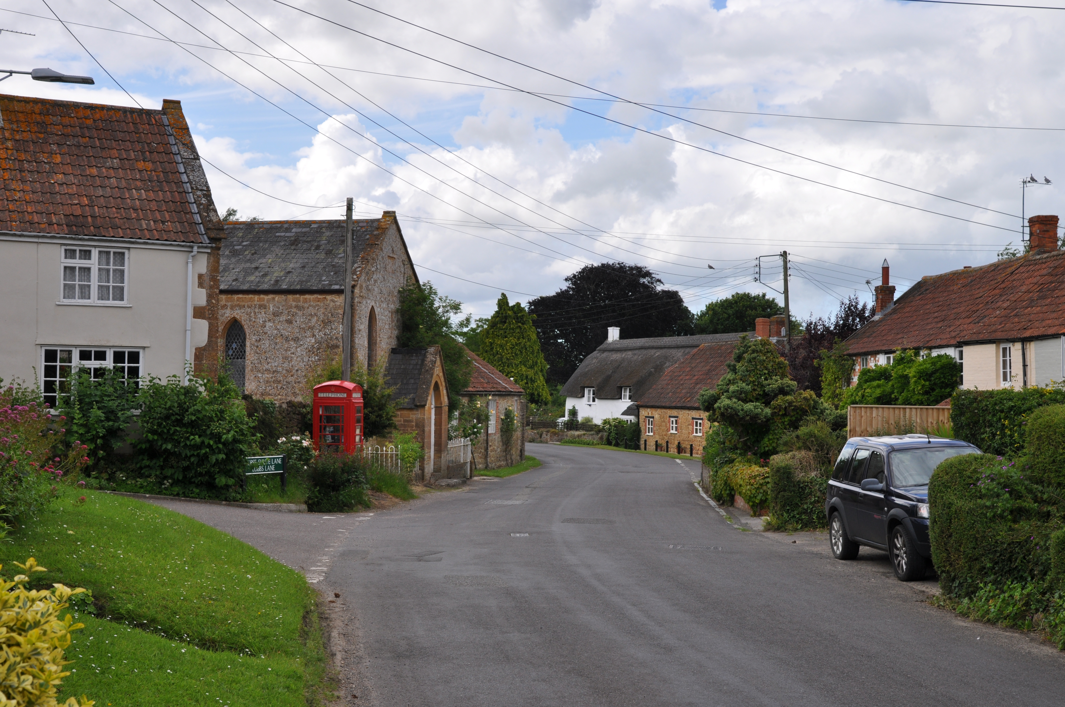
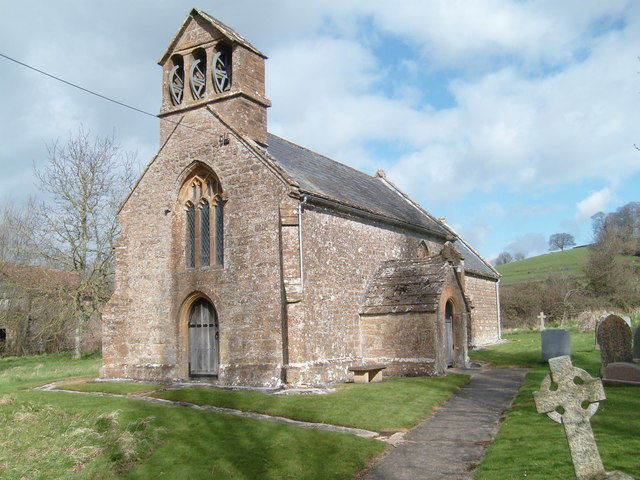
Puckington Hill Images

Images are sourced within 2km of 50.96096/-2.8903242 or Grid Reference ST3718. Thanks to Geograph Open Source API. All images are credited.

Stocklinch Ottersey church Remote from its village
Stocklinch Ottersey church
Remote from its village
Barrington: church St Mary’s church stands above much of the village and dates from the 13th century. With an octagonal crossing tower and transepts the church was nevertheless a subsidiary foundation to South Petherton
Barrington: church
St Mary’s church stands above much of the village and dates from the 13th century. With an octagonal crossing tower and transepts the church was nevertheless a subsidiary foundation to South Petherton
Strode House, Barrington Court from the Garden The garden at Barrington Court was inspired by Gertrude Jekyll. See <span class="nowrap"><a title="http://www.nationaltrust.org.uk/main/w-vh/w-visits/w-findaplace/w-barringtoncourt/w-barrington_court-a_brief_history.htm" rel="nofollow ugc noopener" href="http://www.nationaltrust.org.uk/main/w-vh/w-visits/w-findaplace/w-barringtoncourt/w-barrington_court-a_brief_history.htm">Link</a><img style="margin-left:2px;" alt="External link" title="External link - shift click to open in new window" src="https://s1.geograph.org.uk/img/external.png" width="10" height="10"/></span>
Strode House, Barrington Court from the Garden
The garden at Barrington Court was inspired by Gertrude Jekyll. See LinkExternal link
Puckington: Gummer’s Lane A track and public footpath to Stocklinch. Possibly an old way as it defines the parish boundary with Stocklinch. Looking south east
Puckington: Gummer’s Lane
A track and public footpath to Stocklinch. Possibly an old way as it defines the parish boundary with Stocklinch. Looking south east
Ilton: drainage channel On the river Isle flood plain near Ilford Bridge. In north Somerset this channel would be called a rhine. Looking south east
Ilton: drainage channel
On the river Isle flood plain near Ilford Bridge. In north Somerset this channel would be called a rhine. Looking south east
St Andrews Church Puckington A lovely church set well back from the road, easily missed.
St Andrews Church Puckington
A lovely church set well back from the road, easily missed.
St Andrews Church Puckington
Church Notice Board Puckington
Manor Farmhouse Puckington Manor Farmhouse Puckington adjacent to the church, was possibly the vicarage at one time
Manor Farmhouse Puckington
Manor Farmhouse Puckington adjacent to the church, was possibly the vicarage at one time
Refurbished bridge over the Westport canal at Westport From the sign, it has probably been 'improved' to take vastly more weight than was dreampt of when the canal was built.
Refurbished bridge over the Westport canal at Westport
From the sign, it has probably been 'improved' to take vastly more weight than was dreampt of when the canal was built.
Derelict Westport canal at Westport
Poppy head in Barrington Court  Garden
Poppy head in Barrington Court Garden
South Bradon Farm
South Bradon Farm
Lane past South Bradon Farm
Farm track near North Bradon.
Field near Puckington Level land north of Puckington Hill. Reeds in the hedgerow indicate the dampness, although the ditch across the path was dry. The line of low trees marks Clay Lane, an old track. Taken from (the difficult to use) footpath L24/1.
Field near Puckington
Level land north of Puckington Hill. Reeds in the hedgerow indicate the dampness, although the ditch across the path was dry. The line of low trees marks Clay Lane, an old track. Taken from (the difficult to use) footpath L24/1.
The Hamlet of Atherstone A hamlet of 8 or 10 houses and a couple of farms.
The Hamlet of Atherstone
A hamlet of 8 or 10 houses and a couple of farms.
Ilford Bridges A series of three bridges in close succession. The western most
in the foreground has been clipped by a vehicle as you can see.
The middle bridge is between the white posts just visible on the
left of the road, a hundred yards further on. The third is a further
fifty yards on where the road meanders left then right, a warning
road sign is just visible.
Ilford Bridges
A series of three bridges in close succession. The western most in the foreground has been clipped by a vehicle as you can see. The middle bridge is between the white posts just visible on the left of the road, a hundred yards further on. The third is a further fifty yards on where the road meanders left then right, a warning road sign is just visible.
Show me another place!

Puckington Hill is located at Grid Ref: ST3718 (Lat: 50.96096, Lng: -2.8903242)

Administrative County: Somerset

District: South Somerset

Police Authority: Avon and Somerset

What 3 Words

///digit.nasal.cushy. Near Ilminster, Somerset

Related Wikis

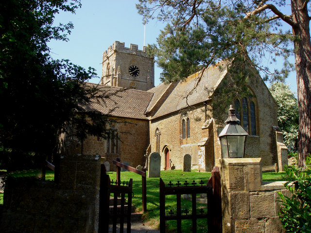
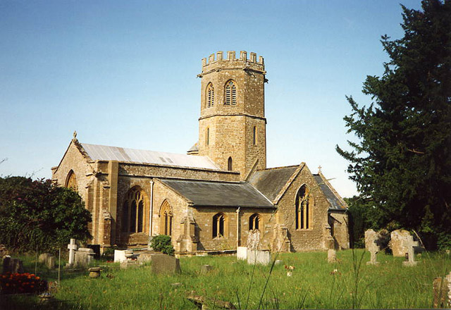
Church of St Andrew, Puckington

The Anglican Church of St Andrew in Puckington, Somerset, England, was built in the 13th century. It is a Grade II* listed building. == History == The...

Puckington

Puckington is a village and civil parish, situated 10 miles (16 km) south-east of Taunton and 10 miles (16 km) west of Yeovil in the South Somerset district...

Barrington, Somerset

Barrington is a village and civil parish, situated 10 miles (16.1 km) south east of Taunton and 10 miles (16.1 km) west of Yeovil in Somerset, England...

Stocklinch

Stocklinch is a village and civil parish 3.5 miles (6 km) north-east of Ilminster in the South Somerset district of Somerset, England. == History == The...

Church of St Mary the Virgin, Barrington

The Church of St Mary the Virgin in Barrington, Somerset, England dates from the 13th century and has been designated as a Grade I listed building.St Mary...

Church of St Mary Magdalene, Stocklinch

The Church of St Mary Magdalen in Stocklinch, Somerset, England, dates from the 13th century. It is recorded in the National Heritage List for England...

Barrington Court

Barrington Court is a Tudor manor house begun around 1538 and completed in the late 1550s, with a vernacular stable court (1675), situated in Barrington...

Ilton

Ilton is a village and civil parish in Somerset, England, situated 8 miles (12.9 km) south-east of Taunton, and 2 miles (3.2 km) north of Ilminster in...

Nearby Amenities

Located within 500m of 50.96096,-2.8903242
Puckington
Place: hamlet
Wikidata: Q2270268
Wikipedia: en:Puckington
Lat/Long: 50.9592542/-2.8885263
Post Box
Operator: Royal Mail
Operator Wikidata: Q638098
Post Box Type: lamp
Ref: TA19 406
Royal Cypher: EIIR
Royal Cypher Wikidata: Q33102113
Lat/Long: 50.9600784/-2.8875779
Power: pole
Source: bing
Lat/Long: 50.9572044/-2.888892
Power: pole
Source: bing
Lat/Long: 50.9565328/-2.8894754
Power: pole
Source: bing
Transformer: distribution
Lat/Long: 50.9637947/-2.8848539
Power: pole
Source: bing
Lat/Long: 50.9627524/-2.8847399
Power: pole
Source: bing
Transformer: distribution
Lat/Long: 50.9622803/-2.8836831
Power: pole
Source: bing
Lat/Long: 50.9599819/-2.8843081
Power: pole
Source: bing
Transformer: distribution
Lat/Long: 50.9575609/-2.8895357
Power: pole
Source: bing
Lat/Long: 50.9578092/-2.8883891
Power: pole
Source: bing
Lat/Long: 50.9586235/-2.8871432
Power: pole
Source: bing
Lat/Long: 50.9598197/-2.8855808
Power: pole
Source: bing
Lat/Long: 50.9596617/-2.8868562
Power: pole
Source: bing
Transformer: distribution
Lat/Long: 50.9595764/-2.8875697
The data included in this document is from www.openstreetmap.org. The data is made available under ODbL.

Have you been to Puckington Hill?

Leave your review of Puckington Hill below (or comments, questions and feedback).