Byrelee Hill
Hill, Mountain in Roxburghshire
Scotland
Byrelee Hill

Byrelee Hill is a prominent hill located in Roxburghshire, a historic county in the Scottish Borders region of Scotland. Standing at an elevation of approximately 399 meters (1,309 feet), it is classified as a hill rather than a mountain.
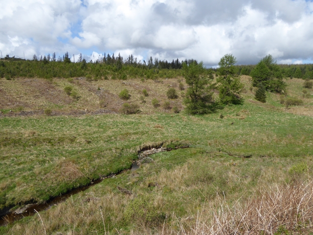
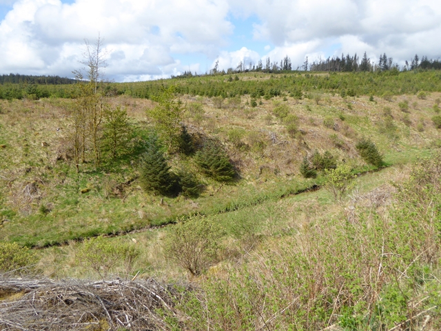
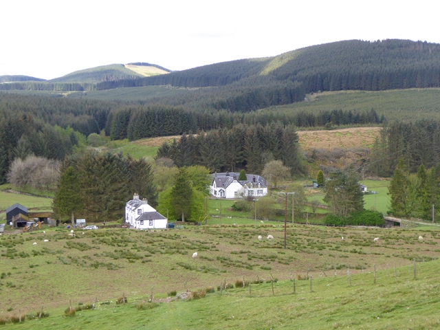
Situated about 6 kilometers (3.7 miles) south of the town of Jedburgh, Byrelee Hill offers breathtaking panoramic views of the surrounding countryside. Its location makes it a popular spot for hikers, walkers, and nature enthusiasts. The hill is also a part of the stunning Cheviot Hills, which straddle the border between Scotland and England.
The ascent to Byrelee Hill is relatively easy, with well-defined paths leading to the summit. On a clear day, visitors can enjoy sweeping vistas of rolling green pastures, picturesque valleys, and distant peaks. The area is known for its rich flora and fauna, with heather, grasses, and wildflowers dotting the landscape.
At the top of Byrelee Hill, there is a trig point, a concrete pillar used in surveying, which serves as a marker and provides a great spot to rest and take in the stunning scenery. The hill's location away from major cities ensures a peaceful and tranquil atmosphere, ideal for those seeking a break from the hustle and bustle of everyday life.
In conclusion, Byrelee Hill in Roxburghshire is a beautiful hill offering stunning views of the Scottish Borders region. Its accessibility and natural beauty make it a popular destination for outdoor enthusiasts and nature lovers alike.
If you have any feedback on the listing, please let us know in the comments section below.
Byrelee Hill Images
Images are sourced within 2km of 55.411413/-2.9886932 or Grid Reference NT3713. Thanks to Geograph Open Source API. All images are credited.


Byrelee Hill is located at Grid Ref: NT3713 (Lat: 55.411413, Lng: -2.9886932)
Unitary Authority: The Scottish Borders
Police Authority: The Lothians and Scottish Borders
What 3 Words
///annotated.deprive.slightly. Near Teviothead, Scottish Borders
Nearby Locations
Related Wikis

Alemoor Loch
Alemoor Loch, also known as Alemoor Reservoir, is a small reservoir in the Scottish Borders area of Scotland. It is situated on the Ale Water, 10 kilometres...

Burnfoot, Roberton
Burnfoot (Scottish Gaelic: Bun na h-Aibhne) is a hamlet in the Scottish Borders area of Scotland, close to Roberton, by the Borthwick Water. The nearest...

Craik Forest
Craik Forest is a forest near Hawick in the Scottish Borders area of Scotland, and managed by the Forestry Commission. It is adjoined to the south-west...
Buccleuch, Scottish Borders
East and West Buccleuch ( bə-KLOO) are two homesteads in the Scottish Borders, in the Ettrick parish of historic Selkirkshire. They are located off the...

Roberton, Scottish Borders
Roberton is a small village in the Scottish Borders area of Scotland, on the B711 and near to the A7, 5 miles (8 kilometres) from Hawick, 22 mi (35 km...

Craik, Scottish Borders
Craik is a hamlet in Craik Forest, by the Airhouse Burn in the Scottish Borders area of Scotland, close to Roberton, Scottish Borders (grid reference NT348084...
Falnash
Falnash (Scots: Fawenesh) is a village in the Scottish Borders of Scotland. It is near Teviothead, in the former Roxburghshire, and in the parish of Teviothead...
Harden Castle
Harden Castle is a 16th century tower house, about 3.5 miles (5.6 km) west of Hawick, Scottish Borders. It is alternatively known as Harden House or Harden...
Have you been to Byrelee Hill?
Leave your review of Byrelee Hill below (or comments, questions and feedback).