Blackcleuch Rig
Hill, Mountain in Roxburghshire
Scotland
Blackcleuch Rig

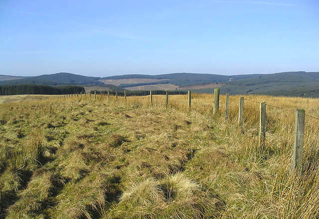
Blackcleuch Rig is a prominent hill located in Roxburghshire, Scotland. With an elevation of about 379 meters (1,243 feet), it is considered a notable landmark in the region. The hill is situated within the Southern Uplands, offering stunning panoramic views of the surrounding countryside.
The terrain of Blackcleuch Rig is characterized by its rolling hills and heather-covered slopes. The hill is composed of sedimentary rocks, primarily sandstone and shale, which contribute to its distinctive appearance. The vegetation on the hill is mainly comprised of heather, grasses, and scattered shrubs, providing habitat for various wildlife species.
Hikers and outdoor enthusiasts are drawn to Blackcleuch Rig for its picturesque trails and challenging climbs. Several paths traverse the hill, offering different levels of difficulty for walkers of all abilities. Along the way, visitors may encounter a variety of bird species, such as red grouse and skylarks, as well as occasional sightings of mammals like hares and deer.
The hill is also steeped in history, with ancient settlements and archaeological sites scattered throughout the area. Ruins of old farmsteads and fortified structures can be found, reflecting the hill's significance in previous centuries. These remnants serve as a reminder of the human presence and activities that once occurred on Blackcleuch Rig.
Overall, Blackcleuch Rig is a remarkable destination for those seeking natural beauty, outdoor recreation, and a glimpse into the rich history of Roxburghshire. Whether it be hiking, birdwatching, or exploring ancient ruins, visitors to this hill are sure to be captivated by its charm and allure.
If you have any feedback on the listing, please let us know in the comments section below.
Blackcleuch Rig Images
Images are sourced within 2km of 55.322265/-2.9894196 or Grid Reference NT3703. Thanks to Geograph Open Source API. All images are credited.


Blackcleuch Rig is located at Grid Ref: NT3703 (Lat: 55.322265, Lng: -2.9894196)
Unitary Authority: The Scottish Borders
Police Authority: The Lothians and Scottish Borders
What 3 Words
///couches.blink.fend. Near Teviothead, Scottish Borders
Nearby Locations
Related Wikis

River Teviot
The River Teviot (; Scottish Gaelic: Abhainn Tìbhiot), or Teviot Water, is a river of the Scottish Borders area of Scotland, and is the largest tributary...

Caerlanrig
Caerlanrig - also spelled 'Carlenrig' - (Gaelic: Cathair Lannraig) is a hamlet in the parish of Cavers, Borders, Scotland, lying on the River Teviot, 6...
Falnash
Falnash (Scots: Fawenesh) is a village in the Scottish Borders of Scotland. It is near Teviothead, in the former Roxburghshire, and in the parish of Teviothead...

Teviothead
Teviothead (Scottish Gaelic: Ceann Tìbhiot) is a small village and civil parish in Teviotdale in the Scottish Borders, known locally as Teviotheid. It...

Craik, Scottish Borders
Craik is a hamlet in Craik Forest, by the Airhouse Burn in the Scottish Borders area of Scotland, close to Roberton, Scottish Borders (grid reference NT348084...
Craik Forest
Craik Forest is a forest near Hawick in the Scottish Borders area of Scotland, and managed by the Forestry Commission. It is adjoined to the south-west...

Cauldcleuch Head
Cauldcleuch Head is a hill in an unnamed range of Roxburghshire hills north of Langholm, part of the Southern Uplands of Scotland. The highest hill in...

Unthank, Dumfries and Galloway
Unthank is a village in Dumfries and Galloway, Scotland. == References == The geographic coordinates are from the Ordnance Survey.
Nearby Amenities
Located within 500m of 55.322265,-2.9894196Have you been to Blackcleuch Rig?
Leave your review of Blackcleuch Rig below (or comments, questions and feedback).