Girnwood Hill

Hill, Mountain in Roxburghshire

Scotland

Girnwood Hill

Deer seat, Outerside Plantation Stalking seat with a ride beyond.
Deer seat, Outerside Plantation Credit: Richard Webb

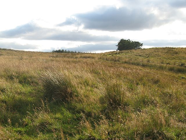
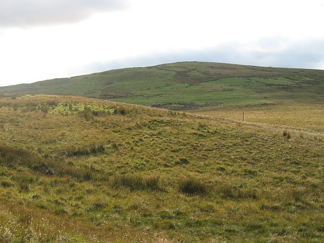
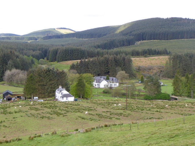
Girnwood Hill is a prominent landmark located in Roxburghshire, Scotland. Rising to an elevation of approximately 445 meters (1,460 feet), it is classified as a hill rather than a mountain. Situated near the village of Lilliesleaf, Girnwood Hill is a popular destination for hikers and nature enthusiasts.

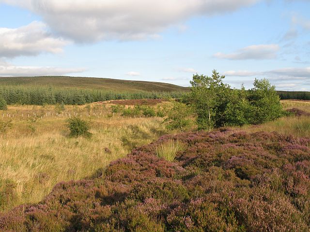
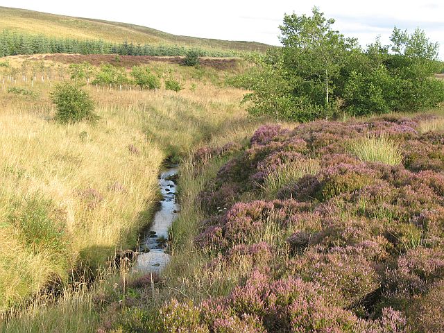
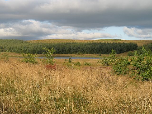
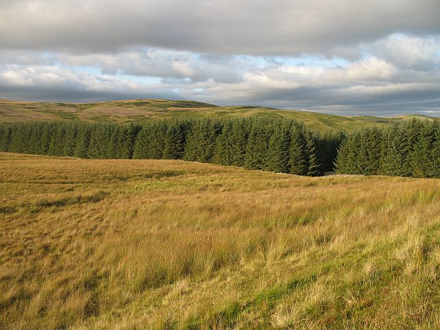
The hill offers breathtaking panoramic views of the surrounding countryside, including the picturesque Scottish Borders region. Its location provides an ideal vantage point to observe the rolling hills, expansive farmland, and winding rivers that characterize the area. On clear days, visitors can even catch a glimpse of the distant Cheviot Hills and Northumberland National Park.

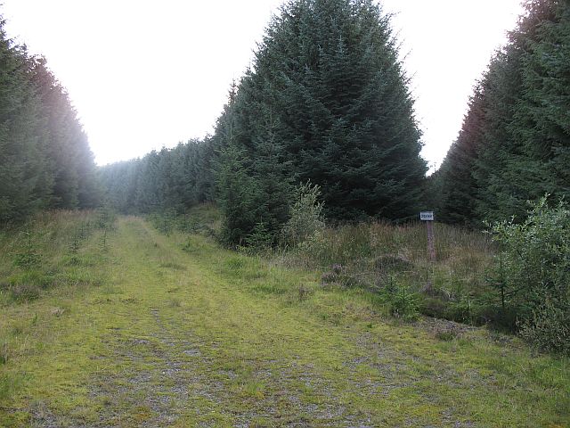
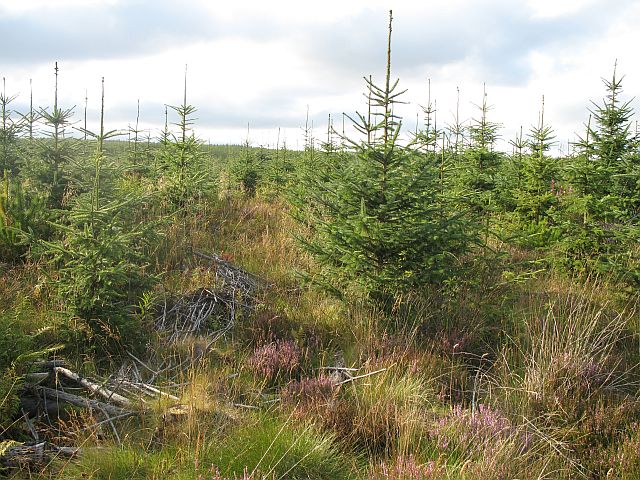
Girnwood Hill is predominantly covered in heather and grass, creating a colorful landscape during the summer months. The hill also hosts a diverse array of wildlife, including red grouse, hares, and various bird species. It is not uncommon to spot buzzards soaring overhead or hear the melodic song of skylarks as they ascend into the sky.

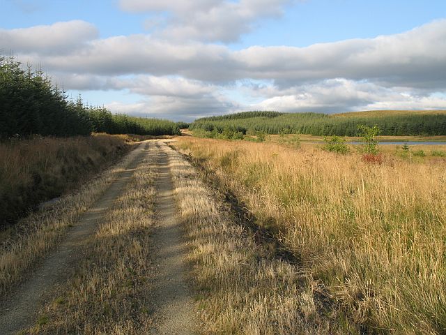
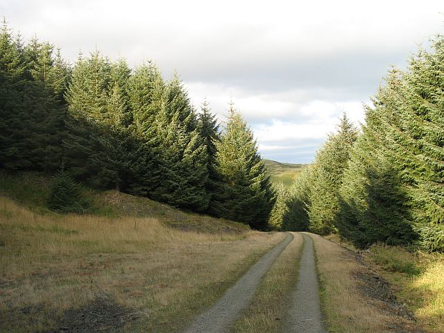
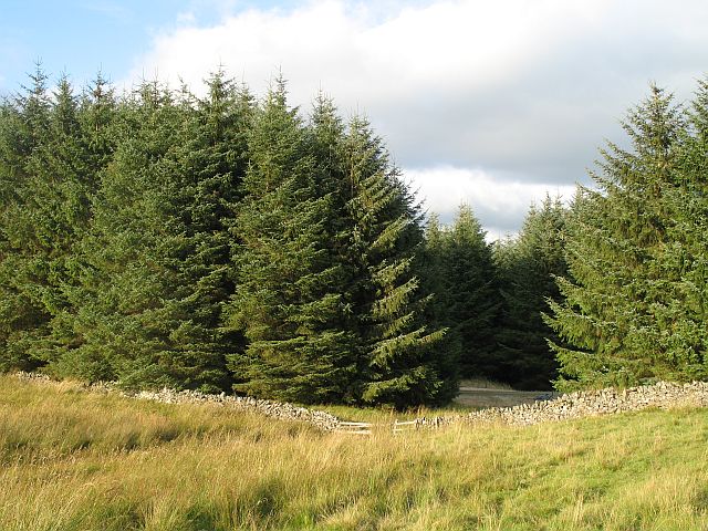
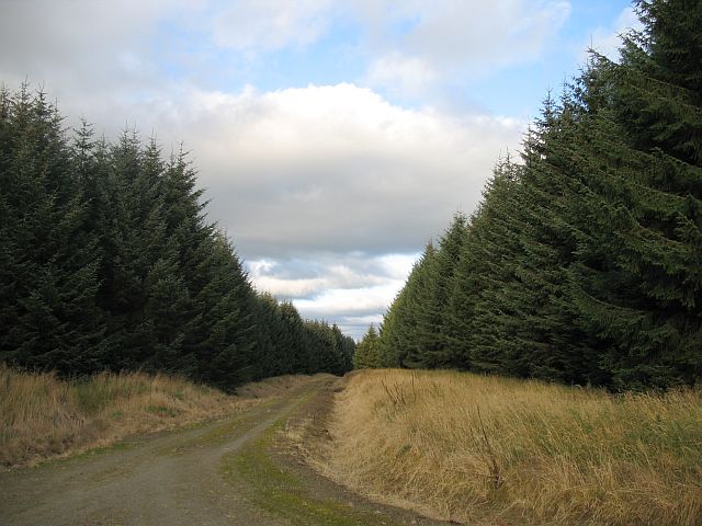
The hill is easily accessible by foot and offers several walking routes of varying difficulty. One popular trail starts from the village of Lilliesleaf and takes approximately two hours to complete. Along the way, walkers can enjoy the tranquil atmosphere, abundant flora, and occasional sightings of wildlife.

Overall, Girnwood Hill provides a stunning natural setting for outdoor enthusiasts and offers a peaceful escape from the hustle and bustle of everyday life.

If you have any feedback on the listing, please let us know in the comments section below.

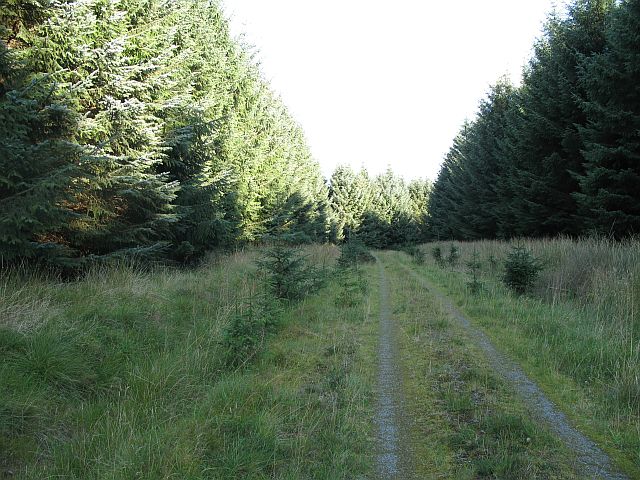
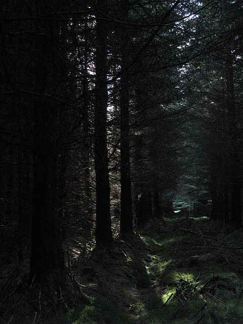
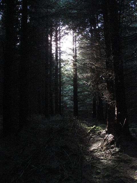
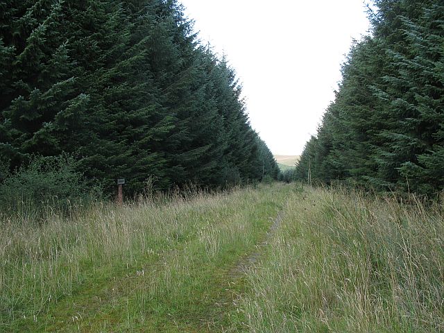
Girnwood Hill Images

Images are sourced within 2km of 55.398388/-2.998063 or Grid Reference NT3612. Thanks to Geograph Open Source API. All images are credited.

Deer seat, Outerside Plantation Stalking seat with a ride beyond.
Deer seat, Outerside Plantation
Stalking seat with a ride beyond.
Forest road, Outerside Rig Little used road in continuous sitka woods.
Forest road, Outerside Rig
Little used road in continuous sitka woods.
Main Road, Maryswood A privately managed part of Craik Forest. The road is occasionally used but grassy. No variety in tree age, suggests that this was planted later than the Forestry Commission holdings nearby.
The roads are signed and the names appear on the 1:25 000 maps.
Main Road, Maryswood
A privately managed part of Craik Forest. The road is occasionally used but grassy. No variety in tree age, suggests that this was planted later than the Forestry Commission holdings nearby. The roads are signed and the names appear on the 1:25 000 maps.
Thinning, Sitka plantation Inside the Sitka plantations of Maryswood. The square is entirely forest, and quite hard to access from the Main Road. Fortunately the trees are currently quite old, and it is easy to walk through the forest, a rarity with sitka spruce. I spent a lot of time seeking an area light enough and I hope the gloom of the forest comes across.
The forest has been thinned and there are a series of these lanes running parallel through the trees.
Thinning, Sitka plantation
Inside the Sitka plantations of Maryswood. The square is entirely forest, and quite hard to access from the Main Road. Fortunately the trees are currently quite old, and it is easy to walk through the forest, a rarity with sitka spruce. I spent a lot of time seeking an area light enough and I hope the gloom of the forest comes across. The forest has been thinned and there are a series of these lanes running parallel through the trees.
Maryswood Inside the sitka, about 200m away from the road. Little light reaches the forest floor.
Maryswood
Inside the sitka, about 200m away from the road. Little light reaches the forest floor.
Girnway. Craik Forest Named road on Cowbush Hill, but little sign of traffic. Do the trees all have addresses?
Girnway. Craik Forest
Named road on Cowbush Hill, but little sign of traffic. Do the trees all have addresses?
Cowbush Hill Covered in commercial sitka plantations. The road is signed as Craikway.
Cowbush Hill
Covered in commercial sitka plantations. The road is signed as Craikway.
Hoscote Burn An area of younger trees, planted when the fashion has moved towards not crowding watercourses with trees. The view shows some of the moorland and rough grazing in the square which is not all forestry.
Hoscote Burn
An area of younger trees, planted when the fashion has moved towards not crowding watercourses with trees. The view shows some of the moorland and rough grazing in the square which is not all forestry.
Hoscote Burn The burn, running through a large area without conifers. This reduced acidification of the water and silting. A lot of the square is outwith Craig Forest and some of the unplanted parts can be seen.
Hoscote Burn
The burn, running through a large area without conifers. This reduced acidification of the water and silting. A lot of the square is outwith Craig Forest and some of the unplanted parts can be seen.
Young trees, Quarry Rig Hard to get at this square, deep vegetation and blanket forestry. The paths on the maps do not exist on the ground, they probably predate the trees and the OS have forgotten to take them off the map. 
This is a second generation planting by the Forestry Commission.
Young trees, Quarry Rig
Hard to get at this square, deep vegetation and blanket forestry. The paths on the maps do not exist on the ground, they probably predate the trees and the OS have forgotten to take them off the map. This is a second generation planting by the Forestry Commission.
Girnwood Loch Shallow lochan in a large wet clearing.
Girnwood Loch
Shallow lochan in a large wet clearing.
The Girnway, Girnwood Loch The land here has only recently suffered the planting of sitka. The trees are still young. Fortunately the area around the loch has been left alone.
The Girnway, Girnwood Loch
The land here has only recently suffered the planting of sitka. The trees are still young. Fortunately the area around the loch has been left alone.
Forest, Girnwood Hill Planting here is restricted to a strip alongside a road. Most of the land is rough grazing for sheep and cattle.
Forest, Girnwood Hill
Planting here is restricted to a strip alongside a road. Most of the land is rough grazing for sheep and cattle.
The Burnway Track running through a narrow part of Craik Forest. There is the site of a roadstone quarry on the left.
This part of the forest is maintained by the Hoscote Woods Estate.
The Burnway
Track running through a narrow part of Craik Forest. There is the site of a roadstone quarry on the left. This part of the forest is maintained by the Hoscote Woods Estate.
Rough grazing, Girnwood Recently grazed by cattle.
Rough grazing, Girnwood
Recently grazed by cattle.
Girnwood Hill Rough grazing, the forest is on the other side. Used for cattle and sheep.
Girnwood Hill
Rough grazing, the forest is on the other side. Used for cattle and sheep.
Forest edge The Burnway, a road running through the narrow plantation can just be seen.
Forest edge
The Burnway, a road running through the narrow plantation can just be seen.
Rigway, Lornaswood Forest road, named and signed as usual in this area.
Rigway, Lornaswood
Forest road, named and signed as usual in this area.
Show me another place!

Girnwood Hill is located at Grid Ref: NT3612 (Lat: 55.398388, Lng: -2.998063)

Unitary Authority: The Scottish Borders

Police Authority: The Lothians and Scottish Borders

What 3 Words

///forced.verve.bride. Near Teviothead, Scottish Borders

Related Wikis

Craik Forest

Craik Forest is a forest near Hawick in the Scottish Borders area of Scotland, and managed by the Forestry Commission. It is adjoined to the south-west...

Craik, Scottish Borders

Craik is a hamlet in Craik Forest, by the Airhouse Burn in the Scottish Borders area of Scotland, close to Roberton, Scottish Borders (grid reference NT348084...

Burnfoot, Roberton

Burnfoot (Scottish Gaelic: Bun na h-Aibhne) is a hamlet in the Scottish Borders area of Scotland, close to Roberton, by the Borthwick Water. The nearest...

Buccleuch, Scottish Borders

East and West Buccleuch ( bÉ™-KLOO) are two homesteads in the Scottish Borders, in the Ettrick parish of historic Selkirkshire. They are located off the...

Have you been to Girnwood Hill?

Leave your review of Girnwood Hill below (or comments, questions and feedback).