Bapchild

Settlement in Kent Swale

England

Bapchild

Tonge Mill, near Sittingbourne A Grade II listed building dating from 1837. It has been restored and converted into a private dwelling.
Tonge Mill, near Sittingbourne Credit: pam fray

Bapchild is a small village located in the county of Kent, in southeastern England. Situated approximately 4 miles southeast of the town of Sittingbourne, Bapchild is nestled in a rural setting surrounded by beautiful countryside and farmland. The village has a population of around 1,400 residents and covers an area of just over 3 square miles.

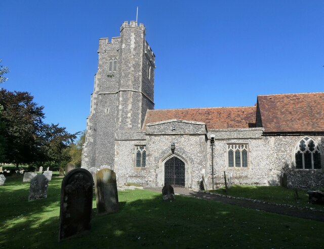
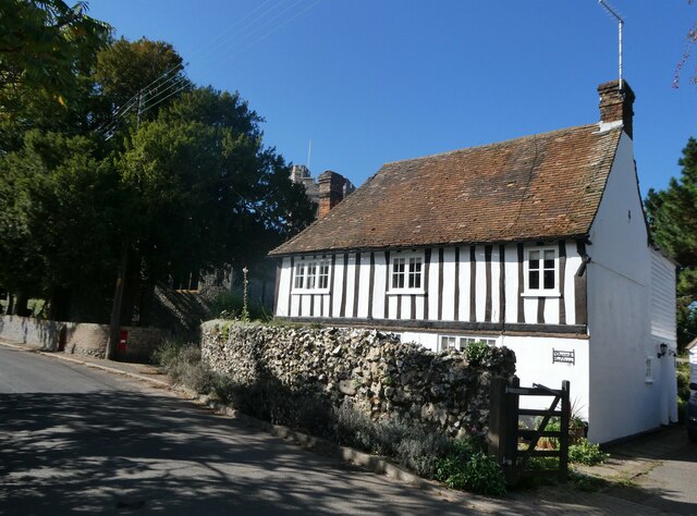
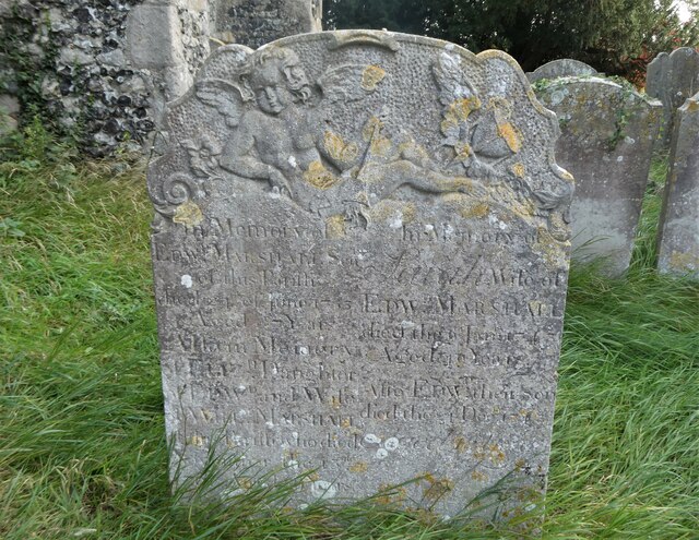
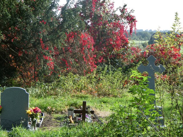
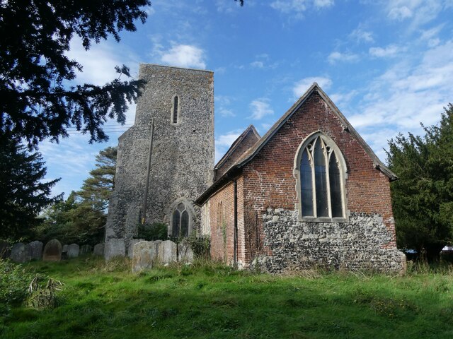
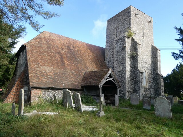
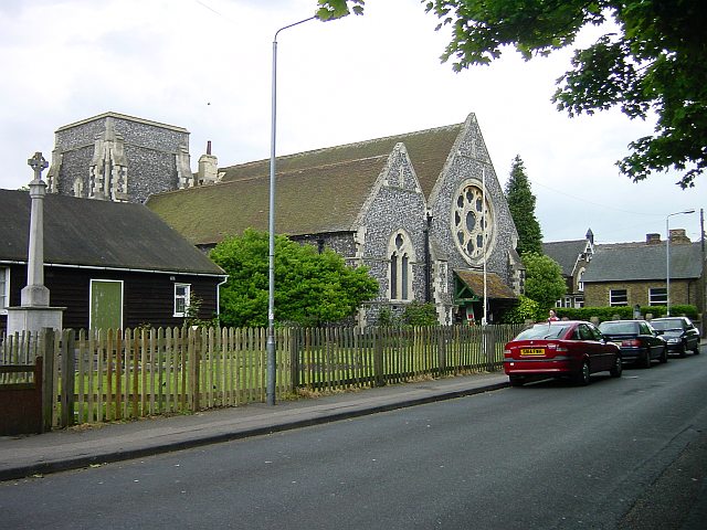
Bapchild is known for its historic significance and has a rich heritage dating back centuries. The village is home to the Grade I listed church of St. Laurence, which dates back to the 12th century and features a beautiful Norman doorway and a 13th-century font. Additionally, Bapchild Manor, a 17th-century manor house, stands as a testament to the village's history.

Despite its small size, Bapchild offers a range of amenities and services for its residents. These include a primary school, a village hall, a local pub, and a convenience store. The village also benefits from its proximity to Sittingbourne, where residents have access to a wider range of shops, supermarkets, and leisure facilities.

Bapchild enjoys a tranquil and peaceful atmosphere, making it an ideal place to live for those seeking a slower pace of life. The village is well-connected to surrounding areas via road links, with the A2 and M2 motorways providing easy access to London and other major cities in the southeast.

Overall, Bapchild is a charming village with a strong sense of community and a rich history, offering residents a peaceful countryside setting while remaining conveniently located near larger towns and amenities.

If you have any feedback on the listing, please let us know in the comments section below.
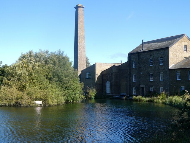
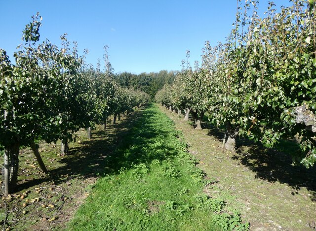
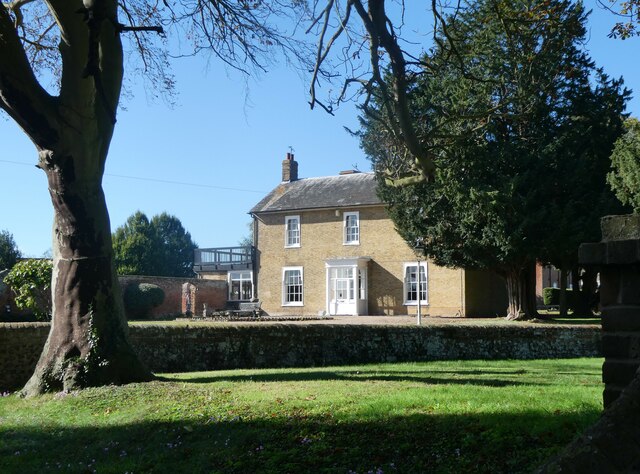
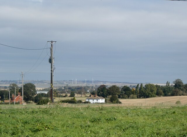
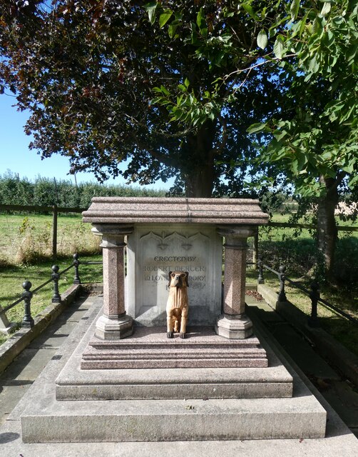
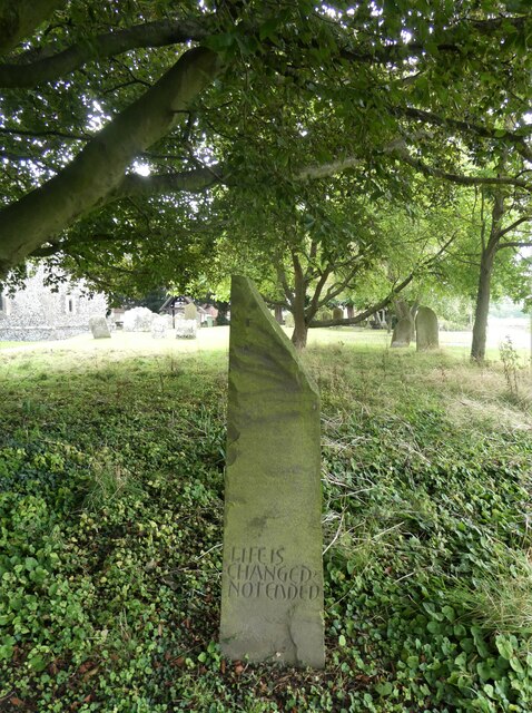
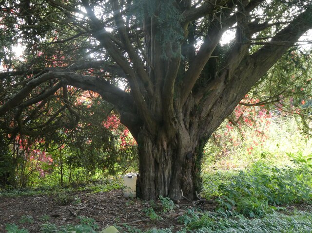
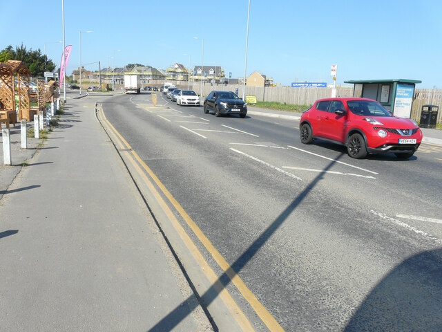
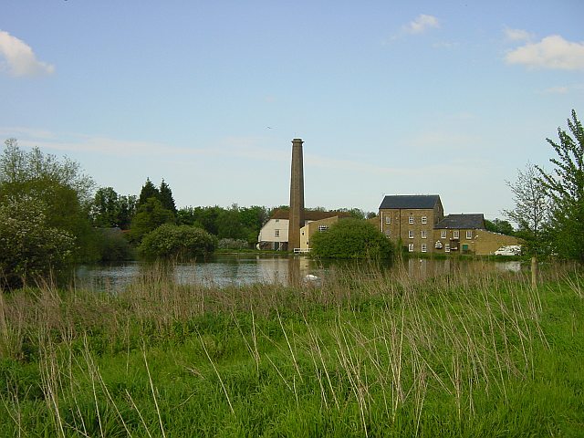
Bapchild Images

Images are sourced within 2km of 51.332949/0.772176 or Grid Reference TQ9362. Thanks to Geograph Open Source API. All images are credited.

Tonge Mill, near Sittingbourne A Grade II listed building dating from 1837. It has been restored and converted into a private dwelling.
Tonge Mill, near Sittingbourne
A Grade II listed building dating from 1837. It has been restored and converted into a private dwelling.
Pear orchard, Tonge South of Tonge Mill and millpond.
Pear orchard, Tonge
South of Tonge Mill and millpond.
Dully House, Tonge, near Sittingbourne On Dully Road.
Dully House, Tonge, near Sittingbourne
On Dully Road.
View across Bapchild and The Swale to the Isle of Sheppey From a footpath running between Dully Road and Church Street, Rodmersham.
View across Bapchild and The Swale to the Isle of Sheppey
From a footpath running between Dully Road and Church Street, Rodmersham.
Rodmersham, near Sittingbourne View from a footpath with the tower of St. Nicholas's church on the left.
Rodmersham, near Sittingbourne
View from a footpath with the tower of St. Nicholas's church on the left.
The Church of St. Nicholas, Rodmersham A Grade I listed building with a 13th century chancel, a 14th century nave and a 15th century tower which was restored 1875-93.
The Church of St. Nicholas, Rodmersham
A Grade I listed building with a 13th century chancel, a 14th century nave and a 15th century tower which was restored 1875-93.
Tomb in the churchyard, St. Nicholas Church, Rodmersham The grave of Helen, wife of Robert Mercer, died Oct. 1906, aged 68 years.  erected by Robert Mercer "In Loving Memory 1907". According to the 1881 census, he was a hop grower and farmer of 180 acres, employing 56 men, 14 boys and 12 women, which suggests he was wealthy enough to erect such an expensive marble tomb.  He died in 1917. The carved dog seems to be a later addition.
Tomb in the churchyard, St. Nicholas Church, Rodmersham
The grave of Helen, wife of Robert Mercer, died Oct. 1906, aged 68 years. erected by Robert Mercer "In Loving Memory 1907". According to the 1881 census, he was a hop grower and farmer of 180 acres, employing 56 men, 14 boys and 12 women, which suggests he was wealthy enough to erect such an expensive marble tomb. He died in 1917. The carved dog seems to be a later addition.
Church Cottage, Rodmersham Church Street. A 16th century Grade II listed building.
Church Cottage, Rodmersham
Church Street. A 16th century Grade II listed building.
Edward Ardizzone's grave, Rodmersham The grave, near burials of other members of his family, is in St. Nicholas' churchyard. Edward Ardizzone, CBE RA (16 October 1900 – 8 November 1979), was an English painter, print-maker and war artist, and the author and illustrator of books, many of them for children. For Tim All Alone, which he wrote and illustrated, Ardizzone won the inaugural Kate Greenaway Medal for the year's best children's book illustration by a British subject
Edward Ardizzone's grave, Rodmersham
The grave, near burials of other members of his family, is in St. Nicholas' churchyard. Edward Ardizzone, CBE RA (16 October 1900 – 8 November 1979), was an English painter, print-maker and war artist, and the author and illustrator of books, many of them for children. For Tim All Alone, which he wrote and illustrated, Ardizzone won the inaugural Kate Greenaway Medal for the year's best children's book illustration by a British subject
Nicholas Ardizzone's grave, Rodmersham churchyard The grave, near burials of other members of his family, is in St. Nicholas' churchyard. His father, Edward Ardizzone, CBE RA (16 October 1900 – 8 November 1979), was an English painter, print-maker and war artist, and the author and illustrator of books, many of them for children. Nicholas, a cinematographer, catalogued his father's work as war artist and also published a detailed catalogue of his prints and lithographs. Edward's grave is hidden behind Nicholas's.
Nicholas Ardizzone's grave, Rodmersham churchyard
The grave, near burials of other members of his family, is in St. Nicholas' churchyard. His father, Edward Ardizzone, CBE RA (16 October 1900 – 8 November 1979), was an English painter, print-maker and war artist, and the author and illustrator of books, many of them for children. Nicholas, a cinematographer, catalogued his father's work as war artist and also published a detailed catalogue of his prints and lithographs. Edward's grave is hidden behind Nicholas's.
Nicholas Ardizzone's grave, Rodmersham churchyard Looking eastwards towards Church Street. The grave, near burials of other members of his family including his father, Edward, is in St. Nicholas' churchyard.  Edward Ardizzone, CBE RA (16 October 1900 – 8 November 1979), was an English painter, print-maker and war artist, and the author and illustrator of books, many of them for children. Nicholas, a cinematographer, catalogued his father's work as war artist and also published a detailed catalogue of his prints and lithographs.
Nicholas Ardizzone's grave, Rodmersham churchyard
Looking eastwards towards Church Street. The grave, near burials of other members of his family including his father, Edward, is in St. Nicholas' churchyard. Edward Ardizzone, CBE RA (16 October 1900 – 8 November 1979), was an English painter, print-maker and war artist, and the author and illustrator of books, many of them for children. Nicholas, a cinematographer, catalogued his father's work as war artist and also published a detailed catalogue of his prints and lithographs.
Rodmersham village From a footpath running between Church Street and Rodmersham Green. St. Nicholas's church tower is on the left and is in Church Street. Rodmersham Court Farm orchard is beyond the field.
Rodmersham village
From a footpath running between Church Street and Rodmersham Green. St. Nicholas's church tower is on the left and is in Church Street. Rodmersham Court Farm orchard is beyond the field.
St. Giles' Churchyard, Tonge An 18th century gravestone in memory of Edward Marshall and family.
St. Giles' Churchyard, Tonge
An 18th century gravestone in memory of Edward Marshall and family.
St. Giles' Churchyard, Tonge An area containing more recent graves.
St. Giles' Churchyard, Tonge
An area containing more recent graves.
St Giles' Church, Tonge The eastern end. Parish church. 12th and 14th century, restored in the 16th and 17th century  and in 1893. A Grade I listed building.
St Giles' Church, Tonge
The eastern end. Parish church. 12th and 14th century, restored in the 16th and 17th century and in 1893. A Grade I listed building.
St Giles' Church, Tonge Parish church. 12th and 14th century, restored in the 16th and 17th century  and in 1893. A Grade I listed building. View of the south side.
St Giles' Church, Tonge
Parish church. 12th and 14th century, restored in the 16th and 17th century and in 1893. A Grade I listed building. View of the south side.
Yew tree, St. Giles' Churchyard, Tonge One of many such ancient trees here.
Yew tree, St. Giles' Churchyard, Tonge
One of many such ancient trees here.
Bus shelter, Fox Hill Previous view shows the same bus shelter with the <a href="https://www.geograph.org.uk/photo/6004172">TQ9263 : Development land</a> behind, which has since been given the name Spring Acres. The present view shows some of the houses, which are being built on the housing estate.
Bus shelter, Fox Hill
Previous view shows the same bus shelter with the TQ9263 : Development land behind, which has since been given the name Spring Acres. The present view shows some of the houses, which are being built on the housing estate.
Show me another place!

Bapchild is located at Grid Ref: TQ9362 (Lat: 51.332949, Lng: 0.772176)

Administrative County: Kent

District: Swale

Police Authority: Kent

What 3 Words

///pipe.nest.firms. Near Teynham, Kent

Nearby Locations

Bapchild

Related Wikis

Tonge, Kent

Tonge is a village near Sittingbourne in Kent, England. The hamlet is north of Bapchild (where at the 2011 Census the population was included), close to...

The Sittingbourne School

The Sittingbourne School is a secondary school and sixth form with academy status located in Sittingbourne, Kent, with around 1600 students. This school...

Rodmersham

Rodmersham is a village and civil parish in the Borough of Swale in the north of the English county of Kent. It is just under 1 mile (1.6 km) south of...

Murston

Murston is a suburb of Sittingbourne in Kent, England. It is about 1 mile north-east of central Sittingbourne, on the east bank of the Milton Creek....

Nearby Amenities

Located within 500m of 51.332949,0.772176
Bapchild
Place: village
Source: npe
Lat/Long: 51.3332747/0.7678153
Historic: yes
Natural: spring
Lat/Long: 51.3348495/0.7703649
Haywood
Building: yes
Source: npe
Lat/Long: 51.3290866/0.7743539
Bapchild and Tonge Village Hall
Building: public
Lat/Long: 51.333774/0.7657927
Bus Stop
Fox and Goose
Bus: yes
Naptan AtcoCode: 2400A011220A
Naptan Bearing: E
Naptan CommonName: Fox and Goose
Naptan Indicator: adj
Naptan Landmark: School Lane
Naptan NaptanCode: kntampdg
Naptan Street: Fox Hill
Naptan Verified: no
Public Transport: platform
Ref: kntampdg
Source: naptan_import
Source Date: 2018-03-16T11:48:00
Lat/Long: 51.3349603/0.7660747
Bus Stop
Pomphreys Garage
Bench: no
Bin: no
Lit: yes
Naptan AtcoCode: 2400A011230A
Naptan Bearing: E
Naptan CommonName: Pomphreys Garage
Naptan Indicator: opp
Naptan Landmark: School Lane
Naptan NaptanCode: kntampdj
Naptan Street: The Street
Naptan Verified: no
Public Transport: platform
Ref: kntampdj
Shelter: no
Source: naptan_import
Source Date: 2012-02-16T16:32:00
Tactile Paving: no
Lat/Long: 51.334214/0.7703033
Bus Stop
Hempstead Lane
Naptan AtcoCode: 2400A011240A
Naptan Bearing: E
Naptan CommonName: Hempstead Lane
Naptan Indicator: adj
Naptan Landmark: Hempstead Lane
Naptan NaptanCode: kntampdm
Naptan Street: London Road
Naptan Verified: no
Public Transport: platform
Ref: kntampdm
Source: naptan_import
Source Date: 2018-03-16T11:52:00
Lat/Long: 51.3334972/0.7743664
Bus Stop
Hempstead Lane
Naptan AtcoCode: 2400A011330A
Naptan Bearing: W
Naptan CommonName: Hempstead Lane
Naptan Indicator: opp
Naptan Landmark: Hempstead Lane
Naptan NaptanCode: kntampgt
Naptan Street: The Street
Naptan Verified: no
Public Transport: platform
Ref: kntampgt
Source: naptan_import
Source Date: 2018-03-16T11:55:00
Lat/Long: 51.3333735/0.7742728
Bus Stop
Pomphreys Garage
Bench: no
Bin: no
Lit: yes
Naptan AtcoCode: 2400A011340A
Naptan Bearing: W
Naptan CommonName: Pomphreys Garage
Naptan Indicator: adj
Naptan Landmark: School Lane
Naptan NaptanCode: kntampgw
Naptan Street: The Street
Naptan Verified: no
Public Transport: platform
Ref: kntampgw
Shelter: no
Source: naptan_import
Source Date: 2018-03-16T12:09:00
Tactile Paving: no
Lat/Long: 51.3342277/0.7693422
Pub
Fox and Goose
Addr Housenumber: 1
Addr Postcode: ME9 9AH
Addr Street: The Street
Fhrs Authority: Swale
Fhrs Id: 951612
Fhrs Inspectiondate: 2017-03-03
Fhrs Rating: 4
Lat/Long: 51.3348265/0.7668317
Place Of Worship
Lat/Long: 51.3325449/0.7651915
Traffic Calming: table
Lat/Long: 51.3327786/0.7713128
Hempstead House Hotel
Addr Postcode: ME9 9PP
Addr Street: London Road
Fhrs Id: 714644
Fhrs Inspectiondate: 2015-06-10
Fhrs Rating: 5
Postal Code: ME9 9PP
Source: OS_OpenData_StreetView
Tourism: hotel
Lat/Long: 51.3330727/0.7738862
The Old Vicarage
Building: yes
Lat/Long: 51.3309499/0.7757108
Seedmeal Cottages
Building: yes
Lat/Long: 51.3321888/0.7779357
Barrier: bollard
Lat/Long: 51.3312668/0.7700114
Barrier: bollard
Lat/Long: 51.3313115/0.7695947
Post Box
Brand: Royal Mail
Brand Wikidata: Q638098
Brand Wikipedia: en:Royal Mail
Collection Plate: CP5
Collection Times: Mo-Fr 16:45; Sa 09:00; Su off
Note: An unusual box with a metal door with enamelled "LETTER BOX" sign screwed to it and scruffy wooden frame around the door. No royal cypher
Operator: Royal Mail
Operator Wikidata: Q638098
Post Box Mounting: building
Post Box Type: wall
Ref: ME9 78
Royal Cypher: no
Source: survey;streetlevel imagery;aerial imagery
Lat/Long: 51.3345666/0.7679501
Post Box
Brand: Royal Mail
Brand Wikidata: Q638098
Brand Wikipedia: en:Royal Mail
Collection Times: Mo-Fr 09:00; Sa 07:00; Su off
Operator: Royal Mail
Operator Wikidata: Q638098
Post Box Mounting: pier
Post Box Type: lamp
Ref: ME10 116D
Royal Cypher: EIIR
Royal Cypher Wikidata: Q33102113
Source: streetlevel imagery;aerial imagery;survey
Lat/Long: 51.3319227/0.7677681
Waste Basket
Lat/Long: 51.3317827/0.7703016
Generator Method: photovoltaic
Generator Output Electricity: yes
Generator Source: solar
Generator Type: solar_photovoltaic_panel
Location: roof
Power: generator
Lat/Long: 51.3332595/0.7707086
Generator Method: photovoltaic
Generator Output Electricity: yes
Generator Source: solar
Generator Type: solar_photovoltaic_panel
Location: roof
Power: generator
Lat/Long: 51.3333701/0.7691637
Generator Method: photovoltaic
Generator Output Electricity: yes
Generator Source: solar
Generator Type: solar_photovoltaic_panel
Location: roof
Power: generator
Lat/Long: 51.3329729/0.7680076
Generator Method: photovoltaic
Generator Output Electricity: yes
Generator Source: solar
Generator Type: solar_photovoltaic_panel
Location: roof
Power: generator
Lat/Long: 51.3329746/0.7681149
Generator Method: photovoltaic
Generator Output Electricity: yes
Generator Source: solar
Generator Type: solar_photovoltaic_panel
Location: roof
Power: generator
Lat/Long: 51.3310826/0.7706456
Generator Method: photovoltaic
Generator Output Electricity: yes
Generator Source: solar
Generator Type: solar_photovoltaic_panel
Location: roof
Power: generator
Lat/Long: 51.3310759/0.7703036
Budgens
Addr Postcode: ME9 9PP
Addr Street: London Road
Brand: Budgens
Brand Wikidata: Q4985016
Opening Hours: Mo-Sa 06:00-21:30; Su 07:00-21:30
Shop: convenience
Website: https://www.budgens.co.uk/our-stores/bapchild
Lat/Long: 51.333836/0.771119
Crossing
Crossing: uncontrolled
Crossing Island: yes
Tactile Paving: yes
Lat/Long: 51.3349335/0.7657711
Crossing
Crossing: uncontrolled
Crossing Island: yes
Tactile Paving: yes
Lat/Long: 51.3349829/0.7658076
The data included in this document is from www.openstreetmap.org. The data is made available under ODbL.

Have you been to Bapchild?

Leave your review of Bapchild below (or comments, questions and feedback).