Birkhouse Moor

Hill, Mountain in Westmorland Eden

England

Birkhouse Moor

Looking up Glenridding Looking up Glenridding.
Looking up Glenridding Credit: Colin Kinnear

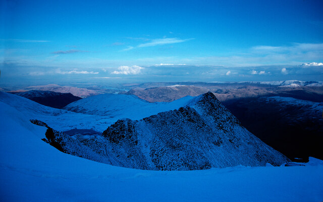
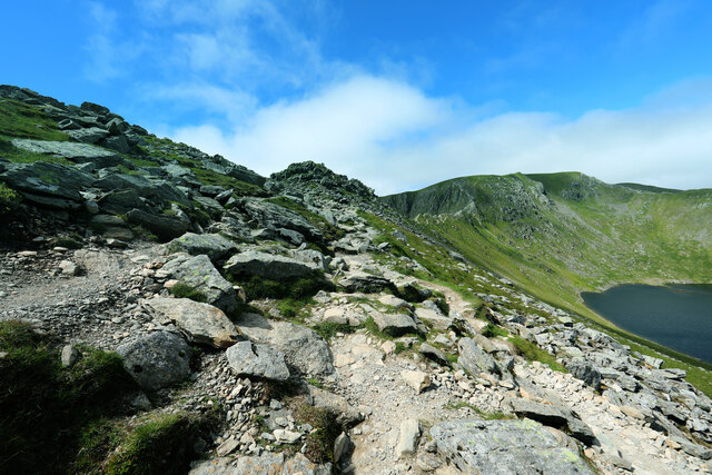
Birkhouse Moor is a hill located in the county of Westmorland, in the northwestern region of England. It is part of the Lake District National Park, known for its stunning landscapes and picturesque views. Birkhouse Moor stands at an elevation of 718 meters (2,356 feet) above sea level, making it a popular destination for hiking and outdoor enthusiasts.

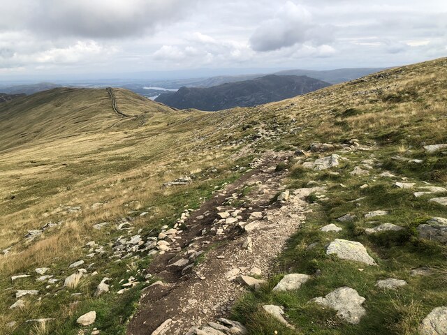
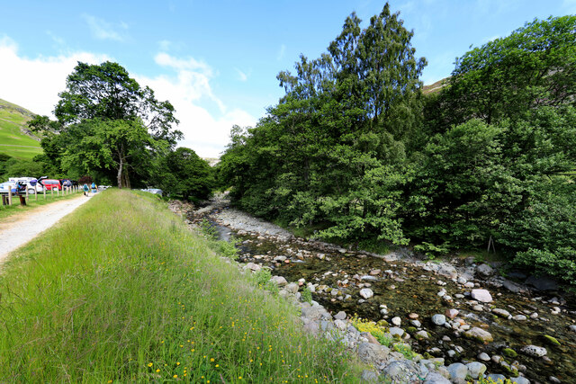
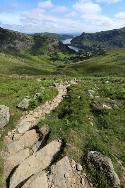
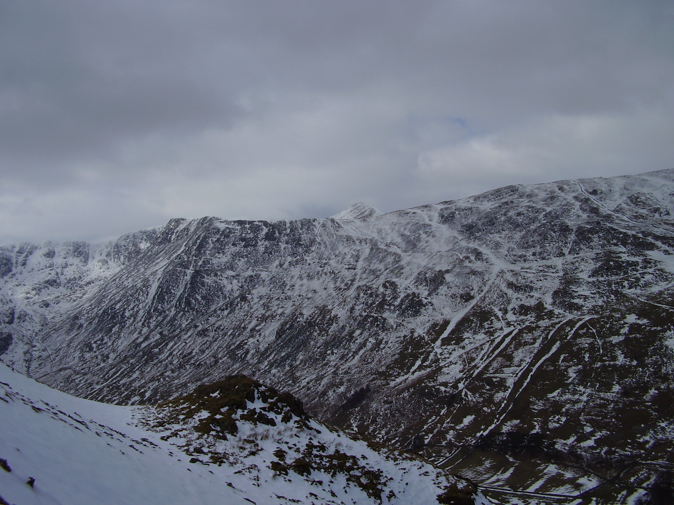
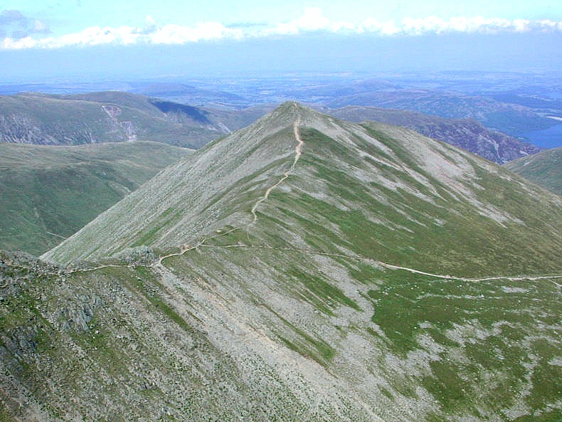
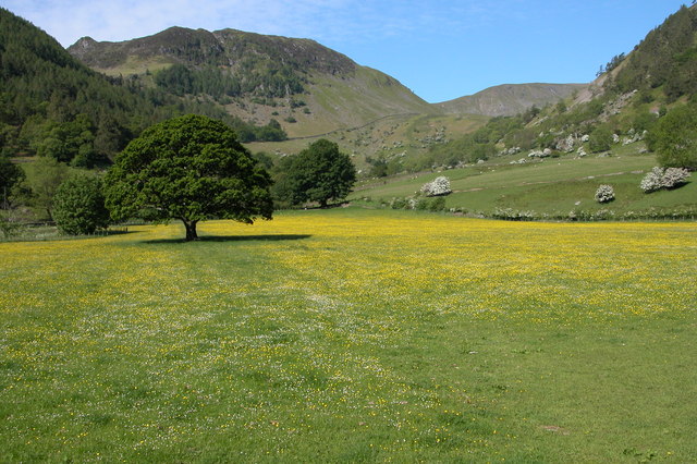
The hill is situated close to the village of Glenridding and is easily accessible from there. It is also in close proximity to other notable peaks in the area, such as Helvellyn and Catstye Cam. Birkhouse Moor offers breathtaking panoramic views of the surrounding valleys, including Ullswater Lake, one of the largest lakes in the Lake District.

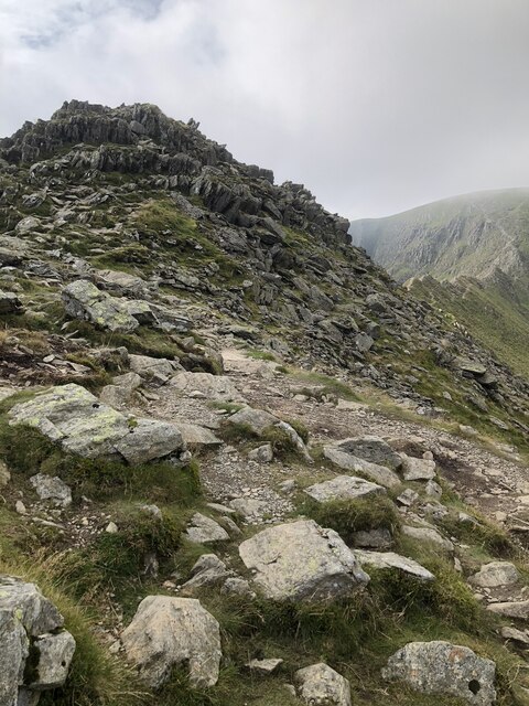
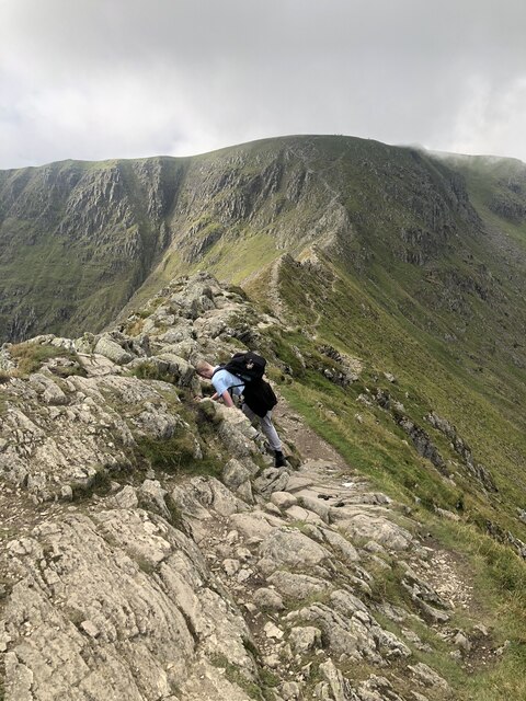
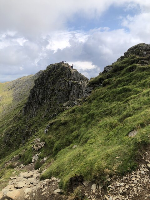
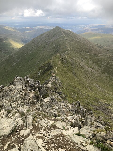
The terrain of Birkhouse Moor is characterized by grassy slopes and rocky outcrops, providing a challenging yet rewarding hiking experience. There are several walking routes that lead to the summit, with the most popular one starting from Glenridding and ascending via the path known as Mires Beck. The ascent can be steep in parts, but the effort is rewarded with stunning vistas once at the top.

Birkhouse Moor is also known for its rich biodiversity, with an array of plant and animal species inhabiting its slopes. During the spring and summer months, the hillside becomes adorned with colorful wildflowers, adding to its natural beauty.

Overall, Birkhouse Moor offers a wonderful opportunity to explore the rugged beauty of the Lake District, providing visitors with a memorable hiking experience and breathtaking views of the surrounding landscapes.

If you have any feedback on the listing, please let us know in the comments section below.

Birkhouse Moor Images

Images are sourced within 2km of 54.535083/-2.9850547 or Grid Reference NY3615. Thanks to Geograph Open Source API. All images are credited.

Looking up Glenridding Looking up Glenridding.
Looking up Glenridding
Looking up Glenridding.
Striding Edge from Swallow Scarth Descending from Nethermost Pike on the way to Helvellyn, the low point above Nethermost Cove is Swallow Scarth, offering a view ahead to the most exciting part of the day's walk, along Striding Edge. In winter conditions, a good head for heights needs to be supplemented with crampons, and whilst an ice-axe is good for balance, it's unlikely to stop a fall on shallow snow over rock, so don't fall off ! We recommend that you don't (as I did on a similar day in the same place, but travelling in the opposite direction) manage to stick the front points of one crampon into the trouser leg of the other foot, leaving oneself teetering on the very top of the edge with a climber's axe too short to reach the ground, pondering the best way out of the predicament. Good balance and a cool head are key. The day seen here was less fraught, but the cloud had rolled in from the west, and daylight was limited, so a headtorch was needed before reaching the car, even though, back in 1987, one was still allowed parking in Grisedale.

Note, although submitted as having been taken 1987-02-22, diary entries are a little sparse, and it might just conceivably have been February 15th (although I would have expected to be too hung over on that Sunday, following a caving club dinner the previous night).
Striding Edge from Swallow Scarth
Descending from Nethermost Pike on the way to Helvellyn, the low point above Nethermost Cove is Swallow Scarth, offering a view ahead to the most exciting part of the day's walk, along Striding Edge. In winter conditions, a good head for heights needs to be supplemented with crampons, and whilst an ice-axe is good for balance, it's unlikely to stop a fall on shallow snow over rock, so don't fall off ! We recommend that you don't (as I did on a similar day in the same place, but travelling in the opposite direction) manage to stick the front points of one crampon into the trouser leg of the other foot, leaving oneself teetering on the very top of the edge with a climber's axe too short to reach the ground, pondering the best way out of the predicament. Good balance and a cool head are key. The day seen here was less fraught, but the cloud had rolled in from the west, and daylight was limited, so a headtorch was needed before reaching the car, even though, back in 1987, one was still allowed parking in Grisedale. Note, although submitted as having been taken 1987-02-22, diary entries are a little sparse, and it might just conceivably have been February 15th (although I would have expected to be too hung over on that Sunday, following a caving club dinner the previous night).
Mires Beck On the lower eastern slope of Birkhouse Moor.
Mires Beck
On the lower eastern slope of Birkhouse Moor.
Path across Birkhouse Moor
Path & wall between Birkhouse Moor and Striding Edge
Looking back along the path above Bleaberry Crag
High Spying How at the start of Striding Edge
On Striding Edge
On Striding Edge
Striding Edge
Striding Edge
Swirral Edge and Catstye Cam
The path to Glenridding
Looking over Glenridding Beck to Rowten Beck
Greenside Mine Former lead mine that reached its peak production in the late 19th / early 20th centuries with final closure in 1962. Info from Wikipedia: <span class="nowrap"><a title="https://en.wikipedia.org/wiki/Greenside_Mine" rel="nofollow ugc noopener" href="https://en.wikipedia.org/wiki/Greenside_Mine">Link</a><img style="margin-left:2px;" alt="External link" title="External link - shift click to open in new window" src="https://s1.geograph.org.uk/img/external.png" width="10" height="10"/></span>
Greenside Mine
Former lead mine that reached its peak production in the late 19th / early 20th centuries with final closure in 1962. Info from Wikipedia: LinkExternal link
Glenridding Beck passes Gillside Campsite It still feels distressingly crowded and almost urban this close to the centre of Glenridding, but keep faith, it gets better soon, if steeper and hotter....
Glenridding Beck passes Gillside Campsite
It still feels distressingly crowded and almost urban this close to the centre of Glenridding, but keep faith, it gets better soon, if steeper and hotter....
Pitch path in Little Cove Being one of the more popular routes from Glenridding onto Helvellyn via Striding Edge, the path following Mires Beck was inevitably subject to a lot of erosion. On this steeper section, potential gullying has been prevented by an excellent piece of path construction using stone that blends in with its surroundings. The view down to Glenridding and Ullswater is a splendid excuse for those labouring upwards to take a break and get the camera out.
Pitch path in Little Cove
Being one of the more popular routes from Glenridding onto Helvellyn via Striding Edge, the path following Mires Beck was inevitably subject to a lot of erosion. On this steeper section, potential gullying has been prevented by an excellent piece of path construction using stone that blends in with its surroundings. The view down to Glenridding and Ullswater is a splendid excuse for those labouring upwards to take a break and get the camera out.
Peaty ponds punctuate path on Birkhouse Moor One of two paths climbing the fell to Striding Edge, the one coming up Little Cove from Gillside encounters more wet ground on the crest of the ridge than it did on its ascent of the cirque. Even in a long, hot, dry summer like 2022, these peaty ponds show the water table to be barely below the ground surface. Looking over the valley of Red Tarn Beck, the view extends to Catstycam and Swirral Edge and beyond them, the long north ridge of Helvellyn to Raise.
Peaty ponds punctuate path on Birkhouse Moor
One of two paths climbing the fell to Striding Edge, the one coming up Little Cove from Gillside encounters more wet ground on the crest of the ridge than it did on its ascent of the cirque. Even in a long, hot, dry summer like 2022, these peaty ponds show the water table to be barely below the ground surface. Looking over the valley of Red Tarn Beck, the view extends to Catstycam and Swirral Edge and beyond them, the long north ridge of Helvellyn to Raise.
Looking back towards Hole in the Wall from High Spying How High Spying How marks the end of the easy ascent from Glenridding over the at times broad path that can be seen in the distance leading from Hole in the Wall. It's best not to be here heading upwards unless you have a head for heights and decent footwear (if you are heading down at this point without those attributes and have come from Helvellyn's summit, well done for surviving this far).
Looking back towards Hole in the Wall from High Spying How
High Spying How marks the end of the easy ascent from Glenridding over the at times broad path that can be seen in the distance leading from Hole in the Wall. It's best not to be here heading upwards unless you have a head for heights and decent footwear (if you are heading down at this point without those attributes and have come from Helvellyn's summit, well done for surviving this far).
Path over High Spying How After the hard work of climbing 700m from the shores of Ullswater at Glenridding, there's only 100m of up to reach Helvellyn, and it is all a lot more fun than what has gone before. Well, as long as you are one of those who feel happy on exposed scrambles, of course. This is the start of Striding Edge, and it is essential to stick rigidly to the crest at all times (there are skulkers' routes round quite a lot of it, really).
Path over High Spying How
After the hard work of climbing 700m from the shores of Ullswater at Glenridding, there's only 100m of up to reach Helvellyn, and it is all a lot more fun than what has gone before. Well, as long as you are one of those who feel happy on exposed scrambles, of course. This is the start of Striding Edge, and it is essential to stick rigidly to the crest at all times (there are skulkers' routes round quite a lot of it, really).
Show me another place!

Birkhouse Moor is located at Grid Ref: NY3615 (Lat: 54.535083, Lng: -2.9850547)

Administrative County: Cumbria

District: Eden

Police Authority: Cumbria

What 3 Words

///bookings.restless.beans. Near Ambleside, Cumbria

Nearby Locations

Birkhouse Moor

Related Wikis

Birkhouse Moor

Birkhouse Moor is a fell in the English Lake District, an outlier of the Helvellyn range in the Eastern Fells. It is properly an eastern ridge of Helvellyn...
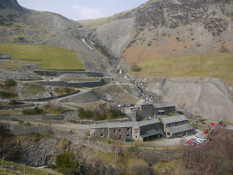
Greenside Mine

Greenside Mine (sometimes referred to as Greenside Lead Mine) was a successful lead mine in the Lake District of England. Between 1825 and 1961 the mine...

Catstye Cam

Catstye Cam is a fell in the English Lake District. It is an outlier of Helvellyn in the Eastern Fells. == Name == The name of the fell is also given as...

Red Tarn

Red Tarn is a small lake in the eastern region of the English Lake District, in the county of Cumbria. It is high up on the eastern flank of Helvellyn...

Helvellyn

Helvellyn (; possible meaning: pale yellow moorland) is a mountain in the English Lake District, the highest point of the Helvellyn range, a north–south...

Sheffield Pike

Sheffield Pike (possibly meaning "the peak above the sheep fold") is a fell in the English Lake District, a prominent intermediate top on one of the eastern...

Raise (Lake District)

Raise is a fell in the English Lake District. It stands on the main spine of the Helvellyn range in the Eastern Fells, between Thirlmere and Ullswater...

Glenridding

Glenridding is a village at the southern end of Ullswater, in the English Lake District. The village is popular with mountain walkers who can scale England...

Nearby Amenities

Located within 500m of 54.535083,-2.9850547
Birkhouse Moor
Ele: 718
Natural: peak
Source: npe
Wikidata: Q4916487
Wikipedia: en:Birkhouse Moor
Lat/Long: 54.5349976/-2.9853112
Man Made: cairn
Lat/Long: 54.535525/-2.9774268
Information: guidepost
Note: Path diverted due to erosion control
Tourism: information
Lat/Long: 54.5356251/-2.9784084
The data included in this document is from www.openstreetmap.org. The data is made available under ODbL.

Have you been to Birkhouse Moor?

Leave your review of Birkhouse Moor below (or comments, questions and feedback).