Blakemere Hill
Hill, Mountain in Herefordshire
England
Blakemere Hill

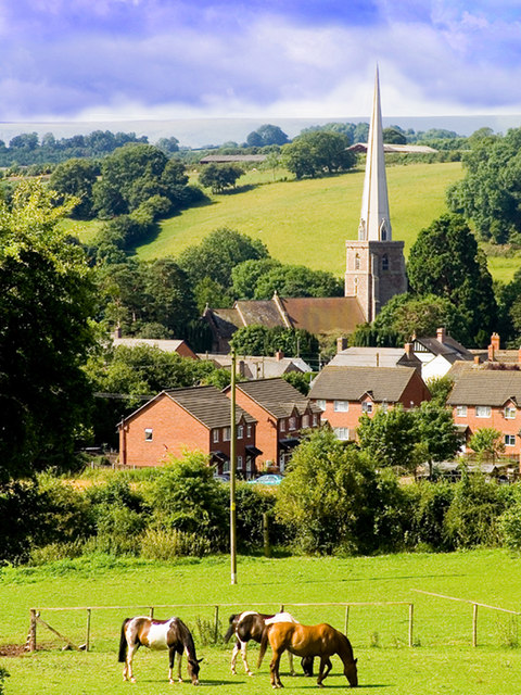
Blakemere Hill is a prominent natural feature located in the picturesque county of Herefordshire, England. This hill, classified as a "hill" rather than a "mountain" due to its elevation, boasts a height of approximately 250 meters (820 feet) above sea level. It is nestled in the stunning countryside, surrounded by rolling green hills and meadows, offering breathtaking panoramic views of the surrounding landscape.
Blakemere Hill is characterized by its gentle slopes and lush vegetation, predominantly covered by various species of grasses and wildflowers. The hill is known for its rich biodiversity, serving as a habitat for numerous species of birds, mammals, and insects. It attracts nature enthusiasts and hikers who can explore the area through well-marked trails and footpaths.
At the summit of Blakemere Hill, visitors are rewarded with a spectacular vista of the Herefordshire countryside. On clear days, the views extend for miles, revealing the patchwork of fields, quaint villages, and distant hills. It is a popular spot for photographers and nature lovers alike, who are captivated by the ever-changing colors and textures of the landscape throughout the seasons.
Blakemere Hill holds historical significance as well, with traces of ancient settlements and archaeological sites discovered in its vicinity. Its name is believed to derive from Old English, referring to the dark-colored lake or bog that once existed at the foot of the hill, contrasting with its present-day verdant appearance.
Overall, Blakemere Hill offers a serene and idyllic escape for those seeking a connection with nature, stunning vistas, and a glimpse into Herefordshire's rich history.
If you have any feedback on the listing, please let us know in the comments section below.
Blakemere Hill Images
Images are sourced within 2km of 52.048787/-2.9308031 or Grid Reference SO3639. Thanks to Geograph Open Source API. All images are credited.


Blakemere Hill is located at Grid Ref: SO3639 (Lat: 52.048787, Lng: -2.9308031)
Unitary Authority: County of Herefordshire
Police Authority: West Mercia
What 3 Words
///stereos.occurs.treatable. Near Tyberton, Herefordshire
Nearby Locations
Related Wikis
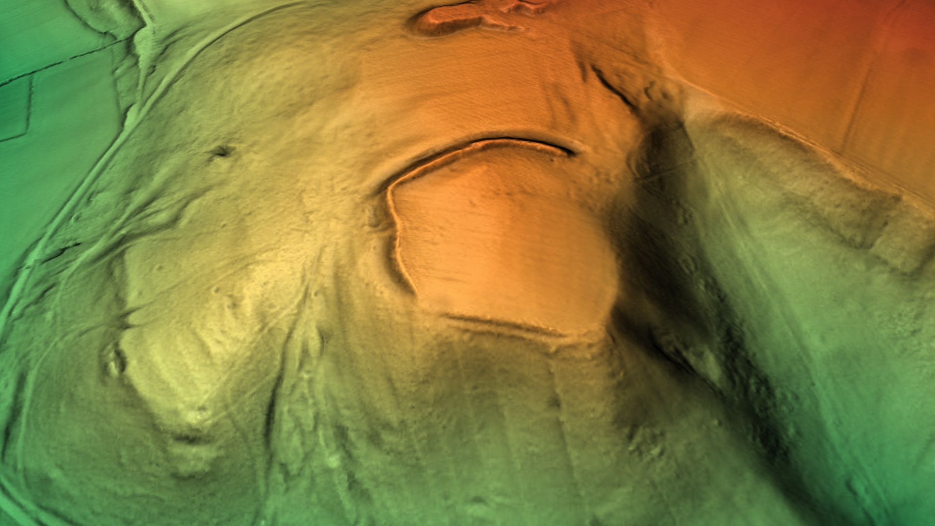
Poston Camp
Poston Camp is an Iron Age hill fort located just south of Vowchurch, Herefordshire. == Further reading == Children, G; Nash, G (1994) Prehistoric Sites...
Peterchurch
Peterchurch is a village and civil parish in the Golden Valley, Herefordshire, England. The countryside around is spectacular, with views of the Black...

Tyberton
Tyberton or Tiberton is a village and civil parish 8 miles (13 km) west of Hereford, in the county of Herefordshire, England. In 2011 the parish had a...

Blakemere
Blakemere is a parish in Herefordshire, England. It is 11 miles west of Hereford, on the road to Hay-on-Wye. == External links == Media related to Blakemere...

Peterchurch railway station
Peterchurch railway station was a station in Peterchurch, Herefordshire, England. The station was opened in 1901, closed to passengers in 1941 and closed...

Fairfield High School, Peterchurch
Fairfield High School is a coeducational secondary school located in Peterchurch, Herefordshire, England. Fairfield High School is located in the Golden...
Vowchurch
Vowchurch is a village and civil parish in Herefordshire, England, situated in the Golden Valley, on the River Dore. The village is about 10 miles (16...

Preston on Wye
Preston on Wye is a village and civil parish in Herefordshire, England. It is situated near the River Wye, about 9 miles west of Hereford. Nearby places...
Have you been to Blakemere Hill?
Leave your review of Blakemere Hill below (or comments, questions and feedback).