Castle Hill

Hill, Mountain in Angus

Scotland

Castle Hill

Minor Road at Bridgend of Balloch The house at Bridgend of Balloch stands above a loop of the Quharity Burn, a curious little stream which has at this point emerged from a deep valley before wandering rather aimlessly through this area and then suddenly cutting south through another steep sided valley. All these features must be linked to work by ice and meltwaters.
Minor Road at Bridgend of Balloch Credit: Gordon Hatton

Castle Hill is a prominent hill located in the county of Angus, Scotland. Rising to a height of approximately 238 meters (781 feet), it is often referred to as Castle Hill of Invergowrie due to its close proximity to the village of Invergowrie, which lies about three miles west of Dundee.

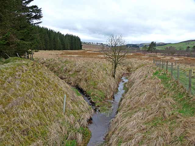
The hill is primarily composed of sandstone and offers stunning panoramic views of the surrounding area. From its summit, visitors can enjoy breathtaking vistas of the River Tay, the Carse of Gowrie, and the city of Dundee. On clear days, it is even possible to see as far as the Sidlaw Hills and the Firth of Tay.

The name Castle Hill is derived from the remains of a 12th-century castle that once stood on its slopes. The castle, known as Invergowrie Castle, was built by William the Lion, King of Scots. Unfortunately, only fragments of the castle walls and earthworks now remain, with most of the structure having been lost to the passage of time and the elements.

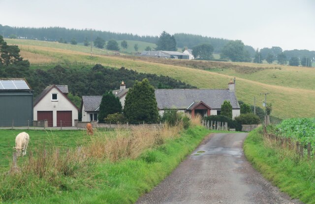
Today, Castle Hill is a popular destination for outdoor enthusiasts, hikers, and nature lovers. It offers well-maintained walking trails that wind their way through the surrounding woodland, providing an opportunity to observe local flora and fauna. The hill's accessibility and natural beauty make it a favored spot for picnicking, photography, and birdwatching.

Overall, Castle Hill in Angus is a captivating natural landmark that combines historical intrigue with stunning vistas, making it a must-visit destination for locals and tourists alike.

If you have any feedback on the listing, please let us know in the comments section below.

Castle Hill Images

Images are sourced within 2km of 56.698688/-3.0440135 or Grid Reference NO3656. Thanks to Geograph Open Source API. All images are credited.

Minor Road at Bridgend of Balloch The house at Bridgend of Balloch stands above a loop of the Quharity Burn, a curious little stream which has at this point emerged from a deep valley before wandering rather aimlessly through this area and then suddenly cutting south through another steep sided valley. All these features must be linked to work by ice and meltwaters.
Minor Road at Bridgend of Balloch
The house at Bridgend of Balloch stands above a loop of the Quharity Burn, a curious little stream which has at this point emerged from a deep valley before wandering rather aimlessly through this area and then suddenly cutting south through another steep sided valley. All these features must be linked to work by ice and meltwaters.
Mysterious 'tin' building in the woods At least two other contributors have suggested that this may have been a chapel or similar, no doubt due to its appearance. There seems to be no way to verify that as it doesn't appear on any of the OS six inch maps that one can access on line as these only cover the period up to the 1920's. The only thing that is marked within 100m  of here is a gravel pit.
Mysterious 'tin' building in the woods
At least two other contributors have suggested that this may have been a chapel or similar, no doubt due to its appearance. There seems to be no way to verify that as it doesn't appear on any of the OS six inch maps that one can access on line as these only cover the period up to the 1920's. The only thing that is marked within 100m of here is a gravel pit.
After the storm 2 One large tree over farm track.
After the storm 2
One large tree over farm track.
Clunehill Wood Much of the woodland has now been cleared.
Clunehill Wood
Much of the woodland has now been cleared.
Clunehill Wood Much of the lower part of the wood has now been cleared.
Clunehill Wood
Much of the lower part of the wood has now been cleared.
Confluence on Balloch Moss Ditches draining this broad marshy area.
Confluence on Balloch Moss
Ditches draining this broad marshy area.
Barns at East Balloch Farm
Bridgend of Pearsie Bungalow in the valley of the Quharity Burn. Airlie Memorial Tower <a href="https://www.geograph.org.uk/gridref/NO3761">NO3761</a> on the skyline.
Bridgend of Pearsie
Bungalow in the valley of the Quharity Burn. Airlie Memorial Tower NO3761 on the skyline.
Bridgend of Balloch Farm in the valley of the Quharity Burn. Just beyond the bridge (to the right, out of sight)) is Bridgend of Pearsie <a href="https://www.geograph.org.uk/photo/2895963">NO3558 : Bridgend of Pearsie</a>. Nether Balgray Farm can be seen up the hillside.
Bridgend of Balloch
Farm in the valley of the Quharity Burn. Just beyond the bridge (to the right, out of sight)) is Bridgend of Pearsie NO3558 : Bridgend of Pearsie. Nether Balgray Farm can be seen up the hillside.
Road to Balloch and Ascreavie The hill on the skyline is the Crandard <a href="https://www.geograph.org.uk/gridref/NO3359">NO3359</a>.
Road to Balloch and Ascreavie
The hill on the skyline is the Crandard NO3359.
Must be an old church Can't imagine that this corrugated iron building was anything other than an old church. The notice is unhelpful - it simply says "Private. Keep out".
Must be an old church
Can't imagine that this corrugated iron building was anything other than an old church. The notice is unhelpful - it simply says "Private. Keep out".
Hay making near Balnagarrow Baling hay in progress near Balnagarrow Farm, in a rare period of settled weather in July 2012.
Hay making near Balnagarrow
Baling hay in progress near Balnagarrow Farm, in a rare period of settled weather in July 2012.
Kinnordy Home Farm
Kinnordy Home Farm
Barley at East Inch Looking north to woodland on Mearns Hill.
Barley at East Inch
Looking north to woodland on Mearns Hill.
Barley at Kinnordy Looking northeast along the road to Caddam Wood towards the lower parts of Glen Clova and Glen Prosen.
Barley at Kinnordy
Looking northeast along the road to Caddam Wood towards the lower parts of Glen Clova and Glen Prosen.
Kinnordy Estate Office At Causewayend, near Kirriemuir.
Kinnordy Estate Office
At Causewayend, near Kirriemuir.
Kinnordy, Kirriemuir Imposing house, once the home of Sir Charles Lyell, lawyer and geologist [1797-1875] <span class="nowrap"><a title="http://en.wikipedia.org/wiki/Charles_Lyell" rel="nofollow ugc noopener" href="http://en.wikipedia.org/wiki/Charles_Lyell">Link</a><img style="margin-left:2px;" alt="External link" title="External link - shift click to open in new window" src="https://s1.geograph.org.uk/img/external.png" width="10" height="10"/></span> . <a href="https://www.geograph.org.uk/photo/1657728">NO3853 : Kirriemuir plaques no. 2 - Sir Charles Lyell</a>
Kinnordy, Kirriemuir
Imposing house, once the home of Sir Charles Lyell, lawyer and geologist [1797-1875] LinkExternal link . NO3853 : Kirriemuir plaques no. 2 - Sir Charles Lyell
Gate to the walled garden at Kinnordy
Show me another place!

Castle Hill is located at Grid Ref: NO3656 (Lat: 56.698688, Lng: -3.0440135)

Unitary Authority: Angus

Police Authority: Tayside

What 3 Words

///aimed.comic.coiling. Near Kirriemuir, Angus

Nearby Locations

Castle Hill

Related Wikis

Kinnordy House

Kinnordy House (alternative spellings: Kynnordy, Kinardy, Kinnordie and Kinorde) is an estate house near Kirriemuir in Angus, Scotland. The first house...

Loch of Kinnordy

Loch of Kinnordy is a small loch located just west of town of Kirriemuir in Angus, Scotland, which is an important wildlife habitat. The loch itself is...

Ascreavie

Ascreavie is a country house in Angus, Scotland. It is located 2 kilometres (1.2 mi) north of Kirkton of Kingoldrum, and 6 kilometres (3.7 mi) north-west...

Kirkton of Kingoldrum

Kirkton of Kingoldrum is a village in Angus, Scotland. It lies in approximately four miles (6 km) west of Kirriemuir on the B951 road. == References ==

Balfour Castle, Angus

Balfour Castle was a baronial mansion at Balfour Mains, near Kirkton of Kingoldrum, Angus, Scotland. The castle which was built in the 16th century is...

Kirriemuir Thistle F.C.

Kirriemuir Thistle Football Club are a Scottish junior football club based in Kirriemuir, Angus. Their home ground is Westview Park. Up until the end of...

Kirriemuir Town Hall

Kirriemuir Town Hall is a municipal structure in Reform Street in Kirriemuir, Angus, Scotland. The structure, which is used as a community events venue...

Kirriemuir Town House

Kirriemuir Town House is a municipal structure in the High Street in Kirriemuir, Angus, Scotland. The structure, which is used as a museum, is a Category...

Nearby Amenities

Located within 500m of 56.698688,-3.0440135
Power: tower
Source: Bing
Lat/Long: 56.6994283/-3.048517
Power: tower
Source: Bing
Lat/Long: 56.6982039/-3.0519545
Power: tower
Source: Bing
Lat/Long: 56.7021196/-3.040961
Power: tower
Source: Bing
Lat/Long: 56.700941/-3.04427
Castle Hill
Ele: 295
Natural: peak
Lat/Long: 56.698544/-3.0443312
The data included in this document is from www.openstreetmap.org. The data is made available under ODbL.

Have you been to Castle Hill?

Leave your review of Castle Hill below (or comments, questions and feedback).