Commonbrae Hill
Hill, Mountain in Roxburghshire
Scotland
Commonbrae Hill

Commonbrae Hill is a prominent feature located in the county of Roxburghshire, Scotland. Situated near the town of Hawick, it is part of the beautiful Scottish Borders region. Commonbrae Hill is categorized as a hill, rather than a mountain, due to its height which falls below the threshold for mountain classification.
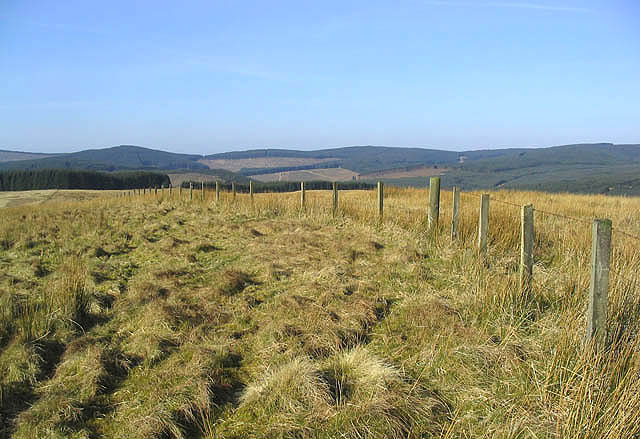
Standing at an elevation of around 300 meters (984 feet), Commonbrae Hill offers breathtaking panoramic views of the surrounding countryside. It boasts a gentle slope, making it easily accessible to hikers and nature enthusiasts of all levels of experience. The hill is covered in lush green vegetation, including heather, grasses, and various wildflowers, creating a picturesque landscape throughout the year.
The hill is home to a variety of wildlife, attracting birdwatchers and nature photographers. Visitors may spot birds such as red grouse, curlew, and skylarks, as well as rabbits and deer in the surrounding fields. The area is also known for its rich history, with remnants of ancient settlements and stone circles scattered across the hillside.
For outdoor enthusiasts, Commonbrae Hill offers a range of activities. Hiking and walking trails crisscross the area, providing opportunities for leisurely strolls or more challenging treks. The hill is also popular among paragliders, who take advantage of the favorable wind conditions and the stunning vistas.
Overall, Commonbrae Hill is a captivating natural landmark in Roxburghshire, Scotland. Its accessibility, diverse wildlife, and scenic views make it a must-visit destination for those seeking tranquility and a connection with nature.
If you have any feedback on the listing, please let us know in the comments section below.
Commonbrae Hill Images
Images are sourced within 2km of 55.312152/-3.0075073 or Grid Reference NT3602. Thanks to Geograph Open Source API. All images are credited.


Commonbrae Hill is located at Grid Ref: NT3602 (Lat: 55.312152, Lng: -3.0075073)
Unitary Authority: The Scottish Borders
Police Authority: The Lothians and Scottish Borders
What 3 Words
///stems.slant.savers. Near Teviothead, Scottish Borders
Nearby Locations
Related Wikis

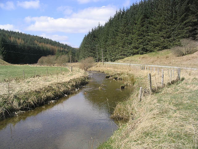
River Teviot
The River Teviot (; Scottish Gaelic: Abhainn Tìbhiot), or Teviot Water, is a river of the Scottish Borders area of Scotland, and is the largest tributary...

Falnash
Falnash (Scots: Fawenesh) is a village in the Scottish Borders of Scotland. It is near Teviothead, in the former Roxburghshire, and in the parish of Teviothead...
Caerlanrig
Caerlanrig - also spelled 'Carlenrig' - (Gaelic: Cathair Lannraig) is a hamlet in the parish of Cavers, Borders, Scotland, lying on the River Teviot, 6...

Teviothead
Teviothead (Scottish Gaelic: Ceann Tìbhiot) is a small village and civil parish in Teviotdale in the Scottish Borders, known locally as Teviotheid. It...

Craik, Scottish Borders
Craik is a hamlet in Craik Forest, by the Airhouse Burn in the Scottish Borders area of Scotland, close to Roberton, Scottish Borders (grid reference NT348084...
Craik Forest
Craik Forest is a forest near Hawick in the Scottish Borders area of Scotland, and managed by the Forestry Commission. It is adjoined to the south-west...

Unthank, Dumfries and Galloway
Unthank is a village in Dumfries and Galloway, Scotland. == References == The geographic coordinates are from the Ordnance Survey.

Cauldcleuch Head
Cauldcleuch Head is a hill in an unnamed range of Roxburghshire hills north of Langholm, part of the Southern Uplands of Scotland. The highest hill in...
Nearby Amenities
Located within 500m of 55.312152,-3.0075073Have you been to Commonbrae Hill?
Leave your review of Commonbrae Hill below (or comments, questions and feedback).