Battle Law
Hill, Mountain in Fife
Scotland
Battle Law

Battle Law is a prominent hill located in the region of Fife, Scotland. Rising to an elevation of approximately 286 meters (938 feet), it forms part of the picturesque Lomond Hills range. The hill is situated near the village of Falkland, which lies about 30 kilometers (18.6 miles) west of the city of St Andrews.
The name "Battle Law" is derived from its historical significance as a site of ancient battles. It is believed that the hill was a strategic location during conflicts between various clans and armies, including the Picts and the Vikings. The remnants of ancient forts and defensive structures can still be seen atop Battle Law, serving as a reminder of its historical importance.
The hill offers breathtaking panoramic views of the surrounding countryside, with vistas extending as far as the Firth of Forth and the East Neuk of Fife. Hiking enthusiasts and nature lovers are drawn to Battle Law for its well-marked trails and scenic beauty. The hill is home to a diverse range of flora and fauna, including heather, gorse, and various bird species.
Visitors to Battle Law can access the hill through a network of paths and tracks that lead to the summit. The ascent is relatively moderate, making it suitable for individuals of various fitness levels. At the top, visitors are rewarded with stunning vistas and the opportunity to explore the ancient ruins and earthworks.
Overall, Battle Law is a historically significant and visually striking hill, attracting visitors who seek a combination of natural beauty and cultural heritage in Fife, Scotland.
If you have any feedback on the listing, please let us know in the comments section below.
Battle Law Images
Images are sourced within 2km of 56.399171/-3.0368035 or Grid Reference NO3623. Thanks to Geograph Open Source API. All images are credited.


Battle Law is located at Grid Ref: NO3623 (Lat: 56.399171, Lng: -3.0368035)
Unitary Authority: Fife
Police Authority: Fife
What 3 Words
///ferried.manhole.radically. Near Invergowrie, Perth & Kinross
Nearby Locations
Related Wikis
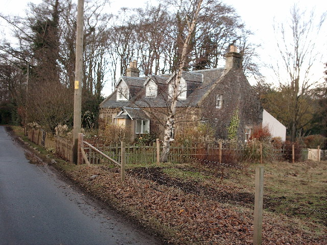
Bottomcraig
Bottomcraig is a village in Fife, Scotland located near Balmerino and The Gauldry. The village is home to Balmerino Parish Church, built in 1811, and the...

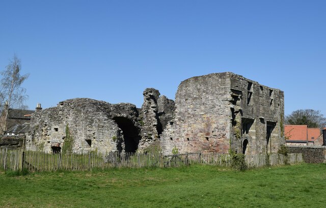
Balmerino Abbey
Balmerino Abbey, or St Edward's Abbey, in Balmerino, Fife, Scotland, was a Cistercian monastic community which has been ruinous since the 16th century...
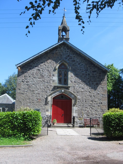
Balmerino Parish Church
Balmerino Parish Church is a Church of Scotland parish church in Bottomcraig, Fife, Scotland. The church sits in the centre of the small village where...

Balmerino
Balmerino is a small village and former monastic centre in Fife, Scotland. It is the home of Balmerino Abbey and the former abbots of Balmerino who were...
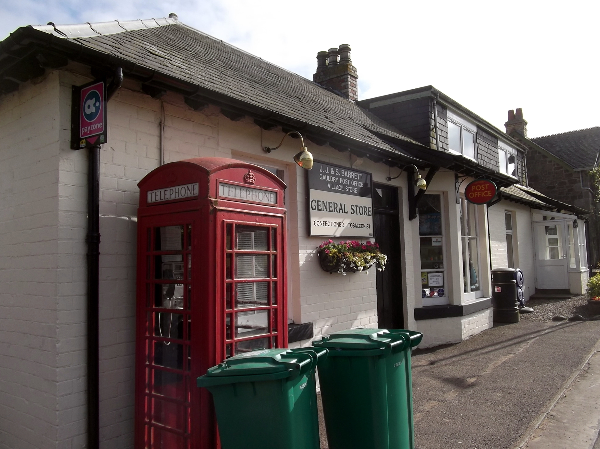
Gauldry
Gauldry, locally sometimes The Gauldry, is a village in Fife, Scotland. It is located 3 kilometres (1.9 mi) southwest of Newport on Tay, 2 kilometres...

Birkhill Castle
Birkhill Castle is a stately home, the residence of the Earl of Dundee, located on the banks of the River Tay, a short drive from St. Andrews. The castle...
Kilmany railway station
Kilmany railway station served the village of Kilmany, Fife, Scotland from 1909 to 1951 on the Newburgh and North Fife Railway. == History == The station...

Kilmany
Kilmany (Scottish Gaelic: Cille Mheinidh) is a village and parish in Fife, Scotland. It is located on the A92 between Auchtermuchty and the Tay Road Bridge...
Nearby Amenities
Located within 500m of 56.399171,-3.0368035Have you been to Battle Law?
Leave your review of Battle Law below (or comments, questions and feedback).