Pike Hill
Hill, Mountain in Roxburghshire
Scotland
Pike Hill

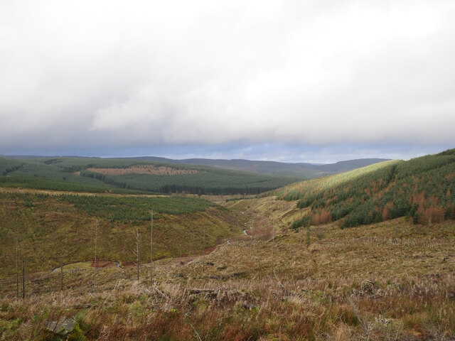
Pike Hill is a prominent hill located in Roxburghshire, a historic county in the Scottish Borders region of Scotland. Situated in the Southern Uplands, Pike Hill is part of a range of hills known as the Moorfoot Hills. It stands at an elevation of approximately 518 meters (1,699 feet).
The hill is known for its distinctive conical shape, which makes it easily recognizable from the surrounding landscape. Its summit offers breathtaking panoramic views of the surrounding countryside, including the rolling hills, valleys, and distant peaks. On a clear day, it is possible to see as far as the Cheviot Hills, which mark the border between Scotland and England.
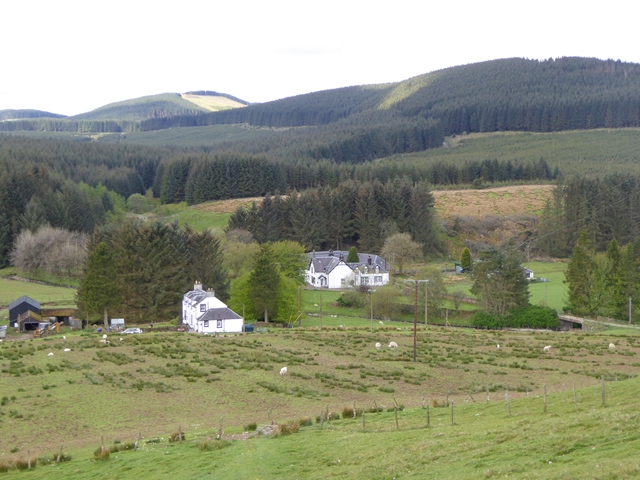
Pike Hill is a popular destination for outdoor enthusiasts, including hikers and walkers, who are attracted by its natural beauty and the opportunity to explore the surrounding area. There are various routes to reach the summit, with some starting from nearby villages such as Oxnam or Crailing. These routes often traverse open moorland and can be quite challenging, particularly in adverse weather conditions.
The hill is also home to a variety of wildlife, including birds of prey such as buzzards and kestrels, as well as grouse and other upland species. The surrounding area is characterized by heather moorland, which provides a habitat for a range of plant and animal species.
Pike Hill is a significant landmark in the region, offering both recreational opportunities and a chance to appreciate the natural beauty of Roxburghshire's countryside.
If you have any feedback on the listing, please let us know in the comments section below.
Pike Hill Images
Images are sourced within 2km of 55.339379/-3.0152144 or Grid Reference NT3505. Thanks to Geograph Open Source API. All images are credited.


Pike Hill is located at Grid Ref: NT3505 (Lat: 55.339379, Lng: -3.0152144)
Unitary Authority: The Scottish Borders
Police Authority: The Lothians and Scottish Borders
What 3 Words
///dignify.laptops.boomer. Near Teviothead, Scottish Borders
Nearby Locations
Related Wikis

Falnash
Falnash (Scots: Fawenesh) is a village in the Scottish Borders of Scotland. It is near Teviothead, in the former Roxburghshire, and in the parish of Teviothead...

Craik, Scottish Borders
Craik is a hamlet in Craik Forest, by the Airhouse Burn in the Scottish Borders area of Scotland, close to Roberton, Scottish Borders (grid reference NT348084...

River Teviot
The River Teviot (; Scottish Gaelic: Abhainn Tìbhiot), or Teviot Water, is a river of the Scottish Borders area of Scotland, and is the largest tributary...
Caerlanrig
Caerlanrig - also spelled 'Carlenrig' - (Gaelic: Cathair Lannraig) is a hamlet in the parish of Cavers, Borders, Scotland, lying on the River Teviot, 6...
Craik Forest
Craik Forest is a forest near Hawick in the Scottish Borders area of Scotland, and managed by the Forestry Commission. It is adjoined to the south-west...

Teviothead
Teviothead (Scottish Gaelic: Ceann Tìbhiot) is a small village and civil parish in Teviotdale in the Scottish Borders, known locally as Teviotheid. It...
Buccleuch, Scottish Borders
East and West Buccleuch ( bə-KLOO) are two homesteads in the Scottish Borders, in the Ettrick parish of historic Selkirkshire. They are located off the...

Burnfoot, Roberton
Burnfoot (Scottish Gaelic: Bun na h-Aibhne) is a hamlet in the Scottish Borders area of Scotland, close to Roberton, by the Borthwick Water. The nearest...
Have you been to Pike Hill?
Leave your review of Pike Hill below (or comments, questions and feedback).