Broom Knowe

Hill, Mountain in Aberdeenshire

Scotland

Broom Knowe

Minor road at Aldunie Looking south-westward.
Minor road at Aldunie Credit: Peter Wood

Broom Knowe is a small hill located in Aberdeenshire, Scotland. It is situated near the town of Stonehaven and offers stunning views of the surrounding countryside. The hill is relatively easy to climb, making it a popular destination for hikers and nature enthusiasts.

Broom Knowe is covered in lush green vegetation, including heather, grasses, and wildflowers. The hill is also home to a variety of wildlife, including birds, rabbits, and deer. Visitors to Broom Knowe may also spot sheep grazing in the fields surrounding the hill.

At the summit of Broom Knowe, hikers are rewarded with panoramic views of the Aberdeenshire countryside, including the North Sea coast and the rolling hills of the surrounding area. On a clear day, it is possible to see as far as the mountains of the Cairngorms National Park.

Overall, Broom Knowe is a picturesque and peaceful spot for outdoor exploration and relaxation. Its accessible location and stunning views make it a must-visit destination for nature lovers in Aberdeenshire.

If you have any feedback on the listing, please let us know in the comments section below.

Broom Knowe Images

Images are sourced within 2km of 57.316248/-3.0703456 or Grid Reference NJ3525. Thanks to Geograph Open Source API. All images are credited.

Minor road at Aldunie Looking south-westward.
Minor road at Aldunie
Looking south-westward.
Minor road at Aldunie This lane is a cul-de-sac, terminating at Aldivalloch, less than a mile ahead (and in the same square).
Minor road at Aldunie
This lane is a cul-de-sac, terminating at Aldivalloch, less than a mile ahead (and in the same square).
Dead Wife's Hillock Having finally reached the top of Dead Wife's Hillock after another uphill slog, albeit not as far or as high as the previous one, we could look down to the 'promised land' of the Cabrach, where our friend would be ready to whisk us home. But the best laid plans .... This is also the point where we got enough of a signal to receive a text message telling us that said friend had gone out on his motor bike, and had broken down in a fairly remote area. Another friend would be coming to meet us .... and at this point the signal failed again and the phone's external backup battery went flat, forcibly demonstrating the extreme undesirability of relying on mobile phones in the wilds. The hill at far right is the Buck, and Tap o' Noth is just visible at far left. I think the hill in the middle of the skyline is Bennachie.
Dead Wife's Hillock
Having finally reached the top of Dead Wife's Hillock after another uphill slog, albeit not as far or as high as the previous one, we could look down to the 'promised land' of the Cabrach, where our friend would be ready to whisk us home. But the best laid plans .... This is also the point where we got enough of a signal to receive a text message telling us that said friend had gone out on his motor bike, and had broken down in a fairly remote area. Another friend would be coming to meet us .... and at this point the signal failed again and the phone's external backup battery went flat, forcibly demonstrating the extreme undesirability of relying on mobile phones in the wilds. The hill at far right is the Buck, and Tap o' Noth is just visible at far left. I think the hill in the middle of the skyline is Bennachie.
Hillhead of Largue The tree, and a few rickles o' stanes beside it, are all that remains of several substantial buildings making up Hillhead of Largue. Further down the brae is Aldivalloch.
Hillhead of Largue
The tree, and a few rickles o' stanes beside it, are all that remains of several substantial buildings making up Hillhead of Largue. Further down the brae is Aldivalloch.
Information Point The information point provides maps and details of walking routes on the Cabrach, Glenfiddich and Glenlivet estates. Since I took <a href="https://www.geograph.org.uk/photo/341414">NJ3526 : Keeper's Cottage at Aldivalloch</a> over 13 years ago, the abandoned cottage has been restored and is now occupied, and a small car park provided for people wishing to enjoy walking and cycling here.
Information Point
The information point provides maps and details of walking routes on the Cabrach, Glenfiddich and Glenlivet estates. Since I took NJ3526 : Keeper's Cottage at Aldivalloch over 13 years ago, the abandoned cottage has been restored and is now occupied, and a small car park provided for people wishing to enjoy walking and cycling here.
Steplar Way Trailhead The information boards at the car park at the Cabrach (east) end of the Steplar Way.
Steplar Way Trailhead
The information boards at the car park at the Cabrach (east) end of the Steplar Way.
Cattle at Aldivalloch The Steplar Way passes through a field currently occupied by a herd of cattle. The glen beyond them is the course of the Perkie Burn.
Cattle at Aldivalloch
The Steplar Way passes through a field currently occupied by a herd of cattle. The glen beyond them is the course of the Perkie Burn.
Cabrach 'Panorama' It's not a proper panorama, of course, because it isn't a 360º view, but a view from the Steplar Way to the Cabrach. The Buck is hidden in the low cloud.
Cabrach 'Panorama'
It's not a proper panorama, of course, because it isn't a 360º view, but a view from the Steplar Way to the Cabrach. The Buck is hidden in the low cloud.
Hillhead of Largue A few scraps of foundations and a rowan tree are all that survive of the farm at Hillhead of Largue. One of many beliefs associated with the rowan is that it has the power to ward off evil, and therefore planting rowans on either side of your door would prevent witches, the devil and other malicious spirits entering the house.
Hillhead of Largue
A few scraps of foundations and a rowan tree are all that survive of the farm at Hillhead of Largue. One of many beliefs associated with the rowan is that it has the power to ward off evil, and therefore planting rowans on either side of your door would prevent witches, the devil and other malicious spirits entering the house.
White Heather (Calluna vulgaris) This is the genuine and original lucky white heather. I think it's only the second time I have ever seen it growing in the wild.
White Heather (Calluna vulgaris)
This is the genuine and original lucky white heather. I think it's only the second time I have ever seen it growing in the wild.
Keeper's Cottage Renovated and smartened up since <a href="https://www.geograph.org.uk/photo/341414">NJ3526 : Keeper's Cottage at Aldivalloch</a> was taken, and the wrought iron snow collectors have been installed since <a href="https://www.geograph.org.uk/photo/6571481">NJ3526 : Information Point</a>.
Keeper's Cottage
Renovated and smartened up since NJ3526 : Keeper's Cottage at Aldivalloch was taken, and the wrought iron snow collectors have been installed since NJ3526 : Information Point.
Hillhead of Largue The site of Hillhead is marked by a tree <a href="https://www.geograph.org.uk/photo/6946418">NJ3526 : Hillhead of Largue</a>.
Hillhead of Largue
The site of Hillhead is marked by a tree NJ3526 : Hillhead of Largue.
Bowmans A long-abandoned cottage near Aldunie.
Bowmans
A long-abandoned cottage near Aldunie.
Bowmans Standing forlornly below a complex of old field dykes.
Bowmans
Standing forlornly below a complex of old field dykes.
Wayside Ditch Just beyond the field gate above Aldivalloch.
Wayside Ditch
Just beyond the field gate above Aldivalloch.
Beside the Track The track leads to Dead Wife's Hillock and then over to the Black Water. The distant heather-covered ridge is the slope of Rounamuck Hill.
Beside the Track
The track leads to Dead Wife's Hillock and then over to the Black Water. The distant heather-covered ridge is the slope of Rounamuck Hill.
Track to Dead Wife's Hillock The track crosses the watershed between Rounumuck Hill (left) and Round Hill (right).
Track to Dead Wife's Hillock
The track crosses the watershed between Rounumuck Hill (left) and Round Hill (right).
Track below Dead Wife's Hillock Looking downhill to the Cabrach.
Track below Dead Wife's Hillock
Looking downhill to the Cabrach.
Show me another place!

Broom Knowe is located at Grid Ref: NJ3525 (Lat: 57.316248, Lng: -3.0703456)

Unitary Authority: Moray

Police Authority: North East

What 3 Words

///barstool.troubled.burglars. Near Dufftown, Moray

Related Wikis

Cabrach

The Cabrach (Scottish Gaelic: A' Chabrach, A' Chabraich) is an estate and largely depopulated rural community in Moray, Scotland. The meaning of the name...

Badenyon

Badenyon (from Scottish Gaelic: Bad an Eòin - Knoll of the Birds) is a former clachan, or village, in Aberdeenshire, Scotland. The last farming inhabitant...

Badenyon Castle

Badenyon Castle was a castle, dating from the 13th century around 7.5 miles (12.1 km) west of Kildrummy, north of Coulins Burn, in Aberdeenshire, Scotland...

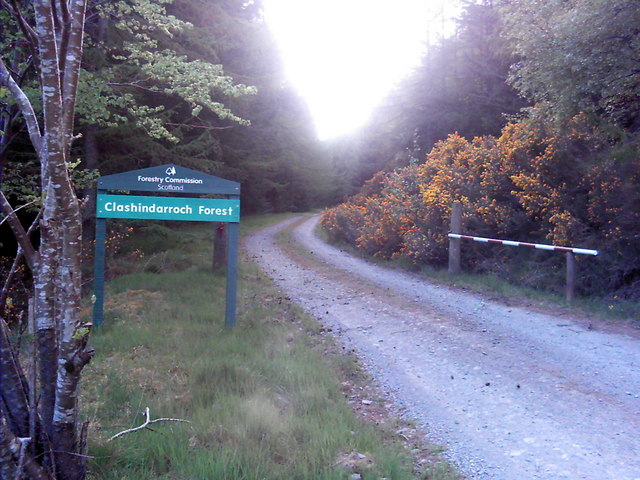
Clashindarroch Forest

Clashindarroch Forest is possibly the largest forest in Aberdeenshire, situated to the south-west of the market town of Huntly. Managed by Forest Enterprise...

Nearby Amenities

Located within 500m of 57.316248,-3.0703456
Power: pole
Lat/Long: 57.3145309/-3.063515
Power: pole
Lat/Long: 57.3150343/-3.0628085
The data included in this document is from www.openstreetmap.org. The data is made available under ODbL.

Have you been to Broom Knowe?

Leave your review of Broom Knowe below (or comments, questions and feedback).