Addergill Hill

Hill, Mountain in Dumfriesshire

Scotland

Addergill Hill

Kirkton, in the valley of the Ewes Water Looking up to the valley of Hare Hope.
Kirkton, in the valley of the Ewes Water Credit: M J Richardson

Addergill Hill is a prominent hill located in Dumfriesshire, a region in the southwest of Scotland. Rising to an elevation of approximately 473 meters (1552 feet), it is classified as a hill rather than a mountain but still offers stunning panoramic views of the surrounding countryside.

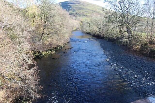
Situated near the village of Carronbridge, Addergill Hill is part of the Southern Uplands, a range of low-lying hills known for their picturesque landscapes and rolling green hills. It is a popular destination for hikers and outdoor enthusiasts, who are drawn to the area for its natural beauty and tranquil surroundings.

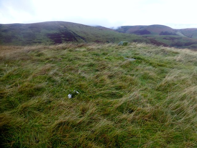
The hill is primarily composed of granite, which gives it a distinctive appearance and contributes to its rugged charm. Its slopes are covered in heather and grass, providing a habitat for a variety of wildlife, including birds, rabbits, and occasionally deer.

A well-defined path leads to the summit of Addergill Hill, offering walkers a relatively straightforward ascent. From the top, visitors are rewarded with breathtaking views of the surrounding countryside, including the nearby Nith Valley and the rolling hills of Dumfriesshire.

In addition to its natural beauty, Addergill Hill also has historical significance. The area is dotted with ancient ruins and archaeological sites, including the remains of Iron Age forts and burial mounds, providing a glimpse into the region's rich history.

Overall, Addergill Hill is a captivating destination that combines natural beauty, outdoor recreation, and historical interest, making it a must-visit location for those exploring the Dumfriesshire region.

If you have any feedback on the listing, please let us know in the comments section below.

Addergill Hill Images

Images are sourced within 2km of 55.202684/-3.0212072 or Grid Reference NY3590. Thanks to Geograph Open Source API. All images are credited.

Kirkton, in the valley of the Ewes Water Looking up to the valley of Hare Hope.
Kirkton, in the valley of the Ewes Water
Looking up to the valley of Hare Hope.
Pasture at Ewes Looking across the track to Kirkton, to Brieryshaw Hill
Pasture at Ewes
Looking across the track to Kirkton, to Brieryshaw Hill
Blackthorn at Brieryshaw The Blackthorn [Prunus spinosa] has been magnificent this Spring - a bumper year for sloe gin; return in October/November. Beyond is Brittleston Height.
Blackthorn at Brieryshaw
The Blackthorn [Prunus spinosa] has been magnificent this Spring - a bumper year for sloe gin; return in October/November. Beyond is Brittleston Height.
Ewes Parish Church And burial ground - just hanging on, with one service a month.
Ewes Parish Church
And burial ground - just hanging on, with one service a month.
Ewes Parish Church
Ewes Parish Church
Ewes War Memorial, and church details The details indicate that it is a part-time church, with one service a month.
Ewes War Memorial, and church details
The details indicate that it is a part-time church, with one service a month.
River Esk at Burnfoot
Farm road, Brieryshaw Leads from the A7 to the hill grazing.
Farm road, Brieryshaw
Leads from the A7 to the hill grazing.
Ewes Parish Church Ewes Parish Church is an attractive rural stone-built Gothic style church dating from 1867. Some of the graves are much older than the church, dating from the 17th to 20th centuries. There is a monthly service on the 3rd Sunday of each month at 6.00 pm. The church is a Category B listed building. <span class="nowrap"><a title="https://www.britishlistedbuildings.co.uk/200342034-ewes-parish-church-and-churchyard-ewes#.WwlfMDGWzwo" rel="nofollow ugc noopener" href="https://www.britishlistedbuildings.co.uk/200342034-ewes-parish-church-and-churchyard-ewes#.WwlfMDGWzwo">Link</a><img style="margin-left:2px;" alt="External link" title="External link - shift click to open in new window" src="https://s1.geograph.org.uk/img/external.png" width="10" height="10"/></span>
Ewes Parish Church
Ewes Parish Church is an attractive rural stone-built Gothic style church dating from 1867. Some of the graves are much older than the church, dating from the 17th to 20th centuries. There is a monthly service on the 3rd Sunday of each month at 6.00 pm. The church is a Category B listed building. LinkExternal link
Grassland, Ewes
Grassland, Ewes
Ewes Parish Church
Ewes Parish Church
Ewes Parish Church
Ewes Parish Church
Ewes Parish Church Beside the A7, the layby is a previous alignment of the road.
Ewes Parish Church
Beside the A7, the layby is a previous alignment of the road.
Ewes Parish Church Viewed from the west.
Ewes Parish Church
Viewed from the west.
Ordnance Survey Flush Bracket S7374 This can be found on the wall of Ewes Parish Church.
For more detail see : <span class="nowrap"><a title="http://www.bench-marks.org.uk/bm2128" rel="nofollow ugc noopener" href="http://www.bench-marks.org.uk/bm2128">Link</a><img style="margin-left:2px;" alt="External link" title="External link - shift click to open in new window" src="https://s1.geograph.org.uk/img/external.png" width="10" height="10"/></span>
Ordnance Survey Flush Bracket S7374
This can be found on the wall of Ewes Parish Church. For more detail see : LinkExternal link
Crags, Wrae Hill
Crags, Wrae Hill
Heading down hill to the settlement of Sorbie and the A7
Wrae Hill Parked by the cattle grid to the ENE on minor road then up Wrae Hill and onto Potholm Hill with Phil Cooper.
Name: Wrae Hill
Hill number: 7489
Height: 308m / 1010ft
Parent (Ma/M): 1920  Pikethaw Hill
Section: 28B: The River Tweed to the English Border
Area: Roxburgh
County/UA: Dumfries and Galloway (UA)
Class: Tump (300-399m), subHuMP
Grid ref: NY361890 (est)
Drop: 96m
Col: 212m  NY361884
Wrae Hill
Parked by the cattle grid to the ENE on minor road then up Wrae Hill and onto Potholm Hill with Phil Cooper. Name: Wrae Hill Hill number: 7489 Height: 308m / 1010ft Parent (Ma/M): 1920 Pikethaw Hill Section: 28B: The River Tweed to the English Border Area: Roxburgh County/UA: Dumfries and Galloway (UA) Class: Tump (300-399m), subHuMP Grid ref: NY361890 (est) Drop: 96m Col: 212m NY361884
Show me another place!

Addergill Hill is located at Grid Ref: NY3590 (Lat: 55.202684, Lng: -3.0212072)

Unitary Authority: Dumfries and Galloway

Police Authority: Dumfries and Galloway

What 3 Words

///airtime.research.roost. Near Bentpath, Dumfries & Galloway

Related Wikis

Ewesdale

Ewesdale is a glen and former lordship in Dumfries and Galloway, Scotland. The Ewes Water runs through the valley from its source at Mosspaul, until it...

Barntalloch Castle

Barntalloch Castle was a castle located at Staplegorton, in Dumfries and Galloway, Scotland. The castle was built in the 12th century by Galfrid de Coninsburgh...

Arkleton

Arkleton is a mansion and estate in the civil parish of Ewes, in Dumfries and Galloway, Scotland. Arkleton House was built in 1860/1884 and incorporates...

Eskdale (Scotland)

Eskdale (Scottish Gaelic: Eisgeadal, IPA:[ˈeʃkʲət̪əɫ̪]) is a glen and former lordship in the county of Dumfriesshire, Scotland. The River Esk flows through...

Nearby Amenities

Located within 500m of 55.202684,-3.0212072
Addergill Hill
Natural: peak
Lat/Long: 55.2026448/-3.0212623
The data included in this document is from www.openstreetmap.org. The data is made available under ODbL.

Have you been to Addergill Hill?

Leave your review of Addergill Hill below (or comments, questions and feedback).