Hurcott

Settlement in Somerset South Somerset

England

Hurcott

St. Mary's, Seavington St. Mary, Somerset Originally built in the 13th Century, the church was extensively rebuilt in the 15th with some restoration in the late 19th.
St. Mary's, Seavington St. Mary, Somerset Credit: Ray Jennings

Hurcott is a small village located in the county of Somerset, England. Situated approximately 4 miles northwest of the town of Bridgwater, it is nestled amidst the picturesque Somerset Levels and Moors. The village is surrounded by rolling hills, lush green fields, and charming farmhouses, offering a tranquil and idyllic countryside setting.

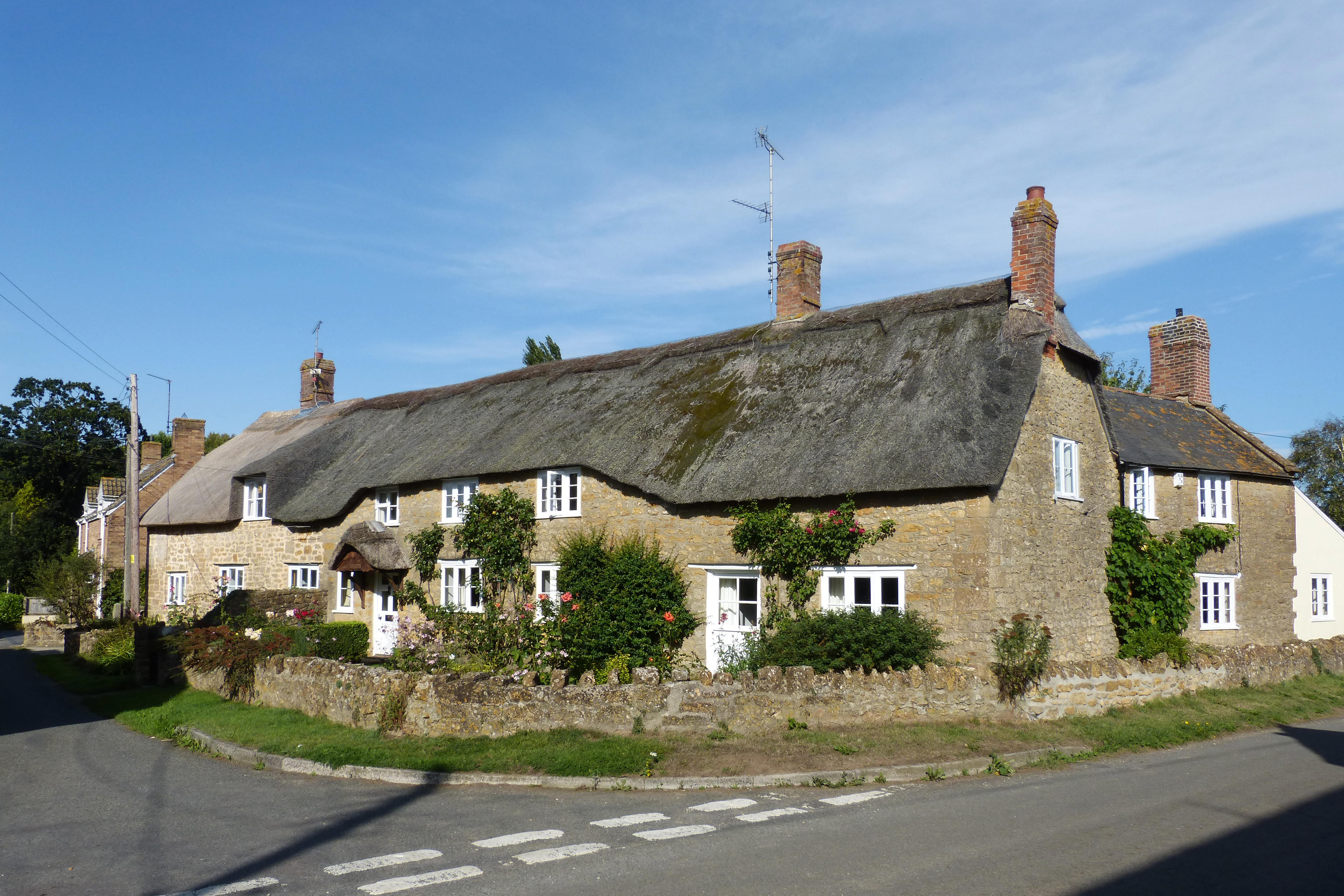
With a population of around 200 residents, Hurcott has a close-knit and friendly community. The village is primarily residential, consisting of a mix of traditional stone cottages and more modern houses. The architecture reflects the rich history and heritage of the area, with some buildings dating back several centuries.

Despite its small size, Hurcott provides a few amenities for its residents. The village has a local pub, offering a cozy atmosphere and serving traditional British food and drinks. There is also a small village hall that hosts various community events and gatherings throughout the year.

The surrounding area offers plenty of outdoor recreational opportunities. The nearby Quantock Hills, designated as an Area of Outstanding Natural Beauty, provide stunning walking and hiking trails, offering breathtaking views of the Somerset countryside. The village is also within easy reach of the beautiful Somerset coast, with popular seaside towns such as Weston-super-Mare and Burnham-on-Sea just a short drive away.

Overall, Hurcott is a charming and peaceful village, perfect for those seeking a rural retreat while still being within easy reach of larger towns and natural attractions.

If you have any feedback on the listing, please let us know in the comments section below.

Hurcott Images

Images are sourced within 2km of 50.940478/-2.860494 or Grid Reference ST3916. Thanks to Geograph Open Source API. All images are credited.

St. Mary's, Seavington St. Mary, Somerset Originally built in the 13th Century, the church was extensively rebuilt in the 15th with some restoration in the late 19th.
St. Mary's, Seavington St. Mary, Somerset
Originally built in the 13th Century, the church was extensively rebuilt in the 15th with some restoration in the late 19th.
St. Mary's, Seavington St. Mary, Somerset The Tower and North wall.
St. Mary's, Seavington St. Mary, Somerset
The Tower and North wall.
St. Mary's, Seavington St. Mary, Somerset North-East corner.
St. Mary's, Seavington St. Mary, Somerset
North-East corner.
St. Mary's, Seavington St. Mary, Somerset The Nave.
St. Mary's, Seavington St. Mary, Somerset
The Nave.
St. Mary's, Seavington St. Mary, Somerset The Chancel and Apse.
St. Mary's, Seavington St. Mary, Somerset
The Chancel and Apse.
St. Michael's, Seavington St. Michael, Somerset Dating from the late 12th Century, alterations and additions were made in both the 15th and 19th Centuries.
St. Michael's, Seavington St. Michael, Somerset
Dating from the late 12th Century, alterations and additions were made in both the 15th and 19th Centuries.
St. Michael's, Seavington St. Michael, Somerset South-East corner.
St. Michael's, Seavington St. Michael, Somerset
South-East corner.
St. Michael's, Seavington St. Michael, Somerset The Nave.
St. Michael's, Seavington St. Michael, Somerset
The Nave.
St. Michael's, Seavington St. Michael, Somerset The Nave - taken from the 19th Century Gallery.
St. Michael's, Seavington St. Michael, Somerset
The Nave - taken from the 19th Century Gallery.
St. Michael's, Seavington St. Michael, Somerset The Font - 12th or 13th Century.
St. Michael's, Seavington St. Michael, Somerset
The Font - 12th or 13th Century.
Whitelackington Village Hall
Whitelackington
Village Hall
Stocklinch Ottersey church Remote from its village
Stocklinch Ottersey church
Remote from its village
Park Lane On the right is Putcombe Copse, which was the site of a C16 deerpark, part of Whitelackington Park. The lane leads to Kingstone.
Park Lane
On the right is Putcombe Copse, which was the site of a C16 deerpark, part of Whitelackington Park. The lane leads to Kingstone.
Hurcott Copse Between the camera and the wooded slopes the A303 lies hidden. In the foreground, Park Lane meets the former main road from Ilminster to Yeovil, now downgraded to unclassified.
Hurcott Copse
Between the camera and the wooded slopes the A303 lies hidden. In the foreground, Park Lane meets the former main road from Ilminster to Yeovil, now downgraded to unclassified.
St Mary's Church, Whitelackington The church is very close to the manor house, and consequently difficult to photograph from the south. <span class="nowrap"><a title="http://webapp1.somerset.gov.uk/her/details.asp?prn=53358" rel="nofollow ugc noopener" href="http://webapp1.somerset.gov.uk/her/details.asp?prn=53358">Link</a><img style="margin-left:2px;" alt="External link" title="External link - shift click to open in new window" src="https://s1.geograph.org.uk/img/external.png" width="10" height="10"/></span>
St Mary's Church, Whitelackington
The church is very close to the manor house, and consequently difficult to photograph from the south. LinkExternal link
Dillington Park A view from the long drive that approaches Dillington House from Whitelackington.
Dillington Park
A view from the long drive that approaches Dillington House from Whitelackington.
Dillington Park Lodge The thatched C17/C18 house is beside the former main road through Whitelackington. Details at <span class="nowrap"><a title="http://webapp1.somerset.gov.uk/her/details.asp?prn=56612" rel="nofollow ugc noopener" href="http://webapp1.somerset.gov.uk/her/details.asp?prn=56612">Link</a><img style="margin-left:2px;" alt="External link" title="External link - shift click to open in new window" src="https://s1.geograph.org.uk/img/external.png" width="10" height="10"/></span> .
Dillington Park Lodge
The thatched C17/C18 house is beside the former main road through Whitelackington. Details at LinkExternal link .
Emergency access slip road to A303 The busy Ilminster bypass runs for 7 miles between junctions, so emergency access routes such as this could be vital. This one is off Boxstone Hill, the lane on the lane, which leads to Shepton Beauchamp.
Emergency access slip road to A303
The busy Ilminster bypass runs for 7 miles between junctions, so emergency access routes such as this could be vital. This one is off Boxstone Hill, the lane on the lane, which leads to Shepton Beauchamp.
Show me another place!

Hurcott is located at Grid Ref: ST3916 (Lat: 50.940478, Lng: -2.860494)

Administrative County: Somerset

District: South Somerset

Police Authority: Avon and Somerset

What 3 Words

///spurring.offshore.tile. Near South Petherton, Somerset

Nearby Locations

Hurcott

Related Wikis

Hurcott Lane Cutting

Hurcott Lane Cutting (grid reference ST398163) is a 0.48 hectare geological Site of Special Scientific Interest in Somerset, notified in 1996. == Sources... ==

Whitelackington

Whitelackington is a village and civil parish on the A303 one mile north east of Ilminster, in Somerset, England. The parish includes Dillington Park and...

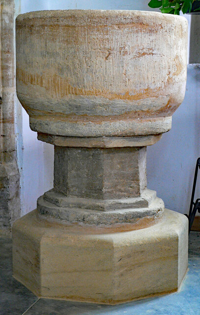
Church of St Mary, Seavington St Mary

The Church of St Mary in Seavington St Mary, Somerset, England, dates from the 15th century and is recorded in the National Heritage List for England as...

Seavington St Mary

Seavington St Mary is a village and civil parish in Somerset, England. It is situated next to the village of Seavington St Michael, about 3 miles (4.8...

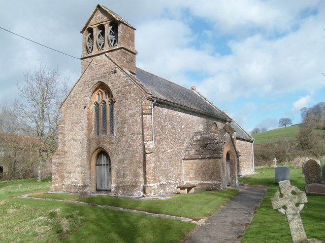
Church of St Mary Magdalene, Stocklinch

The Church of St Mary Magdalen in Stocklinch, Somerset, England, dates from the 13th century. It is recorded in the National Heritage List for England...

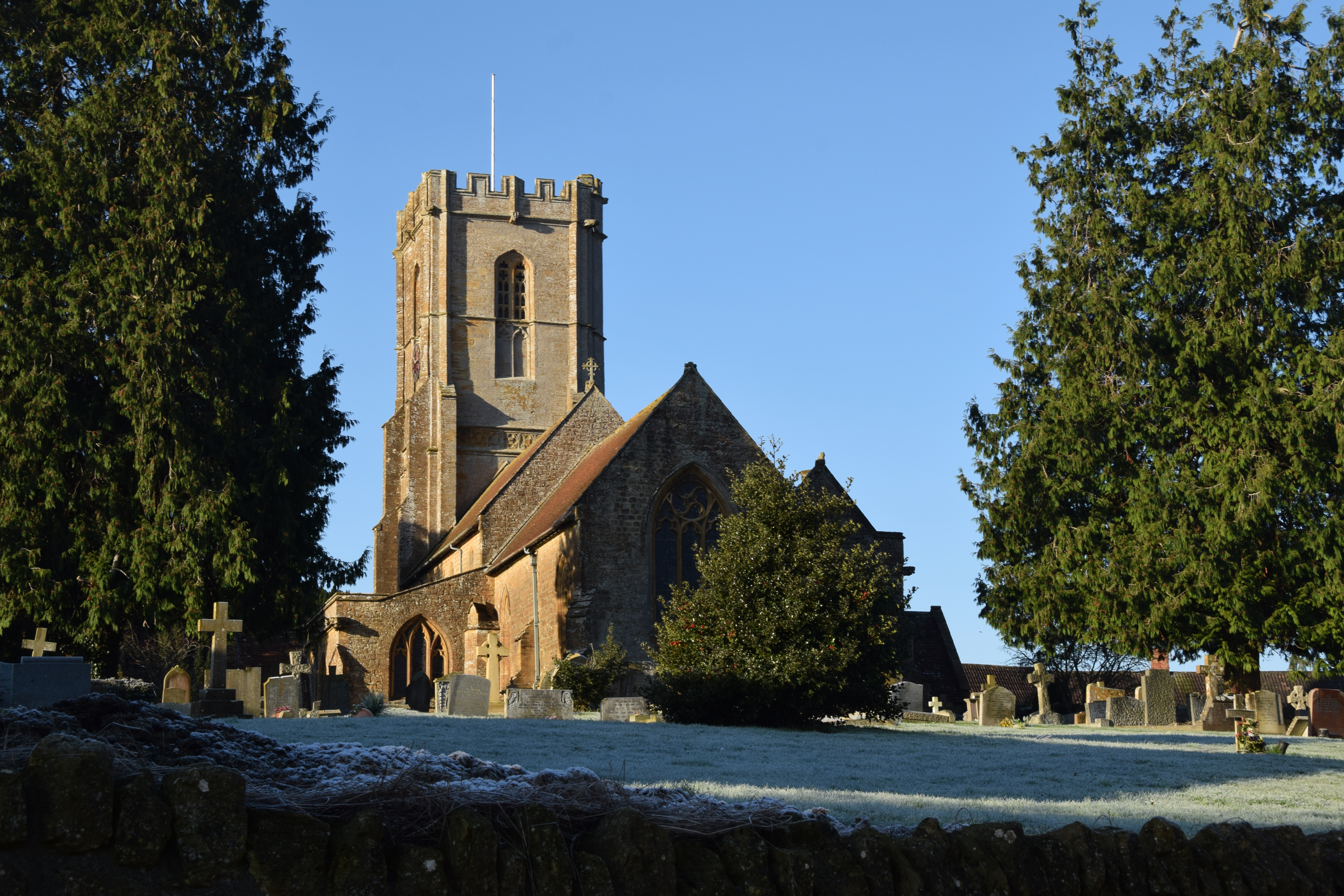
Church of St Michael, Shepton Beauchamp

The Church of St Michael in Shepton Beauchamp, Somerset, England is built of local hamstone, and has 13th-century origins, although it has been extensively...

Seavington St Michael

Seavington St Michael is a village and civil parish in Somerset, England. It is situated next to the village of Seavington St Mary, about 3 miles (4.8...

Shepton Beauchamp

Shepton Beauchamp is a village and civil parish, 1 mile (2 km) from Barrington and 4 miles (6 km) north east of Ilminster between the Blackdown Hills and...

Nearby Amenities

Located within 500m of 50.940478,-2.860494
Hurcott
Place: hamlet
Lat/Long: 50.9409352/-2.8600092
Hurcott Cross
Junction: yes
Lat/Long: 50.9408137/-2.8571685
Power: pole
Lat/Long: 50.9439439/-2.8576684
Power: pole
Lat/Long: 50.9438611/-2.8587332
Power: pole
Lat/Long: 50.9435333/-2.8608254
Power: pole
Lat/Long: 50.9434741/-2.8618312
Power: pole
Lat/Long: 50.9433626/-2.8636685
Power: pole
Lat/Long: 50.9432645/-2.8648648
Power: pole
Lat/Long: 50.9432071/-2.8660101
The data included in this document is from www.openstreetmap.org. The data is made available under ODbL.

Have you been to Hurcott?

Leave your review of Hurcott below (or comments, questions and feedback).