Garvald Law

Hill, Mountain in Midlothian

Scotland

Garvald Law

B709 near Dewar
B709 near Dewar Credit: Steven Brown

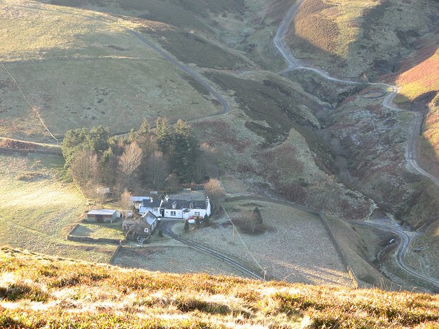
Garvald Law is a prominent hill located in Midlothian, Scotland. It stands at an elevation of 2,073 feet (632 meters) above sea level and is part of the Moorfoot Hills range. The hill is situated near the village of Garvald, which lies to the west of the hill.

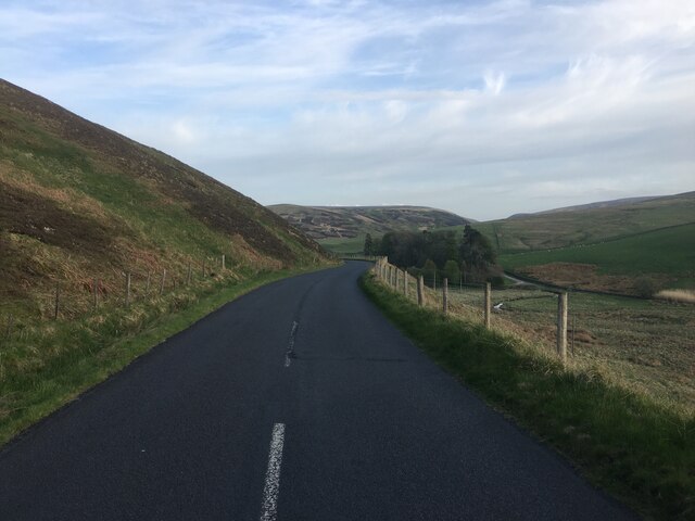
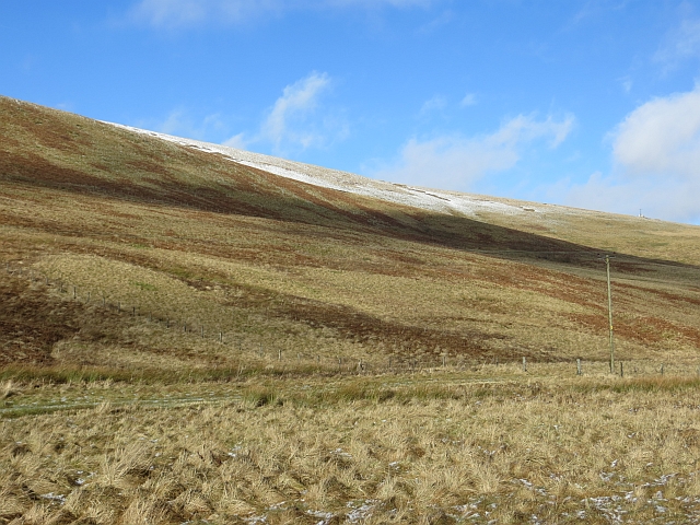
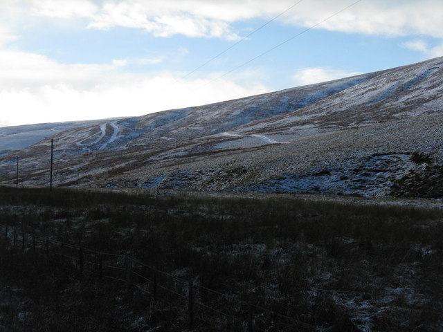
Garvald Law offers stunning views of the surrounding countryside, including the rolling hills and valleys of Midlothian. It is a popular destination for hikers and outdoor enthusiasts, with a number of walking and hiking trails leading to the summit. The hill is also home to a variety of wildlife, including birds of prey such as buzzards and kestrels.

The name "Garvald Law" is thought to derive from the Old English words "geard" meaning enclosure, and "weald" meaning forest, suggesting that the hill may have once been part of a wooded area. Today, Garvald Law is a peaceful and tranquil spot, perfect for those looking to escape the hustle and bustle of city life and enjoy the natural beauty of the Scottish countryside.

If you have any feedback on the listing, please let us know in the comments section below.

Garvald Law Images

Images are sourced within 2km of 55.737789/-3.0499979 or Grid Reference NT3449. Thanks to Geograph Open Source API. All images are credited.

B709 near Dewar
B709 near Dewar
B709 near Dewar
B709 near Dewar
Farm track near Garvald Law
Small footbridge and metal shed by the Blackhope Water At the confluence of the Wooly Burn and the Blackhope Water.
Small footbridge and metal shed by the Blackhope Water
At the confluence of the Wooly Burn and the Blackhope Water.
B709 near Garvald Lodge
B7007 near Garvald
B7007 near Garvald
Old metal shed or bothy below Wooly Law By the side of the Blackhope Water, a tiny burn at this point in the midst of the Moorfoot Hills.
Old metal shed or bothy below Wooly Law
By the side of the Blackhope Water, a tiny burn at this point in the midst of the Moorfoot Hills.
Sheepfold Sheepfold near Dewar passed on the way towards Blackhope Scar.  Most structures today referred to as sheepfolds are ancient dry stone semicircles, with no roof and are one of the oldest types of livestock enclosures.
Sheepfold
Sheepfold near Dewar passed on the way towards Blackhope Scar. Most structures today referred to as sheepfolds are ancient dry stone semicircles, with no roof and are one of the oldest types of livestock enclosures.
Club run, B709, Midlothian Heading up the long steady climb to a pass in the Moorfoot Hills.
Club run, B709, Midlothian
Heading up the long steady climb to a pass in the Moorfoot Hills.
B709, Dewar Approaching the pass at Dewar Gill.
B709, Dewar
Approaching the pass at Dewar Gill.
Track, Gairs Muir Track up into the Moorfoot Hills from Dewar.
Track, Gairs Muir
Track up into the Moorfoot Hills from Dewar.
Gairs Muir Grassy moorland and rough grazing between Garvald Lodge and Dewar, Moorfoot Hills.
Gairs Muir
Grassy moorland and rough grazing between Garvald Lodge and Dewar, Moorfoot Hills.
The B709 in the valley of the Dewar Burn Looking north towards Heriot and the A7, with the slopes of Garvald Law on the left.
The B709 in the valley of the Dewar Burn
Looking north towards Heriot and the A7, with the slopes of Garvald Law on the left.
The Dewar Burn valley Looking west to the slopes of Garvald Hill, with a circular sheep fold camouflaged by the snow and heather.
The Dewar Burn valley
Looking west to the slopes of Garvald Hill, with a circular sheep fold camouflaged by the snow and heather.
Sheep fold at Wolf Cleugh At the foot of Peat Rig.
Sheep fold at Wolf Cleugh
At the foot of Peat Rig.
The B709 at Dewar Looking north in the direction of Heriot and Innerleithen.
The B709 at Dewar
Looking north in the direction of Heriot and Innerleithen.
Winter borderland Looking across the Dewar Burn to Gairs Muir, north of Dewar.
Winter borderland
Looking across the Dewar Burn to Gairs Muir, north of Dewar.
Gairs Muir A low hill to the west of the B709 north of Dewar, which is seen at the left.
Gairs Muir
A low hill to the west of the B709 north of Dewar, which is seen at the left.
Show me another place!

Garvald Law is located at Grid Ref: NT3449 (Lat: 55.737789, Lng: -3.0499979)

Unitary Authority: The Scottish Borders

Police Authority: The Lothians and Scottish Borders

What 3 Words

///clerk.luring.verse. Near Gorebridge, Midlothian

Related Wikis

Dewar, Scottish Borders

Dewar is a fermtoun by the Dewar Burn and Peatrig Hill, in the Scottish Borders area of Scotland.Places nearby include Allanshaugh, Borthwick Hall, Fountainhall...

Garvald, Scottish Borders

Garvald (Scots: Garvit) is a hamlet on the B7007, near Dewar, by the Dewar Burn, in the Moorfoot Hills, in the Scottish Borders area of Scotland, in the...

Moorfoot Hills

The Moorfoot Hills are a range of hills south of Edinburgh in east central Scotland, one of the ranges which collectively form the Southern Uplands....

Peatrig Hill

Peatrig Hill is a minor hill in Scotland, located about 15 km south-southeast of Edinburgh. One of the Moorfoot Hills, it is located in the parish of Heriot...

Nearby Amenities

Located within 500m of 55.737789,-3.0499979
Garvald Law
Ele: 512
Natural: peak
Lat/Long: 55.7377931/-3.0499124
The data included in this document is from www.openstreetmap.org. The data is made available under ODbL.

Have you been to Garvald Law?

Leave your review of Garvald Law below (or comments, questions and feedback).