Bowscale Fell

Hill, Mountain in Cumberland Eden

England

Bowscale Fell

Cairn on Bannerdale Crags This is not the highest point of Bannerdale Crags, which lies a short way to the west, but it is the highest point reached by the path which follows the eastern edge of the plateau. The path continues along the edge towards Bowscale Fell.
Cairn on Bannerdale Crags Credit: Andy Waddington

Bowscale Fell is a prominent hill located in the Lake District National Park, in the county of Cumbria, England. Standing at an elevation of 702 meters (2,303 feet), it is classified as a "fell," which is a local term used to describe a hill or mountain in the region.

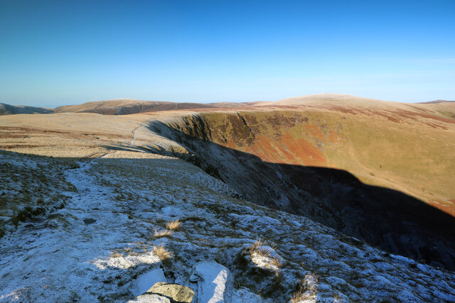
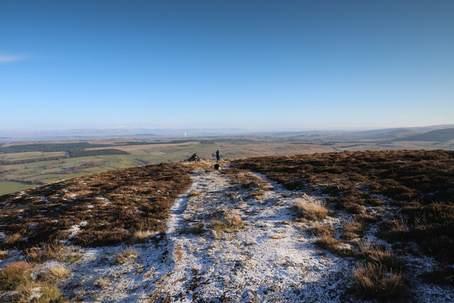
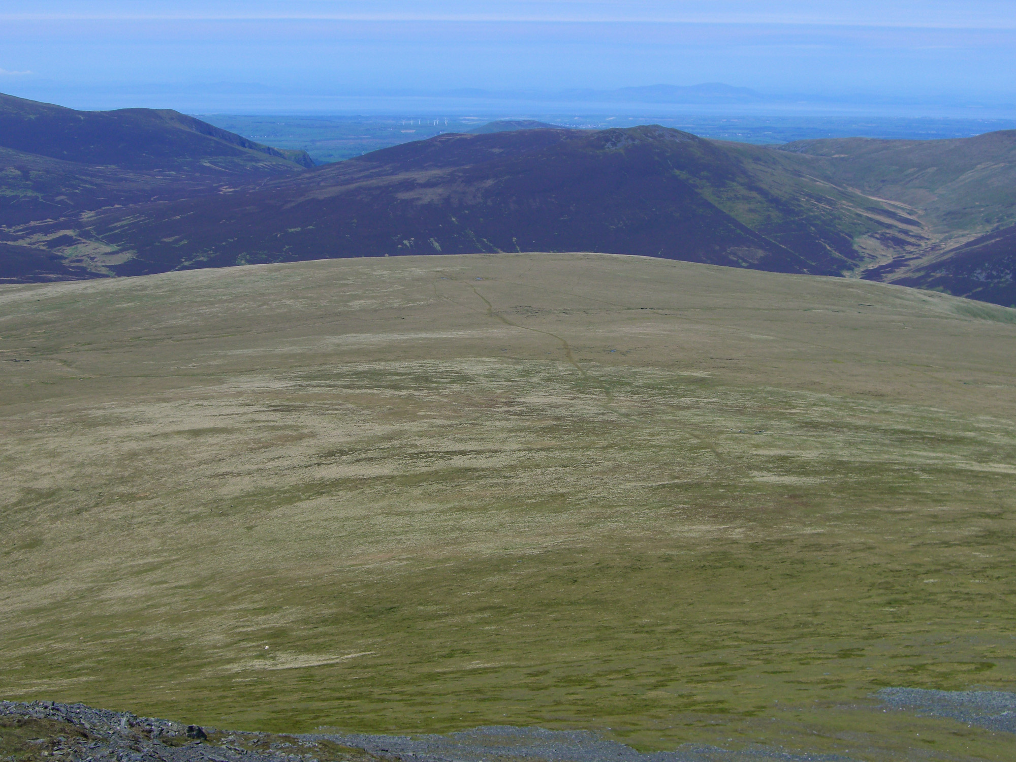
Situated in the northern part of the Lake District, Bowscale Fell offers breathtaking panoramic views of the surrounding landscape. Its location, close to the Caldew Valley and Carrock Fell, enhances its natural beauty. The fell is characterized by its steep slopes covered with grass and heather, making it a popular destination for hikers and walkers seeking an adventurous challenge.

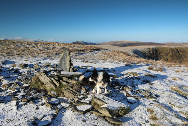
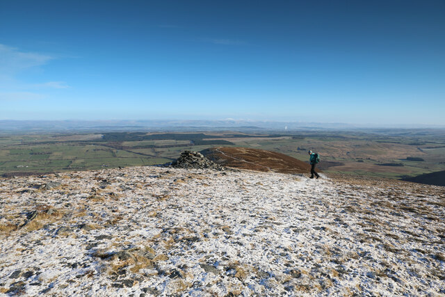
The summit of Bowscale Fell is marked by a cairn, a pile of stones traditionally used as a navigational aid. On clear days, visitors can enjoy stunning vistas that stretch across the Lake District, with notable landmarks such as Blencathra, Skiddaw, and the Helvellyn range visible in the distance. The fell is also known for its abundance of wildlife, including red squirrels and various bird species.

Access to Bowscale Fell is possible from several starting points, including the village of Mungrisdale to the south. The ascent can be challenging, particularly along the steep eastern face, but the reward is a truly memorable experience in one of England's most beautiful natural landscapes. Whether it's for a day hike or part of a longer walking route, Bowscale Fell offers a unique opportunity to immerse oneself in the stunning scenery of the Lake District.

If you have any feedback on the listing, please let us know in the comments section below.

Bowscale Fell Images

Images are sourced within 2km of 54.665537/-3.0350174 or Grid Reference NY3330. Thanks to Geograph Open Source API. All images are credited.

Cairn on Bannerdale Crags This is not the highest point of Bannerdale Crags, which lies a short way to the west, but it is the highest point reached by the path which follows the eastern edge of the plateau. The path continues along the edge towards Bowscale Fell.
Cairn on Bannerdale Crags
This is not the highest point of Bannerdale Crags, which lies a short way to the west, but it is the highest point reached by the path which follows the eastern edge of the plateau. The path continues along the edge towards Bowscale Fell.
Path to Blencathra from Bannerdale Crags Significant paths run from the cairn on Bannerdale Crags SW then W towards Blencathra (seen here) and NW along the edge, curving round to Bowscale Fell or along The Tongue to drop steeply to Mungrisdale. Our approach had been by the rather fainter path from the SE, climbing steeply up White Horse Bent from a footbridge over the infant River Glenderamackin.
Path to Blencathra from Bannerdale Crags
Significant paths run from the cairn on Bannerdale Crags SW then W towards Blencathra (seen here) and NW along the edge, curving round to Bowscale Fell or along The Tongue to drop steeply to Mungrisdale. Our approach had been by the rather fainter path from the SE, climbing steeply up White Horse Bent from a footbridge over the infant River Glenderamackin.
Path to Bowscale Fell From just north of its high point, the path along the edge of Bannerdale Crags heads NNW and curves round northwards to ascend Bowscale Fell (the slightly frosted round summit right of centre) with a branch right heading down into the valley of the River Glenderamackin to reach Mungrisdale.
Path to Bowscale Fell
From just north of its high point, the path along the edge of Bannerdale Crags heads NNW and curves round northwards to ascend Bowscale Fell (the slightly frosted round summit right of centre) with a branch right heading down into the valley of the River Glenderamackin to reach Mungrisdale.
Frosty sedges on Bowscale Fell The path up Bowscale Fell was quite icy and surrounded by somewhat taller vegetation than we'd crossed further south on Bannerdale Crags. There was very little in the way of fallen snow, but all the sedges were heavy with frost making the fell look white and snowy from a distance, as does the Skiddaw massif, seven kilometres to the west.
Frosty sedges on Bowscale Fell
The path up Bowscale Fell was quite icy and surrounded by somewhat taller vegetation than we'd crossed further south on Bannerdale Crags. There was very little in the way of fallen snow, but all the sedges were heavy with frost making the fell look white and snowy from a distance, as does the Skiddaw massif, seven kilometres to the west.
Summit shelter From the small summit shelter on Bowscale Fell, a path leads nrthwards to a junction by the pile of stones, with descents down the NNW and ENE ridges towards the valley of the Caldew. To the right of the photo, a path heads just south of east along the Tongue, to end in a steep descent to Mungrisdale. Behind the photographer is our approach path to this point, coming from Bannerdale Crags (or, more distantly, Mungrisdale Common and Blencathra).
Summit shelter
From the small summit shelter on Bowscale Fell, a path leads nrthwards to a junction by the pile of stones, with descents down the NNW and ENE ridges towards the valley of the Caldew. To the right of the photo, a path heads just south of east along the Tongue, to end in a steep descent to Mungrisdale. Behind the photographer is our approach path to this point, coming from Bannerdale Crags (or, more distantly, Mungrisdale Common and Blencathra).
Bowscale Fell's NNW ridge The rather level summit plateau of Bowscale Fell ends abruptly at steep ground dropping to Bowscale Tarn 180m below in a NE-facing coire. Looking across the corrie, the NNW ridge can be seen, with a network of paths on its lower slopes.
Bowscale Fell's NNW ridge
The rather level summit plateau of Bowscale Fell ends abruptly at steep ground dropping to Bowscale Tarn 180m below in a NE-facing coire. Looking across the corrie, the NNW ridge can be seen, with a network of paths on its lower slopes.
Descending the ENE ridge of Bowscale Fell A ridge heads ENE then east from Bowscale Fell, dropping gently over a couple of small rises before a very steep descent to Mungrisdale. Ahead, there is no more high ground until the Pennines, the low and wide Vale of Eden being separated from these fells by the Carrock End Fault and on the far side from the Alston Block, by various branches of the Pennine Fault.
Descending the ENE ridge of Bowscale Fell
A ridge heads ENE then east from Bowscale Fell, dropping gently over a couple of small rises before a very steep descent to Mungrisdale. Ahead, there is no more high ground until the Pennines, the low and wide Vale of Eden being separated from these fells by the Carrock End Fault and on the far side from the Alston Block, by various branches of the Pennine Fault.
The end of the ridge A ridge heads ENE then east from Bowscale Fell, dropping gently over a couple of small rises before a very steep descent to Mungrisdale just beyond the cairn. Ahead, there is no more high ground until the Pennines, the low and wide Vale of Eden being separated from these fells by the Carrock End Fault and on the far side from the Alston Block, by various branches of the Pennine Fault.
The end of the ridge
A ridge heads ENE then east from Bowscale Fell, dropping gently over a couple of small rises before a very steep descent to Mungrisdale just beyond the cairn. Ahead, there is no more high ground until the Pennines, the low and wide Vale of Eden being separated from these fells by the Carrock End Fault and on the far side from the Alston Block, by various branches of the Pennine Fault.
Cumbria Way and River Caldew below Coomb Height
View across Bannerdale From the path rising alongside The Tongue heading for Bannerdale Crags.
View across Bannerdale
From the path rising alongside The Tongue heading for Bannerdale Crags.
View into Bannerdale
Above Blackhazel Beck On the flank of Mungrisdale Common
Above Blackhazel Beck
On the flank of Mungrisdale Common
View towards Bannerdale crags East ridge. A wild place.
View towards Bannerdale crags East ridge.
A wild place.
The path to Mungrisdale. The rain returns.
The path to Mungrisdale.
The rain returns.
Crags at the top of the east ridge. Bagging Wainwrights from Mungrisdale.
Crags at the top of the east ridge.
Bagging Wainwrights from Mungrisdale.
The ridge from Atkinson Pike The easy way up Blencathra.
The ridge from Atkinson Pike
The easy way up Blencathra.
The Tongue One of the eastern ridges of Bowscale Fell approached from Mungrisdale
The Tongue
One of the eastern ridges of Bowscale Fell approached from Mungrisdale
On The Tongue Attractive Crags on the ascent of The Tongue
On The Tongue
Attractive Crags on the ascent of The Tongue
Show me another place!

Bowscale Fell is located at Grid Ref: NY3330 (Lat: 54.665537, Lng: -3.0350174)

Administrative County: Cumbria

District: Eden

Police Authority: Cumbria

What 3 Words

///excavate.ejects.wisdom. Near Keswick, Cumbria

Nearby Locations

Bowscale Fell

Related Wikis

Bowscale Fell

Bowscale Fell is a hill in the English Lake District. It rises above the village of Mungrisdale in the Northern Fells. Bowscale Fell stands at the extreme...

Bannerdale Crags

Bannerdale Crags is a fell in the English Lake District. It stands between Blencathra and Bowscale Fell in the Northern Fells. == Topography == Bannerdale...

Souther Fell

Souther Fell is a fell in the English Lake District. It stands to the south of Mungrisdale village in the Northern Fells. It is most famous for the appearance...

Mungrisdale Common

Mungrisdale Common, pronounced mun-grize-dl, with emphasis on grize, is a fell in the English Lake District. Although Alfred Wainwright listed it as one...

Bowscale

Bowscale is a hamlet and former civil parish, now in the parish of Mungrisdale, in the Eden district, in the county of Cumbria, England. In 1931 the parish...

Mosedale, Cumbria

Mosedale is a hamlet and former civil parish, now in the parish of Mungrisdale in the Eden district, in the county of Cumbria, in the north west of the...

Mungrisdale

Mungrisdale is a small village and civil parish in the north east of the English Lake District in Cumbria. It is also the name of the valley in which...

Blencathra

Blencathra, also known as Saddleback, is one of the most northerly hills in the English Lake District. It has six separate fell tops, of which the highest...

Nearby Amenities

Located within 500m of 54.665537,-3.0350174
Bowscale Fell
Alt Name: Bowscale
Ele: 702
Natural: peak
Source: npe;https://www.hill-bagging.co.uk/mountaindetails.php?qu=S&rf=2329
Wikidata: Q4951412
Wikipedia: en:Bowscale Fell
Lat/Long: 54.6655423/-3.035059
Man Made: cairn
Lat/Long: 54.662553/-3.0368987
Man Made: cairn
Lat/Long: 54.6661679/-3.0343954
Man Made: cairn
Lat/Long: 54.6655466/-3.0350185
Man Made: cairn
Lat/Long: 54.6686074/-3.0321837
The data included in this document is from www.openstreetmap.org. The data is made available under ODbL.

Have you been to Bowscale Fell?

Leave your review of Bowscale Fell below (or comments, questions and feedback).