Black Craig

Hill, Mountain in Fife

Scotland

Black Craig

Road by Creich Inexplicably part of the Fife Coast Path.
Road by Creich Credit: Richard Webb

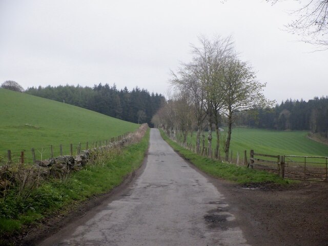
Black Craig is a prominent hill located in Fife, Scotland. Situated around 5 miles southeast of the town of Dunfermline, it is part of the Ochil Hills range. Standing at an elevation of approximately 522 meters (1,713 feet), Black Craig offers breathtaking panoramic views of the surrounding countryside.

The hill is composed mainly of sedimentary rocks, including sandstone and shale, which were formed during the Carboniferous period around 300 million years ago. Its distinct black color is attributed to the presence of coal seams within the rock formations.

The ascent to Black Craig can be challenging, with steep and rugged terrain that requires a moderate level of fitness and hiking experience. However, the effort is rewarded with stunning vistas across the Firth of Forth, the Forth Valley, and the nearby Lomond Hills.

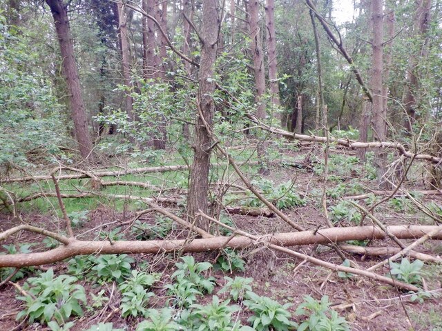
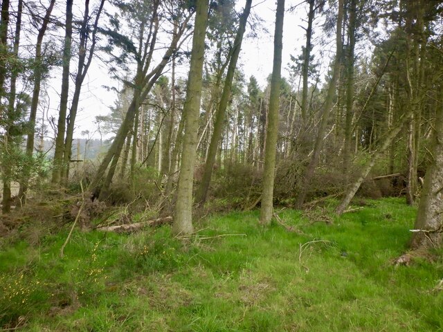
Black Craig is a popular destination for outdoor enthusiasts, including hikers and nature lovers. The hill is home to a variety of wildlife, including red deer, mountain hares, and various bird species, such as peregrine falcons and golden eagles.

The surrounding area offers several walking trails, allowing visitors to explore the diverse flora and fauna of the Ochil Hills. Additionally, there are options for rock climbing and bouldering for those seeking more adventurous activities.

Overall, Black Craig in Fife is a striking natural landmark that offers a challenging yet rewarding experience for outdoor enthusiasts, with its stunning views and diverse wildlife making it a must-visit destination for nature lovers.

If you have any feedback on the listing, please let us know in the comments section below.
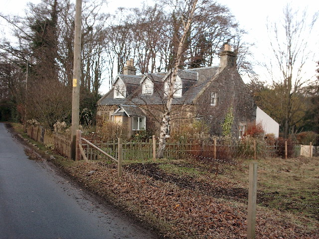
Black Craig Images

Images are sourced within 2km of 56.382987/-3.0864387 or Grid Reference NO3321. Thanks to Geograph Open Source API. All images are credited.

Road by Creich Inexplicably part of the Fife Coast Path.
Road by Creich
Inexplicably part of the Fife Coast Path.
Summit area, Starr Law
Windthrow A strip wood on the slopes of Starr Law.
Windthrow
A strip wood on the slopes of Starr Law.
Creich Kirk. The church is outside the village of Luthrie, above it to the north. Built to replace the now ruined church to the north.
Creich Kirk.
The church is outside the village of Luthrie, above it to the north. Built to replace the now ruined church to the north.
Creich Church Serving the villages of Luthrie and Brunton in Fife.
Creich Church
Serving the villages of Luthrie and Brunton in Fife.
Arable and grazing north of Luthrie In Fife.
Arable and grazing north of Luthrie
In Fife.
Bench Mark, Creich Church The bench mark is on the west wall of the church.  For a view of the church <a href="https://www.geograph.org.uk/photo/2185270">NO3219 : Creich Church</a> and for further information on the bench mark <span class="nowrap"><a title="http://www.bench-marks.org.uk/bm36179" rel="nofollow ugc noopener" href="http://www.bench-marks.org.uk/bm36179">Link</a><img style="margin-left:2px;" alt="External link" title="External link - shift click to open in new window" src="https://s1.geograph.org.uk/img/external.png" width="10" height="10"/></span>
Bench Mark, Creich Church
The bench mark is on the west wall of the church. For a view of the church NO3219 : Creich Church and for further information on the bench mark LinkExternal link
Creich Church Built in 1832, in a prominent situation close to the village of Luthrie.
Creich Church
Built in 1832, in a prominent situation close to the village of Luthrie.
Village street In the village of Brunton.
Village street
In the village of Brunton.
Road north out of Brunton
Village of Brunton Seen from the road to Newburgh.
Village of Brunton
Seen from the road to Newburgh.
Gorse covered hill flank A small hill to the west of Brunton village.
Gorse covered hill flank
A small hill to the west of Brunton village.
Flisk Parish Church The disused church at Flisk, built in 1790, although with significant reconstruction in the 19th century. The building is of whinstone, with Thomas Cappon the architect responsible for the later modifications.
Flisk Parish Church
The disused church at Flisk, built in 1790, although with significant reconstruction in the 19th century. The building is of whinstone, with Thomas Cappon the architect responsible for the later modifications.
Detail of gravestone at Flisk Church A skeleton carved on a gravestone at Flisk Church - a symbol of mortality.
Detail of gravestone at Flisk Church
A skeleton carved on a gravestone at Flisk Church - a symbol of mortality.
Flisk Point A view to the east from Flisk Point, showing the south bank of the River Tay. Significant quantities of shingle are found on the shoreline here, swept up-river by the tide. Flisk wood is visible near the shore. This linear woodland containing ash and elm is a SSSI. It is the largest area of mixed woodland in Fife.
Flisk Point
A view to the east from Flisk Point, showing the south bank of the River Tay. Significant quantities of shingle are found on the shoreline here, swept up-river by the tide. Flisk wood is visible near the shore. This linear woodland containing ash and elm is a SSSI. It is the largest area of mixed woodland in Fife.
The River Tay at Flisk Point A view of the River Tay at Flisk Point, with the Tay railway bridge just visible through mist and heavy rain.
The River Tay at Flisk Point
A view of the River Tay at Flisk Point, with the Tay railway bridge just visible through mist and heavy rain.
Farmland near Balhelvie Farmland near Balhelvie, North Fife, with the River Tay visible in the distance.
Farmland near Balhelvie
Farmland near Balhelvie, North Fife, with the River Tay visible in the distance.
Flisk Wood and the River Tay Flisk wood adjacent to a tidal section of the River Tay. The small burn that flows through Corbie Den enters the Tay to the right of the image.
Flisk Wood and the River Tay
Flisk wood adjacent to a tidal section of the River Tay. The small burn that flows through Corbie Den enters the Tay to the right of the image.
Show me another place!

Black Craig is located at Grid Ref: NO3321 (Lat: 56.382987, Lng: -3.0864387)

Unitary Authority: Fife

Police Authority: Fife

What 3 Words

///woke.acting.undertone. Near Errol, Perth & Kinross

Nearby Locations

Black Craig Drumnod Wood

Related Wikis

Creich, Fife

Creich (Scottish Gaelic: Craoich, pronounced [kʰɾɯːç]; OS: Criech), is a hamlet in Fife, Scotland.The local parish is named after Creich. The ruins of...

Flisk

Flisk (Scottish Gaelic: Fleasg meaning "Stalk" or "Rod") was a parish in Fife, Scotland. According to the 1853 Gazetteer, in part: "Flisk parish is bounded...

Birkhill Castle

Birkhill Castle is a stately home, the residence of the Earl of Dundee, located on the banks of the River Tay, a short drive from St. Andrews. The castle...

Luthrie

Luthrie is a village in the parish of Creich in Fife, Scotland. A small stream shown on maps as Windygates Burn (but known locally as Luthrie Burn) flows...

Norman's Law

Norman's Law is a prominent hill at the far eastern end of the Ochil Fault, Scotland. It sits above the south bank of the River Tay, around four miles...

Luthrie railway station

Luthrie railway station served the village of Luthrie, Fife, Scotland from 1909 to 1951 on the Newburgh and North Fife Railway. == History == The station...

Bottomcraig

Bottomcraig is a village in Fife, Scotland located near Balmerino and The Gauldry. The village is home to Balmerino Parish Church, built in 1811, and the...

Balmerino Abbey

Balmerino Abbey, or St Edward's Abbey, in Balmerino, Fife, Scotland, was a Cistercian monastic community which has been ruinous since the 16th century...

Nearby Amenities

Located within 500m of 56.382987,-3.0864387
Black Craig
Ele: 203
Natural: peak
Source: npe
Lat/Long: 56.3828978/-3.086876
Material: wood
Power: pole
Lat/Long: 56.3829255/-3.0802569
Material: wood
Power: pole
Lat/Long: 56.3824384/-3.0796802
Material: wood
Power: pole
Lat/Long: 56.3819602/-3.0791062
Material: wood
Power: pole
Lat/Long: 56.383466/-3.0808979
Material: wood
Power: pole
Lat/Long: 56.38425/-3.081885
Material: wood
Power: pole
Lat/Long: 56.3848559/-3.0825529
Material: wood
Power: pole
Lat/Long: 56.3854112/-3.0832046
Material: wood
Power: pole
Lat/Long: 56.3859618/-3.0838571
Material: wood
Power: pole
Lat/Long: 56.3864536/-3.0844492
Material: wood
Power: pole
Lat/Long: 56.3869755/-3.0850446
Power: pole
Lat/Long: 56.3794008/-3.0900146
Power: pole
Lat/Long: 56.3797593/-3.0900311
Power: pole
Lat/Long: 56.3800742/-3.0898615
Power: pole
Lat/Long: 56.3807212/-3.0894872
Power: pole
Lat/Long: 56.3813534/-3.0890983
Power: pole
Lat/Long: 56.3816523/-3.0881986
Power: pole
Lat/Long: 56.3820141/-3.0870693
Power: pole
Lat/Long: 56.3823164/-3.0860806
Power: pole
Lat/Long: 56.3826634/-3.0849678
Power: pole
Lat/Long: 56.3830264/-3.0839026
Power: pole
Lat/Long: 56.3833287/-3.0829616
Power: pole
Lat/Long: 56.3835898/-3.0821487
Power: pole
Lat/Long: 56.3838355/-3.0813631
The data included in this document is from www.openstreetmap.org. The data is made available under ODbL.

Have you been to Black Craig?

Leave your review of Black Craig below (or comments, questions and feedback).