Caerlee Hill

Hill, Mountain in Peeblesshire

Scotland

Caerlee Hill

Innerleithen from Traquair A view from the Southern Upland Way to the town with Lee Pen in cloud beyond.
Innerleithen from Traquair Credit: Jim Barton

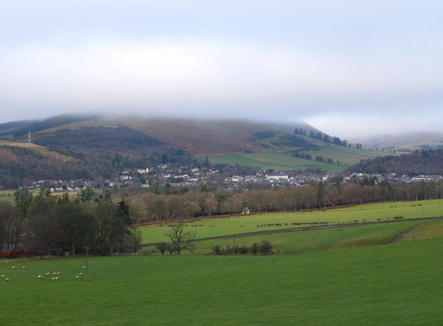
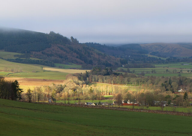
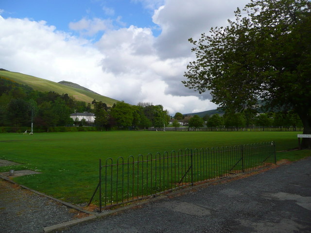
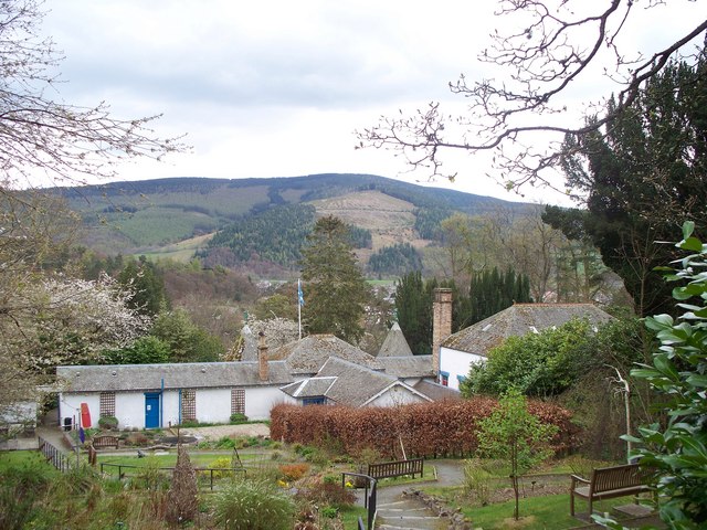
Caerlee Hill is a prominent hill located in Peeblesshire, a historic county in the Scottish Borders region of Scotland. Standing at an altitude of approximately 338 meters (1,108 feet), it offers breathtaking views of the surrounding countryside and the picturesque town of Peebles.

The hill is situated to the south of Peebles, just off the A72 road, making it easily accessible for visitors. It is primarily composed of sandstone, giving it a distinctive reddish appearance. Caerlee Hill is covered in lush vegetation, including heather, grasses, and various species of trees, creating a beautiful and diverse landscape.

At the top of Caerlee Hill, there are the remnants of an ancient hillfort, which is believed to date back to the Iron Age. This fortification, known as Caerlee Hill Fort, once served as a defensive structure and offers a glimpse into the rich history of the region.

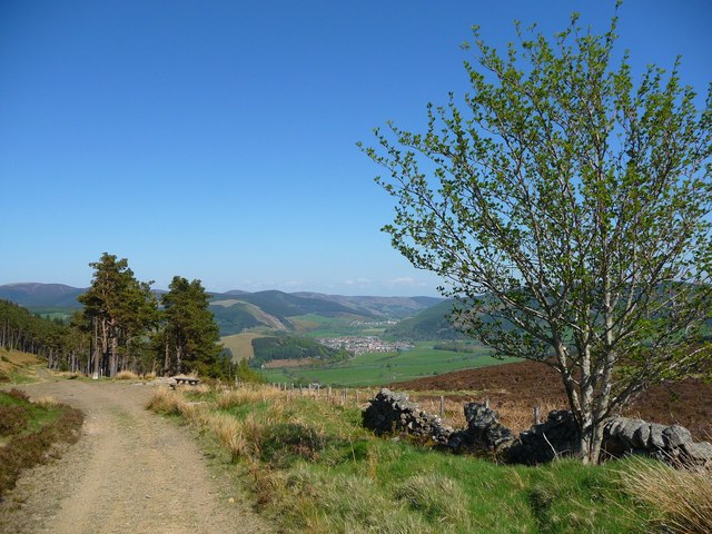
The hill is a popular destination for outdoor enthusiasts and nature lovers, who enjoy hiking and exploring its trails. There are several well-maintained paths that lead to the summit, providing a rewarding and invigorating experience for visitors. Additionally, the hill is home to a variety of wildlife, including birds, rabbits, and occasionally deer.

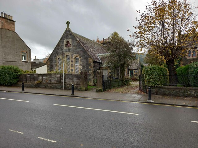
Caerlee Hill is not only a natural landmark but also an important part of the local heritage. It is a place where visitors can immerse themselves in the stunning Scottish countryside while being transported back in time through the remnants of the ancient fort.

If you have any feedback on the listing, please let us know in the comments section below.
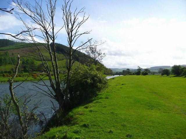
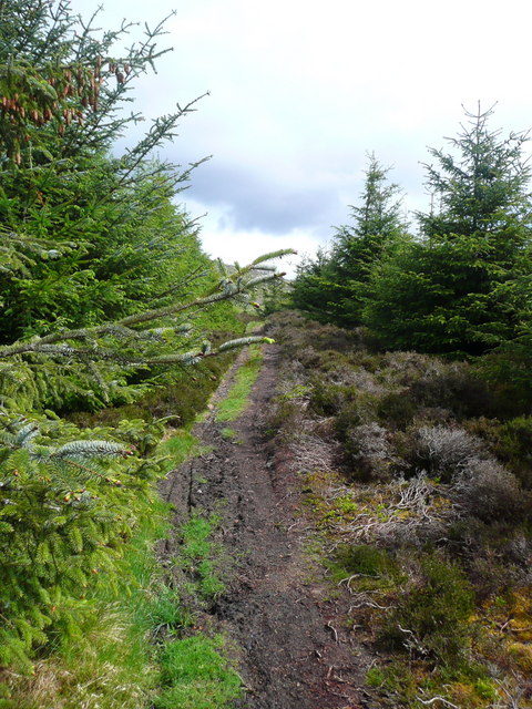
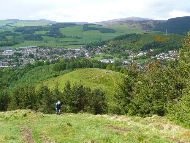
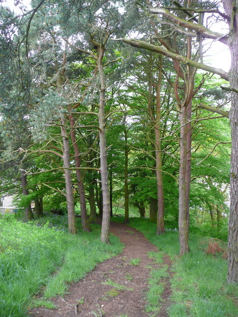
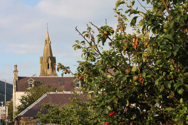
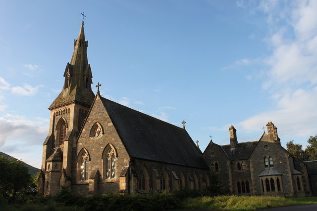
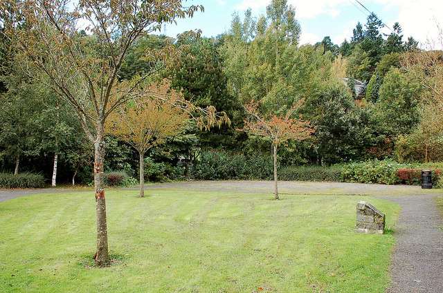
Caerlee Hill Images

Images are sourced within 2km of 55.619674/-3.0736888 or Grid Reference NT3236. Thanks to Geograph Open Source API. All images are credited.

Innerleithen from Traquair A view from the Southern Upland Way to the town with Lee Pen in cloud beyond.
Innerleithen from Traquair
A view from the Southern Upland Way to the town with Lee Pen in cloud beyond.
Sunlight at Traquair Patchy sunlight as a low-lying cloud layer thins out above the Tweed valley.
Sunlight at Traquair
Patchy sunlight as a low-lying cloud layer thins out above the Tweed valley.
Roman Catholic Church of St James, Innerleithen
Church Hall for Roman Catholic Church of St James,
Forest walk Forest walk in Cardrona Forest with view over Tweed Valley to Peebles some 4 or 5 miles distant. Cardrona Forest which is owned by the Forestry Commission has many fine forest walks. It is also a haven for a great variety of wildlife including the recent welcome return of nesting Ospreys.
Forest walk
Forest walk in Cardrona Forest with view over Tweed Valley to Peebles some 4 or 5 miles distant. Cardrona Forest which is owned by the Forestry Commission has many fine forest walks. It is also a haven for a great variety of wildlife including the recent welcome return of nesting Ospreys.
The Tweed at Innerleithen The disused railway bridge (the Haugh-head Viaduct, opened 1866 by North British Rail) in the distance.
The Tweed at Innerleithen
The disused railway bridge (the Haugh-head Viaduct, opened 1866 by North British Rail) in the distance.
The path to Kirnie Law
Looking back on Pirn Hill and its viewpoint The seven stone plinths at the viewpoint above Innerleithen can be clarly seen.
Looking back on Pirn Hill and its viewpoint
The seven stone plinths at the viewpoint above Innerleithen can be clarly seen.
Path through the trees from Pirn Hill
Playing fields at Innerleithen
Coat of arms on St. Ronan's Well pavilion
St Ronans well pavilion from the rear garden
The Pavilion at St Ronan's well
St. James Roman Catholic Church, Innerleithen A sunny day in Innerleithen, the Church Spire makes a superb backdrop to the fruits of the tree.
St. James Roman Catholic Church, Innerleithen
A sunny day in Innerleithen, the Church Spire makes a superb backdrop to the fruits of the tree.
St. James Roman Catholic Church, Innerleithen A blue sky background to a dramatic subject, a very pretty church, in a lovely village by the River Tweed.
St. James Roman Catholic Church, Innerleithen
A blue sky background to a dramatic subject, a very pretty church, in a lovely village by the River Tweed.
D-Day commemorative trees, Innerleithen Trees by the car park in Hall Street. A plaque on the stone plinth reads:

Three Trees Were Planted By
The Chairman Of
Innerleithen Traquair & Glen
Community Council
On The 6th June 1994
To Commemorate The
50th Anniversary Of The D-Day
Landings In France
D-Day commemorative trees, Innerleithen
Trees by the car park in Hall Street. A plaque on the stone plinth reads: Three Trees Were Planted By The Chairman Of Innerleithen Traquair & Glen Community Council On The 6th June 1994 To Commemorate The 50th Anniversary Of The D-Day Landings In France
Remains of mill lade above Kirklands, Innerleithen Here the lade is downstream of the sites of St Ronan's Mill and Wilson's Mill, now occupied by new houses, and is about to turn left into a culvert under the road for a diversion which avoided the old Kirklands cemetery. There are two parallel channels in view with a sluice gate separating them on the left.
Remains of mill lade above Kirklands, Innerleithen
Here the lade is downstream of the sites of St Ronan's Mill and Wilson's Mill, now occupied by new houses, and is about to turn left into a culvert under the road for a diversion which avoided the old Kirklands cemetery. There are two parallel channels in view with a sluice gate separating them on the left.
Culvert exit on E side of B709 The mill lade built in 1846 here crosses under the B709 and continues parallel to the road in its diversion around the old Kirklands cemetery, beyond which it crossed back to the W side to power waterwheels in the town mills.
Culvert exit on E side of B709
The mill lade built in 1846 here crosses under the B709 and continues parallel to the road in its diversion around the old Kirklands cemetery, beyond which it crossed back to the W side to power waterwheels in the town mills.
Show me another place!

Caerlee Hill is located at Grid Ref: NT3236 (Lat: 55.619674, Lng: -3.0736888)

Unitary Authority: The Scottish Borders

Police Authority: The Lothians and Scottish Borders

What 3 Words

///pokes.tipping.harnessed. Near Innerleithen, Scottish Borders

Related Wikis

Leithen Water

Leithen Water (Scottish Gaelic: Leitheann / Abhainn Leitheinn) is a tributary of the River Tweed in Scotland. It rises in the Moorfoot Hills and joins...

Vale of Leithen F.C.

Vale of Leithen Football Club are a football club based in the town of Innerleithen, Scotland. They play in the East of Scotland League First Division...

Robert Smail's Printing Works

Robert Smail's Printing Works is a fully functional Victorian era letterpress printing works in the small Scottish Borders town of Innerleithen, now preserved...

Innerleithen railway station

Innerleithen railway station served the town of Innerleithen, Scottish Borders, Scotland from 1864 to 1962 on the Peebles Railway. == History == The station...

Nearby Amenities

Located within 500m of 55.619674,-3.0736888
Bus Stop
Union Club
Bus: yes
Departures Board: yes
Naptan AtcoCode: 6900479
Naptan Bearing: E
Naptan CommonName: Unionist Club
Naptan Indicator: o/s
Naptan NaptanCode: 72724353
Naptan Street: High Street
Operator: Scottish Borders Council
Public Transport: platform
Ref: 6900479
Shelter: no
Source: NaPTAN
Lat/Long: 55.6179151/-3.0665178
Atm
Check Date: 2022-02-23
Wheelchair: yes
Lat/Long: 55.6174743/-3.0671364
Bicycle Parking
Bicycle Parking: stands
Capacity: 4
Covered: no
Lat/Long: 55.6179633/-3.0668602
Glede Knowe Guest House
Phone: +44 1896 831295
Postal Code: EH44 6RB
Source: survey;web
Tourism: guest_house
Url: http://www.gledeknowe.co.uk/
Lat/Long: 55.6201151/-3.0680407
Caerlee Hill
Ele: 259
Natural: peak
Lat/Long: 55.6199481/-3.0739295
Communication Mobile Phone: yes
Man Made: mast
Material: steel
Tower Construction: lattice
Tower Type: communication
Lat/Long: 55.6203257/-3.0727384
Barrier: kissing_gate
Foot: yes
Lat/Long: 55.6211116/-3.0741231
Bench
Backrest: yes
Material: wood
Lat/Long: 55.6212156/-3.072659
Toilets
Access: yes
Charge: 0.3 GBP
Fee: yes
Toilets Disposal: flush
Toilets Position: seated
Wheelchair: yes
Lat/Long: 55.618872/-3.0664075
Bench
Lat/Long: 55.615722/-3.0755984
Information: guidepost
Tourism: information
Lat/Long: 55.6157164/-3.0757315
Waste Basket
Lat/Long: 55.615765/-3.0756671
Generator Method: photovoltaic
Generator Output Electricity: yes
Generator Source: solar
Generator Type: solar_photovoltaic_panel
Power: generator
Lat/Long: 55.6179245/-3.0692148
Generator Method: photovoltaic
Generator Output Electricity: yes
Generator Source: solar
Generator Type: solar_photovoltaic_panel
Power: generator
Lat/Long: 55.619221/-3.0689335
Generator Method: photovoltaic
Generator Output Electricity: yes
Generator Source: solar
Generator Type: solar_photovoltaic_panel
Power: generator
Lat/Long: 55.6192104/-3.0688938
Generator Method: photovoltaic
Generator Output Electricity: yes
Generator Source: solar
Generator Type: solar_photovoltaic_panel
Power: generator
Lat/Long: 55.6197218/-3.0680409
Generator Method: photovoltaic
Generator Output Electricity: yes
Generator Source: solar
Generator Type: solar_photovoltaic_panel
Power: generator
Lat/Long: 55.6196713/-3.0679759
Generator Method: photovoltaic
Generator Output Electricity: yes
Generator Source: solar
Generator Type: solar_photovoltaic_panel
Power: generator
Lat/Long: 55.6216626/-3.0675226
Entrance: yes
Lat/Long: 55.6186499/-3.0660098
Entrance: yes
Lat/Long: 55.6187238/-3.0661012
Entrance: yes
Lat/Long: 55.6187876/-3.0661833
Generator Method: photovoltaic
Generator Output Electricity: yes
Generator Source: solar
Generator Type: solar_photovoltaic_panel
Power: generator
Lat/Long: 55.6171881/-3.0708248
Generator Method: photovoltaic
Generator Output Electricity: yes
Generator Source: solar
Generator Type: solar_photovoltaic_panel
Power: generator
Lat/Long: 55.6174573/-3.0704941
Generator Method: photovoltaic
Generator Output Electricity: yes
Generator Source: solar
Generator Type: solar_photovoltaic_panel
Power: generator
Lat/Long: 55.6175495/-3.0701783
Power: pole
Lat/Long: 55.6191571/-3.0704098
Power: pole
Lat/Long: 55.6193685/-3.0710904
Power: pole
Lat/Long: 55.6196027/-3.0718123
Power: pole
Lat/Long: 55.619841/-3.0725643
Bench
Backrest: yes
Foot: yes
Material: wood
Lat/Long: 55.6211766/-3.0741507
Generator Method: photovoltaic
Generator Output Electricity: yes
Generator Source: solar
Generator Type: solar_photovoltaic_panel
Power: generator
Lat/Long: 55.6181538/-3.0695102
Generator Method: photovoltaic
Generator Output Electricity: yes
Generator Source: solar
Generator Type: solar_photovoltaic_panel
Power: generator
Lat/Long: 55.6202649/-3.0689761
Generator Method: photovoltaic
Generator Output Electricity: yes
Generator Source: solar
Generator Type: solar_photovoltaic_panel
Power: generator
Lat/Long: 55.6209527/-3.0672366
Generator Method: photovoltaic
Generator Output Electricity: yes
Generator Source: solar
Generator Type: solar_photovoltaic_panel
Power: generator
Lat/Long: 55.6230455/-3.0685822
Give Way
Direction: forward
Lat/Long: 55.6163747/-3.0700029
Give Way
Direction: forward
Lat/Long: 55.6165388/-3.0693774
Generator Method: photovoltaic
Generator Output Electricity: yes
Generator Source: solar
Generator Type: solar_photovoltaic_panel
Power: generator
Lat/Long: 55.6203977/-3.0676461
Charging Station
Capacity: 2
Operator: BP Chargemaster
Lat/Long: 55.6191849/-3.0673058
D-Day memorial
Historic: memorial
Memorial: war_memorial
Lat/Long: 55.6196439/-3.0674308
Board Type: history
Information: board
Tourism: information
Lat/Long: 55.6193745/-3.0671043
Leisure: picnic_table
Lat/Long: 55.6198039/-3.067114
Waste Basket
Lat/Long: 55.6197886/-3.067125
The data included in this document is from www.openstreetmap.org. The data is made available under ODbL.

Have you been to Caerlee Hill?

Leave your review of Caerlee Hill below (or comments, questions and feedback).