Huntington

Settlement in Staffordshire South Staffordshire

England

Huntington

Huntington A new nature reserve has been created at the site of former Littleton colliery in the village of Huntington.
Huntington Credit: Andy Malbon

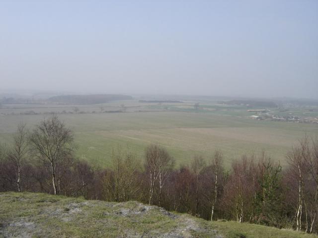
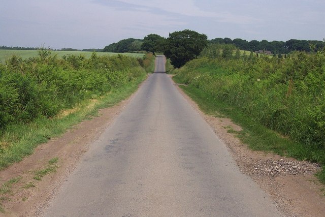
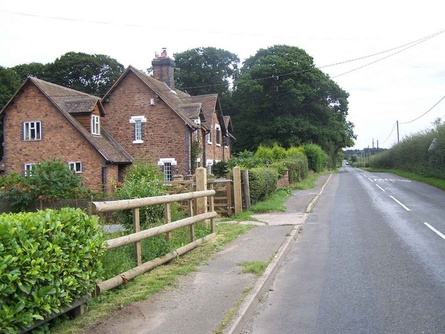
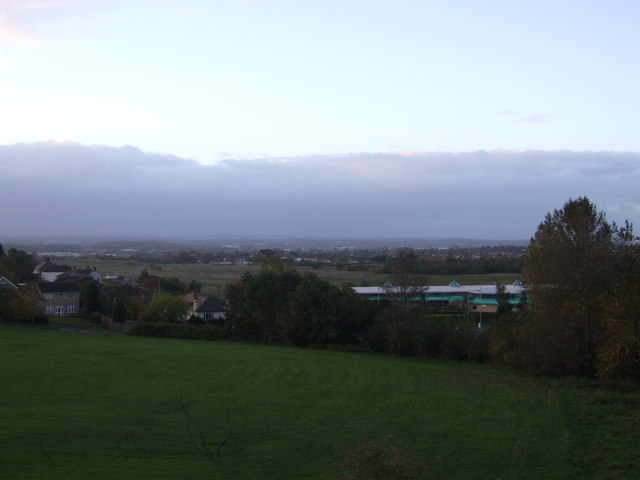
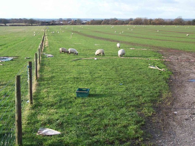
Huntington is a small village located in the county of Staffordshire, England. Situated approximately 4 miles north of the county town of Stafford, it forms part of the Stafford Borough Council area. The village is nestled amidst picturesque countryside and is surrounded by green fields and rolling hills, adding to its rural charm.

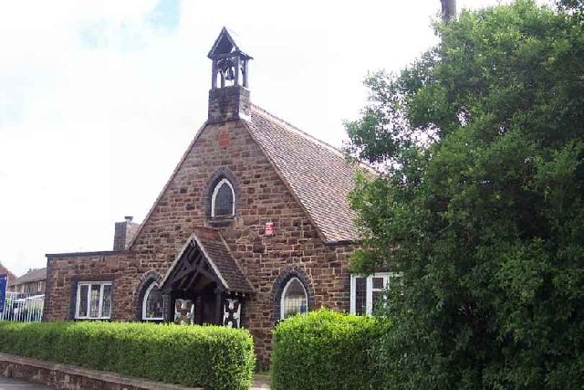
Huntington is primarily a residential area with a close-knit community. The village is known for its quaint cottages and traditional architecture, giving it a timeless character. It offers a tranquil and peaceful environment, making it an ideal place for families and those seeking a quieter lifestyle.

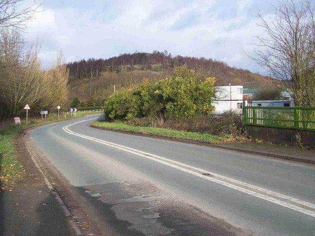
The village is well-connected to neighboring towns and cities, with easy access to major road networks such as the A34 and M6, allowing residents to commute to nearby employment centers. It also benefits from regular bus services, providing convenient transportation options.

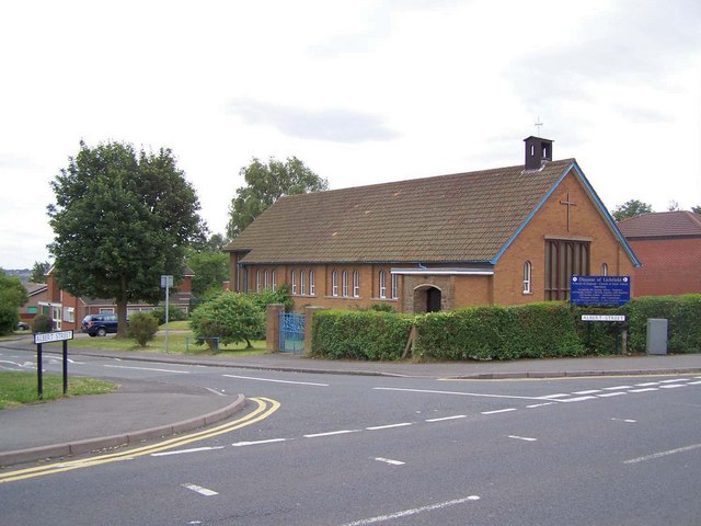
Huntington has a range of local amenities to cater to the needs of its residents. These include a primary school, a community center, a village hall, and a play area for children. Additionally, the village boasts a local pub, providing a social hub for residents and visitors alike.

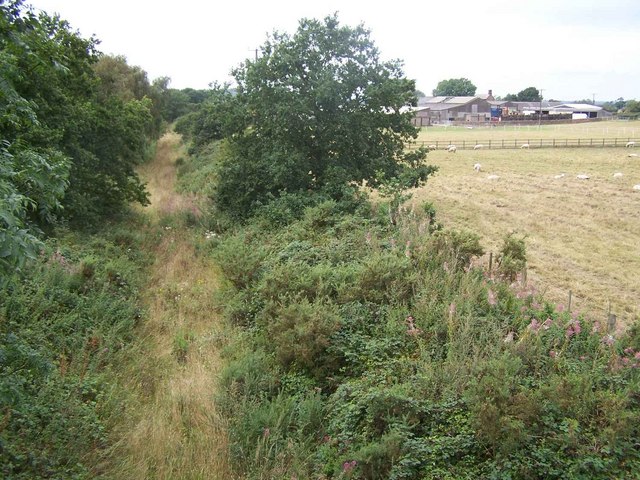
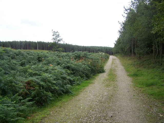
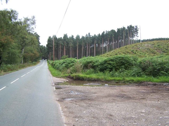
For recreational activities and outdoor pursuits, Huntington offers beautiful walking trails and scenic spots for picnics. The nearby Cannock Chase, an Area of Outstanding Natural Beauty, provides opportunities for cycling, horse riding, and wildlife spotting.

In summary, Huntington is a charming village in Staffordshire, offering a peaceful and idyllic setting for residents. With its close proximity to Stafford and convenient transport links, it strikes a balance between rural living and accessibility to urban amenities.

If you have any feedback on the listing, please let us know in the comments section below.
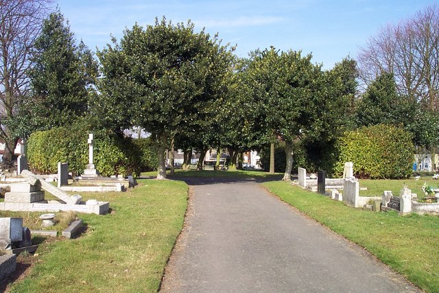
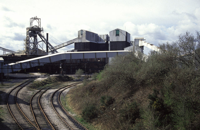
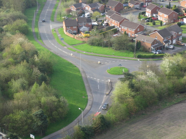
Huntington Images

Images are sourced within 2km of 52.714795/-2.0415687 or Grid Reference SJ9713. Thanks to Geograph Open Source API. All images are credited.

Huntington A new nature reserve has been created at the site of former Littleton colliery in the village of Huntington.
Huntington
A new nature reserve has been created at the site of former Littleton colliery in the village of Huntington.
St. Thomas, Huntington
Cannock Stadium Home of Cannock and Stafford AC
Cannock Stadium
Home of Cannock and Stafford AC
Cannock Cemetery
Cannock Cemetery
Centre of Cannock Cemetery
Littleton Colliery Long gone. I think it was already closed then. I was actually looking for a waterworks beam engine house but that had been replaced by a little hut. The colliery was the booby prize and now it's a memory.
Littleton Colliery
Long gone. I think it was already closed then. I was actually looking for a waterworks beam engine house but that had been replaced by a little hut. The colliery was the booby prize and now it's a memory.
Traffic island This is the junction of Pye Green Road and Rosehill.The photograph was taken from a hot air balloon.
Traffic island
This is the junction of Pye Green Road and Rosehill.The photograph was taken from a hot air balloon.
Mansty Lane
Mansty Lane
St. Aidan's Church, West Chadsmoor
Disused Railway Mansty Farm can be seen on the Right
Disused Railway
Mansty Farm can be seen on the Right
Stafford Road, Cannock
Badger's Hills, Cannock Chase
Cannock Chase near Pottal Pool
Road to Pottal Pool
Road to Pottal Pool
Pye Green Valley and Pye Green Valley School Pye Green Valley was the location of the former West Cannock Collieries, Nos. 1, 2 and 3, a prosperous coal mining area providing local employment within the Cannock area for a large workforce. Several seams of coal were mined at moderate depths under and around the Pye Green Valley. Plans going back to 1880 show the site to be principally occupied by West Cannock Colliery, with colliery buildings associated with pits Nos. 1 and 4 to the north and pit No. 3 in the south.
Pye Green Valley and Pye Green Valley School
Pye Green Valley was the location of the former West Cannock Collieries, Nos. 1, 2 and 3, a prosperous coal mining area providing local employment within the Cannock area for a large workforce. Several seams of coal were mined at moderate depths under and around the Pye Green Valley. Plans going back to 1880 show the site to be principally occupied by West Cannock Colliery, with colliery buildings associated with pits Nos. 1 and 4 to the north and pit No. 3 in the south.
Yew Tree Farm Yew Tree Farm ,Pottal Pool Road, Penkridge

View from the road across the gate
Yew Tree Farm
Yew Tree Farm ,Pottal Pool Road, Penkridge View from the road across the gate
Grazing Land Looking across to Mansty Farm
Grazing Land
Looking across to Mansty Farm
Entering Huntington The hill behind was part of Littleton Colliery, now closed. It has been turned into a picnic area and nature reserve
Entering Huntington
The hill behind was part of Littleton Colliery, now closed. It has been turned into a picnic area and nature reserve
Show me another place!

Huntington is located at Grid Ref: SJ9713 (Lat: 52.714795, Lng: -2.0415687)

Administrative County: Staffordshire

District: South Staffordshire

Police Authority: Staffordshire

What 3 Words

///deflate.another.kiosk. Near Cannock, Staffordshire

Related Wikis

Huntington, Staffordshire

Huntington is a civil parish and former mining village in Staffordshire, on the outskirts of Cannock Chase. It lies on the A34 road just north of Cannock...
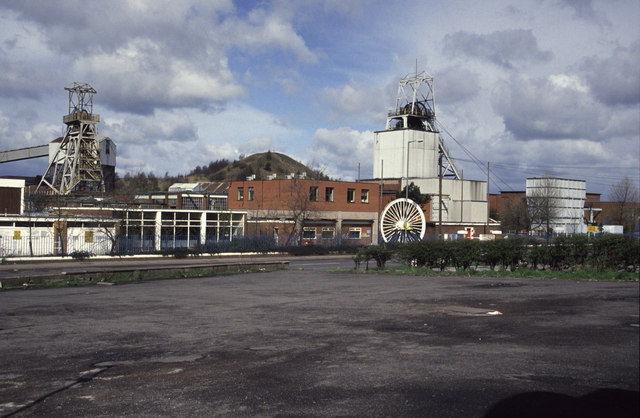
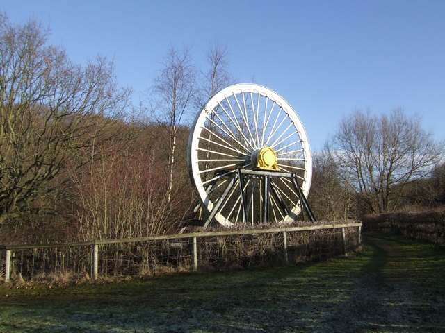
Littleton Colliery

Littleton Colliery was a deep coal mine situated two miles north of Cannock on the A34 in the village of Huntington. The colliery closed on 3 December...

Staffordshire University Academy

Staffordshire University Academy is a secondary school and sixth form located in Marston Road, Hednesford, Cannock, Staffordshire, England. The school...

Pye Green

Pye Green is part of Hednesford, Staffordshire, England, running from Chadsmoor and Hednesford, across the Pye Green valley and to the edge of The Chase...

Cardinal Griffin Catholic College

Cardinal Griffin Catholic College is a coeducational Catholic Secondary school and sixth form located in Cannock, Staffordshire, England. == History... ==

Chadsmoor

Chadsmoor () is a historic village in the Cannock Chase District in Staffordshire, England and is situated between the towns of Cannock and Hednesford...

Pye Green BT Tower

Pye Green BT Tower is a 96.9-metre (318 ft) tall telecommunication tower built of reinforced concrete at Pye Green, Staffordshire, England (grid reference...

Cannock Chase High School

Cannock Chase High School is a secondary school with academy status in Cannock, Staffordshire. The school is situated just north of the town centre, towards...

Nearby Amenities

Located within 500m of 52.714795,-2.0415687
Crossing
Crossing: traffic_signals
Source: bing
Lat/Long: 52.7150604/-2.0415635
Bus Stop
The Littleton Arms PH
Bus: yes
Naptan AtcoCode: 3800C605300
Naptan Bearing: S
Naptan CommonName: The Littleton Arms PH
Naptan Indicator: Adj
Naptan Landmark: The Littleton Arms PH
Naptan Street: Stafford Rd
Naptan Verified: no
Public Transport: platform
Source: naptan_import
Lat/Long: 52.715082/-2.0415091
Bus Stop
The Littleton Arms PH
Bus: yes
Naptan AtcoCode: 3800C605301
Naptan Bearing: N
Naptan CommonName: The Littleton Arms PH
Naptan Indicator: Opp
Naptan Landmark: The Littleton Arms PH
Naptan Street: Stafford Rd
Naptan Verified: no
Public Transport: platform
Source: naptan_import
Lat/Long: 52.7155225/-2.0416576
Bus Stop
Huntington Primary School
Bus: yes
Naptan AtcoCode: 3800C605400
Naptan Bearing: S
Naptan CommonName: Huntington Primary School
Naptan Indicator: Adj
Naptan Landmark: Huntington Primary Sch
Naptan Street: Stafford Rd
Naptan Verified: no
Public Transport: platform
Source: naptan_import
Lat/Long: 52.7191517/-2.0399421
Bus Stop
Teddesley Way
Bus: yes
Naptan AtcoCode: 3800C616901
Naptan Bearing: N
Naptan CommonName: Teddesley Way
Naptan Indicator: Opp
Naptan Landmark: Teddesley Way
Naptan Street: Stafford Road
Naptan Verified: no
Public Transport: platform
Source: naptan_import
Lat/Long: 52.7118148/-2.0411825
Bus Stop
Teddesley Way
Bus: yes
Naptan AtcoCode: 3800C616902
Naptan Bearing: S
Naptan CommonName: Teddesley Way
Naptan Indicator: Adj
Naptan Landmark: Teddesley Way
Naptan Street: Stafford Rd
Naptan Verified: no
Public Transport: platform
Source: naptan_import
Lat/Long: 52.7114324/-2.0407063
Bus Stop
Clay Street
Bus: yes
Naptan AtcoCode: 3800C617601
Naptan Bearing: W
Naptan CommonName: Clay Street
Naptan Indicator: Adj
Naptan Landmark: Clay Street
Naptan Street: Lime Pit Lane
Naptan Verified: no
Public Transport: platform
Source: naptan_import
Lat/Long: 52.7144979/-2.0408128
Post Office
Huntington Post Office
Addr City: Cannock
Addr Postcode: WS12 4NU
Addr Street: Stafford Road
Addr Village: Huntington
Opening Hours: Mo-Sa 06:00-22:00; Su 07:00-22:00
Ref Pol Id: 5523
Lat/Long: 52.7131327/-2.0409029
Speed Camera
Lat/Long: 52.717604/-2.0409378
Defibrillator
Emergency: defibrillator
Not Ref GB The Circuit: E993D86A-82C3-4EC3-BB2D-AEE000C143EB
Source: West Midlands Ambulance Service FOI request
Lat/Long: 52.7143814/-2.042453
Shop: fabric
Lat/Long: 52.7127876/-2.0479772
Huntington
Place: village
Source: NLS - OS 1:25k 1st Series 1937-61
Lat/Long: 52.7155056/-2.0383765
Tourism: attraction
Lat/Long: 52.7136444/-2.0414552
Place Of Worship
Create Church
Religion: christian
Website: https://www.risingbrook.org/
Lat/Long: 52.7125216/-2.0385632
Generator Method: photovoltaic
Generator Output Electricity: yes
Generator Source: solar
Generator Type: solar_photovoltaic_panel
Location: roof
Power: generator
Lat/Long: 52.7117488/-2.0407654
Generator Method: photovoltaic
Generator Output Electricity: yes
Generator Source: solar
Generator Type: solar_photovoltaic_panel
Location: roof
Power: generator
Lat/Long: 52.7153447/-2.0411074
Generator Method: photovoltaic
Generator Output Electricity: yes
Generator Source: solar
Generator Type: solar_photovoltaic_panel
Location: roof
Power: generator
Lat/Long: 52.7158419/-2.04041
Generator Method: photovoltaic
Generator Output Electricity: yes
Generator Source: solar
Generator Type: solar_photovoltaic_panel
Location: roof
Power: generator
Lat/Long: 52.7160823/-2.0394069
Generator Method: photovoltaic
Generator Output Electricity: yes
Generator Source: solar
Generator Type: solar_photovoltaic_panel
Location: roof
Power: generator
Lat/Long: 52.7171368/-2.0391494
The data included in this document is from www.openstreetmap.org. The data is made available under ODbL.

Have you been to Huntington?

Leave your review of Huntington below (or comments, questions and feedback).