Huntingdon

Settlement in Huntingdonshire Huntingdonshire

England

Huntingdon

Calm water of the River Great Ouse in Huntingdon
Calm water of the River Great Ouse in Huntingdon Credit: Richard Humphrey

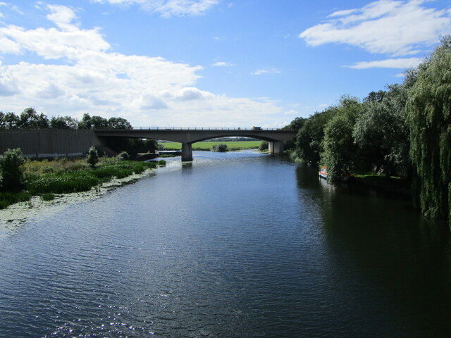
Huntingdon is a historic market town located in the county of Huntingdonshire, England. Situated on the banks of the River Great Ouse, it is approximately 20 miles northwest of the city of Cambridge. The town has a population of around 24,000.

Huntingdon boasts a rich history that dates back to the Saxon era and is closely associated with the famous English military and political leader, Oliver Cromwell, who was born here in 1599. Visitors can explore the Cromwell Museum, which houses a collection of artifacts and exhibits related to his life and times.

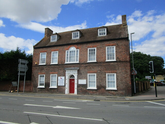
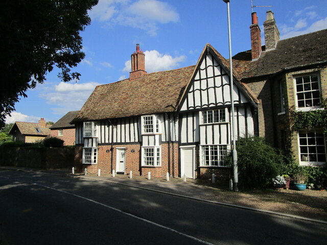
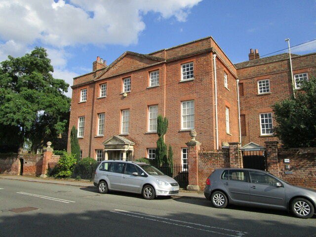
The town center features a mix of medieval and Georgian architecture, with many buildings dating back several centuries. Market Hill, the main square, is a focal point for locals and visitors alike, hosting a weekly market where a wide array of goods are sold.

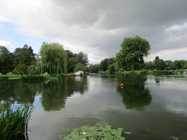
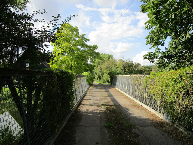
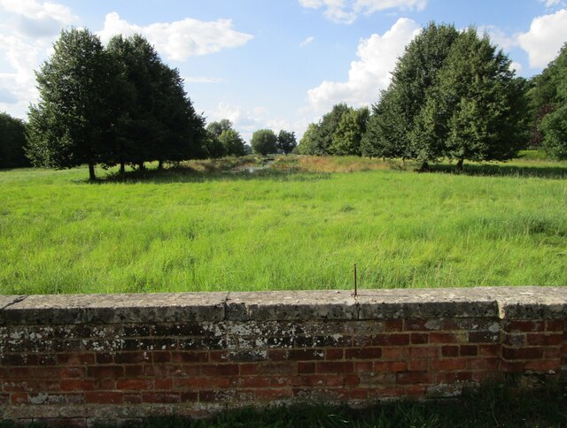
Nature enthusiasts can take advantage of the picturesque riverside walks along the Great Ouse, offering tranquil views and opportunities for wildlife spotting. The nearby Hinchingbrooke Country Park provides a peaceful retreat with woodland, lakes, and meadows.

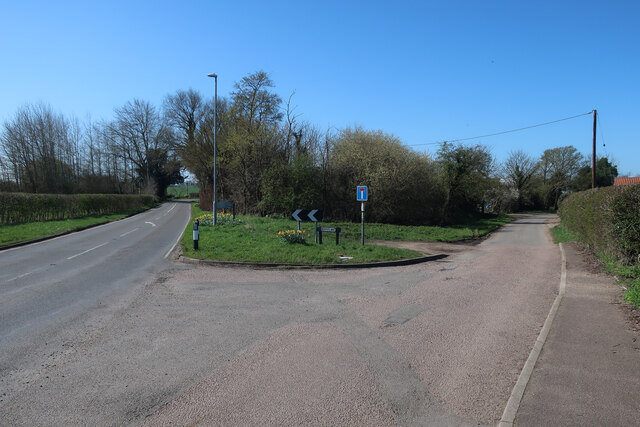
Transport links are excellent, with the A14 and A1 roads passing close by, providing easy access to major cities and towns in the region. Huntingdon also benefits from a railway station, offering direct connections to London and other destinations.

Overall, Huntingdon offers a blend of history, natural beauty, and modern amenities, making it an attractive destination for both residents and visitors.

If you have any feedback on the listing, please let us know in the comments section below.

Huntingdon Images

Images are sourced within 2km of 52.330551/-0.184275 or Grid Reference TL2371. Thanks to Geograph Open Source API. All images are credited.

Calm water of the River Great Ouse in Huntingdon
Tree stump in the bank of the River Great Ouse in Huntingdon
Tree upheaval Recent strong winds have downed six or seven poplar trees on the side of the B1043. Shallow rooting, dry soil, and the fact that they appear to have grown out on a roadstone surface haven't helped.
Tree upheaval
Recent strong winds have downed six or seven poplar trees on the side of the B1043. Shallow rooting, dry soil, and the fact that they appear to have grown out on a roadstone surface haven't helped.
Tree upheaval Poplar trees lying prone by the B1043.
Tree upheaval
Poplar trees lying prone by the B1043.
West Street, Godmanchester
Berry Lane
Berry Lane
Junction for Berry Lane
The River Great Ouse at Godmanchester
The Ouse Valley Way crossing Port Holme
Port Holme and Waters Meet Waters Meet is a housing development close to a minor branch of the River Great Ouse.
Port Holme and Waters Meet
Waters Meet is a housing development close to a minor branch of the River Great Ouse.
Montague House, Huntingdon Mid eighteenth century house <span class="nowrap"><a title="https://historicengland.org.uk/listing/the-list/list-entry/1128610" rel="nofollow ugc noopener" href="https://historicengland.org.uk/listing/the-list/list-entry/1128610">Link</a><img style="margin-left:2px;" alt="External link" title="External link - shift click to open in new window" src="https://s1.geograph.org.uk/img/external.png" width="10" height="10"/></span> isolated from the town centre by the Ring Road which passes in front of it.
Montague House, Huntingdon
Mid eighteenth century house LinkExternal link isolated from the town centre by the Ring Road which passes in front of it.
The River Great Ouse at Huntingdon The bridge used to carry the A14 which has now been diverted.
The River Great Ouse at Huntingdon
The bridge used to carry the A14 which has now been diverted.
Bridge over a branch of the River Great Ouse
31/32 West Street, Godmanchester The former Shepherd and Dog INN. Dates from 1593 <span class="nowrap"><a title="https://historicengland.org.uk/listing/the-list/list-entry/1162411" rel="nofollow ugc noopener" href="https://historicengland.org.uk/listing/the-list/list-entry/1162411">Link</a><img style="margin-left:2px;" alt="External link" title="External link - shift click to open in new window" src="https://s1.geograph.org.uk/img/external.png" width="10" height="10"/></span>
31/32 West Street, Godmanchester
The former Shepherd and Dog INN. Dates from 1593 LinkExternal link
Canal off the River Great Ouse An ornamental feature for Farm Hall.
Canal off the River Great Ouse
An ornamental feature for Farm Hall.
Farm Hall, West Street, Godmanchester Dated to 1746 <span class="nowrap"><a title="https://historicengland.org.uk/listing/the-list/list-entry/1128580" rel="nofollow ugc noopener" href="https://historicengland.org.uk/listing/the-list/list-entry/1128580">Link</a><img style="margin-left:2px;" alt="External link" title="External link - shift click to open in new window" src="https://s1.geograph.org.uk/img/external.png" width="10" height="10"/></span>
Now subdivided.
Farm Hall, West Street, Godmanchester
Dated to 1746 LinkExternal link Now subdivided.
Crommie, the comforter In modern terms Crommie was a post traumatic stress therapy dog for British spies during WW2 <span class="nowrap"><a title="https://www.itv.com/news/anglia/2019-06-11/statue-for-crommie-the-war-time-dog-who-helped-morale-of-spies" rel="nofollow ugc noopener" href="https://www.itv.com/news/anglia/2019-06-11/statue-for-crommie-the-war-time-dog-who-helped-morale-of-spies">Link</a><img style="margin-left:2px;" alt="External link" title="External link - shift click to open in new window" src="https://s1.geograph.org.uk/img/external.png" width="10" height="10"/></span>
Crommie, the comforter
In modern terms Crommie was a post traumatic stress therapy dog for British spies during WW2 LinkExternal link
Show me another place!

Huntingdon is located at Grid Ref: TL2371 (Lat: 52.330551, Lng: -0.184275)

Administrative County: Cambridgeshire

District: Huntingdonshire

Police Authority: Cambridgeshire

What 3 Words

///replayed.grant.suitable. Near Huntingdon, Cambridgeshire

Nearby Locations

Huntingdon

Related Wikis

Cromwell Museum

The Cromwell Museum in Huntingdon, England, is a museum containing collections exploring the life of Oliver Cromwell and to a lesser extent his son Richard...

Huntingdon Town Hall

Huntingdon Town Hall is a municipal structure on Market Hill in Huntingdon, Cambridgeshire, England. The town hall, which was the headquarters of Huntingdon...

Walden House

Walden House is a former municipal structure in Market Hill, Huntingdon, Cambridgeshire, England. The structure, which has formerly the headquarters of...

All Saints' Church, Huntingdon

All Saints' Church is a Church of England church located in Huntingdon, Cambridgeshire, England. There have been multiple churches on the site of this...

Nearby Amenities

Located within 500m of 52.330551,-0.184275
Huntingdon
Is In: Cambridgeshire, England, UK
Place: town
Population: 25428
Population Date: 2021
Source Population: wikipedia
Wikidata: Q685640
Wikipedia: en:Huntingdon
Lat/Long: 52.3305093/-0.1843514
Traffic Signals
Lat/Long: 52.331324/-0.1782996
Traffic Signals
Lat/Long: 52.3316574/-0.1794522
Traffic Signals
Traffic Signals: signal
Traffic Signals Direction: forward
Lat/Long: 52.3298973/-0.1913937
Crossing
Button Operated: yes
Crossing: traffic_signals
Crossing Ref: toucan
Tactile Paving: yes
Lat/Long: 52.3297353/-0.1908889
Crossing
Crossing Island: yes
Lat/Long: 52.3305545/-0.1865271
Traffic Signals
Lat/Long: 52.3332829/-0.1873156
Sebastapol Cannon
Historic: monument
Memorial Conflict: Crimean War 1854
Note: replica of 1850 crimea one
War Memorial: yes
Lat/Long: 52.3298404/-0.1886099
Veterinary
Cromwell Veterinary Hospital
Lat/Long: 52.3317814/-0.1884039
Post Box
Brand: Royal Mail
Brand Wikidata: Q638098
Collection Times: Mo-Fr 09:00; Sa 07:00
Operator: Royal Mail
Operator Wikidata: Q638098
Post Box Type: pillar
Ref: PE29 1D
Royal Cypher: EIIR
Royal Cypher Wikidata: Q33102113
Source: survey
Lat/Long: 52.3335723/-0.1878069
Pharmacy
Wellbeing Pharmacy
Addr City: Huntingdon
Addr Housenumber: 72A
Addr Postcode: PE29 3EZ
Addr Street: Ermine Street
Dispensing: yes
Healthcare: pharmacy
Ref: WP038
Ref GB Nhs Ods: FX693
Website: https://wellbeing-pharmacy.co.uk/
Lat/Long: 52.3339811/-0.188056
Police
Huntingdon Police Station
Lat/Long: 52.332453/-0.188633
Traffic Signals
Lat/Long: 52.3341722/-0.1884619
Crossing
Crossing: unmarked
Crossing Island: no
Crossing Markings: no
Kerb: lowered
Tactile Paving: no
Lat/Long: 52.3342304/-0.1837297
Traffic Signals
Lat/Long: 52.3324472/-0.1819653
Crossing
Crossing: traffic_signals
Tactile Paving: yes
Lat/Long: 52.3333757/-0.1873228
Doctors
Charles Hicks Centre (Ermine Street Surgery)
Healthcare: doctor
Lat/Long: 52.3340436/-0.187256
Community Centre
Huntingdon Community Centre
Building: public
Lat/Long: 52.3343643/-0.1831039
Post Box
Brand: Royal Mail
Brand Wikidata: Q638098
Collection Times: Mo-Fr 09:00; Sa 07:00
Operator: Royal Mail
Operator Wikidata: Q638098
Post Box Type: pillar
Ref: PE29 16D
Royal Cypher: GR
Royal Cypher Wikidata: Q33102273
Source: survey
Lat/Long: 52.3333043/-0.1800257
Crossing
Lat/Long: 52.3320785/-0.1807366
Traffic Signals
Lat/Long: 52.3279689/-0.1787088
Crossing
Crossing: traffic_signals
Traffic Signals: toucan
Lat/Long: 52.328151/-0.1837692
Crossing
Lat/Long: 52.332007/-0.1810916
Crossing
Crossing: unmarked
Crossing Markings: no
Kerb: lowered
Tactile Paving: yes
Lat/Long: 52.3312785/-0.1783238
Traffic Calming: choker
Lat/Long: 52.3327806/-0.1848337
Traffic Signals
Lat/Long: 52.3323433/-0.1815895
Turning Circle
Lat/Long: 52.3319133/-0.1873624
Access: yes
Barrier: bollard
Bollard: fixed
Colour: black
Foot: designated
Height: 1.2
Horse: no
Material: metal
Motor Vehicle: no
Lat/Long: 52.3280611/-0.1789853
Recycling
Lat/Long: 52.329983/-0.1810188
Cafe
Costa
Addr City: Huntingdon
Addr Country: GB
Addr County: Cambridgeshire
Addr Housenumber: 41
Addr Postcode: PE29 3AQ
Addr Street: High Street
Brand: Costa
Brand Wikidata: Q608845
Brand Wikipedia: en:Costa Coffee
Cuisine: coffee_shop
Fhrs Id: 340989
Level: 0
Operator: Costa Coffee
Takeaway: yes
Lat/Long: 52.3296614/-0.1822969
Addr City: Huntingdon
Addr Country: GB
Addr Postcode: PE29 3NG
Old Name: HSBC UK
Shop: vacant
Lat/Long: 52.3297747/-0.1821925
Bank
Nationwide
Atm: yes
Brand: Nationwide
Brand Wikidata: Q846735
Brand Wikipedia: en:Nationwide Building Society
Operator: Nationwide
Website: https://www.nationwide.co.uk/branches/huntingdon/131-high-street
Lat/Long: 52.329856/-0.1823118
Pharmacy
Boots
Brand: Boots
Brand Wikidata: Q6123139
Brand Wikipedia: en:Boots (company)
Healthcare: pharmacy
Operator: Boots
Shop: chemist's-sundries
Website: https://www.boots.com/stores/140-huntingdon-high-street-pe29-3aq
Lat/Long: 52.3297635/-0.1826943
Cafe
Local Café
Lat/Long: 52.3303602/-0.1814466
Bicycle Parking
Lat/Long: 52.3317583/-0.1809662
Restaurant
Prima
Lat/Long: 52.3285255/-0.180105
Pub
The Montagu
Note: sic: no e on Montagu
Lat/Long: 52.3300962/-0.1799555
Atm
Opening Hours: 24/7
Outdoor: yes
Lat/Long: 52.3313546/-0.1814849
Pub
Three Tuns
Addr City: Huntingdon
Addr Country: GB
Addr County: Cambridgeshire
Addr Housenumber: 139
Addr Postcode: PE29 3NF
Addr Street: High Street
Fhrs Id: 865383
Wikidata: Q26421495
Lat/Long: 52.3293179/-0.1814275
Place Of Worship
Spiritualist Church
Denomination: spiritualist
Religion: christian
Source Name: dictaphone
Lat/Long: 52.3275099/-0.1820078
Huntingdon Red Cross
Building: public
Lat/Long: 52.3276478/-0.1819886
Pub
Market Inn
Addr City: Huntingdon
Addr Country: GB
Addr County: Cambridgeshire
Addr Postcode: PE29 3NJ
Addr Street: Market Hill
Fhrs Id: 764360
Operator: Stonegate
Operator Wikidata: Q7619176
Website: https://www.craftunionpubs.com/market-inn-huntingdon
Lat/Long: 52.3301759/-0.1841877
The Thinking Soldier
Historic: memorial
Memorial: war_memorial
Note: created by Kathlean Scott, widow of Robert Scott (2nd person to reach the south pole), mother of Peter Scott (naturalist)
Start Date: 1923-01-01
Wikidata: Q26676626
Lat/Long: 52.3305234/-0.1845637
Bicycle Parking
Bicycle Parking: stands
Capacity: 26
Covered: yes
Lat/Long: 52.3291284/-0.1838407
Recycling
Lat/Long: 52.3287327/-0.1823382
Cafe
Cafe Du Gallery
Addr City: Huntingdon
Addr Country: GB
Addr County: Cambridgeshire
Addr Housename: Newtons Court
Addr Postcode: PE29 3NQ
Addr Unit: 3
Cuisine: british
Fhrs Id: 1172435
Indoor Seating: yes
Opening Hours: Breakfast Lunch (not evening)
Outdoor Seating: yes
Self Service: no
Lat/Long: 52.3300135/-0.1818043
Fast Food
Pizza Town
Addr City: Huntingdon
Addr Country: GB
Addr County: Cambridgeshire
Addr Housename: Newtons Court
Addr Postcode: PE29 3NQ
Addr Unit: 1
Cuisine: pizza
Fhrs Id: 949420
Lat/Long: 52.3301195/-0.1816039
Restaurant
Chilli Bite
Addr City: Huntingdon
Addr Country: GB
Addr County: Cambridgeshire
Addr Housename: Newtons Court
Addr Postcode: PE29 3NQ
Addr Unit: 4-5
Fhrs Id: 893300
Lat/Long: 52.3300214/-0.1815747
Cafe
Cromwell Bar Cafe
Lat/Long: 52.3293945/-0.1816305
Bank
Lloyds Bank
Addr Country: GB
Atm: yes
Brand: Lloyds Bank
Brand Wikidata: Q1152847
Brand Wikipedia: en:Lloyds Bank
Contact Website: https://branches.lloydsbank.com/huntingdon/99-high-street
Operator: Lloyds TSB
Lat/Long: 52.3312223/-0.1853121
Fast Food
Domino's
Addr City: Huntingdon
Addr Country: GB
Addr County: Cambridgeshire
Addr Housenumber: 1
Addr Postcode: PE29 3LF
Addr Street: Grammar School Walk
Brand: Domino's
Brand Wikidata: Q839466
Brand Wikipedia: en:Domino's Pizza
Contact Website: https://www.dominos.co.uk/pizza-near-me/huntingdon/1-grammar-school-walk
Cuisine: pizza
Fhrs Id: 341497
Operator: Domino's Pizza
Takeaway: yes
Lat/Long: 52.3311799/-0.1835014
Hospital
Linnea Cromwell Hospital
Healthcare: hospital
Lat/Long: 52.3325647/-0.1866606
Barrier: bollard
Lat/Long: 52.3320569/-0.1861062
Bank
NatWest
Atm: yes
Brand: NatWest
Brand Wikidata: Q2740021
Brand Wikipedia: en:NatWest
Operator: National Westminster
Website: https://www.natwest.com/search-results/locator/branch.html?sortcode=601130&name=Huntingdon
Wikidata: Q26421491
Lat/Long: 52.3315673/-0.1857548
Bicycle Parking
Lat/Long: 52.330478/-0.1831493
Pub
Samuel Pepys
Lat/Long: 52.3283002/-0.1795985
Bus Stop
Bay 6
Bus: yes
Local Ref: 6
Naptan AtcoCode: 0500HHUNT001
Naptan CommonName: Bus Station
Naptan Indicator: Bay 6
Naptan Landmark: Huntingdon Bus Station
Naptan NaptanCode: cmbdpgmj
Naptan ShortCommonName: Bus Stn
Naptan Street: Princes Street
Naptan Verified: no
Public Transport: platform
Source: naptan_import
Lat/Long: 52.3287894/-0.1844155
Bus Stop
Bay 5
Bus: yes
Local Ref: 5
Naptan AtcoCode: 0500HHUNT003
Naptan CommonName: Bus Station
Naptan Indicator: Bay 5
Naptan Landmark: Bus Station
Naptan NaptanCode: cmbdpgmt
Naptan ShortCommonName: Bus Stn
Naptan Street: Princes Street
Naptan Verified: no
Public Transport: platform
Source: naptan_import
Lat/Long: 52.3288027/-0.1843658
Bus Stop
St Johns Street
Bus: yes
Naptan AtcoCode: 0500HHUNT013
Naptan Bearing: NW
Naptan CommonName: St Johns Street
Naptan Indicator: o/s No 20
Naptan Landmark: St John's Street
Naptan NaptanCode: cmbdpgtd
Naptan ShortCommonName: St Johns Street
Naptan Street: St John's Street
Naptan Verified: no
Public Transport: platform
Source: naptan_import
Lat/Long: 52.3316141/-0.1877576
Bus Stop
Bay 4
Bus: yes
Local Ref: 4
Naptan AtcoCode: 0500HHUNT026
Naptan CommonName: Bus Station
Naptan Indicator: Bay 4
Naptan Landmark: Huntingdon Bus Station
Naptan NaptanCode: cmbdpjad
Naptan ShortCommonName: Huntingdon Bus Stn
Naptan Street: Princes Street
Naptan Verified: no
Public Transport: platform
Source: naptan_import
Lat/Long: 52.3288204/-0.1843156
Bus Stop
Bay 3
Bus: yes
Local Ref: 3
Naptan AtcoCode: 0500HHUNT027
Naptan CommonName: Bus Station
Naptan Indicator: Bay 3
Naptan Landmark: Huntingdon Bus Station
Naptan NaptanCode: cmbdpjag
Naptan ShortCommonName: Huntingdon Bus Stn
Naptan Street: Princes Street
Naptan Verified: no
Public Transport: platform
Source: naptan_import
Lat/Long: 52.3288338/-0.1842616
Bus Stop
Millfield Court
Bus: yes
Loc Name: Sebastapol Cannon
Local Ref: M
Naptan AtcoCode: 0500HHUNT033
Naptan Bearing: E
Naptan CommonName: George Street
Naptan Indicator: Stop M
Naptan Landmark: Railway Station
Naptan NaptanCode: cmbdpjda
Naptan ShortCommonName: George Street
Naptan Street: George Street
Naptan Verified: no
Note: This was incorrectly named George Street. I do not know if Naptan data is also incorrect. or needs updating. Timetables as Millfield Court.
Public Transport: platform
Source: naptan_import
Lat/Long: 52.3301151/-0.1895512
Bus Stop
Millfield Court
Bus: yes
Fixme: This was incorrectly named George Street. I do not know if Naptan data is also incorrect. or needs updating. Timetabled as Millfield Court
Local Ref: L
Naptan AtcoCode: 0500HHUNT034
Naptan Bearing: W
Naptan CommonName: George Street
Naptan Indicator: Stop L
Naptan Landmark: George Street
Naptan NaptanCode: cmbdpjdg
Naptan ShortCommonName: George Street
Naptan Street: George Street
Naptan Verified: no
Public Transport: platform
Source: naptan_import
Lat/Long: 52.3299668/-0.1899824
Bus Stop
Bay 8
Bus: yes
Local Ref: 8
Naptan AtcoCode: 0500HHUNT035
Naptan CommonName: Bus Station
Naptan Indicator: Bay 8
Naptan Landmark: Huntingdon Bus Station
Naptan NaptanCode: cmbdpjdj
Naptan ShortCommonName: Bus Stn
Naptan Street: Princes Street
Naptan Verified: no
Public Transport: platform
Source: naptan_import
Lat/Long: 52.3287655/-0.1845217
Bus Stop
Bay 1
Bus: yes
Local Ref: 1
Naptan AtcoCode: 0500HHUNT046
Naptan CommonName: Bus Station
Naptan Indicator: Bay 1
Naptan Landmark: Huntingdon Bus Station
Naptan NaptanCode: cmbdpjgw
Naptan ShortCommonName: Bus Stn
Naptan Street: Princes Street
Naptan Verified: no
Public Transport: platform
Source: naptan_import
Lat/Long: 52.3288631/-0.1841624
Bus Stop
Bay 7
Bus: yes
Local Ref: 7
Naptan AtcoCode: 0500HHUNT050
Naptan CommonName: Bus Station
Naptan Indicator: Bay 7
Naptan Landmark: Huntingdon Bus Station
Naptan NaptanCode: cmbdpjmj
Naptan ShortCommonName: Huntingdon Bus Stn
Naptan Street: Princes Street
Naptan Verified: no
Public Transport: platform
Source: naptan_import
Lat/Long: 52.3287764/-0.1844661
Bus Stop
Bay 10
Bus: yes
Local Ref: 10
Naptan AtcoCode: 0500HHUNT068
Naptan CommonName: Bus Station
Naptan Indicator: Bay 10
Naptan Landmark: Huntingdon Bus Station
Naptan NaptanCode: cmbdpjwa
Naptan ShortCommonName: Huntingdon Bus Stn
Naptan Street: Princes Street
Naptan Verified: no
Public Transport: platform
Source: naptan_import
Lat/Long: 52.32874/-0.1846212
Bus Stop
Cowper Road
Bus: yes
Naptan AtcoCode: 0500HHUNT075
Naptan Bearing: SE
Naptan CommonName: Cowper Road
Naptan Indicator: near
Naptan Landmark: Cowper Road
Naptan NaptanCode: cmbdpmad
Naptan ShortCommonName: Cowper Road
Naptan Street: Brookside
Naptan Verified: no
Public Transport: platform
Shelter: no
Source: naptan_import
Lat/Long: 52.3327816/-0.1829837
Bus Stop
Avenue Road
Bus: yes
Naptan AtcoCode: 0500HHUNT078
Naptan Bearing: E
Naptan CommonName: Avenue Road
Naptan Indicator: o/s 2
Naptan Landmark: Avenue Road
Naptan NaptanCode: cmbdpmam
Naptan PlusbusZoneRef: HNTNGDN
Naptan ShortCommonName: Avenue Road
Naptan Street: Avenue Road
Naptan Verified: no
Public Transport: platform
Shelter: no
Source: naptan_import
Lat/Long: 52.3338569/-0.1833792
Bus Stop
Bay 9
Bus: yes
Local Ref: 9
Naptan AtcoCode: 0500HHUNT079
Naptan CommonName: Bus Station
Naptan Indicator: Bay 9
Naptan Landmark: Huntingdon Bus Station
Naptan NaptanCode: cmbdpmap
Naptan ShortCommonName: Bus Stn
Naptan Street: Princes Street
Naptan Verified: no
Public Transport: platform
Source: naptan_import
Lat/Long: 52.3287482/-0.1845703
Bus Stop
Avenue Road
Bench: no
Bin: no
Bus: yes
Lit: no
Naptan AtcoCode: 0500HHUNT086
Naptan Bearing: N
Naptan CommonName: Avenue Road
Naptan Indicator: opp
Naptan Landmark: Ashton Gardens
Naptan NaptanCode: cmbdpmdp
Naptan PlusbusZoneRef: HNTNGDN
Naptan ShortCommonName: Avenue Road
Naptan Street: Ambury Road
Naptan Verified: no
Public Transport: platform
Shelter: no
Source: naptan_import
Tactile Paving: no
Lat/Long: 52.3341879/-0.1838067
Bus Stop
Bay 2
Bus: yes
Local Ref: 2
Naptan AtcoCode: 0500HHUNT088
Naptan CommonName: Bus Station
Naptan Indicator: Bay 2
Naptan Landmark: Huntingdon Bus Station
Naptan NaptanCode: cmbdpmdw
Naptan ShortCommonName: Bus Stn
Naptan Street: Princes Street
Naptan Verified: no
Public Transport: platform
Source: naptan_import
Lat/Long: 52.3288551/-0.1842099
Bus Stop
Wood Street
Alt Name: Three Tuns PH
Bus: yes
Naptan AltCommonName: Three Tuns PH
Naptan AtcoCode: 0500HHUNT096
Naptan Bearing: NE
Naptan CommonName: Wood Street
Naptan Indicator: opp
Naptan Landmark: Wood Street
Naptan NaptanCode: cmbdpmgt
Naptan ShortCommonName: Wood Street
Naptan Street: Hartford Road
Naptan Verified: no
Public Transport: platform
Source: naptan_import
Lat/Long: 52.3294602/-0.1810065
Bus Stop
Cowper Road
Bus: yes
Naptan AtcoCode: 0500HHUNT100
Naptan Bearing: S
Naptan Indicator: near
Naptan Landmark: Brookside
Naptan NaptanCode: cmbgdwmj
Naptan Street: Cowper Road
Naptan Verified: no
Public Transport: platform
Source: naptan_import
Lat/Long: 52.3327446/-0.1817523
Bank
Barclays
Brand: Barclays
Brand Wikidata: Q245343
Brand Wikipedia: en:Barclays
Operator: Barclays Bank PLC
Lat/Long: 52.3303754/-0.1839462
Post Box
Brand: Royal Mail
Brand Wikidata: Q638098
Collection Times: Mo-Fr 16:15; Sa 12:15
Operator: Royal Mail
Operator Wikidata: Q638098
Post Box Apertures: 2
Post Box Design: type_c
Post Box Type: pillar
Ref: PE29 4100;PE29 41
Royal Cypher: EIIR
Royal Cypher Wikidata: Q33102113
Source: survey
Lat/Long: 52.3303961/-0.1840446
Post Office
Huntingdon Post Office
Addr City: Huntingdon
Addr Housenumber: 122-123
Addr Postcode: PE29 3LG
Addr Street: High Street
Brand: Post Office
Brand Wikidata: Q1783168
Operator: WH Smith
Ref Pol Id: 114547
Source Ref Pol Id: pol_branch_list_2022‑05‑27
Lat/Long: 52.3304361/-0.1828927
Dentist
Wensleydale Dental Practice
Addr City: Huntingdon
Addr Housenumber: 11
Addr Postcode: PE29 3BD
Addr Street: George Street
Healthcare: dentist
Healthcare Speciality: dentist
Lat/Long: 52.3301247/-0.1870776
Traffic Signals
Traffic Signals: signal
Traffic Signals Direction: forward
Lat/Long: 52.3279379/-0.1897075
Barrier: kissing_gate
Foot: designated
Wheelchair: no
Lat/Long: 52.3282776/-0.1870461
Recycling
Lat/Long: 52.3308459/-0.1803959
Fast Food
Subway
Addr City: Huntingdon
Addr Country: GB
Addr County: Cambridgeshire
Addr Housenumber: 12
Addr Postcode: PE29 3LJ
Addr Street: Chequers Court
Brand: Subway
Brand Wikidata: Q244457
Brand Wikipedia: en:Subway (restaurant)
Contact Website: https://restaurants.subway.com/united-kingdom/en/huntingdon/12-chequers-court
Cuisine: sandwich
Delivery: yes
Fhrs Id: 764370
Takeaway: yes
Lat/Long: 52.3305671/-0.182157
Cafe
Lat/Long: 52.3316729/-0.181117
Bank
The Nottingham
Brand: The Nottingham
Brand Wikidata: Q7063598
Lat/Long: 52.3303429/-0.1831441
Bench
Lat/Long: 52.3296003/-0.1779496
Bench
Lat/Long: 52.3296746/-0.1781471
Boer War Memorial
Historic: memorial
Memorial: war_memorial
Memorial Conflict: Boer_Wars
Memorial Conflict Wikidata: Q1676845
Lat/Long: 52.330938/-0.1850478
Traffic Signals
Lat/Long: 52.3278578/-0.1786446
Crossing
Crossing: marked
Crossing Markings: yes
Traffic Signals: signal
Lat/Long: 52.328744/-0.1849386
Beacon
Historic: memorial
Lat/Long: 52.3273384/-0.1795056
Tourism: viewpoint
Lat/Long: 52.3272654/-0.1794721
Barrier: yes
Lat/Long: 52.3313662/-0.1781312
Barrier: lift_gate
Lat/Long: 52.3309801/-0.1774264
Crossing
Crossing: traffic_signals
Tactile Paving: yes
Lat/Long: 52.3313279/-0.1783198
Turning Circle
Lat/Long: 52.3325191/-0.178929
Cafe
Library Cafe
Lat/Long: 52.3297557/-0.1843637
Turning Circle
Lat/Long: 52.3322477/-0.1780925
EACH
Operator: East Anglia’s Children’s Hospices
Shop: charity
Website: https://www.each.org.uk
Lat/Long: 52.3306762/-0.1820022
Traffic Signals
Traffic Signals: signal
Lat/Long: 52.331545/-0.1790789
Parking
Disabled: designated
Lat/Long: 52.330634/-0.1805513
Traffic Signals
Lat/Long: 52.3317316/-0.1908546
Crossing
Button Operated: yes
Crossing: traffic_signals
Crossing Ref: toucan
Lat/Long: 52.3300466/-0.1908775
Crossing
Bicycle: dismount
Button Operated: yes
Crossing: traffic_signals
Lat/Long: 52.33278/-0.1903089
Traffic Signals
Traffic Signals Direction: forward
Lat/Long: 52.3339568/-0.1885584
Traffic Signals
Lat/Long: 52.3338681/-0.1881076
Pharmacy
Healthcare: pharmacy
Lat/Long: 52.3318245/-0.1815886
Euronics
Brand: Euronics
Brand Wikidata: Q184860
Operator: Euronics
Shop: electronics
Website: https://www.adamscookpearce.co.uk
Lat/Long: 52.3318762/-0.1861774
Restaurant
PizzaExpress
Addr City: Huntingdon
Addr Housenumber: 105
Addr Postcode: PE29 3LB
Addr Street: High Street
Brand: PizzaExpress
Brand Wikidata: Q662845
Brand Wikipedia: en:PizzaExpress
Cuisine: pizza
Opening Hours: Mo-Su 11:30-23:00
Smoking: outside
Website: https://www.pizzaexpress.com/huntingdon-high-street
Wheelchair: yes
Lat/Long: 52.3309061/-0.184678
Fast Food
Hodsons Fish and Chips
Cuisine: fish_and_chips
Lat/Long: 52.3330238/-0.1875301
Huntingdon Castle
Access: yes
Addr City: Huntingdon
Castle Type: site
Description: Motte and Bailey
Designation: scheduling
End Date: ~1174
Heritage Operator: he
Historic: castle
Historic Civilization: medieval
Historic Period: norman
Protect Class: 22
Ref GB Nhle: 1011712
Ruins: no
Start Date: 1068
Was Building: windmill
Wikidata: Q5945108
Wikipedia: en:Huntingdon Castle
Lat/Long: 52.3271871/-0.1810961
Historic: monument
Lat/Long: 52.3317295/-0.1869703
Information: board
Operator: Huntingdon Town Council
Tourism: information
Lat/Long: 52.3272218/-0.1794418
Crossing
Crossing: unmarked
Crossing Markings: no
Lat/Long: 52.3312784/-0.1910765
Crossing
Crossing: zebra
Lat/Long: 52.3318395/-0.1808158
Barrier: cattle_grid
Wheelchair: bad
Wheelchair Description: large wheels or carer propelled only
Lat/Long: 52.3286742/-0.1849977
Bench
WW2 memorial bench
Memorial: bench
Lat/Long: 52.3299388/-0.1888045
Bench
WW1 memorial bench
Memorial: bench
Lat/Long: 52.3299306/-0.1886034
Pub
Sandford House
Addr City: Huntingdon
Addr Country: GB
Addr County: Cambridgeshire
Addr Housename: Sandford House
Addr Postcode: PE29 3BD
Addr Street: George Street
Brand: Wetherspoon
Brand Wikidata: Q6109362
Brand Wikipedia: en:Wetherspoons
Contact Website: https://www.jdwetherspoon.com/pubs/all-pubs/england/cambridgeshire/sandford-house-huntingdon
Fhrs Id: 908385
Opening Hours: Mo-Fr 07:00-24:00; Sa-Su 00:00-01:00,07:00-24:00
Smoking: outside
Lat/Long: 52.3305242/-0.1869901
Dentist
Huntingdon Dental Care
Addr Housenumber: 3
Addr Street: Brampton Road
Healthcare: dentist
Healthcare Speciality: dentist;orthodontics;clinic
Note: NHS and Private
Lat/Long: 52.3301773/-0.1896246
Crossing
Button Operated: yes
Crossing: traffic_signals
Lat/Long: 52.3319794/-0.190785
Cafe
Costa
Addr City: Huntingdon
Addr Housenumber: 13
Addr Postcode: PE29 3FG
Addr Street: St Germain Walk
Brand: Costa
Brand Wikidata: Q608845
Brand Wikipedia: en:Costa Coffee
Cuisine: coffee_shop
Fhrs Id: 1002380
Takeaway: yes
Lat/Long: 52.3306944/-0.1812708
Next
Brand: Next
Brand Wikidata: Q246655
Brand Wikipedia: en:Next plc
Shop: clothes
Lat/Long: 52.3307348/-0.181505
TK Maxx
Addr City: Huntingdon
Addr Country: GB
Addr County: Cambridgeshire
Addr Housenumber: 11
Addr Postcode: PE29 3FG
Addr Street: St Germain Walk
Brand: TK Maxx
Brand Wikidata: Q23823668
Brand Wikipedia: en:TK Maxx
Fhrs Id: 1007659
Shop: department_store
Lat/Long: 52.3308893/-0.181727
Cafe
M&S Café
Brand: Marks & Spencer
Brand Wikidata: Q714491
Cuisine: coffee_shop
Outdoor Seating: no
Takeaway: yes
Website: https://www.marksandspencer.com/stores/huntingdon-foodhall-1996
Lat/Long: 52.3306079/-0.1810859
M&S Foodhall
Brand: M&S Foodhall
Brand Wikidata: Q714491
Brand Wikipedia: en:Marks & Spencer
Shop: supermarket
Website: https://www.marksandspencer.com/stores/huntingdon-foodhall-1996
Lat/Long: 52.3304863/-0.1810011
Crossing
Button Operated: yes
Crossing: traffic_signals
Crossing Ref: toucan
Lat/Long: 52.3299214/-0.1912732
Crossing
Button Operated: yes
Crossing: traffic_signals
Lat/Long: 52.3298395/-0.1913059
Crossing
Button Operated: yes
Crossing: traffic_signals
Crossing Ref: toucan
Lat/Long: 52.3300635/-0.1911498
Traffic Signals
Traffic Signals: signal
Traffic Signals Direction: forward
Lat/Long: 52.3301585/-0.1908903
Traffic Signals
Traffic Signals: signal
Traffic Signals Direction: forward
Lat/Long: 52.3299256/-0.1905246
Cycleway: asl
Lat/Long: 52.3339354/-0.1885971
Crossing
Button Operated: yes
Crossing: traffic_signals
Lat/Long: 52.3339981/-0.188276
Crossing
Button Operated: yes
Crossing: traffic_signals
Lat/Long: 52.3339941/-0.1885042
Crossing
Button Operated: yes
Crossing: traffic_signals
Lat/Long: 52.3339165/-0.1883644
Crossing
Lat/Long: 52.3334482/-0.1896969
Traffic Signals
Traffic Signals: yes
Traffic Signals Direction: backward
Lat/Long: 52.3328269/-0.1902619
Traffic Signals
Traffic Signals: yes
Traffic Signals Direction: forward
Lat/Long: 52.3327216/-0.1903573
Crossing
Crossing: unmarked
Crossing Markings: no
Lat/Long: 52.3311162/-0.1908211
Crossing
Crossing: unmarked
Crossing Markings: no
Lat/Long: 52.3304564/-0.1910779
Cycleway: asl
Lat/Long: 52.3317166/-0.190859
Crossing
Button Operated: yes
Crossing: traffic_signals
Lat/Long: 52.3318573/-0.190494
Crossing
Button Operated: yes
Crossing: traffic_signals
Lat/Long: 52.3317674/-0.1905465
Crossing
Button Operated: yes
Crossing: traffic_signals
Lat/Long: 52.331775/-0.1908424
Cycleway: asl
Lat/Long: 52.3320755/-0.1906227
Crossing
Button Operated: yes
Crossing: traffic_signals
Lat/Long: 52.3320073/-0.1906429
Traffic Signals
Lat/Long: 52.332048/-0.1906313
Crossing
Button Operated: yes
Crossing: traffic_signals
Lat/Long: 52.3317072/-0.190729
WHSmith
Brand: WHSmith
Brand Wikidata: Q1548712
Brand Wikipedia: en:WHSmith
Shop: newsagent
Lat/Long: 52.3303079/-0.183072
Fast Food
Greggs
Addr City: Huntingdon
Addr Country: GB
Addr County: Cambridgeshire
Addr Housenumber: 123b
Addr Postcode: PE29 3LG
Addr Street: High Street
Brand: Greggs
Brand Wikidata: Q3403981
Brand Wikipedia: en:Greggs
Contact Website: https://www.greggs.co.uk/shop-finder?shop-code=0797
Cuisine: sandwich;bakery
Fhrs Id: 341404
Takeaway: yes
Lat/Long: 52.3301749/-0.1828094
Shoe Zone
Brand: Shoe Zone
Brand Wikidata: Q7500016
Brand Wikipedia: en:Shoe Zone
Contact Website: https://www.shoezone.com/Stores/Huntingdon-1160
Shop: shoes
Lat/Long: 52.3301026/-0.1826229
British Heart Foundation
Addr City: Huntingdon
Addr Housenumber: 135
Addr Postcode: PE29 3NF
Addr Street: High Street
Brand: British Heart Foundation
Brand Wikidata: Q4970039
Brand Wikipedia: en:British Heart Foundation
Shop: charity
Website: https://www.bhf.org.uk/what-we-do/find-bhf-near-you/huntingdon-furniture-electrical-store
Lat/Long: 52.3296867/-0.1818989
Bench
Lat/Long: 52.3305695/-0.184819
Bench
Lat/Long: 52.330599/-0.1847385
Bench
Lat/Long: 52.3306277/-0.184654
Bench
Lat/Long: 52.3306629/-0.1845682
Nectar
Addr City: Huntingdon
Addr Country: GB
Addr County: Cambridgeshire
Addr Housenumber: 112
Addr Postcode: PE29 3LD
Addr Street: High Street
Fhrs Id: 1196801
Operator: Nectar Huntingdon Ltd
Shop: convenience
Lat/Long: 52.3307908/-0.1854084
Bench
Lat/Long: 52.3301485/-0.1843824
Sense
Brand: Sense
Brand Wikidata: Q92552497
Brand Wikipedia: en:Sense, The National Deafblind and Rubella Association
Shop: charity
Lat/Long: 52.3302802/-0.1836213
Parking
St Benedicts Court Car Park
Alt Name: Malthouse Close Car Park
Fixme: is this RCP or Just park both appear elsewhere on web?
Layer: 2
Level: 2
Not Operator Wikidata: Q17143517
Note: Actual postcode unknown, but value in postal_code is nearest in Code-Point Open.
Official Name: JustPark
Old Name: Waitrose Car Park
Postal Code: PE29 3AP
Lat/Long: 52.3293975/-0.1834899
Layer: 1
Lat/Long: 52.3297245/-0.1827014
William Hill
Brand: William Hill
Brand Wikidata: Q4053147
Brand Wikipedia: en:William Hill (bookmaker)
Shop: bookmaker
Lat/Long: 52.3307883/-0.1844408
Savers
Addr City: Huntingdon
Addr Country: GB
Addr County: Cambridgeshire
Addr Housenumber: 108
Addr Postcode: PE29 3LD
Addr Street: High Street
Brand: Savers
Brand Wikidata: Q7428189
Brand Wikipedia: en:Savers (UK retailer)
Fhrs Id: 504833
Official Name: Savers Health & Beauty
Opening Hours: Mo-Sa 08:30-17:30; Su 10:00-16:00
Shop: chemist
Lat/Long: 52.3307465/-0.1843603
Cafe
Rosamunds
Addr City: Huntingdon
Addr Country: GB
Addr County: Cambridgeshire
Addr Housenumber: 109
Addr Postcode: PE29 3LD
Addr Street: High Street
Fhrs Id: 1060896
Wikidata: Q26421493
Lat/Long: 52.3307195/-0.1842879
Woodgreen
Second Hand: yes
Shop: charity
Wheelchair: yes
Lat/Long: 52.3306949/-0.1841927
Addr City: Huntingdon
Addr Postcode: PE29 3LD
Disused Shop: yes
Fixme: Is this Poundland still here? (Another store is mapped nearby at https://www.openstreetmap.org/way/287665559)
Lat/Long: 52.3306146/-0.1840451
Grosik
Addr City: Huntingdon
Addr Country: GB
Addr County: Cambridgeshire
Addr Housenumber: 115
Addr Postcode: PE29 3LD
Addr Street: High Street
Fhrs Id: 830966
Operator: Grosik Sklep Ltd
Shop: convenience
Lat/Long: 52.3304187/-0.1834872
Bank
Halifax
Atm: yes
Brand: Halifax
Brand Wikidata: Q3310164
Brand Wikipedia: en:Halifax (bank)
Lat/Long: 52.3304523/-0.1835878
EE
Brand: EE
Brand Wikidata: Q5322942
Brand Wikipedia: en:EE Limited
Shop: mobile_phone
Lat/Long: 52.3303695/-0.183278
Card Factory
Brand: Card Factory
Brand Wikidata: Q5038192
Brand Wikipedia: en:Card Factory
Opening Hours: Mo-Sa 09:00-17:30; Su 10:00-16:00
Shop: gift
Lat/Long: 52.3300647/-0.1829749
Atm
Halifax
Brand: Halifax
Brand Wikidata: Q3310164
Brand Wikipedia: en:Halifax (bank)
Cash In: no
Operator: Halifax
Operator Wikidata: Q3310164
Lat/Long: 52.330422/-0.1836537
The Works
Brand: The Works
Brand Wikidata: Q7775853
Brand Wikipedia: en:The Works (retailer)
Shop: books
Website: https://www.theworks.co.uk/Store?storeId=0453
Lat/Long: 52.3302114/-0.1828596
Three.
Brand: Three
Brand Wikidata: Q407009
Brand Wikipedia: en:3 (company)
Contact Website: https://locator.three.co.uk/midlands/huntingdon/unit-2c
Shop: mobile_phone
Lat/Long: 52.3309588/-0.1819651
Magnet
Brand: Magnet
Brand Wikidata: Q6731427
Brand Wikipedia: en:Magnet Kitchens
Shop: kitchen
Lat/Long: 52.3310567/-0.1818216
Cafe
Caffè Nero
Addr City: Huntingdon
Addr Country: GB
Addr County: Cambridgeshire
Addr Housenumber: 35
Addr Postcode: PE29 3LZ
Addr Street: Chequers Court
Brand: Caffè Nero
Brand Wikidata: Q675808
Brand Wikipedia: en:Caffè Nero
Contact Website: https://caffenero.com/uk/store/huntingdon-726/
Cuisine: coffee_shop
Fhrs Id: 1051130
Takeaway: yes
Lat/Long: 52.3307719/-0.1819088
CeX
Brand: CeX
Brand Wikidata: Q5055676
Brand Wikipedia: en:CeX (company)
Contact Website: https://uk.webuy.com/site/storeDetail/?branchId=3166
Shop: electronics
Lat/Long: 52.330454/-0.1823258
Premier Travel
Shop: travel_agency
Lat/Long: 52.3299008/-0.182751
H.Samuel
Brand: H.Samuel
Brand Wikidata: Q5628558
Brand Wikipedia: en:H. Samuel
Shop: jewelry
Website: https://www.hsamuel.co.uk/store/HS4128-Huntingdon
Lat/Long: 52.329859/-0.1830769
Anytime Fitness
Brand: Anytime Fitness
Brand Wikidata: Q4778364
Brand Wikipedia: en:Anytime Fitness
Leisure: fitness_centre
Level: 0;1
Website: https://www.anytimefitness.co.uk/gyms/uk-0165/huntingdon-east-of-england-pe29-3pr/
Lat/Long: 52.3295606/-0.1832874
Dentist
mydentist
Brand: mydentist
Brand Wikidata: Q65118035
Healthcare: dentist
Old Name: M&Co
Website: https://www.mydentist.co.uk/
Lat/Long: 52.3296518/-0.1830758
Entrance: yes
Lat/Long: 52.3280232/-0.181077
Bicycle Parking
Bicycle Parking: stands
Lat/Long: 52.3280075/-0.1812322
Entrance: yes
Lat/Long: 52.3280471/-0.1812564
Entrance: main
Lat/Long: 52.3282733/-0.1813569
Entrance: yes
Lat/Long: 52.3279676/-0.1815152
Entrance: yes
Lat/Long: 52.3281886/-0.1815319
Entrance: yes
Lat/Long: 52.3283702/-0.1807594
Entrance: yes
Lat/Long: 52.3282171/-0.180139
Phoenix Hair
Shop: hairdresser
Lat/Long: 52.3283985/-0.1801988
Bench
Lat/Long: 52.3286132/-0.1836374
Bench
Lat/Long: 52.3287361/-0.1837099
Bench
Lat/Long: 52.3288828/-0.1837809
Town Sign
Historic: monument
Lat/Long: 52.3284017/-0.183679
Traffic Signals
Traffic Signals: signal
Lat/Long: 52.3282016/-0.1841603
Taxi
Lat/Long: 52.3288976/-0.184029
Bicycle Parking
Bicycle Parking: stands
Lat/Long: 52.329827/-0.1843831
Entrance: yes
Lat/Long: 52.3293326/-0.1845356
Entrance: yes
Lat/Long: 52.3295349/-0.1842035
Bench
Lat/Long: 52.3297352/-0.1852092
Bench
Lat/Long: 52.3297745/-0.1853125
Bicycle Parking
Bicycle Parking: stands
Capacity: 8
Covered: no
Lat/Long: 52.3301417/-0.1859817
Entrance: yes
Lat/Long: 52.3304769/-0.1861854
Access: no
Lat/Long: 52.3305662/-0.1854627
Entrance: yes
Lat/Long: 52.3301333/-0.1858553
Entrance: yes
Lat/Long: 52.3305033/-0.1867897
Entrance: yes
Lat/Long: 52.3304946/-0.1869877
Entrance: yes
Lat/Long: 52.3303808/-0.1871279
Entrance: yes
Lat/Long: 52.330282/-0.1869642
Entrance: yes
Lat/Long: 52.3301137/-0.1865244
Fast Food
Barney's Place
Addr City: Huntingdon
Addr Housenumber: 22
Addr Postcode: PE29 3TA
Addr Street: High Street
Cuisine: fish_and_chips
Opening Hours: Su 16:00-22:00l; Mo-Th 11:30-14:30, 16:00-22:00; Fr-Sa 11:30-22:00
Phone: 01480 437775
Lat/Long: 52.3287369/-0.180949
West End DIY
Shop: doityourself
Lat/Long: 52.3291882/-0.181665
Cash Converters
Addr City: Huntingdon
Addr Housenumber: 35
Addr Postcode: PE29 3AQ
Addr Street: High Street
Brand: Cash Converters
Brand Wikidata: Q5048645
Brand Wikipedia: en:Cash Converters
Opening Hours: Mo-Sa 10:00-17:30
Phone: +44 1480 450939
Shop: pawnbroker
Website: https://www.cashconverters.co.uk/stores/huntingdon
Lat/Long: 52.3293252/-0.1819006
Crossing
Lat/Long: 52.3324926/-0.1821236
Crossing
Lat/Long: 52.3317425/-0.1807676
Oliver James
Office: estate_agent
Website: https://www.ojproperty.co.uk/
Lat/Long: 52.329437/-0.1839586
Grape Tree
Addr City: Huntingdon
Addr Country: GB
Addr County: Cambridgeshire
Addr Housenumber: 2
Addr Postcode: PE29 3LJ
Addr Street: Chequers Court
Brand: Grape Tree
Brand Wikidata: Q87071497
Fhrs Id: 774028
Shop: health_food
Website: https://www.grapetree.co.uk/stores/locator/store/l/huntingdon/chequers-court/3423724
Lat/Long: 52.3303759/-0.1824605
Crossing
Lat/Long: 52.3300526/-0.1901823
Argos
Brand: Argos
Brand Wikidata: Q4789707
Brand Wikipedia: en:Argos (retailer)
Contact Website: https://www.argos.co.uk/stores/4484-huntingdon-argos-in-sainsburys
Shop: catalogue
Lat/Long: 52.3315118/-0.1814079
Sports Direct
Brand: Sports Direct
Brand Wikidata: Q7579661
Brand Wikipedia: en:SportsDirect.com
Shop: sports
Lat/Long: 52.3312479/-0.1817968
Crossing
Lat/Long: 52.330717/-0.1866467
Clarks
Brand: Clarks
Brand Wikidata: Q1095857
Brand Wikipedia: en:C. & J. Clark
Shop: shoes
Lat/Long: 52.3305804/-0.1818968
Ladbrokes
Brand: Ladbrokes
Brand Wikidata: Q1799875
Brand Wikipedia: en:Ladbrokes Coral
Shop: bookmaker
Lat/Long: 52.3305205/-0.1819893
Blades
Shop: hairdresser
Lat/Long: 52.3307385/-0.1821382
Holland & Barrett
Addr City: Huntingdon
Addr Country: GB
Addr County: Cambridgeshire
Addr Housenumber: 20-24
Addr Postcode: PE29 3LN
Addr Street: Chequers Court
Brand: Holland & Barrett
Brand Wikidata: Q5880870
Brand Wikipedia: en:Holland & Barrett
Fhrs Id: 1051166
Shop: health_food
Lat/Long: 52.330795/-0.1822428
Sue Ryder
Brand: Sue Ryder
Brand Wikidata: Q7634271
Brand Wikipedia: en:Sue Ryder (charity)
Shop: charity
Lat/Long: 52.3304033/-0.1833814
Scope
Brand: Scope
Brand Wikidata: Q7434435
Brand Wikipedia: en:Scope (charity)
Shop: charity
Lat/Long: 52.3311246/-0.1850948
Oxfam
Brand: Oxfam
Brand Wikidata: Q267941
Brand Wikipedia: en:Oxfam
Contact Website: https://www.oxfam.org.uk/shops/oxfam-bookshop-huntingdon/
Shop: charity
Lat/Long: 52.3310778/-0.1849875
Belvoir
Office: estate_agent
Lat/Long: 52.3313081/-0.1857766
Fast Food
Chicken Spot
Addr City: Huntingdon
Addr Country: GB
Addr County: Cambridgeshire
Addr Housenumber: 57
Addr Postcode: PE29 3DN
Addr Street: High Street
Cuisine: chicken
Fhrs Id: 1051139
Lat/Long: 52.3313606/-0.1858383
The Co-operative Funeralcare
Brand: The Co-operative Funeralcare
Brand Wikidata: Q7726521
Brand Wikipedia: en:Co-op Funeralcare
Shop: funeral_directors
Lat/Long: 52.3314163/-0.1859214
Thomas Morris
Office: estate_agent
Lat/Long: 52.3314753/-0.1859885
Peter Lane
Office: estate_agent
Lat/Long: 52.3315409/-0.1860556
Harvey Robinson
Office: estate_agent
Lat/Long: 52.331785/-0.186026
Mulberries
Shop: florist
Lat/Long: 52.3319506/-0.1862433
Game
Brand: Game
Brand Wikidata: Q5519813
Brand Wikipedia: en:Game (retailer)
Shop: video_games
Lat/Long: 52.3300115/-0.1825244
Specsavers
Brand: Specsavers
Brand Wikidata: Q2000610
Brand Wikipedia: en:Specsavers
Contact Website: https://www.specsavers.co.uk/stores/huntingdon
Shop: optician
Lat/Long: 52.3299722/-0.1824614
Restaurant
Olmo Lounge
Addr City: Huntingdon
Addr Country: GB
Addr County: Cambridgeshire
Addr Housenumber: 123
Addr Postcode: PE29 3LG
Addr Street: High Street
Bar: yes
Brand: Lounges
Brand Wikidata: Q114313933
Cuisine: british
Fhrs Id: 1196800
Website: https://thelounges.co.uk/olmo/
Lat/Long: 52.3302706/-0.1829683
Bliss
Shop: beauty
Lat/Long: 52.3316248/-0.1861369
Crossing
Lat/Long: 52.3277067/-0.1792196
Barrier: swing_gate
Bicycle: no
Foot: designated
Material: metal
Motor Vehicle: private
Wheelchair: limited
Wheelchair Description: Vehicle gates, or small chair for pedestrian gap.to open heavy gate
Lat/Long: 52.3287105/-0.1850315
Traffic Signals
Traffic Signals: signal
Traffic Signals Direction: forward
Lat/Long: 52.3268895/-0.1849141
Traffic Signals
Traffic Signals: signal
Traffic Signals Direction: backward
Lat/Long: 52.3270968/-0.1851053
Traffic Signals
Traffic Signals: signal
Traffic Signals Direction: forward
Lat/Long: 52.3270497/-0.1854285
Crossing
Crossing: traffic_signals
Crossing Island: yes
Traffic Signals: toucan
Lat/Long: 52.328129/-0.1842613
Traffic Signals
Lat/Long: 52.3282804/-0.1838399
Crossing
Crossing: traffic_signals
Traffic Signals: toucan
Lat/Long: 52.3280993/-0.1839241
Watering Place
Animal: cow
Lat/Long: 52.3283798/-0.1852737
TaxAssist
Brand: TaxAssist Accountants
Brand Wikidata: Q122459380
Office: accountant
Website: https://www.taxassist.co.uk/accountants/huntingdon/
Lat/Long: 52.3299109/-0.1823618
The Salvation Army
Brand: The Salvation Army
Brand Wikidata: Q188307
Shop: charity
Lat/Long: 52.3300412/-0.182583
Music Street
Shop: musical_instrument
Lat/Long: 52.3305196/-0.1822287
Chequers Shoes
Shop: shoes
Lat/Long: 52.3304647/-0.1820799
Check Date: 2023-07-01
Old Name: Pandora
Shop: vacant
Lat/Long: 52.3301074/-0.1830481
Cafe
Milano Cafe
Lat/Long: 52.3305638/-0.1814871
Boots Opticians
Brand: Boots Opticians
Brand Wikidata: Q4944037
Brand Wikipedia: en:Boots Opticians
Shop: optician
Short Name: Boots
Lat/Long: 52.3297171/-0.1821073
Bonmarché
Addr City: Huntingdon
Addr Housenumber: 135
Addr Postcode: PE29 3NF
Addr Street: High Street
Brand: Bonmarché
Brand Wikidata: Q4942146
Brand Wikipedia: en:Bonmarché
Shop: clothes
Lat/Long: 52.3295557/-0.1818564
Crossing
Lat/Long: 52.3332521/-0.1896778
Access: private
Door: hinged
Entrance: main
Level: 0
Lat/Long: 52.3316713/-0.1842219
Access: private
Door: hinged
Entrance: service
Level: 0
Lat/Long: 52.3316812/-0.1840692
Crossing
Lat/Long: 52.330312/-0.1872616
Noexit: yes
Lat/Long: 52.3312898/-0.1794282
Bench
Lat/Long: 52.3299686/-0.1894724
Robert Goddard
Shop: clothes
Website: https://www.robertgoddard.co.uk
Lat/Long: 52.3310037/-0.1818982
Cards Direct
Brand: Cards Direct
Brand Wikidata: Q114826765
Shop: gift
Lat/Long: 52.330907/-0.1820376
Deavesons
Shop: jewelry
Website: https://www.deavesonsjewellers.co.uk
Lat/Long: 52.3306152/-0.1820698
Access: private
Barrier: entrance
Lat/Long: 52.3299927/-0.1897957
Toilets
Access: yes
Fee: no
Opening Hours: shop hours
Wheelchair: limited
Lat/Long: 52.329623/-0.183606
Crossing
Lat/Long: 52.3307528/-0.1857964
Traffic Signals
Traffic Signals: signal
Traffic Signals Direction: forward
Lat/Long: 52.3300146/-0.1912514
Defibrillator
Addr City: Huntingdon
Addr Postcode: PE29 3PN
Defibrillator Location: St Benedicts Court Huntingdon PE20 3PN
Emergency: defibrillator
Indoor: no
Layer: 0
Level: 0
Lat/Long: 52.3295823/-0.1836762
Noexit: yes
Lat/Long: 52.3301256/-0.1811144
Defibrillator
Addr City: Huntingdon
Addr Place: Milano Cafe
Addr Postcode: PE29 3LJ
Addr Street: St Germaine Walk
Defibrillator Location: PE29 3LJ Chequers Court, St Germains Walk Huntingdon.
Emergency: defibrillator
Indoor: no
Lat/Long: 52.3304774/-0.18139
Bench
Lat/Long: 52.3309614/-0.1773549
Crossing
Button Operated: yes
Crossing: traffic_signals
Crossing Ref: toucan
Lat/Long: 52.3300407/-0.1910152
Access: yes
Barrier: cattle_grid
Bicycle: designated
Foot: use_sidepath
Horse: no
Motor Vehicle: no
Wheelchair: use_sidepath
Wheelchair Description: Cattle grid, Large wheels only.
Lat/Long: 52.3290017/-0.1907022
Crossing
Button Operated: yes
Crossing: traffic_signals
Crossing Ref: toucan
Tactile Paving: yes
Lat/Long: 52.3297183/-0.1912247
Crossing
Button Operated: yes
Crossing: traffic_signals
Crossing Island: yes
Crossing Ref: toucan
Tactile Paving: yes
Lat/Long: 52.3298001/-0.1910203
Access: customers
Door: hinged
Entrance: main
Level: 0
Lat/Long: 52.3322236/-0.1870547
Traffic Signals
Traffic Signals: signal
Traffic Signals Direction: forward
Lat/Long: 52.3280866/-0.1897315
Traffic Signals
Traffic Signals: signal
Lat/Long: 52.3285289/-0.1906924
Crossing
Button Operated: yes
Crossing: traffic_signals
Crossing Island: no
Crossing Ref: toucan
Lat/Long: 52.3286375/-0.1906654
Crossing
Button Operated: yes
Crossing: traffic_signals
Crossing Island: no
Crossing Ref: toucan
Lat/Long: 52.3285887/-0.1907748
Barrier: kissing_gate
Bicycle: use_sidepath
Foot: designated
Horse: no
Motor Vehicle: no
Wheelchair: limited
Wheelchair Description: Large Gate but other end of path needs assessing before using this path.
Lat/Long: 52.3289983/-0.1907087
Traffic Signals
Traffic Signals: signal
Traffic Signals Direction: forward
Lat/Long: 52.329768/-0.1910283
Bus Stop
Bus: yes
Public Transport: platform
Shelter: no
Lat/Long: 52.3290455/-0.1911586
Colour: red and white
Marker: aerial
Utility: gas
Lat/Long: 52.3300674/-0.1905993
Colour: red and white
Marker: aerial
Utility: gas
Lat/Long: 52.3298331/-0.1905978
Colour: red and white
Marker: aerial
Utility: gas
Lat/Long: 52.3292218/-0.1907081
Colour: red and white
Marker: aerial
Utility: gas
Lat/Long: 52.3271231/-0.1839163
Colour: yellow
Marker: post
Utility: gas
Lat/Long: 52.3271272/-0.1839157
Colour: red and yellow
Description: temporary marker
Marker: route
Utility: gas
Lat/Long: 52.3271577/-0.1846861
Colour: red and white
Marker: aerial
Utility: gas
Lat/Long: 52.3265478/-0.1840269
Colour: red and yellow
Description: temporary marker
Marker: route
Utility: gas
Lat/Long: 52.3272427/-0.1854011
Traffic Signals
Traffic Signals: signal
Lat/Long: 52.328799/-0.190818
Street Lamp
Note: Reference Marker point which can be seen on Bing before changes to the station and trunk road network.
Lat/Long: 52.3289353/-0.1905469
Colour: red and white
Marker: aerial
Utility: gas
Lat/Long: 52.3263729/-0.1840147
Leisure: playground
Lat/Long: 52.3309031/-0.1769369
Bar
Da Vinci's
Lat/Long: 52.3324579/-0.186091
Restaurant
Rajpoot
Cuisine: indian
Lat/Long: 52.3325372/-0.1861897
Post Box
Brand: Royal Mail
Brand Wikidata: Q638098
Collection Times: Mo-Fr 18:00; Sa 12:15
Operator: Royal Mail
Operator Wikidata: Q638098
Post Box Type: meter
Ref: PE29 2P
Royal Cypher: no
Lat/Long: 52.3296493/-0.1808272
Post Box
Brand: Royal Mail
Brand Wikidata: Q638098
Collection Times: Mo-Fr 18:00; Sa 12:15
Operator: Royal Mail
Operator Wikidata: Q638098
Post Box Apertures: 2
Post Box Type: pillar
Ref: PE29 4500;PE29 45
Royal Cypher: EIIR
Royal Cypher Wikidata: Q33102113
Source: survey
Lat/Long: 52.3296204/-0.1807886
Post Box
Brand: Royal Mail
Brand Wikidata: Q638098
Collection Times: Mo-Fr 16:00; Sa 12:15
Operator: Royal Mail
Operator Wikidata: Q638098
Post Box Apertures: 2
Post Box Type: pillar
Ref: PE29 3010;PE29 301
Royal Cypher: EIIR
Royal Cypher Wikidata: Q33102113
Source: survey
Lat/Long: 52.331235/-0.1815032
Post Box
Brand: Royal Mail
Brand Wikidata: Q638098
Collection Times: Mo-Fr 17:15; Sa 12:00
Indoor: yes
Operator: Royal Mail
Operator Wikidata: Q638098
Post Box Type: pillar
Ref: PE29 302
Royal Cypher: EIIR
Royal Cypher Wikidata: Q33102113
Source: survey
Lat/Long: 52.3304091/-0.1828986
Elevator
Wheelchair: yes
Lat/Long: 52.3296231/-0.1835688
Information: sign
Tourism: information
Lat/Long: 52.3319946/-0.1865369
Bench
Lat/Long: 52.3319455/-0.1867086
Bench
Lat/Long: 52.3317636/-0.1867687
Inscription: yes
Lat/Long: 52.3319815/-0.1866994
Playground: structure
Lat/Long: 52.3325531/-0.1846182
Leisure: picnic_table
Lat/Long: 52.3327984/-0.184156
Barrier: bollard
Lat/Long: 52.3319948/-0.1862582
Barrier: bollard
Motor Vehicle: no
Lat/Long: 52.3296832/-0.1782581
Charging Station
Access: yes
Fee: yes
Lat/Long: 52.3275604/-0.1837733
Essential Supermarket
Diet Halal: yes
Shop: convenience
Lat/Long: 52.3329339/-0.1874301
James Cox
Clothes: men
Rental: clothes
Shop: clothes
Lat/Long: 52.3314192/-0.1855687
Shop: tattoo
Lat/Long: 52.3313146/-0.185455
Atm
Lat/Long: 52.331572/-0.1858154
Instanbul Barber
Hairdresser: barber
Male: yes
Shop: hairdresser
Lat/Long: 52.3314743/-0.1856936
Entrance: yes
Lat/Long: 52.3303901/-0.1843898
Cafe
Lat/Long: 52.3292593/-0.1817759
Taxi
Steves Taxis
Lat/Long: 52.3289394/-0.1812574
Fast Food
Cuisine: chinese
Lat/Long: 52.3284376/-0.1799008
Barrier: lift_gate
Lat/Long: 52.3281467/-0.1817018
Events Venue
Assembly Rooms
Addr City: Huntingdon
Addr Street: Market Hill
Email: town.council@huntingdontown.gov.uk
Operator: Huntingdon Town Council
Postal Code: PE29 3PJ
Lat/Long: 52.3304112/-0.1842354
All Saints Passage
Barrier: yes
Board Type: welcome_sign
Foot: yes
Information: board
Tourism: information
Lat/Long: 52.3300069/-0.1842728
Parking Space
Parking Space: disabled
Lat/Long: 52.3297266/-0.184278
Parking Space
Parking Space: disabled
Lat/Long: 52.3296838/-0.1842587
Traffic Signals
Traffic Signals: signal
Traffic Signals Direction: forward
Lat/Long: 52.3296801/-0.1911903
Cycleway: asl
Direction: forward
Lat/Long: 52.3299203/-0.1905735
Cycleway: asl
Direction: forward
Lat/Long: 52.3299121/-0.1913356
Cycleway: asl
Direction: forward
Lat/Long: 52.3301119/-0.1908895
Traffic Signals
Traffic Signals: signal
Traffic Signals Direction: backward
Lat/Long: 52.3279538/-0.1894111
Addr Unit: 1
Lat/Long: 52.3316338/-0.1832546
Addr Unit: 83
Lat/Long: 52.3322716/-0.1824609
Parking Space
Lat/Long: 52.3329595/-0.1873112
Parking Space
Lat/Long: 52.333033/-0.1873917
Parking Space
Lat/Long: 52.3330158/-0.1873734
Parking Space
Lat/Long: 52.3329972/-0.1873537
Parking Space
Lat/Long: 52.3329784/-0.1873338
Parking Space
Lat/Long: 52.3330515/-0.1874112
Turning Circle
Lat/Long: 52.3260761/-0.1849981
Defibrillator
Emergency: defibrillator
Indoor: no
Survey Date: 2023-10-15
Lat/Long: 52.3304517/-0.186211
Harrolds
Shop: optician
Lat/Long: 52.3297062/-0.1829492
Bank
Santander
Atm: yes
Brand: Santander
Brand Wikidata: Q7420065
Lat/Long: 52.3298527/-0.1826281
Barrier: bollard
Lat/Long: 52.3285442/-0.1799544
Atm
Santander
Brand: Santander
Brand Wikidata: Q7420065
Operator: Santander
Operator Wikidata: Q7420065
Lat/Long: 52.3298297/-0.1827897
Give Way
Direction: forward
Lat/Long: 52.3301502/-0.1772367
Bus Stop
Rail Replacement
Bus: yes
Departures Board: no
Operator: Great Northern Railways
Public Transport: platform
Shelter: no
Lat/Long: 52.3289174/-0.1911096
Shop: hairdresser
Lat/Long: 52.3302617/-0.183442
Artwork Type: sculpture
Material: metal
Tourism: artwork
Lat/Long: 52.3298673/-0.1829467
Man Made: charge_point
Operator: smartcharge
Lat/Long: 52.3314763/-0.180718
Man Made: charge_point
Operator: smartcharge
Lat/Long: 52.3315401/-0.1808273
Man Made: charge_point
Operator: smartcharge
Lat/Long: 52.3315202/-0.1807914
Man Made: charge_point
Operator: smartcharge
Lat/Long: 52.3314968/-0.1807498
Shop: sainsbury instore bakery
Lat/Long: 52.3319241/-0.1814141
Diamond Hampers
Shop: charity
Lat/Long: 52.3296889/-0.1834243
O2
Shop: mobile_phone
Lat/Long: 52.3297845/-0.1831821
Man Made: charge_point
Operator: smartcharge
Lat/Long: 52.3314565/-0.180686
Man Made: charge_point
Operator: smartcharge
Lat/Long: 52.3314346/-0.1806457
Leisure: outdoor_seating
Lat/Long: 52.3307189/-0.187056
Leisure: picnic_table
Lat/Long: 52.3304597/-0.1870497
Traffic Signals
Traffic Signals: signal
Traffic Signals Direction: forward
Lat/Long: 52.3303954/-0.1868206
Traffic Signals
Traffic Signals: signal
Traffic Signals Direction: forward
Lat/Long: 52.3303837/-0.1863941
Traffic Signals
Traffic Signals: signal
Traffic Signals Direction: forward
Lat/Long: 52.3305536/-0.1862936
Crossing
Lat/Long: 52.330146/-0.1863026
Noexit: yes
Lat/Long: 52.3307129/-0.1845379
Access: yes
Barrier: sign
Lat/Long: 52.3305466/-0.186235
Crossing
Lat/Long: 52.3277035/-0.1826369
Crossing
Crossing: zebra
Crossing Island: no
Crossing Markings: zebra
Tactile Paving: yes
Lat/Long: 52.3290878/-0.1812967
Vision Express
Addr Street: Chequers Court
Shop: optician
Lat/Long: 52.3303988/-0.1821838
Restaurant
Golden City
Addr City: Huntingdon
Addr Housenumber: 23
Addr Postcode: PE29 3TA
Addr Street: High Street
Cuisine: chinese
Opening Hours: Mo-Su 12:00-22:00
Phone: 01480 411088
Website: https://golden-citychinese.co.uk/
Lat/Long: 52.3287891/-0.1810101
Restaurant
Don't Panic Pizzeria & Grill
Cuisine: pizza
Lat/Long: 52.3288531/-0.1811222
Crossing
Bicycle: yes
Button Operated: yes
Crossing: traffic_signals
Crossing Island: no
Crossing Markings: dots
Crossing Ref: toucan
Tactile Paving: yes
Lat/Long: 52.3331354/-0.1845052
The data included in this document is from www.openstreetmap.org. The data is made available under ODbL.

Have you been to Huntingdon?

Leave your review of Huntingdon below (or comments, questions and feedback).