Kneedeep

Hill, Mountain in Banffshire

Scotland

Kneedeep

The lower slopes of Carn na Bruar Grouse moorland here, with large area burnt. There is a gate in the deer fence  at NJ 288 241 if you want get up here.
The lower slopes of Carn na Bruar Credit: Peter Aikman

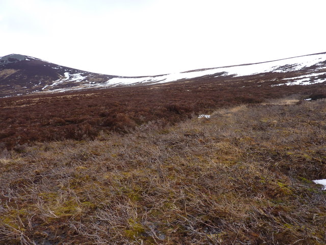
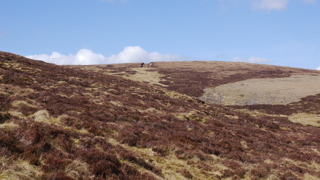
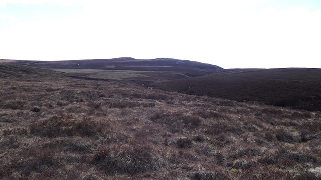
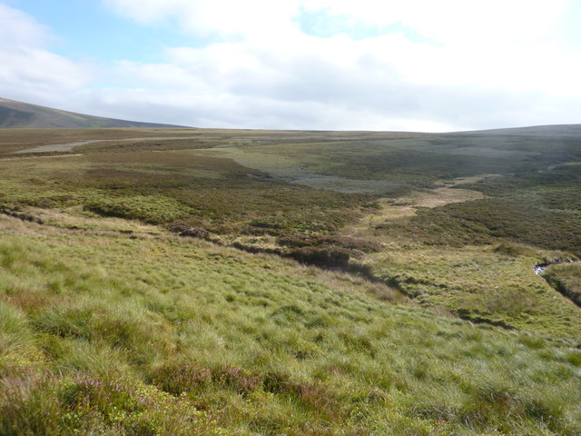
Kneedeep is a prominent hill located in the county of Banffshire, Scotland. Situated within the Cairngorms National Park, it offers stunning views of the surrounding landscape and is a popular destination for outdoor enthusiasts and hikers.

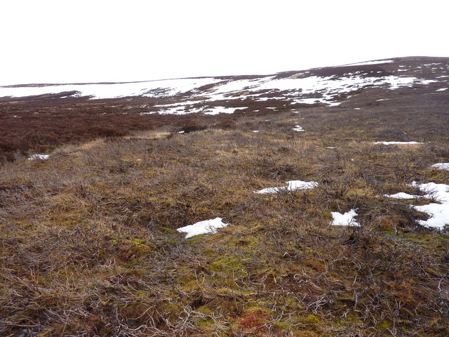
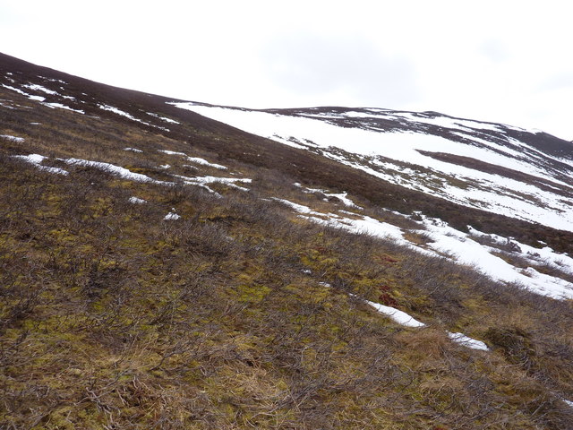
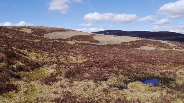
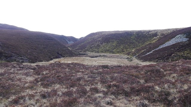
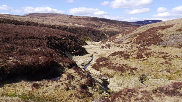
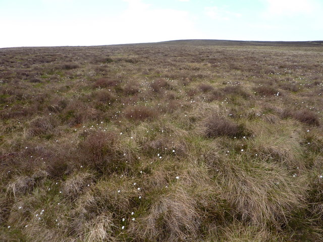
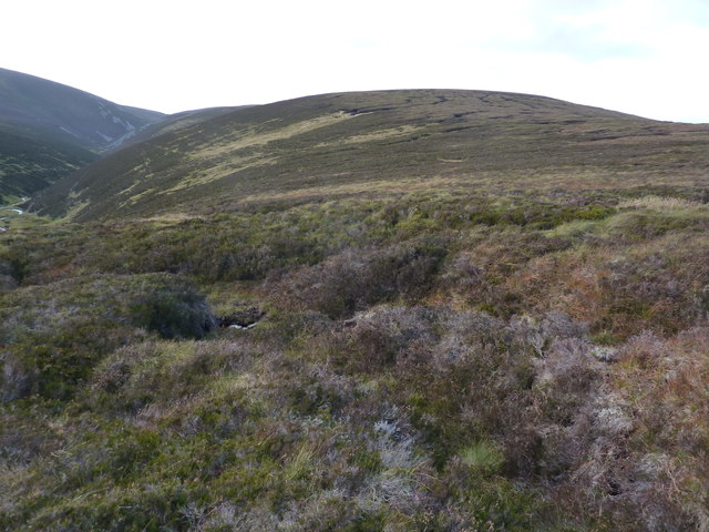
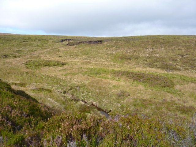
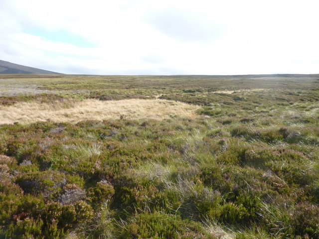
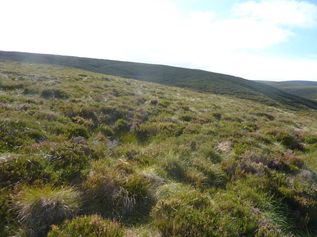
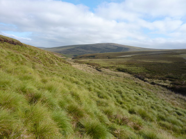
Rising to an elevation of approximately 800 meters (2,625 feet), Kneedeep stands as an imposing landmark in the region. The hill is characterized by its rugged terrain, with steep slopes and rocky outcrops that present a moderate challenge to climbers and walkers. Its location within the Cairngorms provides visitors with an opportunity to explore the diverse ecosystem of the area, including heather-clad moorlands, ancient Caledonian pine forests, and breathtaking glens.

Hikers embarking on the ascent of Kneedeep can choose from various routes, each offering its own unique experience. Some popular paths include the direct ascent from the nearby village of Glenmuick, which provides a shorter but steeper option, as well as longer routes that take in other nearby hills and landmarks such as Loch Muick and Lochnagar.

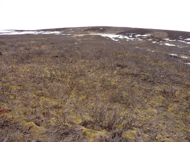
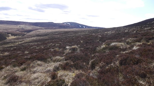
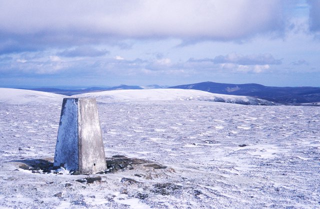
The summit of Kneedeep rewards climbers with panoramic vistas of the surrounding Cairngorms mountains, including the iconic Lochnagar and the vast expanse of the Highland landscape. On clear days, it is even possible to see as far as the North Sea coastline.

Overall, Kneedeep in Banffshire is a must-visit destination for outdoor enthusiasts, offering a challenging yet rewarding hiking experience amidst the stunning natural beauty of the Cairngorms National Park.

If you have any feedback on the listing, please let us know in the comments section below.

Kneedeep Images

Images are sourced within 2km of 57.302734/-3.1490555 or Grid Reference NJ3024. Thanks to Geograph Open Source API. All images are credited.

The lower slopes of Carn na Bruar Grouse moorland here, with large area burnt. There is a gate in the deer fence  at NJ 288 241 if you want get up here.
The lower slopes of Carn na Bruar
Grouse moorland here, with large area burnt. There is a gate in the deer fence at NJ 288 241 if you want get up here.
Unnamed 571m top south-east of Carn na Bruar Still plenty of old snow in early March
Unnamed 571m top south-east of Carn na Bruar
Still plenty of old snow in early March
Burnt heather moorland and moor under snow Above the Kymah Burn
Burnt heather moorland and moor under snow
Above the Kymah Burn
Typical East of Scotland grouse moor Here burnt to allow young heather to grow
Typical East of Scotland grouse moor
Here burnt to allow young heather to grow
East side of Carn na Bruar As I was convalescing, getting this far up Carn na Bruar was a triumph.  The good news was that the underfoot conditions were easy.  There is a line of grouse butts here, all with a pile of cartridge cases as there seems to be a littering is OK ethos here.
East side of Carn na Bruar
As I was convalescing, getting this far up Carn na Bruar was a triumph. The good news was that the underfoot conditions were easy. There is a line of grouse butts here, all with a pile of cartridge cases as there seems to be a littering is OK ethos here.
East side of Carn na Bruar The Blackwater Forest, a large area of heather moorland between Glen Livet and the Cabrach.
East side of Carn na Bruar
The Blackwater Forest, a large area of heather moorland between Glen Livet and the Cabrach.
Moorland, Ladder Hills Deep in the Blackwater Forest, looking towards some meltwater features.
Moorland, Ladder Hills
Deep in the Blackwater Forest, looking towards some meltwater features.
Lochs of Allt na Craoibhe-caorainn Marked as a lochan, this marshy ground lies in a meltwater channel.
Lochs of Allt na Craoibhe-caorainn
Marked as a lochan, this marshy ground lies in a meltwater channel.
Black Ditch Burn in the Blackwater Forest. It attempts to drain peaty uplands in the northern part of the Ladder Hills.
Black Ditch
Burn in the Blackwater Forest. It attempts to drain peaty uplands in the northern part of the Ladder Hills.
Starry Burn The Starry Burn on the way to the Allt na Craoibhe-Caorainn and Black Water.
Starry Burn
The Starry Burn on the way to the Allt na Craoibhe-Caorainn and Black Water.
Cotton grass moorland on the S.E. slope of Thiefsbush Hill
Round Hill
Round Hill
Cairnbrallan ruins looking west This was well-built house. In 1851 it was occupied by John Innes and family. He was described as a "forester gamekeeper". No forests now, and not much game.
Cairnbrallan ruins looking west
This was well-built house. In 1851 it was occupied by John Innes and family. He was described as a "forester gamekeeper". No forests now, and not much game.
Looking up Allt na Craoibhe-cuilinn In the background are the lower slopes of Kneedeep.
Looking up Allt na Craoibhe-cuilinn
In the background are the lower slopes of Kneedeep.
Heather and tussocky grass moorland On the slopes S.W. of Cairnbrallan
Heather and tussocky grass moorland
On the slopes S.W. of Cairnbrallan
Heather moorland on the slopes of Round Hill S.W. of Cairnbrallan, and looking S.W.
Heather moorland on the slopes of Round Hill
S.W. of Cairnbrallan, and looking S.W.
Looking up Allt na Craoibhe-cuilinn
Moorland scenery around Allt na Craoibhe-cuilinn
Show me another place!

Kneedeep is located at Grid Ref: NJ3024 (Lat: 57.302734, Lng: -3.1490555)

Unitary Authority: Moray

Police Authority: North East

What 3 Words

///hydrant.tried.jots. Near Dufftown, Moray

Nearby Locations

Kneedeep

Related Wikis

Badenyon

Badenyon (from Scottish Gaelic: Bad an Eòin - Knoll of the Birds) is a former clachan, or village, in Aberdeenshire, Scotland. The last farming inhabitant...

Badenyon Castle

Badenyon Castle was a castle, dating from the 13th century around 7.5 miles (12.1 km) west of Kildrummy, north of Coulins Burn, in Aberdeenshire, Scotland...

Peatfold Burn

Peatfold Burn is a burn which marks the boundary of the parish of Huntly, Aberdeenshire, Scotland. == References ==

Càrn Mòr (Ladder Hills)

Càrn Mòr (804 m) is the highest mountain of the Ladder Hills on the border of Aberdeenshire and Moray, Scotland. It is located northeast of the Cairngorm...

Have you been to Kneedeep?

Leave your review of Kneedeep below (or comments, questions and feedback).