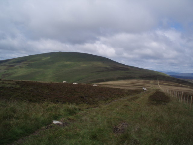
Bodandere Hill
Hill, Mountain in Angus
Scotland
Bodandere Hill

Bodandere Hill is a prominent geographical feature located in the county of Angus, Scotland. It is classified as a hill or mountain, depending on the criteria used, and stands at an elevation of approximately 400 meters (1312 feet) above sea level. The hill is situated in the southern part of Angus, near the town of Forfar.
The terrain of Bodandere Hill is characterized by undulating slopes and is primarily covered with grasses and heather, typical of the Scottish landscape. The hill offers panoramic views of the surrounding countryside, including the Angus Glens, the Sidlaw Hills, and the distant Grampian Mountains.
Bodandere Hill is a popular destination among outdoor enthusiasts, particularly hikers and walkers, due to its accessibility and stunning scenery. Several trails and footpaths traverse the hill, allowing visitors to explore its diverse flora and fauna while enjoying the peacefulness of the countryside.
The hill is also of historical interest, with remnants of ancient settlements and stone circles scattered across its slopes. These archaeological sites provide insight into the area's rich history, dating back thousands of years.
Overall, Bodandere Hill is a picturesque and significant landmark in Angus, offering visitors a chance to connect with nature, appreciate stunning vistas, and delve into the region's fascinating past.
If you have any feedback on the listing, please let us know in the comments section below.
Bodandere Hill Images
Images are sourced within 2km of 56.741064/-3.135761 or Grid Reference NO3061. Thanks to Geograph Open Source API. All images are credited.
Bodandere Hill is located at Grid Ref: NO3061 (Lat: 56.741064, Lng: -3.135761)
Unitary Authority: Angus
Police Authority: Tayside
What 3 Words
///tape.lifeboats.surfaces. Near Kirriemuir, Angus
Nearby Locations
Related Wikis
Cat Law
Cat Law (671 m) is a hill in the southern Mounth of Scotland, north of Kirriemuir in Angus. A rounded peak, it lies above Strathmore in the south and offers...
Balintore Castle
Balintore Castle is a Victorian Category A listed building in Scotland. The castle occupies an elevated site in moorland above Balintore village, a few...
Balintore, Angus
Balintore (Scottish Gaelic: Baile an Todhair) is a village in Angus, Scotland. It lies in Glen Isla, four miles north of the Loch of Lintrathen and seven...
Ascreavie
Ascreavie is a country house in Angus, Scotland. It is located 2 kilometres (1.2 mi) north of Kirkton of Kingoldrum, and 6 kilometres (3.7 mi) north-west...
Backwater Reservoir
Backwater Reservoir is a reservoir in north west Angus, Scotland. The reservoir's sole purpose is to provide drinking water, and as such, it supplies Angus...
Mile Hill, Dykehead
There is another Mile Hill nearby which is a MarilynMile Hill is located in Angus, Scotland, 1000 metres west of Dykehead. It is a circular hill rising...
Kirkton of Kingoldrum
Kirkton of Kingoldrum is a village in Angus, Scotland. It lies in approximately four miles (6 km) west of Kirriemuir on the B951 road. == References ==
Loch of Lintrathen
Loch of Lintrathen is a man-made loch occupying a glacial basin at the southern end of Glen Isla, approximately 13 kilometres (8.1 mi) west of town of...
Nearby Amenities
Located within 500m of 56.741064,-3.135761Have you been to Bodandere Hill?
Leave your review of Bodandere Hill below (or comments, questions and feedback).


