Blake Muir
Hill, Mountain in Peeblesshire
Scotland
Blake Muir

Blake Muir is a prominent hill located in Peeblesshire, a historic county in the Scottish Borders region of Scotland. Rising to an elevation of approximately 566 meters (1,857 feet), it is considered one of the notable peaks in the area.
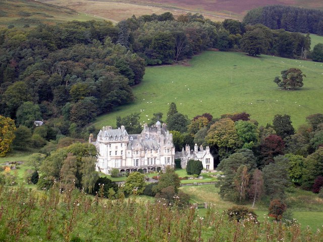
Situated near the small village of Eddleston, Blake Muir offers breathtaking panoramic views of the surrounding countryside. Its location within the Southern Uplands provides visitors with a chance to appreciate the natural beauty of the region. The hill is covered in lush green vegetation, particularly heather and grasses, adding to its picturesque appeal.
Blake Muir is a popular destination for outdoor enthusiasts, offering opportunities for hiking, walking, and mountaineering. The hill is accessible by well-defined trails, making it suitable for both experienced hikers and those looking for a leisurely stroll. The ascent to the summit provides a moderate challenge, rewarded with stunning vistas from its peak.
The hill is also known for its rich wildlife, with various species of birds, mammals, and plants calling it home. Birdwatchers may spot red grouse, pheasants, and buzzards soaring above, while deer and rabbits can occasionally be seen grazing in the surrounding fields.
Overall, Blake Muir in Peeblesshire is a captivating hill that entices adventurers, nature lovers, and those seeking tranquility in the Scottish countryside. Its accessibility, diverse flora and fauna, and breathtaking views make it a must-visit destination for anyone exploring the region.
If you have any feedback on the listing, please let us know in the comments section below.
Blake Muir Images
Images are sourced within 2km of 55.564461/-3.1073837 or Grid Reference NT3030. Thanks to Geograph Open Source API. All images are credited.
Blake Muir is located at Grid Ref: NT3030 (Lat: 55.564461, Lng: -3.1073837)
Unitary Authority: The Scottish Borders
Police Authority: The Lothians and Scottish Borders
What 3 Words
///newsstand.thumps.free. Near Innerleithen, Scottish Borders
Nearby Locations
Related Wikis
The Glen, Scottish Borders
The Glen, also known as Glen House, is an estate and country house in the parish of Traquair, southern Scotland. It is located in the glen of the Quair...
Traquair
Traquair (Scottish Gaelic: Cille Bhrìghde) is a small village and civil parish in the Scottish Borders; until 1975 it was in the county of Peeblesshire...
Sir Walter Scott Way
The Sir Walter Scott Way is a 92-mile (148 km) long-distance footpath in the Scottish Borders. The route broadly follows the waymarked Southern Upland...
Quair Water
The Quair Water is a tributary of the River Tweed in the Scottish Borders area of Scotland. Its name is related to Traquair. == Etymology == The name Quair...
Dun Rig
Dun Rig is a hill in the Manor Hills range, part of the Southern Uplands of Scotland. It is the highest hill in the northernmost cluster of the Manor Hills...
Traquair House
Traquair House, approximately 7 miles southeast of Peebles, is claimed to be the oldest continually inhabited house in Scotland. Whilst not strictly a...
Manor Hills
The Manor Hills, also known as the Tweedsmuir Hills, are a range of hills south of Peebles in the Scottish Borders, one of the ranges which collectively...
Cardrona Forest
The Cardrona Forest is a forest in the Scottish Borders area of Scotland, on the B7062, near Peebles. OS Grid Reference: NT292385. Cardrona Forest consists...
Have you been to Blake Muir?
Leave your review of Blake Muir below (or comments, questions and feedback).


