Archie Hill

Hill, Mountain in Dumfriesshire

Scotland

Archie Hill

Craik Cross Hill on Romans & Reivers Route Not much of a track or surface on this section of the Romans & Reivers Route. Unchallenging for hikers but means pushing for cyclists. Track resumes at top.
Craik Cross Hill on Romans & Reivers Route Credit: Kim McGillivray

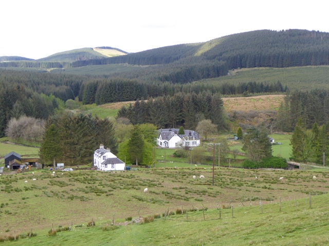
Archie Hill, located in Dumfriesshire, Scotland, is a prominent hill that offers stunning views and a peaceful retreat for outdoor enthusiasts. Standing at an elevation of approximately 414 meters (1,358 feet), it is not classified as a mountain but is often referred to as such due to its steep and rugged terrain.

Archie Hill is situated in a rural area, surrounded by rolling hills and scenic landscapes. It is a popular destination for hikers and climbers seeking a moderate challenge. The ascent to the summit provides an enjoyable trek through a mixture of grassy slopes and rocky paths, offering varying levels of difficulty.

At the top of Archie Hill, visitors are rewarded with breathtaking panoramic views of the surrounding countryside, including the picturesque villages of Dumfries and Galloway. On a clear day, it is even possible to catch a glimpse of the Irish Sea in the distance.

The hill is rich in biodiversity, with an abundance of flora and fauna. The surrounding area is home to various species of birds, including red kites, buzzards, and kestrels. Wildflowers, such as heather and bluebells, decorate the landscape, adding to the natural beauty of the area.

Archie Hill is easily accessible, with well-marked paths leading to the summit. It is recommended to wear appropriate footwear and clothing, as the weather can change quickly. Visitors are advised to bring water, snacks, and a map, as there are limited facilities in the immediate vicinity.

Overall, Archie Hill offers a rewarding outdoor experience for nature lovers and adventurers, with its stunning views, challenging terrain, and tranquil surroundings.

If you have any feedback on the listing, please let us know in the comments section below.

Archie Hill Images

Images are sourced within 2km of 55.347841/-3.1096402 or Grid Reference NT2906. Thanks to Geograph Open Source API. All images are credited.

Craik Cross Hill on Romans & Reivers Route Not much of a track or surface on this section of the Romans & Reivers Route. Unchallenging for hikers but means pushing for cyclists. Track resumes at top.
Craik Cross Hill on Romans & Reivers Route
Not much of a track or surface on this section of the Romans & Reivers Route. Unchallenging for hikers but means pushing for cyclists. Track resumes at top.
Sundown in the forest A view over the western extreme of Craik Forest at 1537 hrs on a late December afternoon.

This photograph was taken during the Coronavirus (COVID-19) pandemic of 2020.
Sundown in the forest
A view over the western extreme of Craik Forest at 1537 hrs on a late December afternoon. This photograph was taken during the Coronavirus (COVID-19) pandemic of 2020.
Snow-laden branches Snow-laden branches hang over the forestry access track near Moodlaw Loch.  Light, wind-driven snow had penetrated deep into the spruce stands and formed fluffy deposits on the branches in the area.

This photograph was taken during the Coronavirus (COVID-19) pandemic of 2020.
Snow-laden branches
Snow-laden branches hang over the forestry access track near Moodlaw Loch. Light, wind-driven snow had penetrated deep into the spruce stands and formed fluffy deposits on the branches in the area. This photograph was taken during the Coronavirus (COVID-19) pandemic of 2020.
A snowy scene at Moodlaw Loch With a temperature of -1°C, Moodlaw Loch was partially-frozen.  The forest has recently been harvested, opening up the loch a little to the north-east.  Forestry machinery could be heard operating in the distance.

This photograph was taken during the Coronavirus (COVID-19) pandemic of 2020.
A snowy scene at Moodlaw Loch
With a temperature of -1°C, Moodlaw Loch was partially-frozen. The forest has recently been harvested, opening up the loch a little to the north-east. Forestry machinery could be heard operating in the distance. This photograph was taken during the Coronavirus (COVID-19) pandemic of 2020.
Reflections at Moodlaw Loch Some spindly spruce specimens have been spared from the harvester and stand (perhaps not for long) on the exposed north-eastern side of Moodlaw Loch.

This photograph was taken during the Coronavirus (COVID-19) pandemic of 2020.
Reflections at Moodlaw Loch
Some spindly spruce specimens have been spared from the harvester and stand (perhaps not for long) on the exposed north-eastern side of Moodlaw Loch. This photograph was taken during the Coronavirus (COVID-19) pandemic of 2020.
The southern end of Moodlaw Loch The area in the foreground consists of damp, tussocky vegetation and one has to be wary where the feet are placed.  Harvesting is taking place nearby and it may well be that come the same time next year, Moodlaw Loch is free of forestry on all sides.

This photograph was taken during the Coronavirus (COVID-19) pandemic of 2020.
The southern end of Moodlaw Loch
The area in the foreground consists of damp, tussocky vegetation and one has to be wary where the feet are placed. Harvesting is taking place nearby and it may well be that come the same time next year, Moodlaw Loch is free of forestry on all sides. This photograph was taken during the Coronavirus (COVID-19) pandemic of 2020.
Late afternoon in the forest Sundown approaching in the forest west of Moodlaw Loch.

This photograph was taken during the Coronavirus (COVID-19) pandemic of 2020.
Late afternoon in the forest
Sundown approaching in the forest west of Moodlaw Loch. This photograph was taken during the Coronavirus (COVID-19) pandemic of 2020.
Between Black Sike and Quickening Cleuch Various stages of forestry as viewed from the access track approaching sundown.  The distinctive profile of the Eildon Hills near Melrose could clearly be noted from this vantage point.

This photograph was taken during the Coronavirus (COVID-19) pandemic of 2020.
Between Black Sike and Quickening Cleuch
Various stages of forestry as viewed from the access track approaching sundown. The distinctive profile of the Eildon Hills near Melrose could clearly be noted from this vantage point. This photograph was taken during the Coronavirus (COVID-19) pandemic of 2020.
Crossing the Wolfcleuch Burn The road has been reopened after being blocked by windthrown trees. Some paths are still blocked elsewhere in the forest.
Crossing the Wolfcleuch Burn
The road has been reopened after being blocked by windthrown trees. Some paths are still blocked elsewhere in the forest.
Ride, Craik Forest An area of spruce ready for harvesting. View down the ride towards Craik Moor.
Ride, Craik Forest
An area of spruce ready for harvesting. View down the ride towards Craik Moor.
Ride, Long Tae (Craik Forest) This ride was once enclosed like its continuation over on far side of the Rankle Burn. One side was felled, and the wind did for the remaining trees on the eastern side. Cotton grass is a reminder that this was once boggy moorland.
Ride, Long Tae (Craik Forest)
This ride was once enclosed like its continuation over on far side of the Rankle Burn. One side was felled, and the wind did for the remaining trees on the eastern side. Cotton grass is a reminder that this was once boggy moorland.
Ride junction, Long Tae A large replanted area on the northeast side of a boggy ride (complete with cotton grass).
Ride junction, Long Tae
A large replanted area on the northeast side of a boggy ride (complete with cotton grass).
Roman road, Craik Cross Hill Looking up the wide ride left along the site of the Roman road towards the summit of Craik Cross Hill. The going would be hard here, if it were not for the new path on the left hand side of the ride, this is part of a long distance route from Ae to Hawick, and is designed for horse traffic. Sadly it is little used, and acting as a seedbed for self seeding Sitka spruce. Without traffic, or herbicides it will soon be unridable. At the moment it gives an enjoyable , sometimes wheel lifting climb from the road end at<a href="https://www.geograph.org.uk/photo/967099">NT2904 : Road end, Mid Moss</a>.
Roman road, Craik Cross Hill
Looking up the wide ride left along the site of the Roman road towards the summit of Craik Cross Hill. The going would be hard here, if it were not for the new path on the left hand side of the ride, this is part of a long distance route from Ae to Hawick, and is designed for horse traffic. Sadly it is little used, and acting as a seedbed for self seeding Sitka spruce. Without traffic, or herbicides it will soon be unridable. At the moment it gives an enjoyable , sometimes wheel lifting climb from the road end atNT2904 : Road end, Mid Moss.
Roman road, Craik Cross Hill New path along or sometimes parallel with the Roman road over Craik Cross Hill. The hard surfaced path makes travel over the watershed much easier for feet, hooves and wheels than the soft deep grass of the ride that runs the course of the Roman Road. It gets little use, and is being colonised by spruce seedlings.
Roman road, Craik Cross Hill
New path along or sometimes parallel with the Roman road over Craik Cross Hill. The hard surfaced path makes travel over the watershed much easier for feet, hooves and wheels than the soft deep grass of the ride that runs the course of the Roman Road. It gets little use, and is being colonised by spruce seedlings.
Roman road, Craik Moor A cutting on the old road off Craik Cross Hill. I expect it was used long after the brief Roman involvement here, judging by the cuttings. It is now lost to deep grass and bog. Fortunately there is now a firm new path crossing from the Forestry Commission's woods around Craik to Kronospan's Eskdalemuir forests, so the route is quite easy again and forms part of a long distance path from Ae to Hawick.
Roman road, Craik Moor
A cutting on the old road off Craik Cross Hill. I expect it was used long after the brief Roman involvement here, judging by the cuttings. It is now lost to deep grass and bog. Fortunately there is now a firm new path crossing from the Forestry Commission's woods around Craik to Kronospan's Eskdalemuir forests, so the route is quite easy again and forms part of a long distance path from Ae to Hawick.
Cherry Lair A friendly greeting from a small enclave of woodland that is neither owned by Kronospan nor the Forestry Commission. Despite the unsuccessful attempt to squeeze a goml sign past the Land Reform Act (2003) the ride beyond did provide an escape route from the deep vegetation of the ride along the Roxburghshire-Dumfriesshire march.
The photograph was taken from the main east-west watershed of Scotland.
Cherry Lair
A friendly greeting from a small enclave of woodland that is neither owned by Kronospan nor the Forestry Commission. Despite the unsuccessful attempt to squeeze a goml sign past the Land Reform Act (2003) the ride beyond did provide an escape route from the deep vegetation of the ride along the Roxburghshire-Dumfriesshire march. The photograph was taken from the main east-west watershed of Scotland.
Road, Post Office Knowe Near the road end on the Dumfriesshire side of Post Office Knowe.
Road, Post Office Knowe
Near the road end on the Dumfriesshire side of Post Office Knowe.
Interpretation board,  Craik Cross Hill Near the summit, on the watershed. Artists impression of the signal tower that once stood here.
Interpretation board, Craik Cross Hill
Near the summit, on the watershed. Artists impression of the signal tower that once stood here.
Show me another place!

Archie Hill is located at Grid Ref: NT2906 (Lat: 55.347841, Lng: -3.1096402)

Unitary Authority: Dumfries and Galloway

Police Authority: Dumfries and Galloway

What 3 Words

///rebel.caked.stud. Near Ettrick, Scottish Borders

Nearby Locations

Archie Hill

Related Wikis

Craik, Scottish Borders

Craik is a hamlet in Craik Forest, by the Airhouse Burn in the Scottish Borders area of Scotland, close to Roberton, Scottish Borders (grid reference NT348084...

Craik Forest

Craik Forest is a forest near Hawick in the Scottish Borders area of Scotland, and managed by the Forestry Commission. It is adjoined to the south-west...

Eskdalemuir Observatory

The Eskdalemuir Observatory is a UK national environmental observatory located near Eskdalemuir, Dumfries and Galloway, Scotland. Along with Lerwick and...

Buccleuch, Scottish Borders

East and West Buccleuch ( bə-KLOO) are two homesteads in the Scottish Borders, in the Ettrick parish of historic Selkirkshire. They are located off the...

Have you been to Archie Hill?

Leave your review of Archie Hill below (or comments, questions and feedback).