Side Pike

Hill, Mountain in Westmorland South Lakeland

England

Side Pike

The Langdale Pikes
The Langdale Pikes Credit: Adrian Taylor

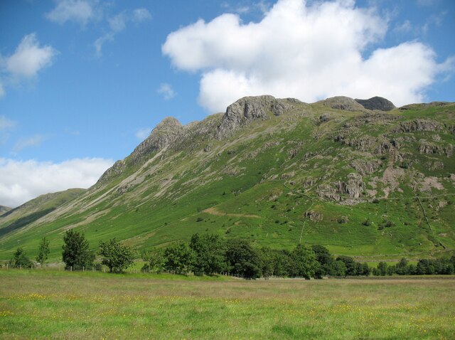
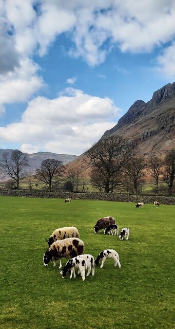
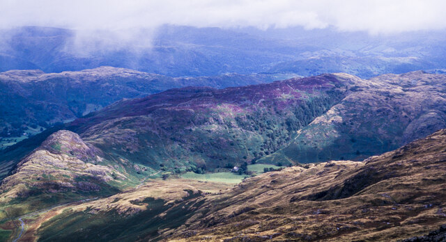
Side Pike is a prominent hill located in the county of Westmorland, in the picturesque Lake District region of England. Rising to an elevation of approximately 366 meters (1,201 feet), it is classified as a hill rather than a mountain. Despite its modest height, Side Pike offers breathtaking panoramic views of the surrounding landscape and is a popular destination for hikers, walkers, and nature enthusiasts.

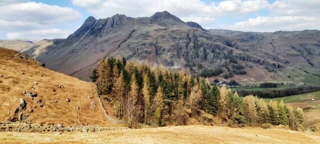
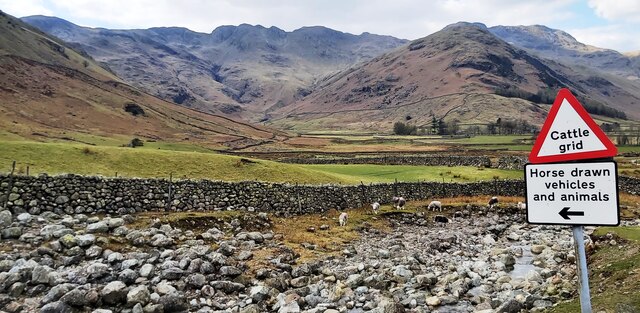
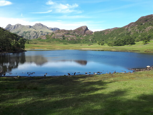
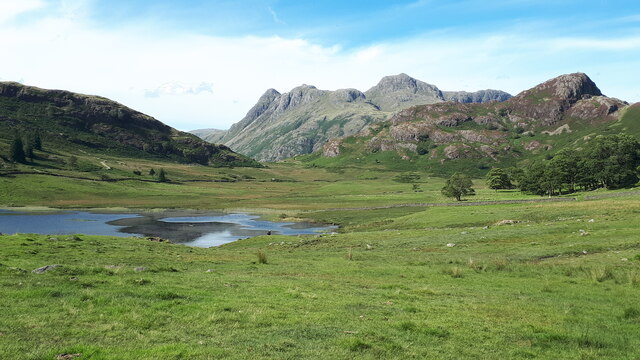
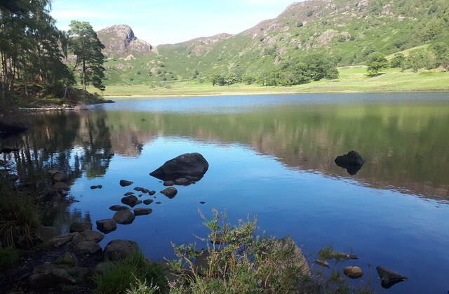
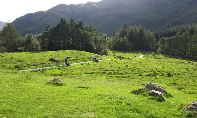
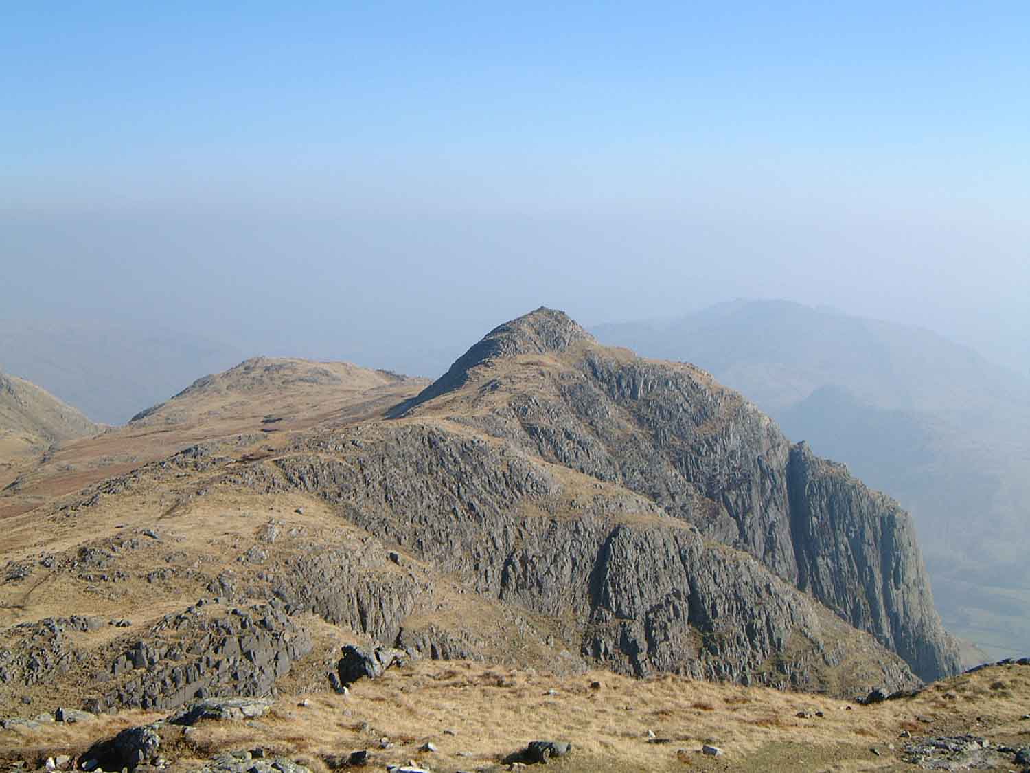
Situated in close proximity to the charming village of Elterwater, Side Pike is easily accessible and attracts visitors throughout the year. The hill forms part of the famous Langdale Pikes, a group of peaks renowned for their rugged beauty and challenging trails. Side Pike is often included in hiking routes that encompass the neighboring hills of Pike o' Stickle and Harrison Stickle, providing a rewarding and unforgettable experience for outdoor enthusiasts.

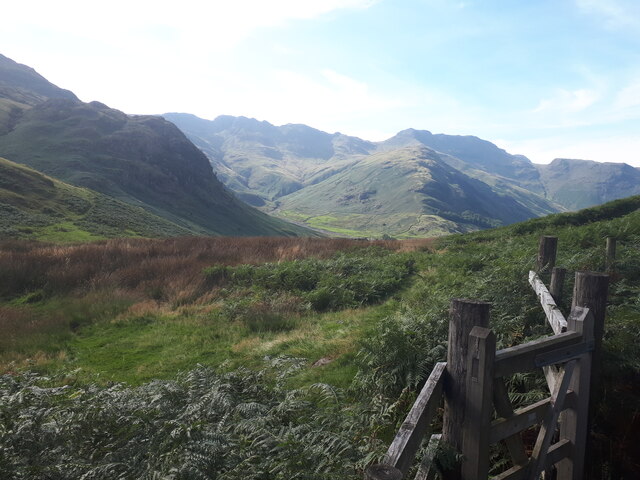
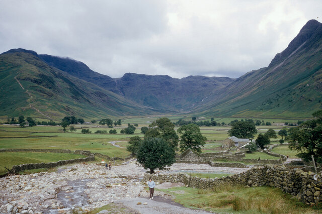
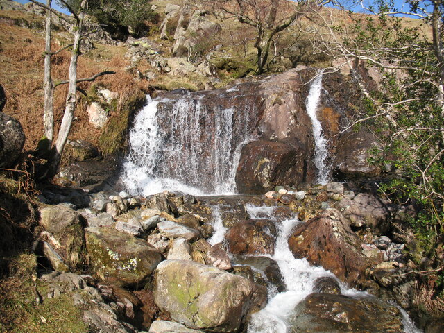
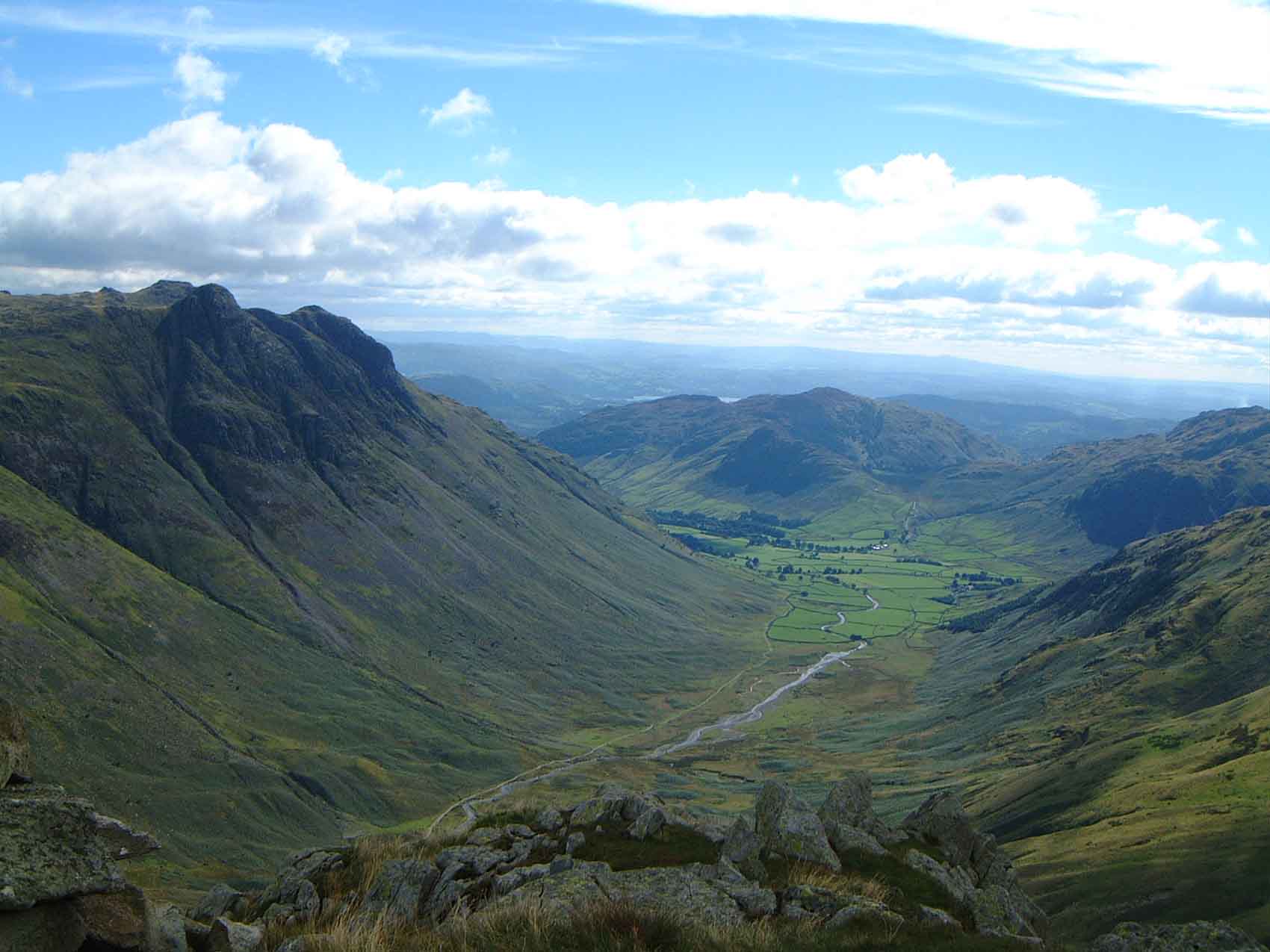
The ascent of Side Pike can be steep in certain sections, requiring a moderate level of fitness and proper hiking gear. The terrain is characterized by rocky paths, grassy slopes, and occasional scree, adding to the adventurous nature of the climb. As walkers ascend Side Pike, they are treated to breathtaking views of the Langdale Valley, the shimmering waters of Elterwater, and the surrounding rolling hills and mountains.

At the summit, visitors are rewarded with a magnificent panorama that stretches as far as the eye can see. The beauty of the Lake District unfolds before them, with its patchwork of lakes, lush green valleys, and majestic peaks. On a clear day, it is even possible to catch a glimpse of the distant Irish Sea.

Overall, Side Pike is a captivating hill in Westmorland, offering a challenging yet rewarding hiking experience and incredible vistas that showcase the natural beauty of the Lake District.

If you have any feedback on the listing, please let us know in the comments section below.
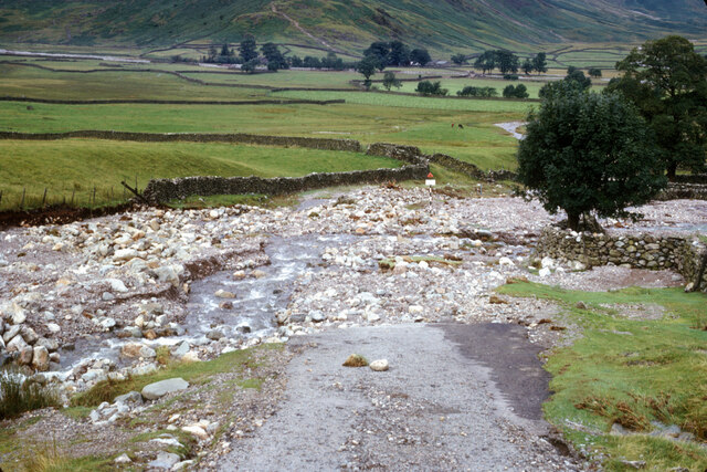
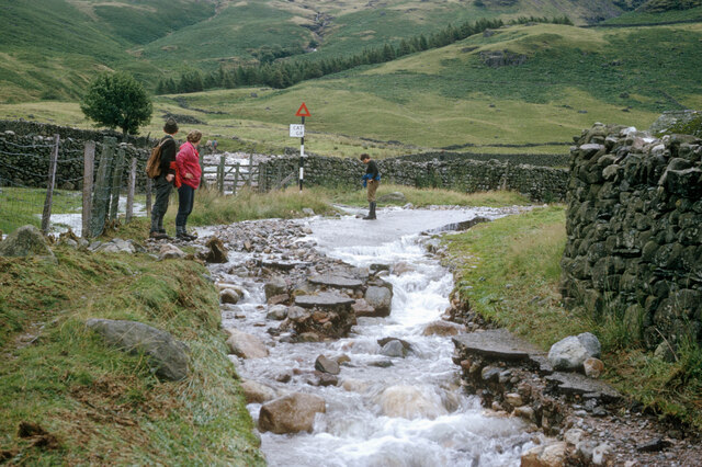
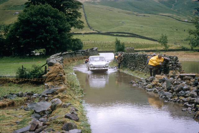
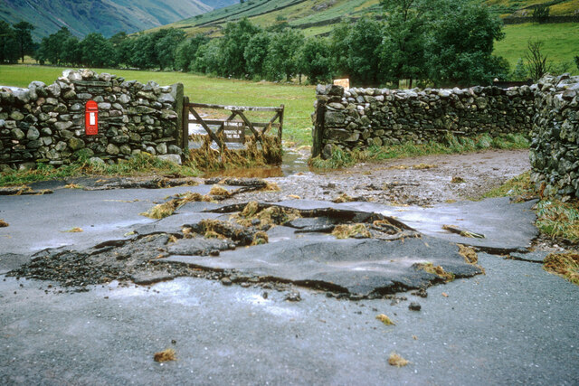
Side Pike Images

Images are sourced within 2km of 54.438786/-3.0913197 or Grid Reference NY2905. Thanks to Geograph Open Source API. All images are credited.

The Langdale Pikes
The Langdale Pikes
Tractors at Stool End Farm
Plantation on Kettle Crag
Inside the Cattle Shed at Stool End Farm
Pasture near Wall End Farm
Redacre Gill near Wall End Farm
Blea Tarn on a sunny and calm September afternoon Looking north across Blea Tarn, with the Langdale Pikes in the distance to the left, and Side Pike central.
Although Side Pike appears nearly as high, it is much closer than the Langdales. 

Side Pike (<a href="https://www.geograph.org.uk/gridref/NY2905">NY2905</a>) is just under 1km from the camera, and 224m above sea level, and only 34m above my position on the 190m contour. Pike of Stickle (<a href="https://www.geograph.org.uk/gridref/NY2707">NY2707</a>) on the left is 3.5km distant, and 709m asl, Harrison Stickle (<a href="https://www.geograph.org.uk/gridref/NY2807">NY2807</a>) is 3.3km distant and 736m asl.
Blea Tarn on a sunny and calm September afternoon
Looking north across Blea Tarn, with the Langdale Pikes in the distance to the left, and Side Pike central. Although Side Pike appears nearly as high, it is much closer than the Langdales. Side Pike (NY2905) is just under 1km from the camera, and 224m above sea level, and only 34m above my position on the 190m contour. Pike of Stickle (NY2707) on the left is 3.5km distant, and 709m asl, Harrison Stickle (NY2807) is 3.3km distant and 736m asl.
Blea Tarn and the Langdale Pikes
Blea Tarn, calm September afternoon Looking towards the rocky Side Pike on the left and the rising ground of Lingmoor Fell on the right.
Blea Tarn, calm September afternoon
Looking towards the rocky Side Pike on the left and the rising ground of Lingmoor Fell on the right.
Footpath through the bracken below Side Pike And just above the road past Blea Tarn. Looking towards the Langdale valley.
Footpath through the bracken below Side Pike
And just above the road past Blea Tarn. Looking towards the Langdale valley.
Footpath on the south side of Blea Tarn There's a very clear and easy footpath that takes you from the gate opposite the car park, along the south and west sides of the tarn. Then you can return along the road.
(That's a large white fluffy dog on the path, not a sheep.)
Footpath on the south side of Blea Tarn
There's a very clear and easy footpath that takes you from the gate opposite the car park, along the south and west sides of the tarn. Then you can return along the road. (That's a large white fluffy dog on the path, not a sheep.)
The Blea Tarn to Langdale Road after the deluge The road approaching Wall End from Blea Tarn was washed away after a major storm in the summer of 1966.  This was the result of 12 hours of rain after which the day was fine!  The Langdale campsite was navigable by canoe.
The Blea Tarn to Langdale Road after the deluge
The road approaching Wall End from Blea Tarn was washed away after a major storm in the summer of 1966. This was the result of 12 hours of rain after which the day was fine! The Langdale campsite was navigable by canoe.
Storm damage to the Blea Tarn to Langdale Road The Redacre Gill had burst its banks and followed the course of the road.  The cattle grid sign lower down the road is seen across the stream.
Storm damage to the Blea Tarn to Langdale Road
The Redacre Gill had burst its banks and followed the course of the road. The cattle grid sign lower down the road is seen across the stream.
Looking up the Blea Tarn road from Langdale The cattle grid is marked on the OS Map. The road has been taken over by the Redacre Gill.  Rain fell continuously for over 12 hours before the floods and rivers bursting their banks.
Looking up the Blea Tarn road from Langdale
The cattle grid is marked on the OS Map. The road has been taken over by the Redacre Gill. Rain fell continuously for over 12 hours before the floods and rivers bursting their banks.
Langdale floods, September 1966 The campsite that had contained our tents was completely under water. The staff at The Old Dungeon Ghyll hotel allowed those from the campsite to spend the night in the basement of the hotel.  This was the prospect the day after the rain.
Langdale floods, September 1966
The campsite that had contained our tents was completely under water. The staff at The Old Dungeon Ghyll hotel allowed those from the campsite to spend the night in the basement of the hotel. This was the prospect the day after the rain.
Road damage after the September 1966 Langdale storm It was a surprise how fast the water receded after the storm but the impact of the storm remained.
Road damage after the September 1966 Langdale storm
It was a surprise how fast the water receded after the storm but the impact of the storm remained.
Slopes of Wrynose Fell The near slopes are those of Wrynose Fell which is descending to Great Langdale.
The lower hill occupying the central part of the image is Lingmoor with the sunlit feature of Side Pike at the left side of the frame.
Slopes of Wrynose Fell
The near slopes are those of Wrynose Fell which is descending to Great Langdale. The lower hill occupying the central part of the image is Lingmoor with the sunlit feature of Side Pike at the left side of the frame.
Waterfall on Dungeon Ghyll Just above the footbridge carrying the public bridleway from New Dungeon Ghyll to Mickleden and adjacent to The Cumbria Way long distance path, this modest waterfall takes Dungeon Ghyll Beck over a layer of hard volcanic rock.
Waterfall on Dungeon Ghyll
Just above the footbridge carrying the public bridleway from New Dungeon Ghyll to Mickleden and adjacent to The Cumbria Way long distance path, this modest waterfall takes Dungeon Ghyll Beck over a layer of hard volcanic rock.
Show me another place!

Side Pike is located at Grid Ref: NY2905 (Lat: 54.438786, Lng: -3.0913197)

Administrative County: Cumbria

District: South Lakeland

Police Authority: Cumbria

What 3 Words

///formally.thousands.weekday. Near Ambleside, Cumbria

Related Wikis

Lingmoor Fell

Lingmoor Fell is a fell in the English Lake District, situated eight kilometres (five miles) west of Ambleside. The fell reaches a height of 469 m (1,540...

Great Langdale

Great Langdale is a valley in the Lake District National Park in North West England, the epithet, "Great" distinguishing it from the neighbouring valley...

Langdale axe industry

The Langdale axe industry (or factory) is the name given by archaeologists to a Neolithic centre of specialised stone tool production in the Great Langdale...

Ting Mound

The Ting Mound or Thing Moot at Fellfoot Farm, Little Langdale, Cumbria, England is an Ancient Monument (a 'nationally important' archaeological site)...

Stickle Tarn, Langdale

Stickle Tarn is a small tarn near Harrison Stickle in Lake District, England. The tarn was enlarged by the building of a stone dam in 1838 and is used...

Loft Crag

Loft Crag is a fell in the English Lake District, situated nine kilometres (5+1⁄2 miles) west of Ambleside in the valley of Great Langdale. Along with...

Harrison Stickle

Harrison Stickle is a fell in the central part of the English Lake District, situated above Great Langdale. The fell is one of the three (although the...

Pike of Blisco

Pike of Blisco, or Pike o' Blisco, is a mountain in the Lake District in Cumbria, England. Located between the valleys of Great Langdale and Little Langdale...

Nearby Amenities

Located within 500m of 54.438786,-3.0913197
Ele: 230
Lat/Long: 54.4364349/-3.0971388
Barrier: stile
Lat/Long: 54.4373299/-3.0856322
Barrier: cattle_grid
Lat/Long: 54.4364066/-3.0970977
Side Pike
Ele: 362
Natural: peak
Lat/Long: 54.4386478/-3.0913129
Barrier: stile
Lat/Long: 54.4367037/-3.0964791
Barrier: stile
Lat/Long: 54.4426109/-3.0924262
Barrier: stile
Lat/Long: 54.4358881/-3.0931255
Barrier: kissing_gate
Lat/Long: 54.4364845/-3.0970615
Fat Man's Agony
Alt Name: The squeeze
Place: locality
Lat/Long: 54.4381805/-3.0911545
Ford: yes
Lat/Long: 54.4367226/-3.0916956
Barrier: stile
Lat/Long: 54.4422049/-3.0947495
Ford: yes
Lat/Long: 54.4427139/-3.0920566
Ford: yes
Lat/Long: 54.4431922/-3.0905717
Information: guidepost
Tourism: information
Lat/Long: 54.4361923/-3.0914229
Information: guidepost
Tourism: information
Lat/Long: 54.4364914/-3.0970434
Information: guidepost
Tourism: information
Lat/Long: 54.4362119/-3.0973601
Barrier: stile
Lat/Long: 54.441589/-3.0944112
The data included in this document is from www.openstreetmap.org. The data is made available under ODbL.

Have you been to Side Pike?

Leave your review of Side Pike below (or comments, questions and feedback).