Castle Hill

Hill, Mountain in Peeblesshire

Scotland

Castle Hill

Track by the Hope Burn Bundles of fence posts by the track on the way up by Hope Burn towards the plantations of Glentress Forest.
Track by the Hope Burn Credit: Jim Barton

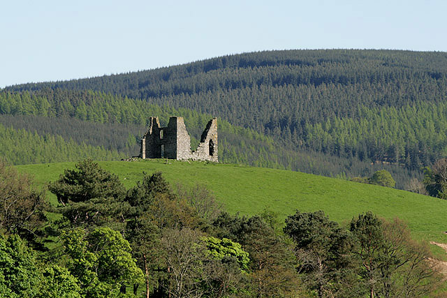
Castle Hill is a prominent hill located in Peeblesshire, Scotland. Situated near the town of Peebles, it stands at an elevation of approximately 250 meters (820 feet). The hill is known for its distinctive shape, resembling the profile of a castle, hence its name.

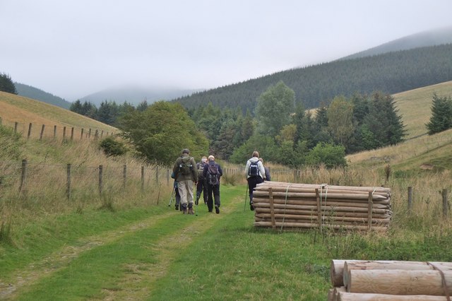
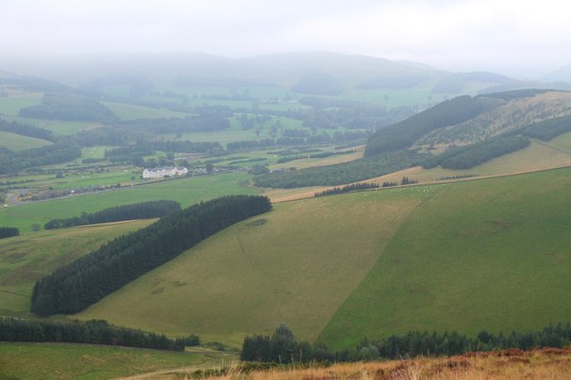
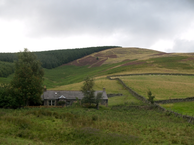
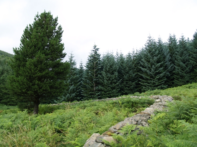
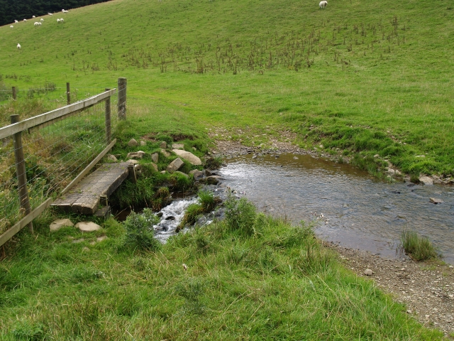
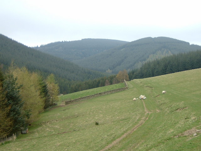
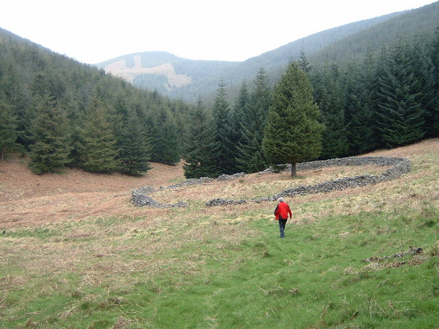
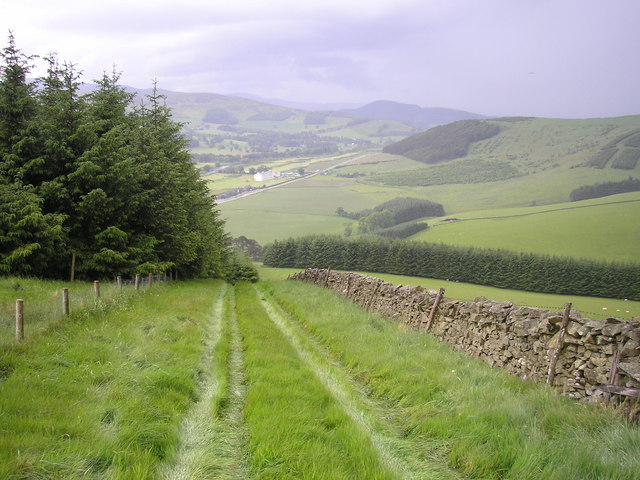
Castle Hill is a popular destination for hikers and outdoor enthusiasts, offering breathtaking panoramic views of the surrounding countryside. The hill is covered in lush green vegetation, which adds to its natural beauty. Its slopes are relatively gentle, making it accessible for walkers of all levels of fitness.

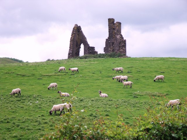
At the summit of Castle Hill, there are remnants of an ancient fortification, believed to have been built during the Iron Age. These archaeological remains include earthworks and a series of ditches and ramparts, providing insights into the area's historical significance. The site has also been associated with Roman occupation in the region.

The hill is a designated Scheduled Monument, reflecting its cultural and historical importance. It attracts both casual visitors and history enthusiasts who are keen to explore its ancient past. The surrounding area is also home to a diverse range of wildlife, including various bird species and small mammals.

Castle Hill offers a tranquil escape from the hustle and bustle of everyday life, providing an opportunity to immerse oneself in nature and connect with the region's rich history. Whether it is for a leisurely stroll or a more challenging hike, Castle Hill is a captivating destination that showcases the beauty and heritage of Peeblesshire.

If you have any feedback on the listing, please let us know in the comments section below.
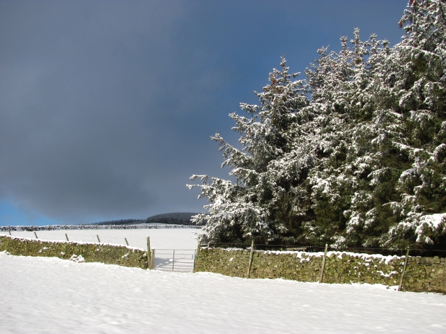
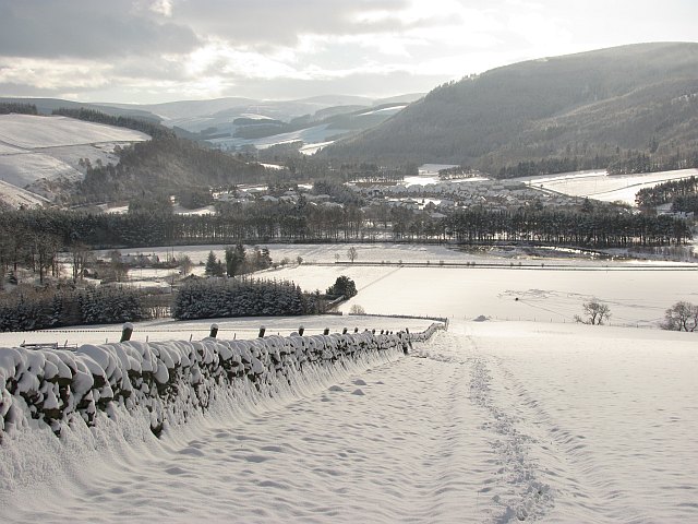
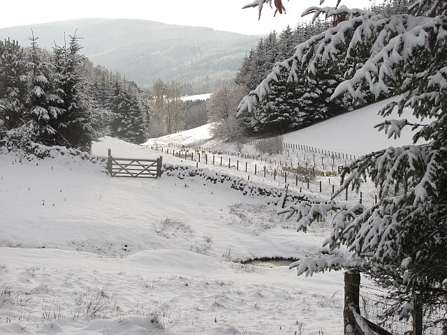
Castle Hill Images

Images are sourced within 2km of 55.648971/-3.1273433 or Grid Reference NT2940. Thanks to Geograph Open Source API. All images are credited.

Track by the Hope Burn Bundles of fence posts by the track on the way up by Hope Burn towards the plantations of Glentress Forest.
Track by the Hope Burn
Bundles of fence posts by the track on the way up by Hope Burn towards the plantations of Glentress Forest.
Bught Hill from Habs Cleuch Shank Much of the land in the middle foreground will be planted by the Forestry Commission over the next few years. The white building in the valley is the Macdonald Cardrona Hotel.
Bught Hill from Habs Cleuch Shank
Much of the land in the middle foreground will be planted by the Forestry Commission over the next few years. The white building in the valley is the Macdonald Cardrona Hotel.
Hope and Habs Cleuch Shank Hope is the cottage, and Habs Cleuch Shank the ridge behind on the right.  A very secluded dwelling, reachable only up a grass track.
Hope and Habs Cleuch Shank
Hope is the cottage, and Habs Cleuch Shank the ridge behind on the right. A very secluded dwelling, reachable only up a grass track.
Old Sheep Fold, Glentress Forest Nowadays not many sheep find their way to this place, now surrounded by dense forest.
Old Sheep Fold, Glentress Forest
Nowadays not many sheep find their way to this place, now surrounded by dense forest.
Footbridge and ford, Horsburgh Hope Burn. Living at the end of this track might be the one valid reason for owning a SUV.
Footbridge and ford, Horsburgh Hope Burn.
Living at the end of this track might be the one valid reason for owning a SUV.
Track to Hope cottage The cottage lies just over the rise. The eastern stretches of Glentress Forest clothe the hillsides at the head of this glen.
Track to Hope cottage
The cottage lies just over the rise. The eastern stretches of Glentress Forest clothe the hillsides at the head of this glen.
Circular sheepfold in forest clearing The Horsbrugh Heights trail from Glentress Forest passes this spot.
Circular sheepfold in forest clearing
The Horsbrugh Heights trail from Glentress Forest passes this spot.
On Mill Rig
On Mill Rig
End of the Strip The butt of a shelterbelt rising up from the Hope.
End of the Strip
The butt of a shelterbelt rising up from the Hope.
Farm track, Nether Horsburgh Looking downhill along a trackway towards the new village of Cardrona on the floor of Tweeddale.
Farm track, Nether Horsburgh
Looking downhill along a trackway towards the new village of Cardrona on the floor of Tweeddale.
Enclosure, Bught Hill A circular earthbank on a spur, marked as an enclosure on the Ordnance Survey map.
Enclosure, Bught Hill
A circular earthbank on a spur, marked as an enclosure on the Ordnance Survey map.
Hope Hope, the house in a hope,  seen from Bught Hill.
Hope
Hope, the house in a hope, seen from Bught Hill.
Glentress Forest, Hope Looking into the forest, from steep slopes above Hope.
Glentress Forest, Hope
Looking into the forest, from steep slopes above Hope.
Forest Edge The Hope Burn emerges from Glentress Forest.
Forest Edge
The Hope Burn emerges from Glentress Forest.
Horseburgh Hope A glen draining part of Glentress Forest in the Moorfoot Hills.
Horseburgh Hope
A glen draining part of Glentress Forest in the Moorfoot Hills.
Horseburgh Hope Looking downstream, away from Glentress Forest and into a mixed landscape of sheep grazing and shelter belts.
Horseburgh Hope
Looking downstream, away from Glentress Forest and into a mixed landscape of sheep grazing and shelter belts.
Horseburgh Hope Looking downstream towards where sheep had just been fed.
Horseburgh Hope
Looking downstream towards where sheep had just been fed.
Horsburgh Castle ruin with sheep pasture
Show me another place!

Castle Hill is located at Grid Ref: NT2940 (Lat: 55.648971, Lng: -3.1273433)

Unitary Authority: The Scottish Borders

Police Authority: The Lothians and Scottish Borders

What 3 Words

///tilts.friction.meal. Near Peebles, Scottish Borders

Nearby Locations

Castle Hill Kirn Law

Related Wikis

Horsburgh Castle

Horsburgh Castle, also known as Horsbrugh Castle or Horsbrugh Tower, is a ruined tower house castle by the River Tweed, on the A72 road from Peebles to...

Nether Horsburgh Castle

Nether Horsburgh Castle is a ruined tower house near Cardrona, in the Scottish Borders, in the former county of Peebleshire. It is situated at the back...

Cardrona railway station

Cardrona railway station served the village of Cardrona, Scottish Borders, Scotland from 1864 to 1962 on the Peebles Railway. == History == The station...

Cardrona, Scottish Borders

Cardrona is a village on the A72 and B7062, between Peebles and Innerleithen, in the Scottish Borders area of Scotland. Places nearby include Glentress...

Kirkburn, Scottish Borders

Kirkburn is a village on the B7062, close to Peebles and the River Tweed, in the Scottish Borders area of Scotland, at the edge of the Cardrona Forest...

Kailzie Gardens

Kailzie Gardens is a walled garden near Kirkburn in the Scottish Borders area of Scotland, in the Tweed valley, four km east of Peebles, off the B7062...

Peebles Hydro

Peebles Hydro is an early 20th century hotel and spa resort in Peebles, in the historic county of Peebles-shire in the Scottish Borders. It is one of...

Whitestone Park

Whitestone Park is a sports ground in Peebles, Scottish Borders, Scotland, used for football and cricket. It has been the home ground of Peebles Rovers...

Nearby Amenities

Located within 500m of 55.648971,-3.1273433
Toilets
Changing Table: no
Fee: no
Wheelchair: yes
Lat/Long: 55.651171/-3.1340644
Castle Hill
Ele: 324
Natural: peak
Wikidata: Q97164773
Lat/Long: 55.6489448/-3.1270372
Vending Machine
Survey Date: 2019-11-16
Vending: parking_tickets
Lat/Long: 55.6504456/-3.1348035
Bicycle Parking
Bicycle Parking: stands
Capacity: 4
Covered: no
Fee: no
Lat/Long: 55.6507803/-3.1346243
The data included in this document is from www.openstreetmap.org. The data is made available under ODbL.

Have you been to Castle Hill?

Leave your review of Castle Hill below (or comments, questions and feedback).