Wetherlam

Hill, Mountain in Lancashire South Lakeland

England

Wetherlam

Ordnance Survey Rivet This OS rivet can be found on a rock south side of the road. It marks a point 387.812m above mean sea level.
Ordnance Survey Rivet Credit: Adrian Dust

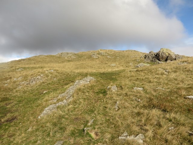
Wetherlam is a prominent hill located in the southern part of the Lake District National Park in Lancashire, England. Rising to an elevation of 762 meters (2,500 feet), it is one of the many peaks that make up the awe-inspiring landscape of the region. Wetherlam sits in close proximity to the popular town of Coniston, which lies to the north-west.

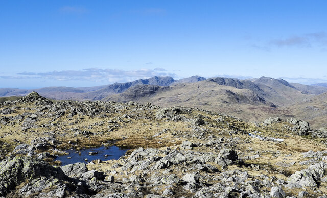
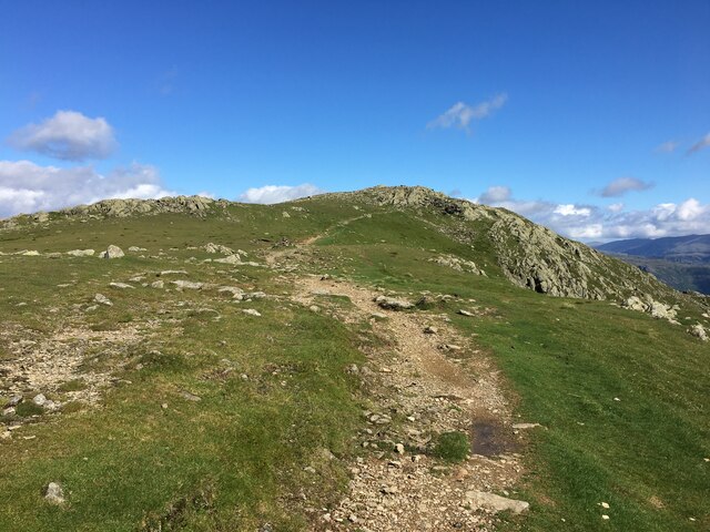
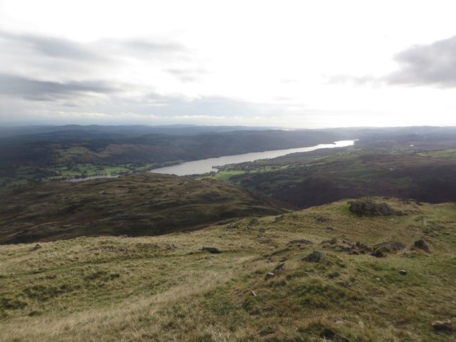
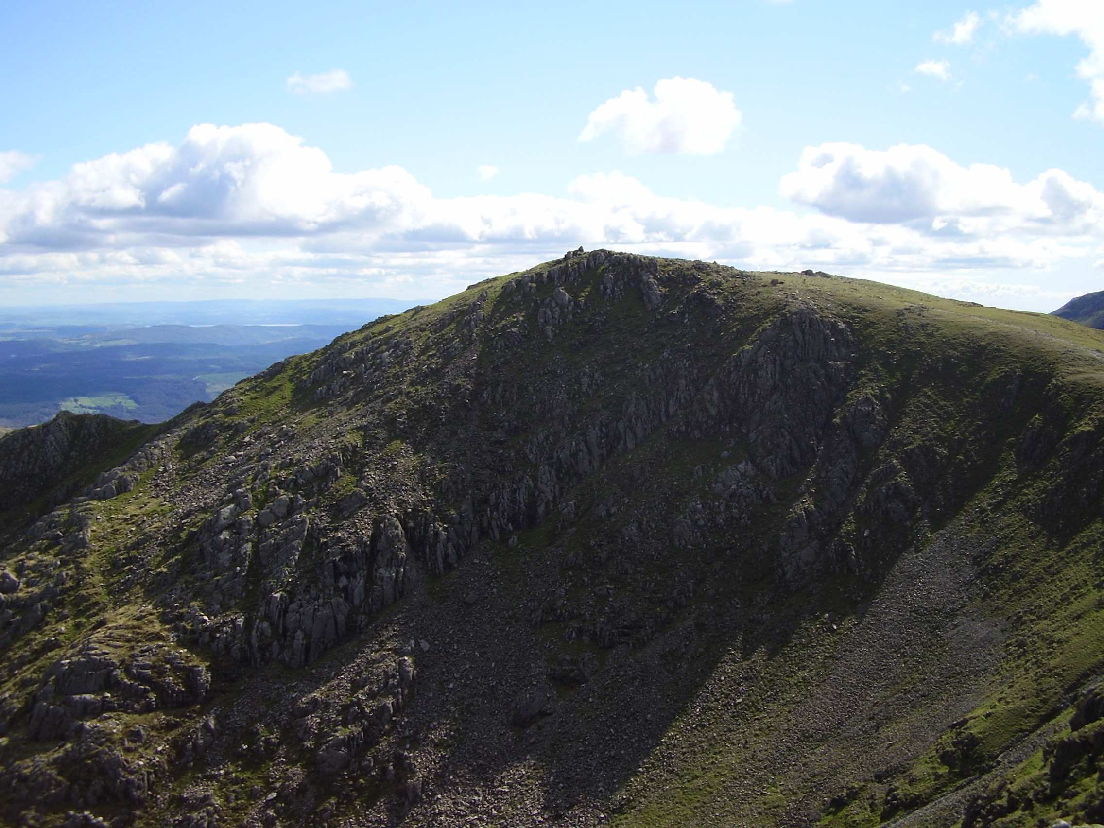
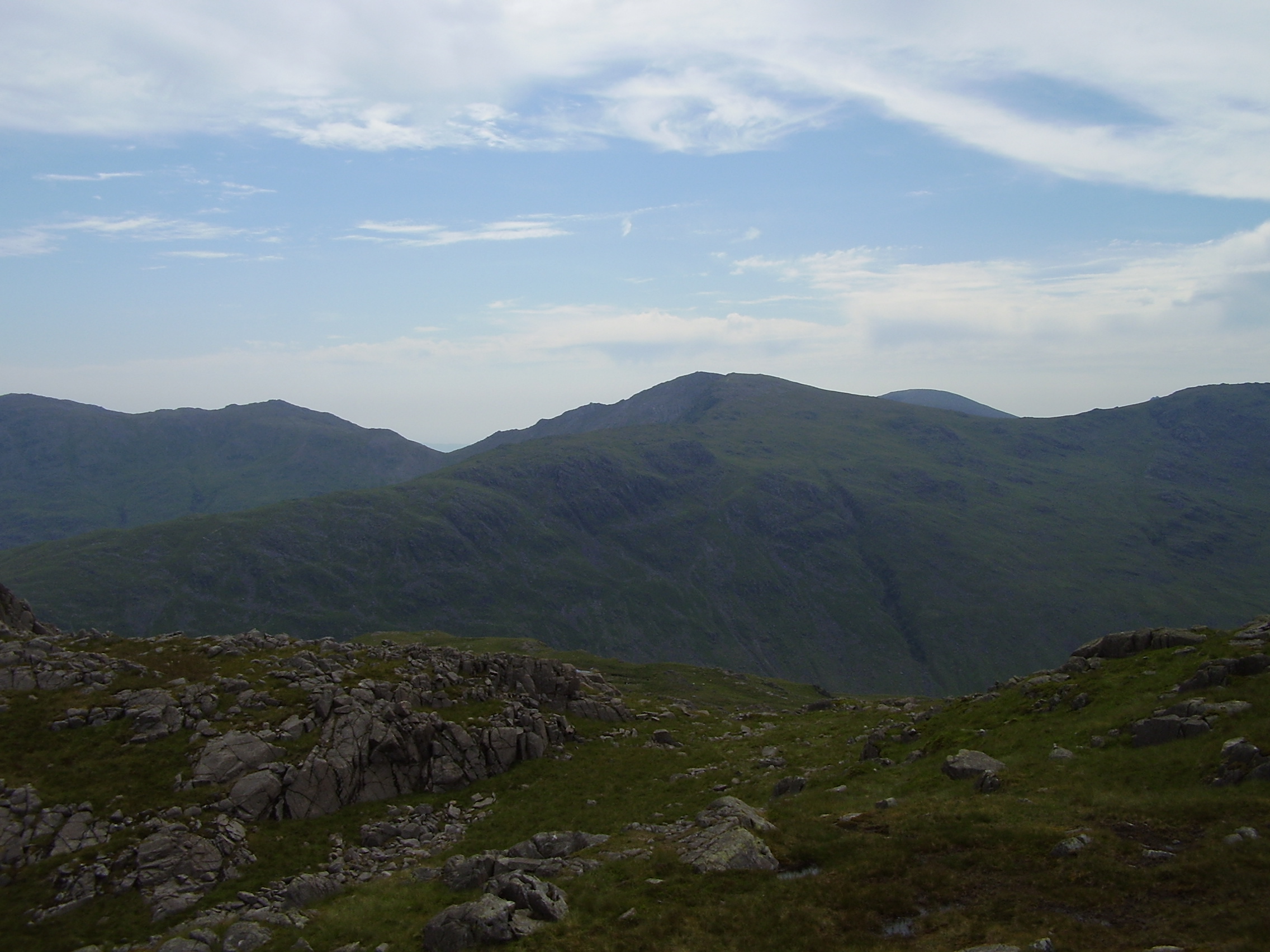
The hill offers breathtaking panoramic views of the surrounding valleys, lakes, and other peaks, making it a popular destination for hikers, climbers, and nature enthusiasts. Its distinct pyramid shape and rugged terrain add to its appeal, attracting both experienced mountaineers and casual walkers. Wetherlam is often included in the well-known "Old Man of Coniston" circuit, a challenging route that encompasses several nearby summits.

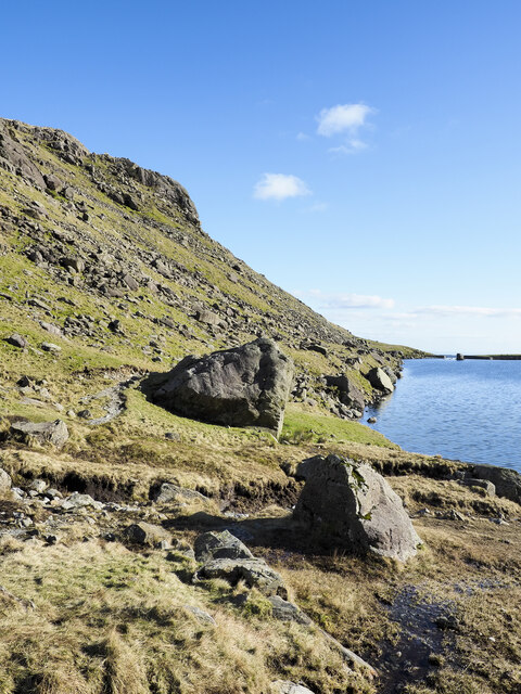
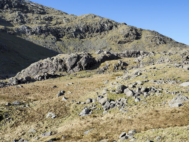
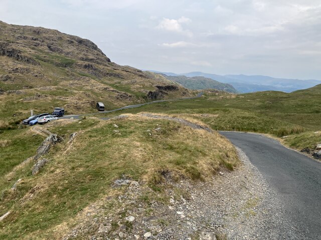
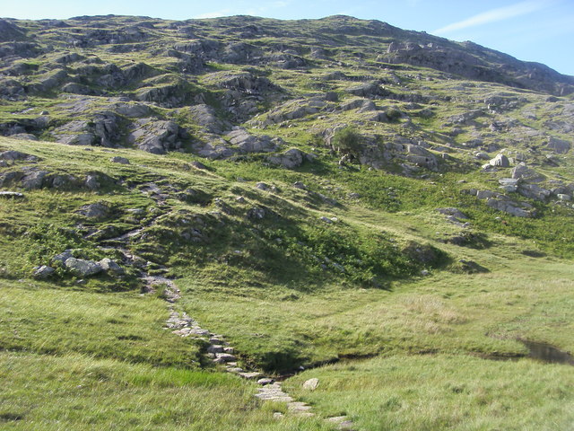
The ascent to Wetherlam can be approached from various directions, with routes available from Coniston, Tilberthwaite, and Little Langdale. Each trail offers its own unique experience and showcases the diverse natural beauty of the area, including lush green meadows, vibrant wildflowers, and rocky outcrops. The hill is also home to a diverse range of flora and fauna, with sightings of red deer, buzzards, and ravens not uncommon.

As with any mountainous region, weather conditions on Wetherlam can change rapidly, and it is essential for visitors to be suitably prepared. Proper hiking gear, including sturdy footwear and waterproof clothing, is advised. Additionally, a map and compass, along with knowledge of navigation, are crucial for a safe and enjoyable experience on Wetherlam.

If you have any feedback on the listing, please let us know in the comments section below.
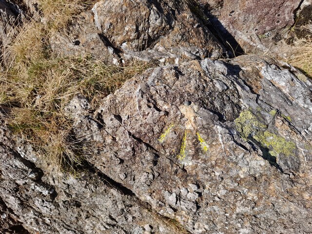
Wetherlam Images

Images are sourced within 2km of 54.400376/-3.0979708 or Grid Reference NY2801. Thanks to Geograph Open Source API. All images are credited.

Ordnance Survey Rivet This OS rivet can be found on a rock south side of the road. It marks a point 387.812m above mean sea level.
Ordnance Survey Rivet
This OS rivet can be found on a rock south side of the road. It marks a point 387.812m above mean sea level.
Ordnance Survey Rivet This OS rivet can be found on a rock NW side of the road. It marks a point 379.116m above mean sea level.
Ordnance Survey Rivet
This OS rivet can be found on a rock NW side of the road. It marks a point 379.116m above mean sea level.
Shallow pool on ridge rising to Wetherlam A broad, lengthy ridge which in its higher reach is fairly featureless rises generally northwards to the Wetherlam summit. There are minor knolls and a tarn or two; this is the more attractive of them.
Helvellyn and Fairfield and their satellite mountains are in the distance.
Shallow pool on ridge rising to Wetherlam
A broad, lengthy ridge which in its higher reach is fairly featureless rises generally northwards to the Wetherlam summit. There are minor knolls and a tarn or two; this is the more attractive of them. Helvellyn and Fairfield and their satellite mountains are in the distance.
Rock exposures at summit area of Wetherlam Extensive, knobbly exposures of bare rock lying to the north of the summit cairn with little of it standing much above the  general ground level.
The distant range of mountains has Slight Side and Scafell to the left with Bow Fell at the right.
Rock exposures at summit area of Wetherlam
Extensive, knobbly exposures of bare rock lying to the north of the summit cairn with little of it standing much above the general ground level. The distant range of mountains has Slight Side and Scafell to the left with Bow Fell at the right.
Large rocks at eastern shore of Levers Water Levers Water is an enlarged tarn, dammed to create a greater volume of water for the generation of power for use in the mines below. The dam can be seen in the distance.
Large rocks at eastern shore of Levers Water
Levers Water is an enlarged tarn, dammed to create a greater volume of water for the generation of power for use in the mines below. The dam can be seen in the distance.
Boulders on mountain slope Boulders, large, small and embedded below Sam Bottom in the valley of Swirl Hause Beck which runs down into Levers Water.
The slope rising beyond reaches Swirl How.
Boulders on mountain slope
Boulders, large, small and embedded below Sam Bottom in the valley of Swirl Hause Beck which runs down into Levers Water. The slope rising beyond reaches Swirl How.
Path traversing northern side of Black Sails Black Sails is a summit among the Coniston group of mountains; it rises to the right out of the image. Probably, not being a 'Wainwright' top, it's rather ignored by many walkers and so this path has developed bypassing the hill and connecting Wetherlam, which is the distant summit, with Swirl How, behind the camera location.
Path traversing northern side of Black Sails
Black Sails is a summit among the Coniston group of mountains; it rises to the right out of the image. Probably, not being a 'Wainwright' top, it's rather ignored by many walkers and so this path has developed bypassing the hill and connecting Wetherlam, which is the distant summit, with Swirl How, behind the camera location.
Path towards Swirl How
Path near Great Carrs
Wrynose Pass
Wrynose Pass
Wrynose Pass Centre left is the Three Shire Stone <a href="https://www.geograph.org.uk/photo/7517658">NY2702 : Three Shire Stone, Wrynose Pass</a>
Wrynose Pass
Centre left is the Three Shire Stone NY2702 : Three Shire Stone, Wrynose Pass
Three Shire Stone, Wrynose Pass Boundary stone marking the point the historic counties of Cumberland, Lancashire and Westmorland meet.
Three Shire Stone, Wrynose Pass
Boundary stone marking the point the historic counties of Cumberland, Lancashire and Westmorland meet.
Path to Red Tarn
Path to Red Tarn
The Air Ambulance on Wetherlam The Coniston Mountain Rescue Team (MRT) were training at base when the call came for a fell-runner who had slipped on descent, injured his ankle, and could no longer stand. The team attended and carried him down below the cloud. Fortunately a helicopter was available to transport the casualty to Furness General Hospital.
The Air Ambulance on Wetherlam
The Coniston Mountain Rescue Team (MRT) were training at base when the call came for a fell-runner who had slipped on descent, injured his ankle, and could no longer stand. The team attended and carried him down below the cloud. Fortunately a helicopter was available to transport the casualty to Furness General Hospital.
Path heading up to Wetherlam From Hole Rake the path heading up to Wetherlam
Path heading up to Wetherlam
From Hole Rake the path heading up to Wetherlam
Levers Water
Levers Water
Footpath towards Red Gill Head Moss Looking up a grassy slope to the south of Red Gill Head Moss.
Footpath towards Red Gill Head Moss
Looking up a grassy slope to the south of Red Gill Head Moss.
View towards Coniston Water Looking back down the fell from the approach to Red Gill Head Moss with Coniston Water in the distance.
View towards Coniston Water
Looking back down the fell from the approach to Red Gill Head Moss with Coniston Water in the distance.
Show me another place!

Wetherlam is located at Grid Ref: NY2801 (Lat: 54.400376, Lng: -3.0979708)

Administrative County: Cumbria

District: South Lakeland

Police Authority: Cumbria

What 3 Words

///reversed.responses.cuddling. Near Ambleside, Cumbria

Related Wikis

Wetherlam

Wetherlam (763 m) is a mountain in the English Lake District. It is the most northerly of the Coniston Fells, the range of fells to the north-west of Coniston...

Swirl How

Swirl How is a fell in the English Lake District. It stands between Coniston and the Duddon Valley in the southern part of the District. It rivals the...

Great Carrs

Great Carrs is a fell in the English Lake District. It stands above Wrynose Pass in the southern part of the District. == Topography == The Coniston (or...

Wrynose Pass

The Wrynose Pass is a mountain pass in the Lake District National Park in Cumbria, England between the Duddon Valley and Little Langdale. == Etymology... ==

Nearby Amenities

Located within 500m of 54.400376,-3.0979708
Wetherlam
Ele: 763
Natural: peak
Wikidata: Q7990103
Wikipedia: en:Wetherlam
Lat/Long: 54.4005084/-3.0980369
Long Crag Iron Mine
Abandoned: yes
Historic: mine
Mineral: iron
Lat/Long: 54.404289/-3.1008662
Hen Tor
Place: locality
Lat/Long: 54.3991925/-3.0945152
Little Walls
Place: locality
Lat/Long: 54.4009321/-3.0981898
Tilberthwaite High Fells
Place: locality
Lat/Long: 54.4038176/-3.097379
Man Made: cairn
Lat/Long: 54.4004866/-3.0980231
Man Made: cairn
Lat/Long: 54.3975877/-3.0997738
Ford: yes
Lat/Long: 54.4000543/-3.102777
The data included in this document is from www.openstreetmap.org. The data is made available under ODbL.

Have you been to Wetherlam?

Leave your review of Wetherlam below (or comments, questions and feedback).