Carn na Glascoill

Hill, Mountain in Banffshire

Scotland

Carn na Glascoill

Slopes of Letterach With heather just starting to flower.
Slopes of Letterach Credit: Dorothy Carse

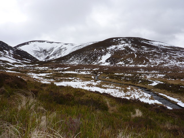
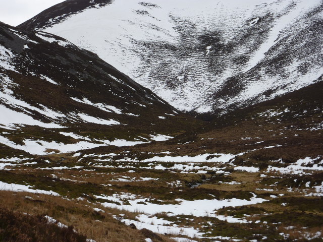
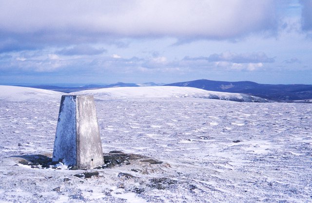
Carn na Glascoill is a prominent hill located in Banffshire, Scotland. It is part of the Grampian Mountains, which stretch across the eastern side of the country. Standing at an elevation of approximately 675 meters (2,215 feet), it offers stunning panoramic views of the surrounding landscape.

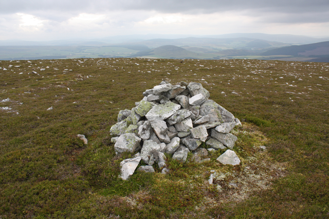
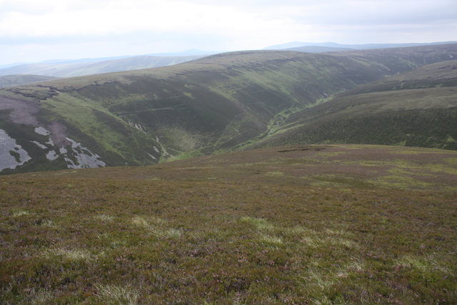
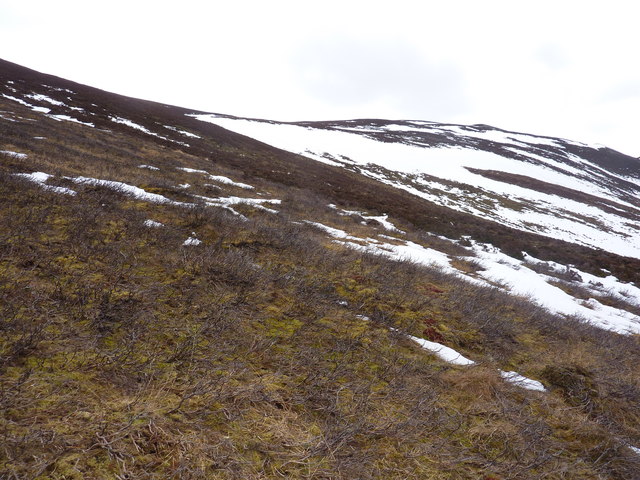
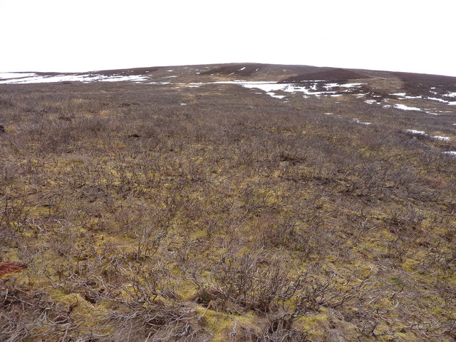
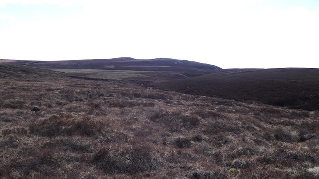
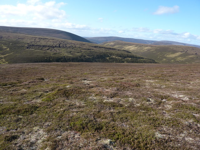
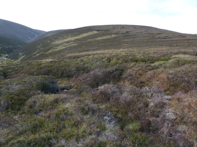
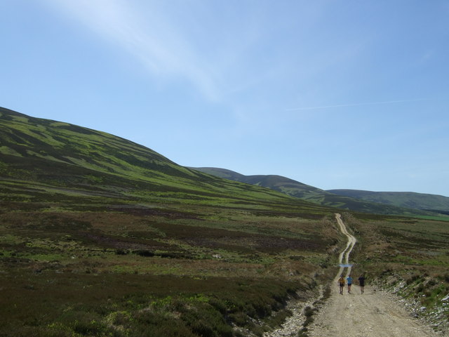
The hill is characterized by its rugged terrain, covered in heather and scattered with rocky outcrops. It is a popular destination for hikers and nature enthusiasts, who are drawn to its natural beauty and tranquility. The diverse flora and fauna found on Carn na Glascoill make it a haven for wildlife, with sightings of red deer, mountain hares, and various bird species being common.

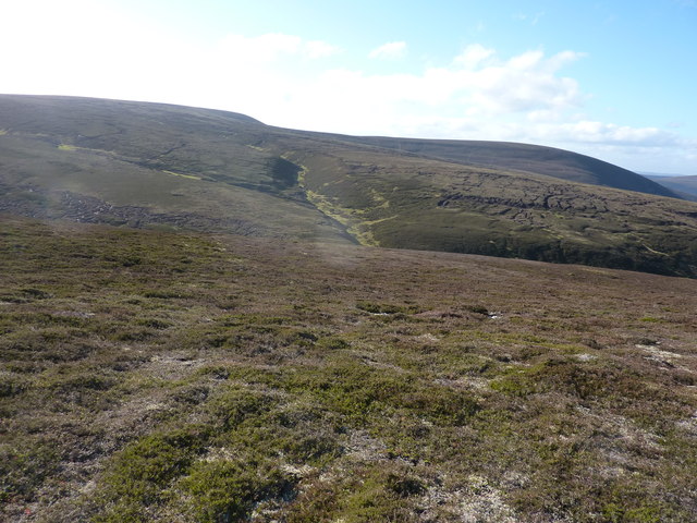
The ascent to the summit of Carn na Glascoill is relatively moderate, making it accessible to both experienced hikers and those with less experience. As one climbs higher, the views become increasingly breathtaking, with the surrounding countryside, including the nearby Moray Firth and the Cairngorms National Park, coming into sight.

Despite its relatively modest height compared to some of the neighboring peaks, Carn na Glascoill offers a sense of solitude and peacefulness that is cherished by visitors. Its location in Banffshire, known for its picturesque landscapes and rich history, adds to its appeal as a destination for outdoor enthusiasts and those seeking a connection with nature.

In conclusion, Carn na Glascoill is a captivating hill in Banffshire, Scotland, offering striking views, diverse wildlife, and a peaceful escape for those who venture to its summit.

If you have any feedback on the listing, please let us know in the comments section below.

Carn na Glascoill Images

Images are sourced within 2km of 57.285875/-3.1835677 or Grid Reference NJ2822. Thanks to Geograph Open Source API. All images are credited.

Slopes of Letterach With heather just starting to flower.
Slopes of Letterach
With heather just starting to flower.
Tracks on Carn na Glascoill Erosion caused by argocats with a new track bypassing the deepest holes.  Higher up the hill stones have been used to fill the ruts.  Tom a Voan wood can be seen in the distance.
Tracks on Carn na Glascoill
Erosion caused by argocats with a new track bypassing the deepest holes. Higher up the hill stones have been used to fill the ruts. Tom a Voan wood can be seen in the distance.
Summit cairn, Carn na Glascoill Looking over the Braes of Glenlivet with the rounded shape of the Bochel ahead.
Summit cairn, Carn na Glascoill
Looking over the Braes of Glenlivet with the rounded shape of the Bochel ahead.
Eastern slopes of Carn na Glaschoill Looking across the Kymah Burn towards Round Hill.
Eastern slopes of Carn na Glaschoill
Looking across the Kymah Burn towards Round Hill.
Caochan Ranaich A tributary of Kymah Burn.
Caochan Ranaich
A tributary of Kymah Burn.
Peat hags near Caochan Odhar An area of moorland with large peat hags.
Peat hags near Caochan Odhar
An area of moorland with large peat hags.
Track on Carn na Glascoill Argo track used to access grouse moors between Caochan Ranaich and Caochan Odhar.  Looking towards Letterach.
Track on Carn na Glascoill
Argo track used to access grouse moors between Caochan Ranaich and Caochan Odhar. Looking towards Letterach.
Looking up the Kymah Burn The burn comes down through an interesting-looking narrow valley. Still large patches of snow after the winter, and although it was around 7 degrees, the snow was sufficiently melted and frozen to take my weight.
Looking up the Kymah Burn
The burn comes down through an interesting-looking narrow valley. Still large patches of snow after the winter, and although it was around 7 degrees, the snow was sufficiently melted and frozen to take my weight.
The Eachrach and Bachd Buidhe These are the names given to the ground on either side of The Kymah Burn. The rockier east bank is The Eachrach. Straight ahead are the slopes of Carn na Glascoill.
The Eachrach and Bachd Buidhe
These are the names given to the ground on either side of The Kymah Burn. The rockier east bank is The Eachrach. Straight ahead are the slopes of Carn na Glascoill.
Burnt heather moorland and moor under snow Above the Kymah Burn
Burnt heather moorland and moor under snow
Above the Kymah Burn
Typical East of Scotland grouse moor Here burnt to allow young heather to grow
Typical East of Scotland grouse moor
Here burnt to allow young heather to grow
Black Ditch Burn in the Blackwater Forest. It attempts to drain peaty uplands in the northern part of the Ladder Hills.
Black Ditch
Burn in the Blackwater Forest. It attempts to drain peaty uplands in the northern part of the Ladder Hills.
Looking across to the junction of the burns which drain the moorland Dry walking on low heather, but there are peat hags to negotiate.
Looking across to the junction of the burns which drain the moorland
Dry walking on low heather, but there are peat hags to negotiate.
Looking across to the moorland above the deep-cut elbow of the Kymah Burn
The deep valley of the Kymah Burn
Round Hill
Round Hill
Letterach Boggy northern top of Carn Mor. looking along the Ladder hills to Carn Mor.
Letterach
Boggy northern top of Carn Mor. looking along the Ladder hills to Carn Mor.
Track above Glenlivet
Show me another place!

Carn na Glascoill is located at Grid Ref: NJ2822 (Lat: 57.285875, Lng: -3.1835677)

Unitary Authority: Moray

Police Authority: North East

What 3 Words

///ridge.remission.reckoned. Near Dufftown, Moray

Nearby Locations

Carn na Glascoill

Related Wikis

Càrn Mòr (Ladder Hills)

Càrn Mòr (804 m) is the highest mountain of the Ladder Hills on the border of Aberdeenshire and Moray, Scotland. It is located northeast of the Cairngorm...

Ladder Hills

The Ladder Hills (Scottish Gaelic: Monadh an Fhàraidh) are a range of hills in northeast Scotland which straddle the border between Aberdeenshire and Moray...

Braeval distillery

Braeval distillery is a distiller of Scotch whisky in Chapeltown, Banffshire, Scotland. Founded in 1973 as Braes of Glenlivet, the distillery is owned...

Scalan

The Scalan was once a seminary and was one of the few places in Scotland where the Roman Catholic faith was kept alive during the troubled times of the...

Clashnoir

Clashnoir is a settlement in Glenlivet, Moray, Scotland, 92 miles north of Edinburgh and 25 miles south of Elgin.

Badenyon

Badenyon (from Scottish Gaelic: Bad an Eòin - Knoll of the Birds) is a former clachan, or village, in Aberdeenshire, Scotland. The last farming inhabitant...

Badenyon Castle

Badenyon Castle was a castle, dating from the 13th century around 7.5 miles (12.1 km) west of Kildrummy, north of Coulins Burn, in Aberdeenshire, Scotland...

County of Moray

Moray; (Scottish Gaelic: Moireibh [ˈmɤɾʲəv]) or Morayshire, called Elginshire until 1919, is a historic county, registration county and lieutenancy area...

Nearby Amenities

Located within 500m of 57.285875,-3.1835677
Cairn na Glascoill
Ele: 730
Natural: peak
Lat/Long: 57.2857222/-3.1827721
The data included in this document is from www.openstreetmap.org. The data is made available under ODbL.

Have you been to Carn na Glascoill?

Leave your review of Carn na Glascoill below (or comments, questions and feedback).