Abinger Common

Settlement in Surrey Mole Valley

England

Abinger Common

Sutton Place A road of scattered houses on the edge of Hurt Wood, between Holmbury St Mary and Peaslake.
Sutton Place Credit: Ian Capper

Abinger Common is a picturesque village located in the county of Surrey, England. Situated within the Surrey Hills Area of Outstanding Natural Beauty, it is surrounded by stunning countryside and offers a tranquil and idyllic setting for residents and visitors alike.

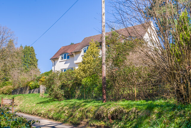
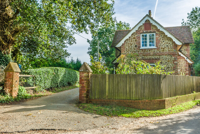
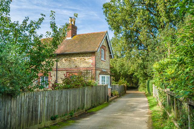
The village is located approximately 7 miles southeast of Guildford and is part of the larger civil parish of Abinger. It is renowned for its charming character, with a number of historic cottages and buildings dating back to the 16th century. The village green, known as Abinger Green, is a focal point and has been the heart of community life for centuries.

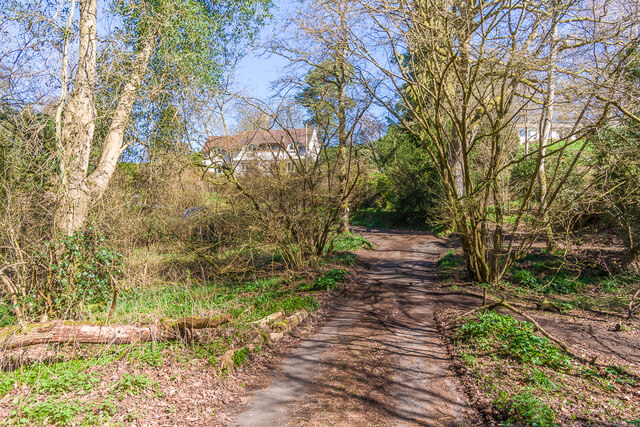
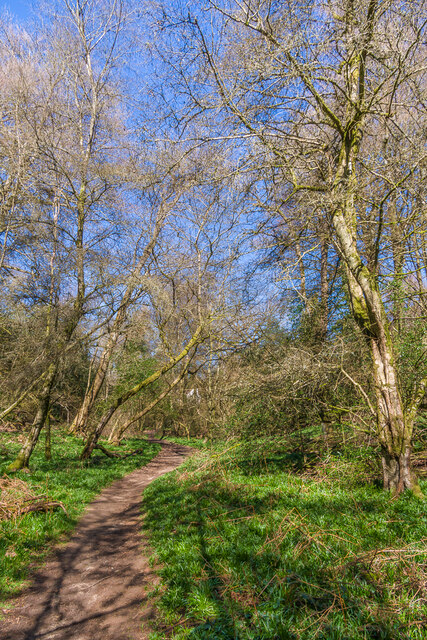
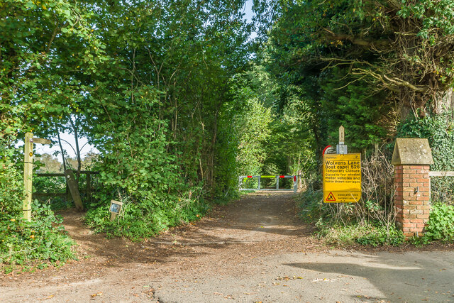
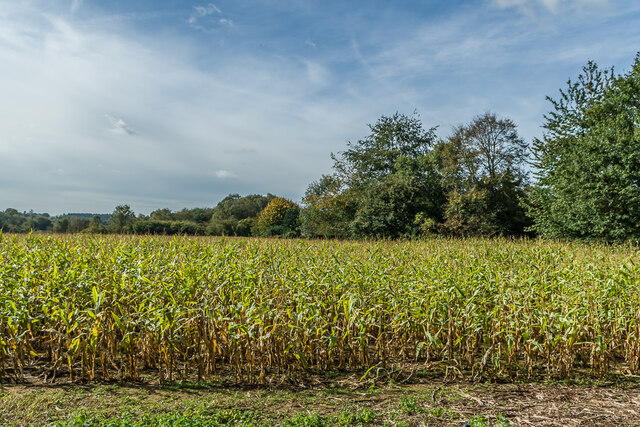
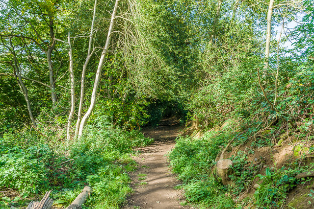
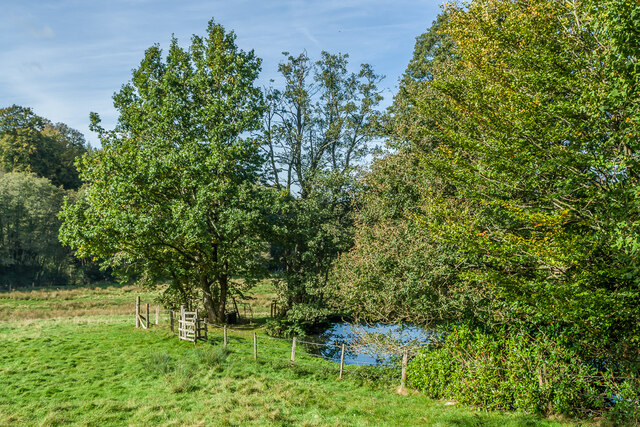
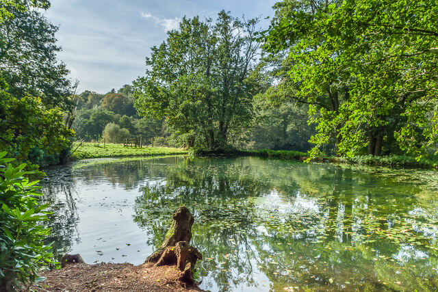
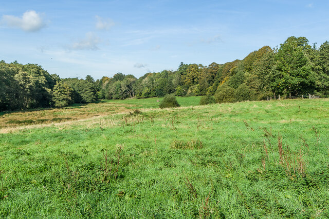
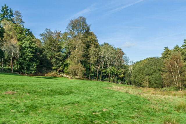
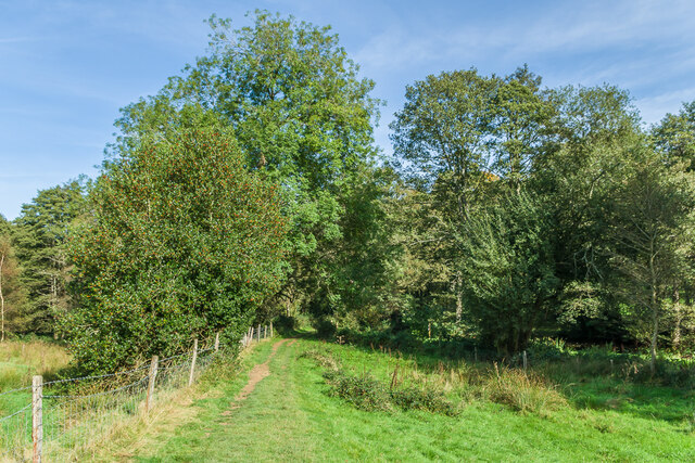
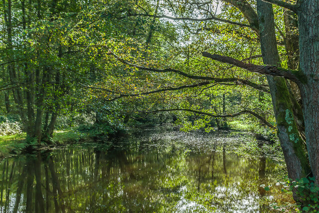
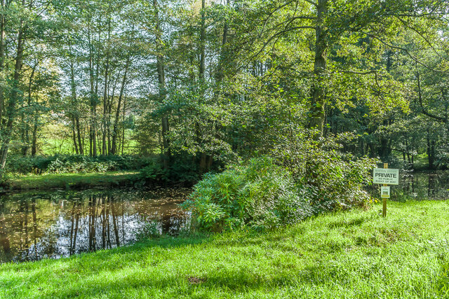
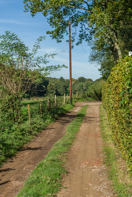
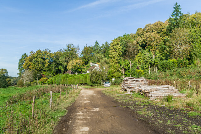
Abinger Common is blessed with an abundance of natural beauty. The area is characterized by rolling hills, woodlands, and open fields, making it a popular destination for outdoor enthusiasts. There are numerous footpaths and bridleways that crisscross the surrounding countryside, providing ample opportunities for walking, cycling, and horse riding.

The village is home to St. James Church, a beautiful and historic place of worship that dates back to the 12th century. The church is a prominent feature of the village and adds to its overall charm.

In terms of amenities, Abinger Common has a local pub, The Abinger Hatch, which offers a warm and welcoming atmosphere for residents and visitors to enjoy. There are also a few small businesses and shops in the village, providing convenience for the local community.

Overall, Abinger Common is a delightful village that offers a peaceful and scenic retreat within the stunning Surrey countryside. It is a place where history, natural beauty, and community spirit come together to create a truly special destination.

If you have any feedback on the listing, please let us know in the comments section below.

Abinger Common Images

Images are sourced within 2km of 51.200795/-0.401886 or Grid Reference TQ1145. Thanks to Geograph Open Source API. All images are credited.

Sutton Place A road of scattered houses on the edge of Hurt Wood, between Holmbury St Mary and Peaslake.
Sutton Place
A road of scattered houses on the edge of Hurt Wood, between Holmbury St Mary and Peaslake.
Little Mallet House in Sutton Place, a road of scattered houses on the edge of Hurt Wood, between Holmbury St Mary and Peaslake.
Little Mallet
House in Sutton Place, a road of scattered houses on the edge of Hurt Wood, between Holmbury St Mary and Peaslake.
Tenningshook Wood A path in Tenningshook Wood on the edge of Hurt Wood, between Holmbury St Mary and Peaslake.
Tenningshook Wood
A path in Tenningshook Wood on the edge of Hurt Wood, between Holmbury St Mary and Peaslake.
Wolvens Lane Byway between Coldharbour and Wotton, seen here at its Wotton end.  Although it is a "BOAT" (Byway open to all traffic), the sign refers to a temporary closure to four wheel drive vehicles, to avoid damage to recent repairs, and a consultation is currently under way to make the closure permanent.
Wolvens Lane
Byway between Coldharbour and Wotton, seen here at its Wotton end. Although it is a "BOAT" (Byway open to all traffic), the sign refers to a temporary closure to four wheel drive vehicles, to avoid damage to recent repairs, and a consultation is currently under way to make the closure permanent.
Off Sheephouse Lane Farmland off Sheephouse Lane.
Off Sheephouse Lane
Farmland off Sheephouse Lane.
Tillingbourne Lodge 19th Century former lodge to a large house, Tillingbourne House, which had been built by the Duke of Norfolk to replace Lonesome Lodge, a Palladian mansion further up the valley which had been built in 1740, which the Duke had purchased in 1840.   Tillingbourne House was itself demolished in 1968, to be replaced by a modernist building which was then in turn demolished and replaced in the late 2010s.
Tillingbourne Lodge
19th Century former lodge to a large house, Tillingbourne House, which had been built by the Duke of Norfolk to replace Lonesome Lodge, a Palladian mansion further up the valley which had been built in 1740, which the Duke had purchased in 1840. Tillingbourne House was itself demolished in 1968, to be replaced by a modernist building which was then in turn demolished and replaced in the late 2010s.
Footpath Footpath near Tillingbourne House forming part of the Greensand Way.
Footpath
Footpath near Tillingbourne House forming part of the Greensand Way.
Pond Pond in the Tilling Bourne valley on the Wotton Estate.
Pond
Pond in the Tilling Bourne valley on the Wotton Estate.
Pond Pond in the Tilling Bourne valley on the Wotton Estate.
Pond
Pond in the Tilling Bourne valley on the Wotton Estate.
Pasture Pastureland in the Tilling Bourne valley on the Wotton Estate.
Pasture
Pastureland in the Tilling Bourne valley on the Wotton Estate.
Pasture Pastureland in the Tilling Bourne valley on the Wotton Estate.
Pasture
Pastureland in the Tilling Bourne valley on the Wotton Estate.
Footpath Footpath across pastureland in the Tilling Bourne valley on the Wotton Estate.  The stream itself runs through a chain of ponds in the woods in the background.
Footpath
Footpath across pastureland in the Tilling Bourne valley on the Wotton Estate. The stream itself runs through a chain of ponds in the woods in the background.
Tilling Bourne One of a chain of ponds on the Tilling Bourne.  These were created by Theodore Jacobsen, owner and architect of the long demolished Lonesome Lodge, in the mid 18th Century as part of the landscaping of his estate.
Tilling Bourne
One of a chain of ponds on the Tilling Bourne. These were created by Theodore Jacobsen, owner and architect of the long demolished Lonesome Lodge, in the mid 18th Century as part of the landscaping of his estate.
Tilling Bourne One of a chain of ponds on the Tilling Bourne.  These were created by Theodore Jacobsen, owner and architect of the long demolished Lonesome Lodge, in the mid 18th Century as part of the landscaping of his estate.  The sign on the right is stating that the land off the footpath is private, with one below warning of adders.  For another example nearby see <a href="https://www.geograph.org.uk/photo/7009486">TQ1346 : Private</a>.
Tilling Bourne
One of a chain of ponds on the Tilling Bourne. These were created by Theodore Jacobsen, owner and architect of the long demolished Lonesome Lodge, in the mid 18th Century as part of the landscaping of his estate. The sign on the right is stating that the land off the footpath is private, with one below warning of adders. For another example nearby see TQ1346 : Private.
Private Sign off a public path in the Tilling Bourne valley.  The top one warns that this is private land, and below it is one warning of adders in the area.  It did strike me, though, that if they are saying that the public shouldn't be entering the land in the first place, why the need to alert them to the presence of adders?
Private
Sign off a public path in the Tilling Bourne valley. The top one warns that this is private land, and below it is one warning of adders in the area. It did strike me, though, that if they are saying that the public shouldn't be entering the land in the first place, why the need to alert them to the presence of adders?
Track Track in the Tilling Bourne valley.  The hedge on the right is along the garden of Mandrakes (see <a href="https://www.geograph.org.uk/photo/7009500">TQ1346 : Mandrakes</a>).
Track
Track in the Tilling Bourne valley. The hedge on the right is along the garden of Mandrakes (see TQ1346 : Mandrakes).
Mandrakes House in the Tilling Bourne valley.
Mandrakes
House in the Tilling Bourne valley.
Show me another place!

Abinger Common is located at Grid Ref: TQ1145 (Lat: 51.200795, Lng: -0.401886)

Administrative County: Surrey

District: Mole Valley

Police Authority: Surrey

What 3 Words

///hers.salon.lowest. Near Peaslake, Surrey

Nearby Locations

Abinger Common

Related Wikis

Abinger Common War Memorial

Abinger Common War Memorial is a First World War memorial in the village of Abinger Common in Surrey, south-eastern England. The memorial was destroyed...

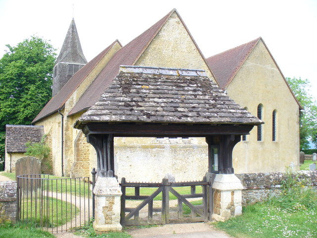
St James's Church, Abinger Common

St James's Church stands on Abinger Lane in Abinger Common, a small village within the civil parish of Abinger in Surrey, south-eastern England. The church...

Goddards

Goddards is a Grade II*-listed house in Abinger Common, Surrey, England. It was designed by Edwin Lutyens in 1898–1900 in the ideals of the Arts and Crafts...

Abinger

Abinger is a large, well-wooded and mostly rural civil parish that lies between the settlements of Dorking, Shere and Ewhurst in the district of Mole Valley...

Woodhouse Copse, Holmbury St Mary

Woodhouse Copse is an Arts and Crafts style house in the village of Holmbury St Mary, Surrey, England. It is a Grade II listed building, with gardens originally...

Friday Street

Friday Street is a hamlet on the gentle lower north slope of Leith Hill in Surrey, England. It is in a wooded headwater ravine, just to the south of Wotton...

Wotton House, Surrey

Wotton House is a hotel, wedding venue, conference centre and former country house in Wotton near Dorking, Surrey, England. Originally the centre of the...

Belmont School, Surrey

Belmont is an independent co-educational school in Surrey which takes pupils from the ages of 3 to 16. The school is a charitable trust, administered...

Nearby Amenities

Located within 500m of 51.200795,-0.401886
Pub
The Abinger Hatch
Addr City: Dorking
Addr Country: GB
Addr Postcode: RH5 6HZ
Addr Street: Abinger Lane
Fax: +44 1306 731429
Fhrs Id: 660489
Food: yes
Phone: +44 1306 730737
Pub Garden: yes
Wikidata: Q26658512
Lat/Long: 51.201976/-0.4043757
Access: private
Description: Motte and Bailey in someone's garden
Historic: castle
Lat/Long: 51.2021726/-0.4069218
Parking
Capacity: 8
Lat/Long: 51.2022852/-0.404998
Capacity: 3
Historic: stocks
Lat/Long: 51.2021389/-0.4049286
Hall
Lat/Long: 51.2021407/-0.404609
Tumulus
Archaeological Site: tumulus
Historic: archaeological_site
Note: Position only approximate
Source: npe
Lat/Long: 51.2026085/-0.4017668
Bus Stop
Friday Street Turning
Naptan AtcoCode: 40004408093B
Naptan Bearing: S
Naptan CommonName: Friday Street Turning
Naptan Indicator: adj
Naptan Landmark: Friday Street Turning
Naptan NaptanCode: surdadmw
Naptan Street: Hollow Lane
Naptan Verified: no
Public Transport: platform
Source: naptan_import
Lat/Long: 51.1979893/-0.3976841
Barrier: stile
Lat/Long: 51.2008901/-0.4054495
Barrier: stile
Lat/Long: 51.1993967/-0.4060134
Leisure: playground
Lat/Long: 51.2011455/-0.4056193
Bench
Backrest: yes
Seats: 3
Source: gps
Lat/Long: 51.2013575/-0.4053765
Bench
Backrest: yes
Lat/Long: 51.2015147/-0.4052263
Bench
Backrest: yes
Lat/Long: 51.2014233/-0.4046235
Barrier: kissing_gate
Lat/Long: 51.2023731/-0.4079983
Bench
Lat/Long: 51.2024378/-0.405372
Post Box
Post Box Type: wall
Ref: RH5 19
Royal Cypher: GR
Royal Cypher Wikidata: Q33102273
Lat/Long: 51.2020536/-0.4046863
Barrier: kissing_gate
Lat/Long: 51.2019232/-0.4051291
Bench
Backrest: yes
Material: wood
Seats: 2
Lat/Long: 51.2017813/-0.4056841
Bus Stop
Friday Street Turning
Naptan AtcoCode: 40004408093A
Naptan Bearing: N
Naptan CommonName: Friday Street Turning
Naptan Indicator: Just Before
Naptan Landmark: Abinger Common
Naptan NaptanCode: surdadmt
Naptan Street: Hollow Lane
Naptan Verified: no
Public Transport: platform
Source: naptan_import
Lat/Long: 51.1976653/-0.3978458
Bench
Backrest: yes
Seats: 4
Source: gps
Lat/Long: 51.2013116/-0.4055393
Post Box
Collection Times: Mo-Fr 09:00; Sa 07:00
Operator: Royal Mail
Post Box Mounting: pier
Post Box Type: lamp
Ref: RH5 74D
Royal Cypher: EIIR
Royal Cypher Wikidata: Q33102113
Lat/Long: 51.1981548/-0.3998403
The data included in this document is from www.openstreetmap.org. The data is made available under ODbL.

Have you been to Abinger Common?

Leave your review of Abinger Common below (or comments, questions and feedback).