Low White Stones

Hill, Mountain in Cumberland Allerdale

England

Low White Stones

Blackmoss Pot Langstrath Beck, in spate, passes through a narrow cleft in a band of rocks.
Blackmoss Pot Credit: Ian Taylor

Low White Stones is a prominent hill located in Cumberland, a county in the northwestern region of England. It is part of the Lake District National Park, renowned for its picturesque landscapes and rich natural beauty. Standing at an elevation of approximately 2,002 feet (610 meters), Low White Stones is classified as a hill rather than a mountain.

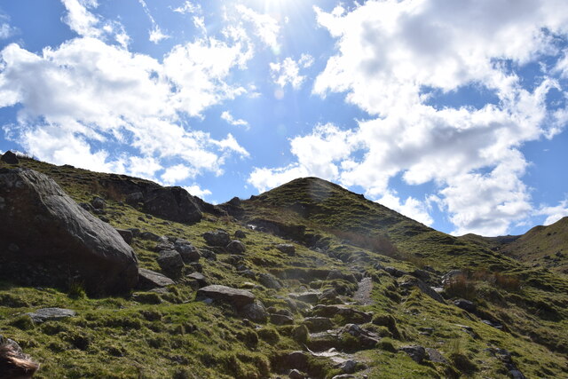
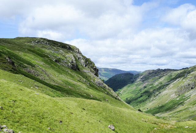
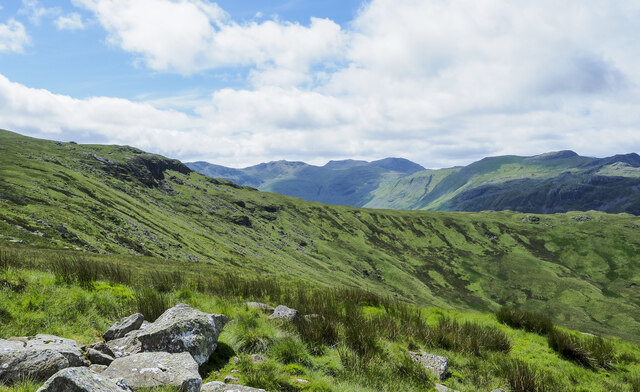
The hill is characterized by its distinctive white limestone outcrops, which give it its name. These outcrops are scattered across the slopes, creating a unique and visually striking feature. Low White Stones offers breathtaking panoramic views of the surrounding countryside, including the nearby fells and valleys.

The terrain of Low White Stones is mostly rocky and rugged, with occasional patches of grass and heather. It is a popular destination for hikers and outdoor enthusiasts, who are drawn to its challenging yet rewarding trails. The ascent to the summit can be steep and demanding, providing a satisfying experience for those seeking a more adventurous hike. However, the hill is also accessible to less experienced walkers through alternative routes that offer a gentler incline.

Wildlife is abundant in the area, with a variety of birds, mammals, and plant species calling Low White Stones home. Visitors may spot red deer, golden eagles, and various species of wildflowers, enhancing the natural charm of the hill.

Overall, Low White Stones offers a unique and captivating experience for nature lovers and hikers, combining stunning views, challenging trails, and diverse wildlife, making it a must-visit destination in Cumberland.

If you have any feedback on the listing, please let us know in the comments section below.

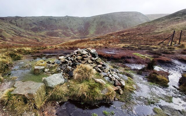
Low White Stones Images

Images are sourced within 2km of 54.480465/-3.1096542 or Grid Reference NY2810. Thanks to Geograph Open Source API. All images are credited.
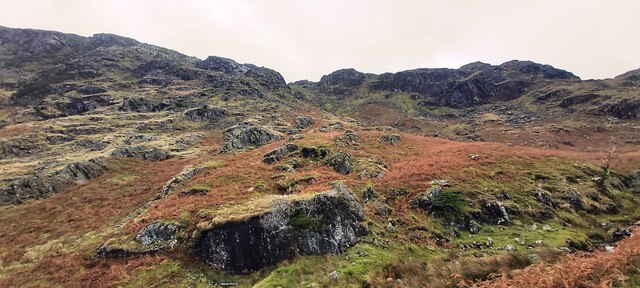
Blackmoss Pot Langstrath Beck, in spate, passes through a narrow cleft in a band of rocks.
Blackmoss Pot
Langstrath Beck, in spate, passes through a narrow cleft in a band of rocks.
On Sergeant's Crag Looking across Langstrath to White Crag. Fleetwith Pike (left) and Dale Head (centre) are prominent in the background.
On Sergeant's Crag
Looking across Langstrath to White Crag. Fleetwith Pike (left) and Dale Head (centre) are prominent in the background.
Stake Beck Stake Beck drains the high ground of Martcrag Moor, tumbling down beside the Stake Pass track to discharge into Langstrath Beck.
Stake Beck
Stake Beck drains the high ground of Martcrag Moor, tumbling down beside the Stake Pass track to discharge into Langstrath Beck.
A "back door" approach to Eagle Crag There is a path leaving Greenup Gill but that soon disappears on the way up. The height ahead is not the summit of Eagle Crag, which can't be seen yet.
A "back door" approach to Eagle Crag
There is a path leaving Greenup Gill but that soon disappears on the way up. The height ahead is not the summit of Eagle Crag, which can't be seen yet.
Grassy slope beside Greenup Gill The slope extends towards Eagle Crag with the stream out of view.
The lower Greenup valley is to the right from where the slope rises towards Ullscarf.
Grassy slope beside Greenup Gill
The slope extends towards Eagle Crag with the stream out of view. The lower Greenup valley is to the right from where the slope rises towards Ullscarf.
Grassy slope at head of Greenup valley The rock band beyond the slope at the head of the valley is Long Crag.
Mountains of the Scafell group are seen distantly at the centre of the image.
Grassy slope at head of Greenup valley
The rock band beyond the slope at the head of the valley is Long Crag. Mountains of the Scafell group are seen distantly at the centre of the image.
Bridge over Stake Beck At the bottom of Stake Pass this bridge carries the Stake Pass path over Stake beck.  The path is a public bridleway and it is also the route of The Cumbria Way.
Bridge over Stake Beck
At the bottom of Stake Pass this bridge carries the Stake Pass path over Stake beck. The path is a public bridleway and it is also the route of The Cumbria Way.
Broadstone Head
Broadstone Head
Cairn at the head of Far Easedale
Tarn on Brownrigg Moss
Bedded lapilli tufts See my blog ‘From Pyroclastic Flows to Lapilli Tuffs — Navigating the Langdale Pikes’. 2023. Out & About ... <<span class="nowrap"><a title="http://www.fhithich.uk/?p=33150>" rel="nofollow ugc noopener" href="http://www.fhithich.uk/?p=33150>">Link</a><img style="margin-left:2px;" alt="External link" title="External link - shift click to open in new window" src="https://s1.geograph.org.uk/img/external.png" width="10" height="10"/></span> [accessed 16 September 2023]
Bedded lapilli tufts
See my blog ‘From Pyroclastic Flows to Lapilli Tuffs — Navigating the Langdale Pikes’. 2023. Out & About ... <LinkExternal link [accessed 16 September 2023]
Ruined Sheepfold, High Raise
High Raise Trig Point Moments before the weather closed in. Pike o&amp;#039;Stickle just visible.
High Raise Trig Point
Moments before the weather closed in. Pike o'Stickle just visible.
Ascending Stake Pass The ascent from Langstrath is made easy by the fantastic switch back path constructed by Stake Beck. Looking down Langstrath.
Ascending Stake Pass
The ascent from Langstrath is made easy by the fantastic switch back path constructed by Stake Beck. Looking down Langstrath.
Langstrath Beck Taken from the footbridge looking south towards the confluence of the beck with Stake Beck.
Langstrath Beck
Taken from the footbridge looking south towards the confluence of the beck with Stake Beck.
Drifting snow, Codale head Deep snow has collected in the lee of rocks and lumpy ground and been sculpted by the wind. Most of the higher fell country has snow cover which makes progress difficult at times when it is deep and soft like this.
Drifting snow, Codale head
Deep snow has collected in the lee of rocks and lumpy ground and been sculpted by the wind. Most of the higher fell country has snow cover which makes progress difficult at times when it is deep and soft like this.
Sergeant Man Two walkers summit the small rocky peak. Beyond, are the craggy coves of Crinkle Crags.
Sergeant Man
Two walkers summit the small rocky peak. Beyond, are the craggy coves of Crinkle Crags.
Show me another place!

Low White Stones is located at Grid Ref: NY2810 (Lat: 54.480465, Lng: -3.1096542)

Administrative County: Cumbria

District: Allerdale

Police Authority: Cumbria

What 3 Words

///growl.elastic.variety. Near Ambleside, Cumbria

Nearby Locations

Low White Stones

Related Wikis

High Raise (Langdale)

High Raise is a fell in the Central Fells of the English Lake District, not to be confused with another High Raise situated in the Far Eastern Fells. High...

Sergeant Man

Sergeant Man is a fell in the English Lake District. It is properly a secondary summit of High Raise, but is given a separate chapter by Alfred Wainwright...

Sergeant's Crag

Sergeant's Crag is a fell in the English Lake District. It is an intermediate height on the ridge between the Langstrath and Greenup valleys in the Central...

Calf Crag

Calf Crag is a fell in the English Lake District, on the eastern side of the High Raise massif. == Topography == The spine of the Central Fells runs on...

Thunacar Knott

Thunacar Knott is a fell in the central part of the English Lake District in the county of Cumbria. == Topography == The main spine of the Central Fells...

Pavey Ark

Pavey Ark is a fell in the English county of Cumbria. It is one of the Langdale Pikes, lying to the north of Great Langdale, in the heart of the Lake District...

Eagle Crag

Eagle Crag is a fell in the Lake District in Cumbria, England, it is situated near the village of Stonethwaite where the valleys of Langstrath and Greenup...

Tarn Crag (Easedale)

Tarn Crag is a fell in the Central Fells of the English Lake District. Strictly the name refers only to the rock face looking down upon Easedale Tarn,...

Nearby Amenities

Located within 500m of 54.480465,-3.1096542
Wythburn Fells
Place: locality
Lat/Long: 54.4795696/-3.1037879
Low White Stones
Ele: 731
Place: locality
Lat/Long: 54.4811937/-3.1105214
High Raise
Description: OS trig pillar
Ele: 762.3
Man Made: survey_point
Note: Accurate location import for imagery offset calibration. Please do not move.
Ref: S5989
Source: Ordnance Survey (OGL)
Survey Point: pillar
Lat/Long: 54.4760997/-3.1114447
The data included in this document is from www.openstreetmap.org. The data is made available under ODbL.

Have you been to Low White Stones?

Leave your review of Low White Stones below (or comments, questions and feedback).