Bruntshields

Hill, Mountain in Angus

Scotland

Bruntshields

Below Glenclova Forest The Burn of Farchal flows in the dip from right to left, to join Prosen Water a short distance downstream.
Why the forest is called 'Glenclova', when it is at the head of Glen Prosen and not accessible from Glen Clova at all, is a bit of a mystery to me!
Below Glenclova Forest Credit: David Purchase

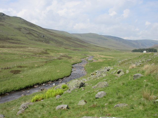
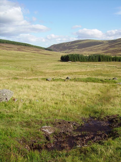
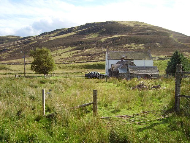
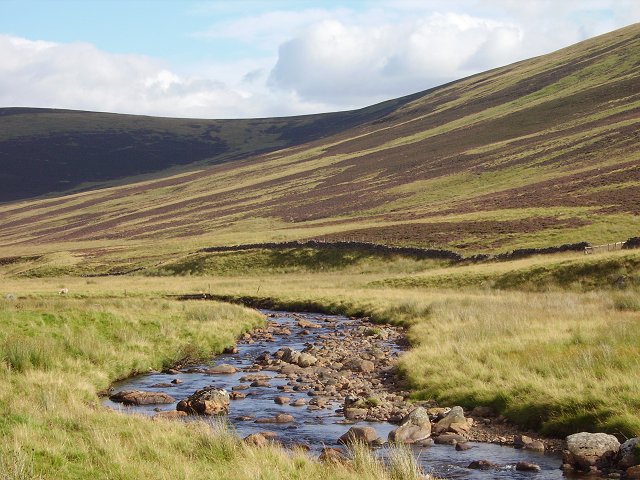
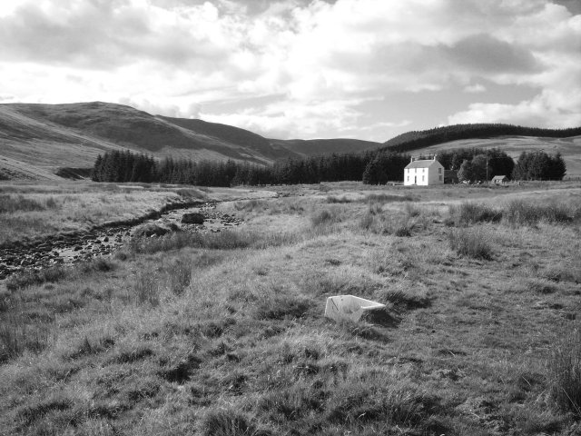
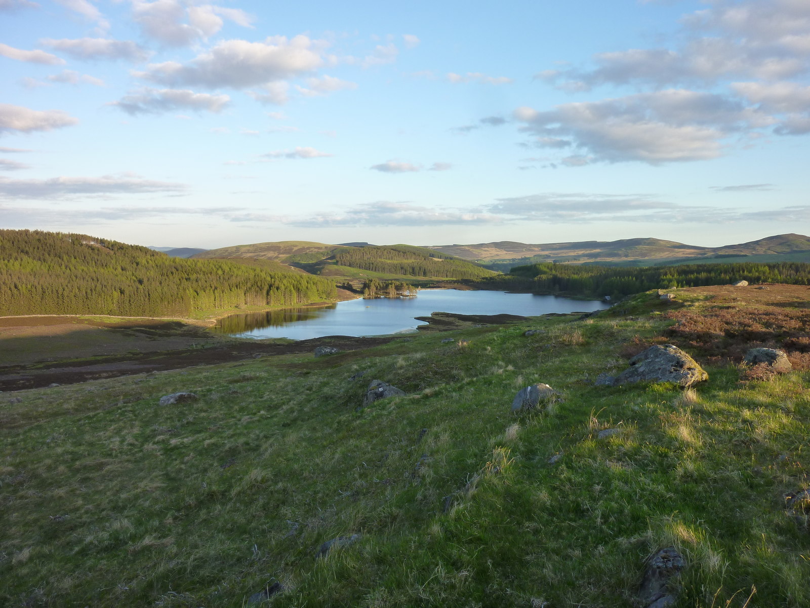
Bruntshields is a prominent hill located in the Angus region of Scotland. Situated in the eastern part of the country, it forms part of the Grampian Mountains, which are renowned for their picturesque landscapes and natural beauty.

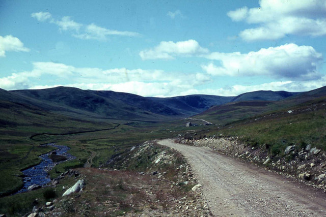
Standing at an elevation of approximately 520 meters (1,706 feet), Bruntshields offers breathtaking panoramic views of the surrounding countryside and neighboring hills. Its distinctive shape, with a well-defined peak and gentle slopes, makes it easily recognizable from a distance.

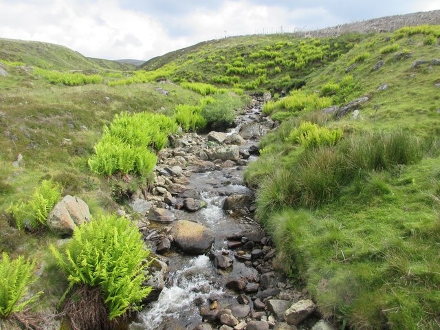
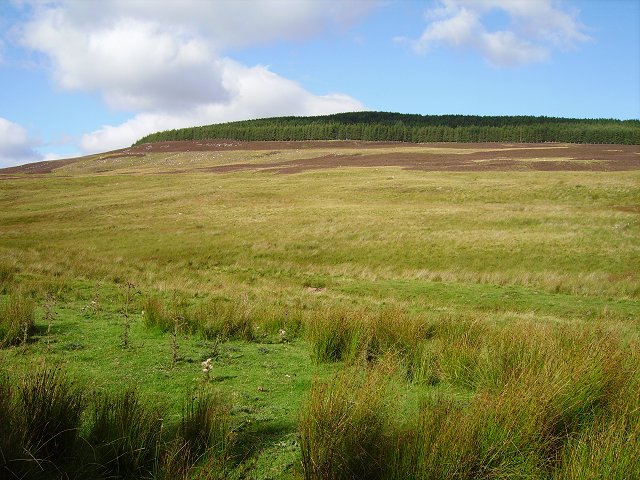
The hill is mainly composed of granite, a type of rock commonly found in the Grampian Mountains. This geological makeup gives Bruntshields a rugged and rocky appearance, with occasional outcrops visible along its slopes. The vegetation on the hill consists of heather, grasses, and patches of woodland.

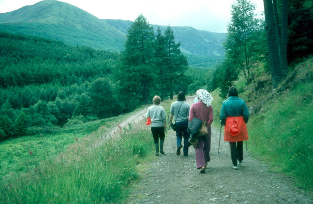
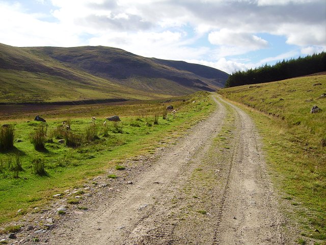
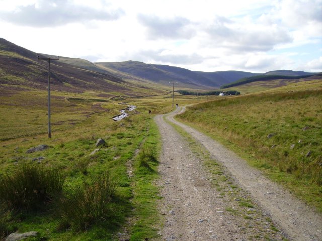
Bruntshields is a popular destination for hikers, nature enthusiasts, and those seeking to enjoy the great outdoors. Several hiking trails traverse its slopes, offering varying levels of difficulty to cater to different skill levels. The hill's summit provides a rewarding vantage point, allowing visitors to admire the stunning views of the surrounding countryside.

Wildlife is abundant in the area, with various bird species, such as buzzards and kestrels, often spotted soaring above the hill. Red deer and mountain hares are also known to inhabit the region, adding to the natural diversity and charm of Bruntshields.

Overall, Bruntshields stands as a testament to the awe-inspiring beauty of the Scottish landscape, offering visitors a chance to connect with nature and enjoy the tranquility of the Angus countryside.

If you have any feedback on the listing, please let us know in the comments section below.

Bruntshields Images

Images are sourced within 2km of 56.799295/-3.2005625 or Grid Reference NO2668. Thanks to Geograph Open Source API. All images are credited.

Below Glenclova Forest The Burn of Farchal flows in the dip from right to left, to join Prosen Water a short distance downstream.
Why the forest is called 'Glenclova', when it is at the head of Glen Prosen and not accessible from Glen Clova at all, is a bit of a mystery to me!
Below Glenclova Forest
The Burn of Farchal flows in the dip from right to left, to join Prosen Water a short distance downstream. Why the forest is called 'Glenclova', when it is at the head of Glen Prosen and not accessible from Glen Clova at all, is a bit of a mystery to me!
The road up Glen Prosen
Glen Prosen
Glen Prosen
Burn of Louie The Burn of Louie viewed from the track in Glen Prosen.
Burn of Louie
The Burn of Louie viewed from the track in Glen Prosen.
Old Craig Old Craig in the upper reaches of Glen Prosen.
Old Craig
Old Craig in the upper reaches of Glen Prosen.
Glen Prosen The Prosen Water heading up the upper reaches of the glen, with the white house of Old Craig visible in the distance on the extreme right.
Glen Prosen
The Prosen Water heading up the upper reaches of the glen, with the white house of Old Craig visible in the distance on the extreme right.
Sheep pens at Runtaleave Sheep pens at Runtaleave next to the track in Glen Prosen.
Sheep pens at Runtaleave
Sheep pens at Runtaleave next to the track in Glen Prosen.
Lone tree, High Tree Farmland in upper Glen Prosen.  The tree may be a survivor from a former plantation on this site, according to the old map. View up Glen Prosen towards The High Tree
Lone tree, High Tree
Farmland in upper Glen Prosen. The tree may be a survivor from a former plantation on this site, according to the old map. View up Glen Prosen towards The High Tree
Glen Prosen View down the glen past Old Craig. Deer wallow in the foreground. The glen floor is more grassy, the heather restricted to the slopes.
Glen Prosen
View down the glen past Old Craig. Deer wallow in the foreground. The glen floor is more grassy, the heather restricted to the slopes.
Glen Prosen View up the glen towards Craigie Thieves, along the forestry / estate road that runs up the higher reaches of Glen Prosen.
Glen Prosen
View up the glen towards Craigie Thieves, along the forestry / estate road that runs up the higher reaches of Glen Prosen.
Glen Prosen slopes North side of the glen, above Old Craig.  Sheep grazing country on gentle slopes.
Glen Prosen slopes
North side of the glen, above Old Craig. Sheep grazing country on gentle slopes.
Old Craig Last house in Glen Prosen. Probably a lodge or holiday home. Provisions being unloaded as we passed by.
Old Craig
Last house in Glen Prosen. Probably a lodge or holiday home. Provisions being unloaded as we passed by.
Water of Prosen Just downstream of Old Craig.
Water of Prosen
Just downstream of Old Craig.
Glen Prosen View up the glen, with the white house of Old Craig and its power line.
Glen Prosen
View up the glen, with the white house of Old Craig and its power line.
Glen Prosen Just downstream of Old Craig. The old sink in the foreground is used to hold salt licks for livestock.
Glen Prosen
Just downstream of Old Craig. The old sink in the foreground is used to hold salt licks for livestock.
Mystery object, Runtaleave What's this then?  Would make a great toy for a bull to bash around a field, but I cannot work out its purpose?
Runtaleave, the last farm in Glen Prosen, heading upstream.
Mystery object, Runtaleave
What's this then? Would make a great toy for a bull to bash around a field, but I cannot work out its purpose? Runtaleave, the last farm in Glen Prosen, heading upstream.
Track to The High Tree from Bad Buidhe The track follows a line on the Glen Damff side of the ridge
Track to The High Tree from Bad Buidhe
The track follows a line on the Glen Damff side of the ridge
Fence, The High Tree Looking S towards Bad Buidhe
Fence, The High Tree
Looking S towards Bad Buidhe
Show me another place!

Bruntshields is located at Grid Ref: NO2668 (Lat: 56.799295, Lng: -3.2005625)

Unitary Authority: Angus

Police Authority: Tayside

What 3 Words

///estimated.crackles.consoled. Near Kirriemuir, Angus

Nearby Locations

Bruntshields

Related Wikis

Driesh

Driesh (Gaelic: Dris) is a mountain located in the Grampians of Scotland. Apart from Mount Keen (939 m/3,080 ft), it is the most easterly of the Munro...

Mayar (mountain)

Mayar is a mountain in the Grampians, in Angus, Scotland. It is usually climbed together with its near neighbour, Driesh. At an elevation of 928 m, it...

Corrie Fee

Corrie Fee is a glacier-carved corrie situated at the head of Glen Clova in the Angus Glens of Scotland. It forms part of Corrie Fee National Nature Reserve...

Glen Doll

Glen Doll, also sometimes spelt Glendoll, lies within the Cairngorms National Park, Scotland, at the top of Glen Clova, in an area of steep hills, corries...

Clova, Angus

Clova is a village in Glen Clova, Angus, Scotland. It lies on the River South Esk, some 12 miles (19 km) north of Kirriemuir. During the 1745 Jacobite...

Auchintaple Loch

Auchintaple Loch also known as Auchenchapel Loch, is a small shallow freshwater loch that is located in Glen Isla in Angus, Scotland. == See also == List...

Cat Law

Cat Law (671 m) is a hill in the southern Mounth of Scotland, north of Kirriemuir in Angus. A rounded peak, it lies above Strathmore in the south and offers...

Little Forter

Little Forter is a hamlet in Glen Isla, Angus, Scotland. It is on the River Isla, 13 miles (21 kilometres) north-west of Kirriemuir and 11 miles (18 kilometres...

Nearby Amenities

Located within 500m of 56.799295,-3.2005625
Bruntshields
Ele: 532
Name Sco: Bruntshiels
Natural: peak
Lat/Long: 56.7987684/-3.1995581
The data included in this document is from www.openstreetmap.org. The data is made available under ODbL.

Have you been to Bruntshields?

Leave your review of Bruntshields below (or comments, questions and feedback).